

Home
››
New Mills Central Railway Station
››
Roadmap from New Mills Central Railway Station to Rhondda
How to get from New Mills Central Railway Station (England) to Rhondda (Wales)
Calculate route from New Mills Central Railway Station (England, United Kingdom) to Rhondda (Wales, United Kingdom).
The flight distance (as the crow flies) between New Mills Central Railway Station and Rhondda is 213.2 km.
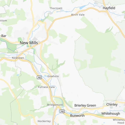
Roadmap (route) to go from New Mills Central Railway Station to Rhondda detailed above, you can also see the course layout on the map.
While doing trip New Mills Central Railway Station - Rhondda by car, the calculated route ends at a distance , or more straight.
Distance and duration of the route between New Mills Central Railway Station and Rhondda
Calculation of distance and route from Rhondda to New Mills Central Railway Station :
213.2268.0 km4h4mn
Continue onto Hague Bar Road 0h0mn 279 mTurn right onto Union Road 0h0mn 291 mTurn left onto Church Road 0h1mn 578 mTurn right onto Marsh Lane 0h3mn 2.2 kmTurn sharp left onto Buxton Road 0h2mn 1.3 kmAt roundabout, take exit 4 onto Buxton Road 0h2mn 1.9 kmTurn right onto Lower Macclesfield Road 0h14mn 13.2 kmAt roundabout, take exit 2 onto Hibel Road 0h1mn 421 mAt roundabout, take exit 1 onto Churchill Way 0h0mn 61 mTurn right onto King Edward Street 0h0mn 263 mTurn slight right onto Chester Road 0h0mn 379 mAt roundabout, take exit 1 onto Oxford Road 0h1mn 973 mContinue onto Congleton Road 0h8mn 9.2 kmAt roundabout, take exit 1 onto Macclesfield Road 0h1mn 993 mAt roundabout, take exit 2 onto Lower Heath 0h1mn 857 mKeep left onto Rood Hill 0h0mn 366 mAt roundabout, take exit 3 onto Mill Street 0h0mn 201 mTurn left onto Mill Street 0h0mn 214 mTurn left onto Wagg Street 0h2mn 1.7 kmTurn left onto Newcastle Road 0h9mn 8.9 kmContinue onto Coalpit Hill 0h1mn 685 mTurn right onto Audley Road 0h6mn 4.6 kmTurn left onto Heathcote Road 0h1mn 1.1 kmTurn left onto High Street 0h1mn 796 mTurn right onto Scot Hay Road 0h2mn 1.7 kmTurn right onto Scot Hay Road 0h2mn 2.6 kmTurn right onto Keele Road 0h0mn 332 mKeep left onto Newcastle Road 0h6mn 6.3 kmKeep left 0h0mn 54 mTurn slight left onto Gravenhunger Lane 0h2mn 1.1 kmTurn left onto London Road 0h0mn 43 mTurn right onto London Road 0h3mn 2.7 kmKeep right onto B5415 0h3mn 4.4 kmTurn right onto Newcastle Road 0h2mn 3.1 kmAt roundabout, take exit 2 onto Market Drayton Bypass 0h1mn 835 mAt roundabout, take exit 2 onto Market Drayton Bypass 0h1mn 2.1 kmAt roundabout, take exit 3 onto Shrewsbury Road 0h1mn 1.9 kmAt roundabout, take exit 2 onto A53 0h4mn 5.3 kmAt roundabout, take exit 2 onto Hodnet Bypass 0h8mn 9.7 kmTurn right 0h1mn 2.0 kmTurn right onto A53 0h3mn 4.2 kmAt roundabout, take exit 1 onto Battlefield Roundabout 0h1mn 2.1 kmAt roundabout, take exit 2 onto Sundorne Roundabout 0h2mn 2.6 kmAt roundabout, take exit 2 onto Preston Island 0h1mn 1.7 kmKeep left onto A5 0h0mn 116 mKeep left onto A5 0h2mn 3.4 kmKeep left and take A49 toward Leominster 0h22mn 28.5 kmTurn right onto Long Lane 0h0mn 341 mTurn left onto Watling Street 0h2mn 1.1 kmTurn right onto Clun Road 0h1mn 1.5 kmKeep left onto Broome Marsh Road 0h4mn 3.9 kmTurn left onto Broome Road 0h4mn 4.1 kmTurn slight right onto A4113 0h12mn 12.5 kmTurn right onto B4362 0h3mn 3.5 kmTurn left 0h2mn 2.0 kmTurn right 0h0mn 14 mTurn left 0h7mn 5.6 kmTurn right onto A44 0h0mn 30 mTurn left 0h1mn 1.3 kmContinue onto A480 0h0mn 48 mKeep right 0h3mn 4.6 kmTurn right onto A4111 0h1mn 776 mTurn left onto Apostles Lane 0h5mn 3.9 kmTurn left onto Hergest Bridge 0h6mn 4.9 kmTurn slight right onto A438 0h9mn 11.9 kmTurn right onto A438 0h5mn 5.8 kmAt roundabout, take exit 2 onto A438 0h1mn 766 mAt roundabout, take exit 1 onto A438 0h8mn 11.6 kmAt roundabout, take exit 2 onto A40 0h2mn 3.9 kmAt roundabout, take exit 1 onto Tarell Roundabout 0h0mn 52 mContinue onto A470 0h19mn 25.5 kmKeep right onto A470 0h0mn 23 mKeep left onto A470 0h0mn 94 mAt roundabout, take exit 2 onto Heads of the Valleys Road 0h2mn 2.5 kmKeep left onto Merthyr Road 0h6mn 4.3 kmAt roundabout, take exit 1 onto A4059 0h0mn 595 mAt roundabout, take exit 2 onto A4059 0h1mn 770 mAt roundabout, take exit 2 onto A4233 0h0mn 149 mAt roundabout, take exit 1 onto A4233 0h1mn 243 mAt roundabout, take exit 1 onto High Street 0h1mn 527 mKeep left onto Monk Street 0h7mn 7.2 kmTurn sharp left onto Oxford Street 0h1mn 263 mTurn right onto Brook Street 0h0mn 70 mTurn left onto Maerdy Road 0h4mn 2.1 kmTurn right onto Rhondda Road 0h1mn 630 mTurn right onto High Street 0h0mn 102 mTurn right onto Cross Lake Street 0h0mn 231 mTurn right onto Brook Street 0h0mn 41 mTurn left onto Rhondda Terrace 0h0mn 134 mArrive at destination 0h0mn 0 m
Travel from New Mills Central Railway Station (Wales) to a selection of major cities.
Distances from New Mills Central Railway Station to biggest cities in England
- Plymouth,260,203 inhabitants.364 km
- Luton,258,018 inhabitants.197 km
- Wolverhampton,252,791 inhabitants.87 km
- City of Westminster,247,614 inhabitants.244 km
- Southampton,246,201 inhabitants.277 km
- Blackpool,239,409 inhabitants.85 km
- Milton Keynes,229,941 inhabitants.170 km
- Bexley,228,000 inhabitants.259 km
- Northampton,215,963 inhabitants.145 km
- Archway,215,667 inhabitants.237 km
- Norwich,213,166 inhabitants.236 km
- Dudley,199,059 inhabitants.96 km
- Portsmouth,194,150 inhabitants.292 km
- Newcastle upon Tyne,192,382 inhabitants.181 km
- Sutton,187,600 inhabitants.256 km
- Swindon,185,609 inhabitants.202 km
- Crawley,180,508 inhabitants.280 km
- Ipswich,178,835 inhabitants.258 km
- Wigan,175,405 inhabitants.46 km
- Croydon,173,314 inhabitants.256 km
Other major cities in country :
- Bridgend [WLS], 58,380 inhabitants. 233 km
- Castlereagh [NIR], 56,679 inhabitants. 287 km
- Livingston [SCT], 56,570 inhabitants. 299 km
- Barry [WLS], 54,673 inhabitants. 235 km
- Hamilton [SCT], 53,200 inhabitants. 298 km
- Cumbernauld [SCT], 51,610 inhabitants. 315 km
- Dunfermline [SCT], 50,380 inhabitants. 315 km
Route from Rhondda to major cities (United Kingdom).
- Distance Rhondda London230 km
- Distance Rhondda Birmingham140 km
- Distance Rhondda Liverpool198 km
- Distance Rhondda Nottingham213 km
- Distance Rhondda Sheffield234 km
- Distance Rhondda Bristol63 km
- Distance Rhondda Glasgow471 km
- Distance Rhondda Leicester192 km
- Distance Rhondda Edinburgh478 km
- Distance Rhondda Leeds270 km
- Distance Rhondda Manchester219 km
- Distance Rhondda Stoke-on-Trent173 km
- Distance Rhondda Coventry157 km
- Distance Rhondda Sunderland387 km
- Distance Rhondda Birkenhead195 km
- Distance Rhondda Islington232 km
- Distance Rhondda Reading173 km
- Distance Rhondda Kingston upon Hull313 km
- Distance Rhondda Preston240 km
- Distance Rhondda Bradford264 km
Nearest cities to New Mills Central Railway Station :
- London, 7,556,900 inhabitants. 243 km
- Birmingham, 984,333 inhabitants. 99 km
- Liverpool, 864,122 inhabitants. 65 km
- Nottingham, 729,977 inhabitants. 73 km
- Sheffield, 685,368 inhabitants. 36 km
- Bristol, 617,280 inhabitants. 216 km
- Glasgow, 591,620 inhabitants. 314 km
- Leicester, 508,916 inhabitants. 100 km
- Edinburgh, 464,990 inhabitants. 298 km
- Leeds, 455,123 inhabitants. 57 km
- Cardiff, 447,287 inhabitants. 224 km
- Manchester, 395,515 inhabitants. 20 km
- Stoke-on-Trent, 372,775 inhabitants. 42 km
- Coventry, 359,262 inhabitants. 112 km
- Sunderland, 335,415 inhabitants. 176 km
- Birkenhead, 325,264 inhabitants. 67 km
- Islington, 319,143 inhabitants. 241 km
- Reading, 318,014 inhabitants. 224 km
- Kingston upon Hull, 314,018 inhabitants. 118 km
- Preston, 313,332 inhabitants. 64 km
- Newport, 306,844 inhabitants. 209 km
- Swansea, 300,352 inhabitants. 234 km
- Bradford, 299,310 inhabitants. 51 km
- Southend-on-Sea, 295,310 inhabitants. 275 km
- Derby, 270,468 inhabitants. 61 km
- Plymouth, 260,203 inhabitants. 364 km
- Luton, 258,018 inhabitants. 197 km
- Wolverhampton, 252,791 inhabitants. 87 km
- City of Westminster, 247,614 inhabitants. 244 km
- Southampton, 246,201 inhabitants. 277 km
- Blackpool, 239,409 inhabitants. 85 km
- Milton Keynes, 229,941 inhabitants. 170 km
- Bexley, 228,000 inhabitants. 259 km
- Northampton, 215,963 inhabitants. 145 km
- Archway, 215,667 inhabitants. 237 km
- Dudley, 199,059 inhabitants. 96 km
- Portsmouth, 194,150 inhabitants. 292 km
- Newcastle upon Tyne, 192,382 inhabitants. 181 km
- Sutton, 187,600 inhabitants. 256 km
- Swindon, 185,609 inhabitants. 202 km
- Crawley, 180,508 inhabitants. 280 km
- Wigan, 175,405 inhabitants. 46 km
- Croydon, 173,314 inhabitants. 256 km
- Walsall, 172,141 inhabitants. 87 km
- Mansfield, 171,958 inhabitants. 60 km
- Oxford, 171,380 inhabitants. 187 km
- Warrington, 165,456 inhabitants. 38 km
- Slough, 163,777 inhabitants. 228 km
- Bournemouth, 163,600 inhabitants. 295 km
- Peterborough, 163,379 inhabitants. 147 km
Location New Mills Central Railway Station (England) :
| Country flag |  |
| Location | New Mills Central Railway Station |
| State | England |
| County | Derbyshire |
| Country | United Kingdom |
| Country code / ISO 2 | GB |
| Latitude | 53.3650000 |
| Longitude | -2.0060000 |
| Altitude | 0 meters |
| Time zone | Europe/London |
Location Rhondda (Wales) :
| Country flag | |
| Location | Rhondda |
| State | Wales |
| County | Rhondda Cynon Taf |
| Country | United Kingdom |
| Country code / ISO 2 | GB |
| Latitude | 51.6589600 |
| Longitude | -3.4488500 |
| Altitude | 0 meters |
| Time zone | Europe/London |


