
How to get from Ely Railway Station (England) to Derby (England)
Calculate route from Ely Railway Station (England, United Kingdom) to Derby (England, United Kingdom).
The flight distance (as the crow flies) between Ely Railway Station and Derby is 131.5 km.
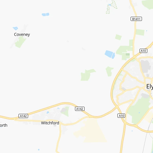
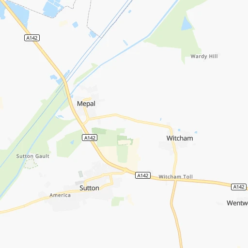
Roadmap (route) to go from Ely Railway Station to Derby detailed above, you can also see the course layout on the map.
While doing trip Ely Railway Station - Derby by car, the calculated route ends at a distance , or more straight.
Distance and duration of the route between Ely Railway Station and Derby
Calculation of distance and route from Derby to Ely Railway Station :
131.5153.3 km2h4mn
Continue 0h0mn 34 mTurn left 0h0mn 27 mTurn right 0h0mn 127 mTurn left onto Station Road 0h0mn 117 mAt roundabout, take exit 1 onto Angel Drove 0h0mn 230 mAt roundabout, take exit 2 onto Angel Drove 0h1mn 976 mAt roundabout, take exit 3 onto Angel Drove 0h0mn 481 mAt roundabout, take exit 2 onto A10 0h1mn 723 mAt roundabout, take exit 1 onto Witchford Road 0h1mn 1.1 kmAt roundabout, take exit 3 onto Witchford Bypass 0h2mn 3.3 kmContinue onto Sutton Road 0h3mn 3.5 kmAt roundabout, take exit 2 onto Mepal Road 0h4mn 5.3 kmAt roundabout, take exit 2 onto Ireton's Way 0h4mn 5.6 kmAt roundabout, take exit 3 onto Doddington Road 0h2mn 1.8 kmTurn left onto Forty Foot Bank 0h6mn 7.6 kmTurn right onto Wells Bridge 0h1mn 1.4 kmTurn right onto Oilmills Road 0h5mn 5.1 kmTurn right onto Herne Road 0h0mn 255 mTurn left onto Ramsey Road (Milk And Water Drove) 0h6mn 6.5 kmTurn left onto Whittlesey Road 0h0mn 96 mAt roundabout, take exit 1 onto Stanground Bypass 0h1mn 1.0 kmAt roundabout, take exit 1 onto Stanground Bypass 0h1mn 1.5 kmAt roundabout, take exit 3 onto Stanham Way 0h0mn 388 mKeep left onto A1139 0h1mn 1.6 kmKeep left 0h0mn 400 mAt roundabout, take exit 3 onto Nene Parkway 0h2mn 3.8 kmAt roundabout, take exit 2 onto Thorpe Wood Interchange 0h4mn 5.9 kmAt roundabout, take exit 2 onto A47 0h2mn 2.5 kmAt roundabout, take exit 1 onto Wansford Interchange 0h0mn 293 mAt roundabout, take exit 3 onto Old North Road 0h0mn 144 mContinue and take A1 toward The NORTH 0h6mn 10.3 kmKeep left 0h0mn 332 mTurn left onto Empingham Road 0h11mn 14.3 kmAt roundabout, take exit 3 onto Burley Park Way 0h1mn 1.1 kmAt roundabout, take exit 2 onto Burley Park Way 0h1mn 548 mAt roundabout, take exit 2 onto A606 0h1mn 947 mAt roundabout, take exit 2 onto A606 0h1mn 916 mAt roundabout, take exit 2 onto A606 0h13mn 13.6 kmTurn left onto Market Place 0h0mn 221 mKeep right onto Leicester Street 0h0mn 39 mTurn right onto Wilton Road 0h0mn 216 mKeep left 0h2mn 2.4 kmAt roundabout, take exit 2 onto A6006 0h1mn 1.3 kmAt roundabout, take exit 2 onto A6006 0h1mn 1.7 kmContinue onto Loughborough Road 0h8mn 10.0 kmContinue onto East Road 0h6mn 6.7 kmTurn sharp right onto Loughborough Road 0h0mn 624 mTurn left onto Rempstone Road 0h1mn 1.2 kmTurn left onto Woodgate Road 0h1mn 944 mTurn right onto Brickyard Lane 0h1mn 1.5 kmTurn slight right onto Melton Lane 0h2mn 2.4 kmContinue onto Station Road 0h1mn 1.1 kmTurn left onto Station Road 0h2mn 1.3 kmTurn right onto Derby Road 0h1mn 704 mAt roundabout, take exit 2 onto A50 0h5mn 7.8 kmKeep left onto A6 0h1mn 2.5 kmAt roundabout, take exit 1 onto Thulston Island 0h0mn 220 mAt roundabout, take exit 2 onto Shardlow Road 0h1mn 648 mAt roundabout, take exit 2 onto Shardlow Road 0h2mn 1.2 kmAt roundabout, take exit 2 onto Shardlow Road 0h0mn 186 mAt roundabout, take exit 2 onto London Road 0h2mn 1.7 kmAt roundabout, take exit 3 onto A6 0h0mn 312 mContinue onto Pride Parkway 0h0mn 368 mAt roundabout, take exit 2 onto Pride Parkway 0h0mn 398 mAt roundabout, take exit 2 onto Pride Parkway 0h0mn 425 mAt roundabout, take exit 2 onto Pride Parkway 0h1mn 970 mKeep left 0h0mn 75 mTurn right 0h0mn 334 mAt roundabout, take exit 1 onto Tennant Street 0h0mn 84 mTurn left 0h0mn 5 mArrive at destination 0h0mn 0 m
Travel from Ely Railway Station (England) to a selection of major cities.
Distances from Ely Railway Station to biggest cities in England
- Plymouth,260,203 inhabitants.380 km
- Luton,258,018 inhabitants.74 km
- Wolverhampton,252,791 inhabitants.163 km
- City of Westminster,247,614 inhabitants.103 km
- Southampton,246,201 inhabitants.202 km
- Blackpool,239,409 inhabitants.273 km
- Milton Keynes,229,941 inhabitants.80 km
- Bexley,228,000 inhabitants.106 km
- Northampton,215,963 inhabitants.80 km
- Archway,215,667 inhabitants.96 km
- Norwich,213,166 inhabitants.75 km
- Dudley,199,059 inhabitants.160 km
- Portsmouth,194,150 inhabitants.201 km
- Newcastle upon Tyne,192,382 inhabitants.313 km
- Sutton,187,600 inhabitants.120 km
- Swindon,185,609 inhabitants.168 km
- Crawley,180,508 inhabitants.146 km
- Ipswich,178,835 inhabitants.71 km
- Wigan,175,405 inhabitants.233 km
- Croydon,173,314 inhabitants.115 km
Other major cities in country :
- Bridgend [WLS], 58,380 inhabitants. 281 km
- Castlereagh [NIR], 56,679 inhabitants. 474 km
- Livingston [SCT], 56,570 inhabitants. 462 km
- Barry [WLS], 54,673 inhabitants. 268 km
- Hamilton [SCT], 53,200 inhabitants. 469 km
- Cumbernauld [SCT], 51,610 inhabitants. 483 km
- Dunfermline [SCT], 50,380 inhabitants. 476 km
Route from Derby to major cities (United Kingdom).
- Distance Derby Glasgow374 km
- Distance Derby Edinburgh355 km
- Distance Derby Cardiff198 km
- Distance Derby Newport181 km
- Distance Derby Swansea222 km
- Distance Derby Belfast347 km
- Distance Derby Aberdeen472 km
- Distance Derby Dundee406 km
- Distance Derby Londonderry County Borough446 km
- Distance Derby Derry446 km
- Distance Derby Lisburn349 km
- Distance Derby Paisley376 km
- Distance Derby East Kilbride362 km
- Distance Derby Wrexham102 km
- Distance Derby Newtownabbey350 km
- Distance Derby Buckley111 km
- Distance Derby Tonypandy198 km
- Distance Derby Bangor336 km
- Distance Derby Rhondda194 km
- Distance Derby Craigavon365 km
Nearest cities to Ely Railway Station :
- London, 7,556,900 inhabitants. 102 km
- Birmingham, 984,333 inhabitants. 147 km
- Nottingham, 729,977 inhabitants. 114 km
- Sheffield, 685,368 inhabitants. 160 km
- Bristol, 617,280 inhabitants. 222 km
- Leicester, 508,916 inhabitants. 99 km
- Leeds, 455,123 inhabitants. 198 km
- Manchester, 395,515 inhabitants. 207 km
- Stoke-on-Trent, 372,775 inhabitants. 179 km
- Coventry, 359,262 inhabitants. 121 km
- Sunderland, 335,415 inhabitants. 300 km
- Islington, 319,143 inhabitants. 98 km
- Reading, 318,014 inhabitants. 134 km
- Kingston upon Hull, 314,018 inhabitants. 156 km
- Preston, 313,332 inhabitants. 251 km
- Bradford, 299,310 inhabitants. 206 km
- Southend-on-Sea, 295,310 inhabitants. 100 km
- Derby, 270,468 inhabitants. 132 km
- Luton, 258,018 inhabitants. 74 km
- Wolverhampton, 252,791 inhabitants. 163 km
- City of Westminster, 247,614 inhabitants. 103 km
- Southampton, 246,201 inhabitants. 202 km
- Milton Keynes, 229,941 inhabitants. 80 km
- Bexley, 228,000 inhabitants. 106 km
- Northampton, 215,963 inhabitants. 80 km
- Archway, 215,667 inhabitants. 96 km
- Norwich, 213,166 inhabitants. 75 km
- Dudley, 199,059 inhabitants. 160 km
- Portsmouth, 194,150 inhabitants. 201 km
- Newcastle upon Tyne, 192,382 inhabitants. 313 km
- Sutton, 187,600 inhabitants. 120 km
- Swindon, 185,609 inhabitants. 168 km
- Crawley, 180,508 inhabitants. 146 km
- Ipswich, 178,835 inhabitants. 71 km
- Wigan, 175,405 inhabitants. 233 km
- Croydon, 173,314 inhabitants. 115 km
- Walsall, 172,141 inhabitants. 154 km
- Mansfield, 171,958 inhabitants. 129 km
- Oxford, 171,380 inhabitants. 126 km
- Warrington, 165,456 inhabitants. 221 km
- Slough, 163,777 inhabitants. 115 km
- Bournemouth, 163,600 inhabitants. 238 km
- Peterborough, 163,379 inhabitants. 40 km
- Cambridge, 158,434 inhabitants. 24 km
- Doncaster, 158,141 inhabitants. 157 km
- York, 153,717 inhabitants. 196 km
- Poole, 150,092 inhabitants. 243 km
- Gloucester, 150,053 inhabitants. 181 km
- Burnley, 149,422 inhabitants. 229 km
- Huddersfield, 149,017 inhabitants. 196 km
Location Ely Railway Station (England) :
| Country flag |  |
| Location | Ely Railway Station |
| State | England |
| County | Cambridgeshire |
| Country | United Kingdom |
| Country code / ISO 2 | GB |
| Latitude | 52.3905300 |
| Longitude | 0.2664800 |
| Altitude | 0 meters |
| Time zone | Europe/London |
Location Derby (England) :
| Country flag | |
| Location | Derby |
| State | England |
| County | Derby |
| Country | United Kingdom |
| Country code / ISO 2 | GB |
| Latitude | 52.9227700 |
| Longitude | -1.4766300 |
| Altitude | 0 meters |
| Time zone | Europe/London |


