

Home
››
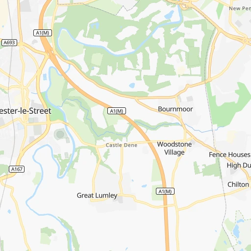
Chester-le-Street Railway Station
››
Roadmap from Chester-le-Street Railway Station to Cardiff
How to get from Chester-le-Street Railway Station (England) to Cardiff (Wales)
Calculate route from Chester-le-Street Railway Station (England, United Kingdom) to Cardiff (Wales, United Kingdom).
The flight distance (as the crow flies) between Chester-le-Street Railway Station and Cardiff is 389.9 km.
Roadmap (route) to go from Chester-le-Street Railway Station to Cardiff detailed above, you can also see the course layout on the map.
While doing trip Chester-le-Street Railway Station - Cardiff by car, the calculated route ends at a distance , or more straight.
Distance and duration of the route between Chester-le-Street Railway Station and Cardiff
Calculation of distance and route from Cardiff to Chester-le-Street Railway Station :
389.9473.8 km5h8mn
Continue 0h0mn 3 mTurn left onto Station Road 0h0mn 161 mTurn right onto Osborne Road 0h0mn 297 mAt roundabout, take exit 1 0h0mn 153 mAt roundabout, take exit 3 onto Durham Road 0h1mn 672 mTurn slight left onto Durham Road 0h0mn 22 mAt roundabout, take exit 2 onto Chester Moor roundabout 0h1mn 1.7 kmAt roundabout, take exit 2 onto A167 0h1mn 1.2 kmAt roundabout, take exit 1 onto A167 0h1mn 2.0 kmAt roundabout, take exit 3 onto A167 0h1mn 1.7 kmAt roundabout, take exit 1 onto A167 0h0mn 305 mAt roundabout, take exit 3 onto Whitesmocks 0h4mn 4.2 kmAt roundabout, take exit 2 onto Cock o' the North 0h1mn 1.9 kmAt roundabout, take exit 1 onto A167 0h1mn 977 mAt roundabout, take exit 1 onto A167 0h1mn 1.7 kmAt roundabout, take exit 2 onto A167 0h1mn 1.0 kmAt roundabout, take exit 2 onto Thinford Roundabout 0h4mn 4.7 kmAt roundabout, take exit 2 onto A167 0h1mn 1.2 kmAt roundabout, take exit 2 onto A167 0h6mn 7.5 kmAt roundabout, take exit 1 onto A167 0h0mn 581 mAt roundabout, take exit 3 onto Aycliffe Interchange 1h55mn 94.3 kmKeep left onto A1(M) 0h17mn 29.6 kmKeep right onto Doncaster Bypass 0h7mn 12.4 kmKeep left and take M18 toward Sheffield(M1), Scunthorpe(M180) 0h0mn 499 mAt roundabout, take exit 3 onto Wadworth Interchange 0h28mn 46.9 kmKeep left onto M1 and take A38 toward Mansfield, Derby 0h0mn 593 mAt roundabout, take exit 3 onto Pinxton Interchange 0h13mn 21.7 kmAt roundabout, take exit 2 onto Abbey Hill 0h3mn 4.5 kmAt roundabout, take exit 2 onto Kingsway 0h1mn 1.1 kmAt roundabout, take exit 2 onto Kingsway Roundabout 0h1mn 2.3 kmKeep right onto A38 0h18mn 29.4 kmKeep right onto A38 0h2mn 3.5 kmKeep right onto A5148 0h2mn 2.7 kmKeep right onto A5 0h0mn 49 mKeep left onto Birmingham Road 0h1mn 819 mAt roundabout, take exit 2 onto Birmingham Road 0h4mn 3.9 kmAt roundabout, take exit 3 onto Blake Street 0h1mn 1.2 kmContinue onto Rosemary Hill Road 0h3mn 1.9 kmAt roundabout, take exit 2 onto Thornhill Road 0h1mn 1.0 kmTurn sharp right onto Manor Road 0h0mn 25 mTurn left onto Manor Road 0h4mn 2.8 kmTurn left onto Beacon Road 0h1mn 646 mTurn right onto Old Hall Lane 0h1mn 402 mKeep left onto Chapel Lane 0h3mn 1.9 kmTurn left onto Birmingham Road 0h0mn 127 mKeep left 0h0mn 292 mAt roundabout, take exit 2 onto Great Barr Interchange 0h1mn 841 mKeep left onto M5 1h38mn 63.9 kmKeep left 0h1mn 797 mAt roundabout, take exit 2 onto Strensham Interchange 0h20mn 34.7 kmAt roundabout, take exit 1 onto Travellers Rest 0h0mn 794 mAt roundabout, take exit 3 onto A40 0h2mn 2.3 kmAt roundabout, take exit 4 onto Wilton Roundabout 0h9mn 14.5 kmAt roundabout, take exit 2 onto A40 0h19mn 32.0 kmAt roundabout, take exit 3 onto Ringland Way 0h1mn 613 mAt roundabout, take exit 2 onto Ringland Way 0h2mn 2.0 kmAt roundabout, take exit 3 onto Ringland Way 0h0mn 455 mKeep left onto Ringland Way 0h1mn 1.0 kmAt roundabout, take exit 3 onto Spytty Road 0h0mn 364 mAt roundabout, take exit 2 onto Spytty Road 0h2mn 1.8 kmContinue onto Usk Way 0h0mn 426 mAt roundabout, take exit 1 onto Usk Way 0h2mn 1.7 kmAt roundabout, take exit 2 onto Docks Way 0h0mn 391 mAt roundabout, take exit 2 onto Docks Way 0h2mn 2.0 kmKeep right 0h2mn 2.9 kmKeep left onto A48(M) 0h5mn 7.4 kmKeep left onto A48 and take A4232 toward Cardiff, Docks 0h0mn 308 mKeep left onto Southern Way 0h1mn 684 mKeep left 0h0mn 341 mAt roundabout, take exit 2 onto Newport Road 0h0mn 413 mAt roundabout, take exit 2 onto Newport Road 0h2mn 1.3 kmContinue onto Newport Road 0h3mn 2.3 kmTurn sharp left onto North Road 0h0mn 298 mTurn slight left onto Duke Street 0h0mn 255 mKeep left onto Westgate Street 0h0mn 30 mTurn slight left onto Westgate Street 0h0mn 190 mTurn left onto Quay Street 0h0mn 79 mArrive at destination 0h0mn 0 m
Travel from Chester-le-Street Railway Station (Wales) to a selection of major cities.
Distances from Chester-le-Street Railway Station to biggest cities in England
- Plymouth,260,203 inhabitants.528 km
- Luton,258,018 inhabitants.340 km
- Wolverhampton,252,791 inhabitants.255 km
- City of Westminster,247,614 inhabitants.386 km
- Southampton,246,201 inhabitants.440 km
- Blackpool,239,409 inhabitants.150 km
- Milton Keynes,229,941 inhabitants.318 km
- Bexley,228,000 inhabitants.397 km
- Northampton,215,963 inhabitants.294 km
- Archway,215,667 inhabitants.378 km
- Norwich,213,166 inhabitants.312 km
- Dudley,199,059 inhabitants.264 km
- Portsmouth,194,150 inhabitants.453 km
- Newcastle upon Tyne,192,382 inhabitants.13 km
- Sutton,187,600 inhabitants.401 km
- Swindon,185,609 inhabitants.367 km
- Crawley,180,508 inhabitants.427 km
- Ipswich,178,835 inhabitants.360 km
- Wigan,175,405 inhabitants.162 km
- Croydon,173,314 inhabitants.399 km
Other major cities in country :
- Bridgend [WLS], 58,380 inhabitants. 396 km
- Castlereagh [NIR], 56,679 inhabitants. 279 km
- Livingston [SCT], 56,570 inhabitants. 169 km
- Barry [WLS], 54,673 inhabitants. 401 km
- Hamilton [SCT], 53,200 inhabitants. 186 km
- Cumbernauld [SCT], 51,610 inhabitants. 195 km
- Dunfermline [SCT], 50,380 inhabitants. 180 km
Route from Cardiff to major cities (United Kingdom).
- Distance Cardiff London212 km
- Distance Cardiff Birmingham142 km
- Distance Cardiff Liverpool215 km
- Distance Cardiff Nottingham215 km
- Distance Cardiff Sheffield242 km
- Distance Cardiff Bristol41 km
- Distance Cardiff Glasgow493 km
- Distance Cardiff Leicester190 km
- Distance Cardiff Edinburgh498 km
- Distance Cardiff Leeds280 km
- Distance Cardiff Manchester232 km
- Distance Cardiff Stoke-on-Trent183 km
- Distance Cardiff Coventry154 km
- Distance Cardiff Sunderland400 km
- Distance Cardiff Birkenhead213 km
- Distance Cardiff Islington213 km
- Distance Cardiff Reading153 km
- Distance Cardiff Kingston upon Hull317 km
- Distance Cardiff Preston256 km
- Distance Cardiff Bradford275 km
Nearest cities to Chester-le-Street Railway Station :
- Birmingham, 984,333 inhabitants. 265 km
- Liverpool, 864,122 inhabitants. 185 km
- Nottingham, 729,977 inhabitants. 214 km
- Sheffield, 685,368 inhabitants. 164 km
- Glasgow, 591,620 inhabitants. 203 km
- Leicester, 508,916 inhabitants. 248 km
- Edinburgh, 464,990 inhabitants. 159 km
- Leeds, 455,123 inhabitants. 118 km
- Manchester, 395,515 inhabitants. 159 km
- Stoke-on-Trent, 372,775 inhabitants. 210 km
- Coventry, 359,262 inhabitants. 273 km
- Sunderland, 335,415 inhabitants. 14 km
- Birkenhead, 325,264 inhabitants. 188 km
- Kingston upon Hull, 314,018 inhabitants. 148 km
- Preston, 313,332 inhabitants. 142 km
- Bradford, 299,310 inhabitants. 119 km
- Derby, 270,468 inhabitants. 215 km
- Luton, 258,018 inhabitants. 340 km
- Wolverhampton, 252,791 inhabitants. 255 km
- Blackpool, 239,409 inhabitants. 150 km
- Milton Keynes, 229,941 inhabitants. 318 km
- Northampton, 215,963 inhabitants. 294 km
- Norwich, 213,166 inhabitants. 312 km
- Dudley, 199,059 inhabitants. 264 km
- Aberdeen, 196,670 inhabitants. 257 km
- Newcastle upon Tyne, 192,382 inhabitants. 13 km
- Ipswich, 178,835 inhabitants. 360 km
- Wigan, 175,405 inhabitants. 162 km
- Walsall, 172,141 inhabitants. 254 km
- Mansfield, 171,958 inhabitants. 193 km
- Warrington, 165,456 inhabitants. 175 km
- Peterborough, 163,379 inhabitants. 269 km
- Cambridge, 158,434 inhabitants. 316 km
- Doncaster, 158,141 inhabitants. 151 km
- York, 153,717 inhabitants. 105 km
- Gloucester, 150,053 inhabitants. 336 km
- Burnley, 149,422 inhabitants. 125 km
- Huddersfield, 149,017 inhabitants. 135 km
- Telford, 147,980 inhabitants. 249 km
- Dundee, 147,710 inhabitants. 200 km
- Blackburn, 146,521 inhabitants. 136 km
- Middlesbrough, 142,707 inhabitants. 38 km
- Bolton, 141,331 inhabitants. 152 km
- Stockport, 139,052 inhabitants. 165 km
- West Bromwich, 135,618 inhabitants. 262 km
- Grimsby, 134,160 inhabitants. 174 km
- Burton upon Trent, 122,199 inhabitants. 228 km
- Colchester, 121,859 inhabitants. 369 km
- Rotherham, 117,618 inhabitants. 159 km
- Cheltenham, 116,447 inhabitants. 331 km
Location Chester-le-Street Railway Station (England) :
| Country flag |  |
| Location | Chester-le-Street Railway Station |
| State | England |
| County | County Durham |
| Country | United Kingdom |
| Country code / ISO 2 | GB |
| Latitude | 54.8550000 |
| Longitude | -1.5780000 |
| Altitude | 0 meters |
| Time zone | Europe/London |
Location Cardiff (Wales) :
| Country flag | |
| Location | Cardiff |
| State | Wales |
| County | Cardiff |
| Country | United Kingdom |
| Country code / ISO 2 | GB |
| Latitude | 51.4800000 |
| Longitude | -3.1800000 |
| Altitude | 0 meters |
| Time zone | Europe/London |


