


How to get from Cruise Line Terminal (California) to Tracy (California)
Calculate route from Cruise Line Terminal (California, United States) to Tracy (California, United States).
The flight distance (as the crow flies) between Cruise Line Terminal and Tracy is 86.7 km.
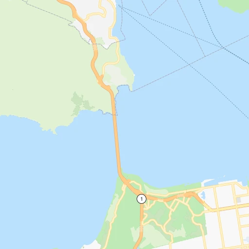
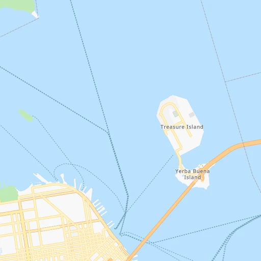
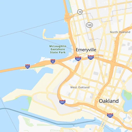
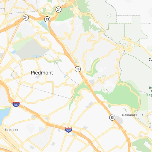
Roadmap (route) to go from Cruise Line Terminal to Tracy detailed above, you can also see the course layout on the map.
While doing trip Cruise Line Terminal - Tracy by car, the calculated route ends at a distance , or more straight.
Distance and duration of the route between Cruise Line Terminal and Tracy
Calculation of distance and route from Tracy to Cruise Line Terminal :
86.7100.1 km1h10mn
Continue 0h0mn 77 mTurn sharp left onto The Embarcadero 0h0mn 321 mContinue onto The Embarcadero 0h1mn 466 mTurn right 0h2mn 1.6 kmTurn left onto Bush Street 0h1mn 705 mKeep right onto 1st Street 0h0mn 34 mContinue onto 1st Street 0h0mn 90 mContinue and take I 80 East toward Bay Bridge, Oakland 0h8mn 9.5 kmKeep right and take I 580 East toward Downtown Oakland, Hayward-Stockton 1h47mn 74.3 kmKeep left onto Robert T. Monagan Freeway and take I 205 East toward Tracy, Stockton 0h4mn 6.2 kmKeep right onto I 205 Bus 0h6mn 6.9 kmArrive at destination 0h0mn 0 m
Travel from Cruise Line Terminal (California) to a selection of major cities.
Distances from Cruise Line Terminal to biggest cities in California
- Moreno Valley,204,198 inhabitants.635 km
- Huntington Beach,201,899 inhabitants.610 km
- Glendale,201,020 inhabitants.554 km
- Santa Clarita,182,371 inhabitants.515 km
- Oceanside,175,691 inhabitants.686 km
- Garden Grove,175,393 inhabitants.604 km
- Rancho Cucamonga,175,236 inhabitants.598 km
- Santa Rosa,174,972 inhabitants.75 km
- Ontario,171,214 inhabitants.598 km
- Hollywood,167,664 inhabitants.553 km
- Elk Grove,166,913 inhabitants.113 km
- Corona,164,226 inhabitants.618 km
- Lancaster,161,103 inhabitants.517 km
- Palmdale,158,351 inhabitants.527 km
- Hayward,158,289 inhabitants.33 km
- Salinas,157,380 inhabitants.143 km
- Pomona,153,266 inhabitants.592 km
- Sunnyvale,151,754 inhabitants.59 km
- Escondido,151,451 inhabitants.711 km
- Torrance,148,475 inhabitants.575 km
Other major cities in country :
- Detroit [MI], 677,116 inhabitants. 3,361 km
- Boston [MA], 667,137 inhabitants. 4,336 km
- Memphis [TN], 655,770 inhabitants. 2,897 km
- New South Memphis [TN], 641,608 inhabitants. 2,898 km
- Portland [OR], 632,309 inhabitants. 859 km
- Oklahoma City [OK], 631,346 inhabitants. 2,232 km
- Las Vegas [NV], 623,747 inhabitants. 672 km
- Baltimore [MD], 621,849 inhabitants. 3,948 km
- Washington, D.C. [DC], 601,723 inhabitants. 3,921 km
- Milwaukee [WI], 600,155 inhabitants. 2,960 km
- South Boston [MA], 571,281 inhabitants. 4,338 km
- Albuquerque [NM], 559,121 inhabitants. 1,441 km
- Tucson [AZ], 531,641 inhabitants. 1,216 km
- Nashville [TN], 530,852 inhabitants. 3,154 km
- Kansas City [MO], 475,378 inhabitants. 2,421 km
- Mesa [AZ], 471,825 inhabitants. 1,074 km
- Staten Island [NY], 468,730 inhabitants. 4,124 km
- Atlanta [GA], 463,878 inhabitants. 3,440 km
- Colorado Springs [CO], 456,568 inhabitants. 1,538 km
- Virginia Beach [VA], 452,745 inhabitants. 4,068 km
Route from Tracy to major cities (United States).
- Distance Tracy New York City4,053 km
- Distance Tracy Chicago2,906 km
- Distance Tracy Brooklyn4,059 km
- Distance Tracy Houston2,560 km
- Distance Tracy Queens4,068 km
- Distance Tracy Philadelphia3,973 km
- Distance Tracy Phoenix971 km
- Distance Tracy Manhattan4,055 km
- Distance Tracy San Antonio2,311 km
- Distance Tracy The Bronx4,062 km
- Distance Tracy Dallas2,297 km
- Distance Tracy Austin2,330 km
- Distance Tracy Jacksonville3,731 km
- Distance Tracy Columbus3,315 km
- Distance Tracy Fort Worth2,255 km
- Distance Tracy Indianapolis3,050 km
- Distance Tracy Charlotte3,615 km
- Distance Tracy Seattle1,101 km
- Distance Tracy Denver1,443 km
- Distance Tracy El Paso1,518 km
Nearest cities to Cruise Line Terminal :
- San Jose, 1,026,908 inhabitants. 69 km
- San Francisco, 864,816 inhabitants. 4 km
- Fresno, 520,052 inhabitants. 262 km
- Sacramento, 490,712 inhabitants. 118 km
- Oakland, 419,267 inhabitants. 12 km
- Stockton, 305,658 inhabitants. 100 km
- Reno, 241,445 inhabitants. 296 km
- Fremont, 232,206 inhabitants. 47 km
- Modesto, 211,266 inhabitants. 126 km
- Santa Rosa, 174,972 inhabitants. 75 km
- Elk Grove, 166,913 inhabitants. 113 km
- Hayward, 158,289 inhabitants. 33 km
- Salinas, 157,380 inhabitants. 143 km
- Sunnyvale, 151,754 inhabitants. 59 km
- Roseville, 130,269 inhabitants. 144 km
- Concord, 128,667 inhabitants. 38 km
- Santa Clara, 126,215 inhabitants. 65 km
- Vallejo, 121,253 inhabitants. 36 km
- Berkeley, 120,972 inhabitants. 14 km
- Fairfield, 112,970 inhabitants. 59 km
- Antioch, 110,542 inhabitants. 57 km
- Richmond, 109,708 inhabitants. 15 km
- Daly City, 106,562 inhabitants. 12 km
- Santa Maria, 105,093 inhabitants. 364 km
- Clovis, 104,180 inhabitants. 263 km
- San Mateo, 103,536 inhabitants. 28 km
- Chinatown, 100,574 inhabitants. 1 km
- Vacaville, 96,803 inhabitants. 71 km
- Sparks, 96,094 inhabitants. 300 km
- Arden-Arcade, 92,186 inhabitants. 126 km
- Redding, 91,582 inhabitants. 309 km
- San Leandro, 90,712 inhabitants. 24 km
- Chico, 90,316 inhabitants. 219 km
- Livermore, 88,126 inhabitants. 58 km
- Tracy, 87,075 inhabitants. 87 km
- Citrus Heights, 87,056 inhabitants. 141 km
- Redwood City, 85,288 inhabitants. 39 km
- Merced, 82,436 inhabitants. 179 km
- Mountain View, 80,435 inhabitants. 55 km
- Napa, 80,434 inhabitants. 55 km
- Pleasanton, 79,510 inhabitants. 50 km
- Alameda, 78,630 inhabitants. 16 km
- Milpitas, 77,604 inhabitants. 61 km
- Folsom, 76,375 inhabitants. 145 km
- San Ramon, 76,134 inhabitants. 38 km
- Manteca, 75,448 inhabitants. 105 km
- Union City, 74,494 inhabitants. 42 km
- Turlock, 72,292 inhabitants. 142 km
- Rancho Cordova, 71,017 inhabitants. 130 km
- Pittsburg, 69,424 inhabitants. 52 km
Location Cruise Line Terminal (California) :
| Country flag |  |
| Location | Cruise Line Terminal |
| State | California |
| County | City and County of San Francisco |
| Country | United States |
| Country code / ISO 2 | US |
| Latitude | 37.8084000 |
| Longitude | -122.4100000 |
| Altitude | 0 meters |
| Time zone | America/Los_Angeles |
Location Tracy (California) :
| Country flag | |
| Location | Tracy |
| State | California |
| County | San Joaquin County |
| Country | United States |
| Country code / ISO 2 | US |
| Latitude | 37.7398700 |
| Longitude | -121.4261800 |
| Altitude | 16 meters |
| Time zone | America/Los_Angeles |


