
Home
››
Tattenham Corner Railway Station
››
Roadmap from Tattenham Corner Railway Station to Londonderry
How to get from Tattenham Corner Railway Station (England) to Londonderry (Northern Ireland)
Calculate route from Tattenham Corner Railway Station (England, United Kingdom) to Londonderry (Northern Ireland, United Kingdom).
The flight distance (as the crow flies) between Tattenham Corner Railway Station and Londonderry is 623.8 km.
Roadmap (route) to go from Tattenham Corner Railway Station to Londonderry detailed above, you can also see the course layout on the map.
While doing trip Tattenham Corner Railway Station - Londonderry by car, the calculated route ends at a distance , or more straight.
Distance and duration of the route between Tattenham Corner Railway Station and Londonderry
Calculation of distance and route from Londonderry to Tattenham Corner Railway Station :
623.8760.9 km13h58mn
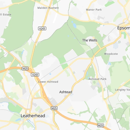
Continue onto Emily Davison Drive 0h0mn 110 mTurn right onto Royal Drive 0h0mn 23 mTurn left onto Tattenham Crescent 0h0mn 148 mTurn right onto Tattenham Corner Road 0h0mn 263 mAt roundabout, take exit 3 onto Tattenham Corner Road 0h1mn 601 mAt roundabout, take exit 2 onto Ashley Road 0h0mn 442 mTurn left onto Langley Vale Road 0h2mn 2.2 kmTurn right onto Farm Lane 0h1mn 1.1 kmTurn left onto Rookery Hill 0h1mn 655 mTurn left onto Park Lane 0h0mn 13 mTurn slight right onto Dene Road 0h1mn 524 mTurn left onto Parker's Lane 0h0mn 121 mContinue onto Parker's Hill 0h0mn 167 mTurn left onto Leatherhead Road 0h1mn 1.3 kmAt roundabout, take exit 3 onto Leatherhead By-Pass 0h1mn 712 mAt roundabout, take exit 3 onto M25 0h25mn 40.8 kmKeep left onto M40 and take M40 (W) toward Birmingham, Oxford 0h27mn 45.5 kmKeep right onto M40 1h54mn 91.3 kmKeep left onto M42 and take M42 North toward Birmingham (E,N & C), Solihull, National Exibition Centre, Birmingham Airport 0h3mn 5.0 kmKeep left and take A34 toward Shirley 0h0mn 239 mKeep right and take A34 toward Shirley 0h0mn 82 mContinue 0h0mn 26 mAt roundabout, take exit 1 onto Stratford Road 0h2mn 1.5 kmAt roundabout, take exit 1 onto Stratford Road 0h1mn 504 mAt roundabout, take exit 2 onto Stratford Road 0h1mn 503 mAt roundabout, take exit 2 onto Stratford Road 0h0mn 445 mAt roundabout, take exit 2 onto Stratford Road 0h1mn 430 mAt roundabout, take exit 1 onto Stratford Road 0h1mn 550 mAt roundabout, take exit 2 onto Stratford Road 0h2mn 1.6 kmKeep right 0h0mn 57 mTurn left 0h0mn 9 mTurn right onto Stratford Road 0h1mn 419 mAt roundabout, take exit 3 onto Stratford Road 0h3mn 2.3 kmTurn right onto Reddings Lane 0h1mn 1.0 kmTurn left onto Battery Way 0h1mn 526 mContinue onto Weston Lane 0h0mn 108 mTurn left onto Warwick Road 0h0mn 360 mAt roundabout, take exit 2 onto Warwick Road 0h0mn 339 mAt roundabout, take exit 2 onto Warwick Road 0h1mn 491 mTurn right onto Stratford Road 0h0mn 208 mKeep left 0h0mn 59 mTurn slight left onto Highgate Road 0h2mn 1.1 kmAt roundabout, take exit 2 onto Belgrave Middleway 0h3mn 2.5 kmAt roundabout, take exit 3 onto Ladywood Middleway 0h1mn 811 mAt roundabout, take exit 2 onto Wood Street 0h0mn 122 mContinue onto Icknield Port Road 0h1mn 1.2 kmContinue onto Winson Green Road 0h0mn 214 mTurn left onto Heath Street 0h1mn 1.2 kmTurn left onto Cranford Street 0h0mn 22 mAt roundabout, take exit 3 onto Soho Way 0h2mn 2.0 kmAt roundabout, take exit 3 onto Telford Way 0h1mn 732 mAt roundabout, take exit 2 onto Kenrick Way 0h1mn 537 mAt roundabout, take exit 2 onto West Bromwich Interchange 0h0mn 281 mContinue onto M5 toward M5 0h1mn 2.5 kmKeep right onto M5 0h2mn 2.7 kmKeep left onto M5 0h6mn 10.0 kmKeep right onto M6 1h0mn 102.8 kmKeep left toward M62 0h15mn 24.5 kmKeep right 0h0mn 230 mTurn left 0h1mn 1.1 kmKeep right 0h0mn 64 mTurn left onto Saint Oswalds Street 0h0mn 16 mTurn right onto Edge Lane Drive 0h5mn 3.9 kmKeep right onto Norton Street 0h0mn 115 mKeep left onto Hunter Street 0h1mn 420 mKeep right onto A5047 0h0mn 304 mKeep left 0h1mn 857 mKeep right onto Leeds Street 0h0mn 123 mTurn right onto Great Howard Street 0h0mn 80 mTurn left onto Paisley Street 0h0mn 162 mTurn right onto Waterloo Road 0h1mn 377 mTurn left onto Jessee Hartley Way 0h0mn 270 mAt roundabout, take exit 1 onto Triskelion Way 0h0mn 239 mKeep left 0h0mn 26 mKeep right 4h51mn 130.5 kmContinue 0h0mn 117 mTurn left 0h0mn 46 mKeep left 0h0mn 70 mTurn sharp left 0h0mn 107 mKeep left onto Belfast - Isle of Man 4h52mn 154.5 kmContinue 0h0mn 129 mTurn right 0h0mn 47 mTurn left 0h1mn 207 mAt roundabout, take exit 1 onto Belfast Harbour 0h1mn 496 mKeep left onto A2 0h0mn 302 mTurn left onto M2 0h2mn 4.0 kmKeep left onto M2 0h23mn 38.4 kmAt roundabout, take exit 1 onto Moneynick Road 0h3mn 3.4 kmAt roundabout, take exit 2 onto Hillhead Road 0h2mn 2.5 kmTurn left and take A6 toward Londonderry 0h2mn 3.0 kmAt roundabout, take exit 3 onto Castledawson Roundabout 0h20mn 28.9 kmKeep left onto Dungiven Bypass 0h15mn 25.3 kmAt roundabout, take exit 1 onto Tirbracken Road 0h3mn 3.2 kmAt roundabout, take exit 2 onto Dungiven Road 0h1mn 892 mContinue onto Glendermott Road 0h1mn 428 mTurn right onto King Street 0h0mn 189 mArrive at destination 0h0mn 0 m
Travel from Tattenham Corner Railway Station (Northern Ireland) to a selection of major cities.
Distances from Tattenham Corner Railway Station to biggest cities in England
- Plymouth,260,203 inhabitants.293 km
- Luton,258,018 inhabitants.65 km
- Wolverhampton,252,791 inhabitants.192 km
- City of Westminster,247,614 inhabitants.23 km
- Southampton,246,201 inhabitants.93 km
- Blackpool,239,409 inhabitants.338 km
- Milton Keynes,229,941 inhabitants.89 km
- Bexley,228,000 inhabitants.31 km
- Northampton,215,963 inhabitants.114 km
- Archway,215,667 inhabitants.30 km
- Norwich,213,166 inhabitants.181 km
- Dudley,199,059 inhabitants.183 km
- Portsmouth,194,150 inhabitants.82 km
- Newcastle upon Tyne,192,382 inhabitants.418 km
- Sutton,187,600 inhabitants.5 km
- Swindon,185,609 inhabitants.110 km
- Crawley,180,508 inhabitants.22 km
- Ipswich,178,835 inhabitants.128 km
- Wigan,175,405 inhabitants.297 km
- Croydon,173,314 inhabitants.13 km
Other major cities in country :
- Bridgend [WLS], 58,380 inhabitants. 233 km
- Castlereagh [NIR], 56,679 inhabitants. 524 km
- Livingston [SCT], 56,570 inhabitants. 555 km
- Barry [WLS], 54,673 inhabitants. 212 km
- Hamilton [SCT], 53,200 inhabitants. 556 km
- Cumbernauld [SCT], 51,610 inhabitants. 572 km
- Dunfermline [SCT], 50,380 inhabitants. 571 km
Route from Londonderry to major cities (United Kingdom).
- Distance Londonderry London616 km
- Distance Londonderry Birmingham453 km
- Distance Londonderry Liverpool333 km
- Distance Londonderry Nottingham463 km
- Distance Londonderry Sheffield421 km
- Distance Londonderry Bristol504 km
- Distance Londonderry Glasgow216 km
- Distance Londonderry Leicester483 km
- Distance Londonderry Edinburgh280 km
- Distance Londonderry Leeds396 km
- Distance Londonderry Cardiff478 km
- Distance Londonderry Manchester371 km
- Distance Londonderry Stoke-on-Trent402 km
- Distance Londonderry Coventry478 km
- Distance Londonderry Sunderland379 km
- Distance Londonderry Birkenhead332 km
- Distance Londonderry Islington615 km
- Distance Londonderry Reading577 km
- Distance Londonderry Kingston upon Hull473 km
- Distance Londonderry Preston329 km
Nearest cities to Tattenham Corner Railway Station :
- London, 7,556,900 inhabitants. 24 km
- Birmingham, 984,333 inhabitants. 173 km
- Liverpool, 864,122 inhabitants. 299 km
- Nottingham, 729,977 inhabitants. 193 km
- Sheffield, 685,368 inhabitants. 245 km
- Bristol, 617,280 inhabitants. 164 km
- Leicester, 508,916 inhabitants. 160 km
- Leeds, 455,123 inhabitants. 291 km
- Cardiff, 447,287 inhabitants. 205 km
- Manchester, 395,515 inhabitants. 277 km
- Stoke-on-Trent, 372,775 inhabitants. 231 km
- Coventry, 359,262 inhabitants. 150 km
- Birkenhead, 325,264 inhabitants. 299 km
- Islington, 319,143 inhabitants. 27 km
- Reading, 318,014 inhabitants. 53 km
- Kingston upon Hull, 314,018 inhabitants. 271 km
- Preston, 313,332 inhabitants. 320 km
- Newport, 306,844 inhabitants. 194 km
- Bradford, 299,310 inhabitants. 295 km
- Southend-on-Sea, 295,310 inhabitants. 71 km
- Derby, 270,468 inhabitants. 198 km
- Luton, 258,018 inhabitants. 65 km
- Wolverhampton, 252,791 inhabitants. 192 km
- City of Westminster, 247,614 inhabitants. 23 km
- Southampton, 246,201 inhabitants. 93 km
- Blackpool, 239,409 inhabitants. 338 km
- Milton Keynes, 229,941 inhabitants. 89 km
- Bexley, 228,000 inhabitants. 31 km
- Northampton, 215,963 inhabitants. 114 km
- Archway, 215,667 inhabitants. 30 km
- Norwich, 213,166 inhabitants. 181 km
- Dudley, 199,059 inhabitants. 183 km
- Portsmouth, 194,150 inhabitants. 82 km
- Sutton, 187,600 inhabitants. 5 km
- Swindon, 185,609 inhabitants. 110 km
- Crawley, 180,508 inhabitants. 22 km
- Ipswich, 178,835 inhabitants. 128 km
- Wigan, 175,405 inhabitants. 297 km
- Croydon, 173,314 inhabitants. 13 km
- Walsall, 172,141 inhabitants. 186 km
- Mansfield, 171,958 inhabitants. 213 km
- Oxford, 171,380 inhabitants. 86 km
- Warrington, 165,456 inhabitants. 281 km
- Slough, 163,777 inhabitants. 33 km
- Bournemouth, 163,600 inhabitants. 132 km
- Peterborough, 163,379 inhabitants. 141 km
- Cambridge, 158,434 inhabitants. 102 km
- Doncaster, 158,141 inhabitants. 254 km
- York, 153,717 inhabitants. 300 km
- Poole, 150,092 inhabitants. 139 km
Location Tattenham Corner Railway Station (England) :
| Country flag |  |
| Location | Tattenham Corner Railway Station |
| State | England |
| County | Surrey |
| Country | United Kingdom |
| Country code / ISO 2 | GB |
| Latitude | 51.3090600 |
| Longitude | -0.2422900 |
| Altitude | 0 meters |
| Time zone | Europe/London |
Location Londonderry (Northern Ireland) :
| Country flag | |
| Location | Londonderry |
| State | Northern Ireland |
| County | Derry City and Strabane |
| Country | United Kingdom |
| Country code / ISO 2 | GB |
| Latitude | 54.9981000 |
| Longitude | -7.3093400 |
| Altitude | 0 meters |
| Time zone | Europe/London |


