
How to get from New Rochelle Amtrak (New York) to Indianapolis (Indiana)
Calculate route from New Rochelle Amtrak (New York, United States) to Indianapolis (Indiana, United States).
The flight distance (as the crow flies) between New Rochelle Amtrak and Indianapolis is 1,054.0 km.
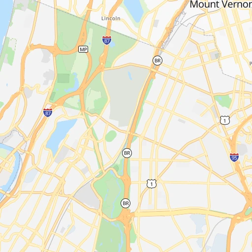
Roadmap (route) to go from New Rochelle Amtrak to Indianapolis detailed above, you can also see the course layout on the map.
While doing trip New Rochelle Amtrak - Indianapolis by car, the calculated route ends at a distance , or more straight.
Distance and duration of the route between New Rochelle Amtrak and Indianapolis
Calculation of distance and route from Indianapolis to New Rochelle Amtrak :
1,054.01,154.7 km13h40mn
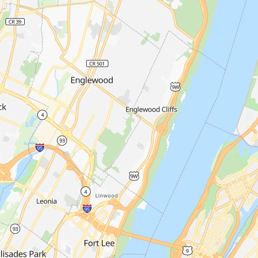
Continue 0h0mn 65 mTurn right 0h0mn 25 mTurn left onto Main Street 0h4mn 4.0 kmTurn slight right onto Boston Road 0h2mn 2.0 kmTurn right onto East Gun Hill Road 0h1mn 1.6 kmTurn left onto Webster Avenue 0h1mn 702 mTurn slight right onto Webster Avenue 0h4mn 4.0 kmTurn right onto US 1 and take I 95 South, US 1 South toward Cross Bronx Expressway, George Washington Bridge 0h2mn 2.3 kmKeep left onto Trans-Manhattan Expressway and drive toward Upper Level 0h3mn 3.8 kmKeep right onto US 1, US 9, US 46 and take US 1 South, US 9 South toward Palisades Park 0h3mn 3.1 kmKeep right onto US 1, US 9 and take US 1 South, US 9 South toward Broad Avenue 0h0mn 537 mKeep left toward US 46 West 0h1mn 764 mKeep right and take I 95 South, I 80 West toward NJ Turnpike, Teaneck Road 0h0mn 513 mKeep left and take I 95 South, NJTP South toward Newark 0h1mn 1.5 kmKeep right and take I 95 South, NJTP South toward Trenton 0h8mn 12.5 kmKeep right and take I 280 toward Newark, Kearny 0h1mn 995 mKeep right and take CR 508 West toward Kearny 0h4mn 3.6 kmTurn left onto McCarter Highway 0h0mn 82 mKeep right onto Lombardy Place 0h0mn 143 mTurn right onto Lombardy Street 0h0mn 136 mTurn left onto Broad Street / Kenneth A. Gibson Boulevard 0h0mn 16 mKeep right 0h0mn 43 mTurn slight right onto Washington Place 0h0mn 55 mTurn left onto Halsey Street 0h0mn 83 mTurn right onto Central Avenue 0h0mn 250 mTurn left onto University Avenue 0h1mn 706 mTurn right onto Market Street 0h0mn 40 mKeep left 0h0mn 37 mContinue onto Springfield Avenue 0h6mn 6.6 kmTurn slight right onto Springfield Avenue 0h2mn 2.0 kmContinue onto Springfield Avenue 0h2mn 1.6 kmKeep right and take NJ 24 West toward Morristown 0h1mn 2.0 kmKeep left onto I 78 and take I 78 West toward Clinton 1h46mn 72.7 kmKeep right onto US 22 and take US 22, NJ 122 toward Phillipsburg, Alpha 0h1mn 799 mTurn left onto New Brunswick Avenue 0h7mn 6.3 kmTurn left onto Union Square 0h1mn 548 mAt roundabout, take exit 4 onto South 3rd Street 0h0mn 211 mTurn right onto Pine Street 0h0mn 167 mTurn right onto South 4th Street 0h0mn 92 mTurn left onto Northampton Street 0h1mn 609 mKeep right onto Wood Avenue 0h1mn 1.2 kmTurn right and take US 22 West toward Bethlehem 2h60mn 175.1 kmKeep right and take US 11 toward New Kingstown, Middlesex 0h0mn 432 mKeep right toward US 11 South 0h2mn 1.6 kmKeep right toward I 76, PATP 0h1mn 746 mKeep right and take I 76 West toward Pittsburgh 0h0mn 397 mTurn right onto Pennsylvania Turnpike 2h13mn 219.5 kmKeep right and take PA 31, PA 711 toward Ligonier, Uniontown 0h0mn 529 mKeep right and take PA 31 toward Mount Pleasant, Uniontown 0h16mn 17.4 kmTurn slight right onto Mount Pleasant Road 0h12mn 12.8 kmTurn left 1h9mn 97.0 kmKeep left onto USS West Virginia Memorial Highway and take I 470 West toward Columbus OH 5h56mn 487.3 kmKeep right and drive toward Michigan Street, Ohio Street, Fletcher Avenue 0h1mn 1.0 kmKeep right and drive toward Michigan Street, New York Street 0h0mn 310 mKeep right and drive toward Michigan Street, New York Street 0h0mn 36 mTurn slight right onto East North Street 0h1mn 448 mTurn left onto Massachusetts Avenue 0h0mn 220 mContinue onto Massachusetts Avenue 0h0mn 219 mKeep left onto North Alabama Street 0h1mn 311 mTurn right onto East Ohio Street 0h1mn 307 mTurn left onto North Pennsylvania Street 0h0mn 258 mTurn right onto East Court Street 0h0mn 155 mTurn right onto North Meridian Street 0h0mn 48 mEnter roundabout 0h0mn 4 mArrive at destination 0h0mn 0 m
Travel from New Rochelle Amtrak (Indiana) to a selection of major cities.
Distances from New Rochelle Amtrak to biggest cities in New York
- East Harlem,115,921 inhabitants.17 km
- Elmhurst,113,364 inhabitants.20 km
- Bushwick,112,620 inhabitants.25 km
- Gravesend,112,229 inhabitants.37 km
- Corona,109,698 inhabitants.18 km
- Richmond Hill,98,984 inhabitants.23 km
- Albany,98,469 inhabitants.195 km
- Fordham,94,678 inhabitants.10 km
- West Albany,93,794 inhabitants.198 km
- Flatbush,93,361 inhabitants.31 km
- Canarsie,87,366 inhabitants.30 km
- Greenburgh,86,764 inhabitants.15 km
- New Rochelle,79,846 inhabitants.1 km
- Cheektowaga,75,178 inhabitants.468 km
- Kings Bridge,75,132 inhabitants.10 km
- Brownsville,74,497 inhabitants.29 km
- Ridgewood,69,317 inhabitants.24 km
- Mount Vernon,68,628 inhabitants.4 km
- Forest Hills,67,714 inhabitants.21 km
- Jackson Heights,67,067 inhabitants.18 km
Other major cities in country :
- Boston [MA], 667,137 inhabitants. 279 km
- Memphis [TN], 655,770 inhabitants. 1,559 km
- New South Memphis [TN], 641,608 inhabitants. 1,564 km
- Portland [OR], 632,309 inhabitants. 3,937 km
- Oklahoma City [OK], 631,346 inhabitants. 2,155 km
- Las Vegas [NV], 623,747 inhabitants. 3,604 km
- Baltimore [MD], 621,849 inhabitants. 300 km
- Washington, D.C. [DC], 601,723 inhabitants. 356 km
- Milwaukee [WI], 600,155 inhabitants. 1,191 km
- South Boston [MA], 571,281 inhabitants. 278 km
- Albuquerque [NM], 559,121 inhabitants. 2,936 km
- Tucson [AZ], 531,641 inhabitants. 3,430 km
- Nashville [TN], 530,852 inhabitants. 1,246 km
- Fresno [CA], 520,052 inhabitants. 3,968 km
- Sacramento [CA], 490,712 inhabitants. 4,040 km
- Kansas City [MO], 475,378 inhabitants. 1,780 km
- Long Beach [CA], 474,140 inhabitants. 3,965 km
- Mesa [AZ], 471,825 inhabitants. 3,446 km
- Atlanta [GA], 463,878 inhabitants. 1,229 km
- Colorado Springs [CO], 456,568 inhabitants. 2,647 km
Route from Indianapolis to major cities (United States).
- Distance Indianapolis New York City1,037 km
- Distance Indianapolis Los Angeles2,909 km
- Distance Indianapolis Chicago264 km
- Distance Indianapolis Brooklyn1,042 km
- Distance Indianapolis Houston1,394 km
- Distance Indianapolis Queens1,051 km
- Distance Indianapolis Philadelphia939 km
- Distance Indianapolis Phoenix2,411 km
- Distance Indianapolis Manhattan1,041 km
- Distance Indianapolis San Antonio1,610 km
- Distance Indianapolis San Diego2,876 km
- Distance Indianapolis The Bronx1,049 km
- Distance Indianapolis Dallas1,230 km
- Distance Indianapolis San Jose3,102 km
- Distance Indianapolis Austin1,492 km
- Distance Indianapolis Jacksonville1,127 km
- Distance Indianapolis San Francisco3,133 km
- Distance Indianapolis Columbus271 km
- Distance Indianapolis Fort Worth1,271 km
- Distance Indianapolis Charlotte690 km
Nearest cities to New Rochelle Amtrak :
- New York City, 8,175,133 inhabitants. 27 km
- Brooklyn, 2,300,664 inhabitants. 31 km
- Queens, 2,272,771 inhabitants. 25 km
- Philadelphia, 1,567,442 inhabitants. 157 km
- Manhattan, 1,487,536 inhabitants. 20 km
- The Bronx, 1,385,108 inhabitants. 8 km
- Boston, 667,137 inhabitants. 279 km
- Baltimore, 621,849 inhabitants. 300 km
- South Boston, 571,281 inhabitants. 278 km
- Staten Island, 468,730 inhabitants. 48 km
- Newark, 281,944 inhabitants. 37 km
- Jersey City, 264,290 inhabitants. 31 km
- Jamaica, 216,866 inhabitants. 23 km
- Yonkers, 201,116 inhabitants. 10 km
- Worcester, 184,815 inhabitants. 225 km
- Harlem, 181,259 inhabitants. 17 km
- Providence, 179,207 inhabitants. 224 km
- East Flatbush, 178,464 inhabitants. 30 km
- East New York, 173,198 inhabitants. 27 km
- Springfield, 154,341 inhabitants. 167 km
- Washington Heights, 152,613 inhabitants. 13 km
- Astoria, 150,165 inhabitants. 18 km
- Borough Park, 149,248 inhabitants. 34 km
- Paterson, 147,754 inhabitants. 32 km
- Bridgeport, 147,629 inhabitants. 58 km
- Syracuse, 144,142 inhabitants. 308 km
- New Haven, 130,322 inhabitants. 86 km
- Elizabeth, 129,007 inhabitants. 44 km
- Stamford, 128,874 inhabitants. 27 km
- Sunset Park, 126,000 inhabitants. 34 km
- Hartford, 124,006 inhabitants. 133 km
- Sheepshead Bay, 122,534 inhabitants. 37 km
- North Stamford, 121,230 inhabitants. 34 km
- Allentown, 120,207 inhabitants. 147 km
- East Harlem, 115,921 inhabitants. 17 km
- Elmhurst, 113,364 inhabitants. 20 km
- Bushwick, 112,620 inhabitants. 25 km
- Gravesend, 112,229 inhabitants. 37 km
- Lowell, 110,699 inhabitants. 282 km
- Cambridge, 110,402 inhabitants. 277 km
- Manchester, 110,229 inhabitants. 303 km
- Corona, 109,698 inhabitants. 18 km
- Waterbury, 108,802 inhabitants. 96 km
- Edison, 102,548 inhabitants. 67 km
- Richmond Hill, 98,984 inhabitants. 23 km
- Albany, 98,469 inhabitants. 195 km
- Brockton, 95,314 inhabitants. 266 km
- New Bedford, 94,958 inhabitants. 253 km
- Fordham, 94,678 inhabitants. 10 km
- West Albany, 93,794 inhabitants. 198 km
Location New Rochelle Amtrak (New York) :
| Country flag |  |
| Location | New Rochelle Amtrak |
| State | New York |
| County | Westchester County |
| Country | United States |
| Country code / ISO 2 | US |
| Latitude | 40.9010000 |
| Longitude | -73.7928000 |
| Altitude | 0 meters |
| Time zone | America/New_York |
Location Indianapolis (Indiana) :
| Country flag | |
| Location | Indianapolis |
| State | Indiana |
| County | Marion County |
| Country | United States |
| Country code / ISO 2 | US |
| Latitude | 39.7683800 |
| Longitude | -86.1580400 |
| Altitude | 218 meters |
| Time zone | America/Indiana/Indianapolis |


