
How to get from Shpola (Cherkasy) to Zhashkiv (Cherkasy)
Calculate route from Shpola (Cherkasy, Ukraine) to Zhashkiv (Cherkasy, Ukraine).
The flight distance (as the crow flies) between Shpola and Zhashkiv is 97.1 km.
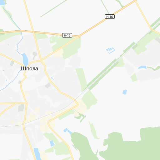
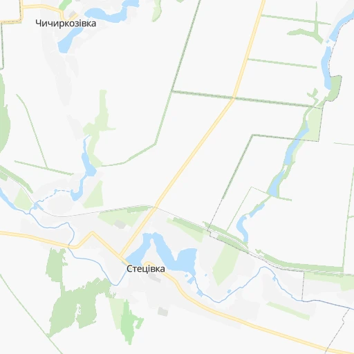
Roadmap (route) to go from Shpola to Zhashkiv detailed above, you can also see the course layout on the map.
While doing trip Shpola - Zhashkiv by car, the calculated route ends at a distance , or more straight.
Distance and duration of the route between Shpola and Zhashkiv
Calculation of distance and route from Zhashkiv to Shpola :
97.1115.4 km2h52mn
Continue 0h1mn 329 mTurn right onto вулиця Івана Гончара 0h1mn 282 mTurn right onto Соборна вулиця 0h1mn 666 mTurn left onto вулиця Таранця 0h0mn 129 mTurn right onto вулиця Таранця 0h0mn 284 mTurn left onto Лозуватська вулиця 0h3mn 2.8 kmTurn left onto Н-16 0h26mn 28.5 kmTurn right 0h2mn 1.6 kmContinue onto проспект Шевченка 0h4mn 3.0 kmAt roundabout, take exit 2 onto Рижанівська вулиця 0h2mn 2.6 kmTurn right toward Т-24-05 1h44mn 42.4 kmTurn right onto Т-24-05 0h1mn 852 mTurn right onto Т-24-05 0h1mn 939 mTurn right onto Т-24-05 0h20mn 26.7 kmTurn left onto Спортивна вулиця 0h1mn 540 mTurn sharp right onto Заводська вулиця 0h5mn 3.6 kmTurn left 0h0mn 113 mArrive at destination 0h0mn 0 m
Travel from Shpola (Cherkasy) to a selection of major cities.
Distances from Shpola to biggest cities in Cherkasy
Other major cities in country :
- Zhytomyr [27], 282,192 inhabitants. 241 km
- Horlivka [05], 278,550 inhabitants. 495 km
- Rivne [19], 255,106 inhabitants. 412 km
- Kropyvnytskyi [10], 249,454 inhabitants. 84 km
- Kamianske [04], 248,575 inhabitants. 242 km
- Chernivtsi [03], 236,250 inhabitants. 409 km
- Ternopil [22], 235,676 inhabitants. 426 km
- Kremenchuk [18], 227,494 inhabitants. 148 km
- Lutsk [24], 213,661 inhabitants. 476 km
- Ivano-Frankivsk [06], 204,200 inhabitants. 489 km
- Bila Tserkva [13], 199,163 inhabitants. 129 km
- Kramators'k [05], 173,700 inhabitants. 452 km
- Melitopol [26], 158,000 inhabitants. 381 km
- Kerch [11], 148,932 inhabitants. 559 km
- Nikopol [04], 130,500 inhabitants. 274 km
- Syevyerodonets'k [14], 130,000 inhabitants. 518 km
- Sloviansk [05], 124,800 inhabitants. 455 km
- Berdyansk [26], 118,284 inhabitants. 474 km
- Uzhgorod [25], 117,878 inhabitants. 668 km
- Alchevs'k [14], 116,000 inhabitants. 548 km
Route from Zhashkiv to major cities (Ukraine).
- Distance Zhashkiv Kyiv138 km
- Distance Zhashkiv Kharkiv450 km
- Distance Zhashkiv Dnipro371 km
- Distance Zhashkiv Donetsk582 km
- Distance Zhashkiv Odessa312 km
- Distance Zhashkiv Zaporizhia406 km
- Distance Zhashkiv Lviv444 km
- Distance Zhashkiv Kryvyi Rih283 km
- Distance Zhashkiv Mykolayiv290 km
- Distance Zhashkiv Mariupol601 km
- Distance Zhashkiv Luhansk677 km
- Distance Zhashkiv Sevastopol580 km
- Distance Zhashkiv Khmelnytskyi227 km
- Distance Zhashkiv Makiyivka590 km
- Distance Zhashkiv Vinnytsia118 km
- Distance Zhashkiv Simferopol565 km
- Distance Zhashkiv Kherson344 km
- Distance Zhashkiv Poltava323 km
- Distance Zhashkiv Chernihiv265 km
- Distance Zhashkiv Sumy383 km
Nearest cities to Shpola :
- Kyiv, 2,797,553 inhabitants. 173 km
- Odessa, 1,001,558 inhabitants. 286 km
- Kryvyi Rih, 652,380 inhabitants. 191 km
- Mykolayiv, 510,840 inhabitants. 232 km
- Vinnytsia, 352,115 inhabitants. 214 km
- Kherson, 320,477 inhabitants. 277 km
- Chernihiv, 307,684 inhabitants. 278 km
- Cherkasy, 297,568 inhabitants. 68 km
- Zhytomyr, 282,192 inhabitants. 241 km
- Kropyvnytskyi, 249,454 inhabitants. 84 km
- Kremenchuk, 227,494 inhabitants. 148 km
- Bila Tserkva, 199,163 inhabitants. 129 km
- Oleksandriya, 103,000 inhabitants. 132 km
- Konotop, 91,798 inhabitants. 280 km
- Brovary, 88,506 inhabitants. 173 km
- Uman, 87,658 inhabitants. 91 km
- Berdychiv, 86,250 inhabitants. 225 km
- Shostka, 85,432 inhabitants. 350 km
- Nizhyn, 75,499 inhabitants. 230 km
- Pervomays'k, 70,746 inhabitants. 114 km
- Smila, 67,530 inhabitants. 43 km
- Korosten', 65,000 inhabitants. 293 km
- Pryluky, 62,823 inhabitants. 190 km
- Boryspil', 55,000 inhabitants. 153 km
- Chornomors'k, 54,102 inhabitants. 306 km
- Lubny, 52,600 inhabitants. 161 km
- Horishni Plavni, 51,740 inhabitants. 164 km
- Zhovti Vody, 51,559 inhabitants. 172 km
- Fastiv, 51,143 inhabitants. 160 km
- Nova Kakhovka, 50,672 inhabitants. 290 km
- Bilhorod-Dnistrovskyi, 50,201 inhabitants. 323 km
- Romny, 48,570 inhabitants. 245 km
- Svitlovods'k, 47,946 inhabitants. 135 km
- Bucha, 42,279 inhabitants. 191 km
- Voznesensk, 42,248 inhabitants. 161 km
- Myrhorod, 41,377 inhabitants. 193 km
- Irpin, 40,789 inhabitants. 188 km
- Podil's'k, 40,664 inhabitants. 196 km
- Vasylkiv, 39,700 inhabitants. 153 km
- Yuzhnoukrains'k, 39,430 inhabitants. 133 km
- Kakhovka, 36,816 inhabitants. 290 km
- Pereyaslav-Khmel'nyts'kyy, 36,527 inhabitants. 118 km
- Hlukhiv, 35,387 inhabitants. 347 km
- Boyarka, 34,631 inhabitants. 166 km
- Dolyns'ka, 34,267 inhabitants. 142 km
- Vyshneve, 33,183 inhabitants. 171 km
- Obukhiv, 31,557 inhabitants. 135 km
- Tsyurupyns'k, 28,800 inhabitants. 284 km
- Znomenka, 28,318 inhabitants. 99 km
- Zolotonosha, 27,722 inhabitants. 87 km
Location Shpola (Cherkasy) :
| Country flag |  |
| Location | Shpola |
| State | Cherkasy |
| County | |
| Country | Ukraine |
| Country code / ISO 2 | UA |
| Latitude | 49.0068700 |
| Longitude | 31.3947100 |
| Altitude | 0 meters |
| Time zone | Europe/Kiev |
Location Zhashkiv (Cherkasy) :
| Country flag | |
| Location | Zhashkiv |
| State | Cherkasy |
| County | |
| Country | Ukraine |
| Country code / ISO 2 | UA |
| Latitude | 49.2454500 |
| Longitude | 30.1102000 |
| Altitude | 0 meters |
| Time zone | Europe/Kiev |