

How to get from Stantsiya Sukhachivka (Dnipropetrovsk) to Pokrovsk (Donetsk)
Calculate route from Stantsiya Sukhachivka (Dnipropetrovsk, Ukraine) to Pokrovsk (Donetsk, Ukraine).
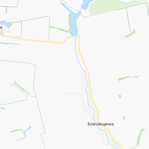
The flight distance (as the crow flies) between Stantsiya Sukhachivka and Pokrovsk is 176.3 km.
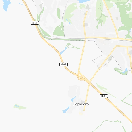
Roadmap (route) to go from Stantsiya Sukhachivka to Pokrovsk detailed above, you can also see the course layout on the map.
While doing trip Stantsiya Sukhachivka - Pokrovsk by car, the calculated route ends at a distance , or more straight.
Distance and duration of the route between Stantsiya Sukhachivka and Pokrovsk
Calculation of distance and route from Pokrovsk to Stantsiya Sukhachivka :
176.3199.2 km3h54mn
Continue onto Привокзальна вулиця 0h1mn 587 mTurn slight left onto Лісова вулиця 0h1mn 888 mTurn right onto вулиця Генерала Волівача 0h3mn 2.0 kmContinue onto Новопокровська вулиця 0h3mn 2.5 kmTurn right onto Геологічна вулиця 0h1mn 967 mContinue onto Мукачівська вулиця 0h2mn 1.6 kmTurn right onto Велика Діївська вулиця 0h4mn 3.2 kmContinue onto Велика Діївська вулиця 0h0mn 78 mTurn slight right onto проспект Свободи 0h3mn 2.5 kmTurn left onto вулиця Кайдацький Шлях 0h15mn 15.0 kmKeep right onto О040410 0h0mn 50 mKeep left onto Шосейна вулиця 2h16mn 167.5 kmTurn left onto Прокоф'єва вулиця 0h3mn 2.3 kmTurn right onto Європейська вулиця 0h0mn 171 mTurn right 0h0mn 19 mArrive at destination 0h0mn 0 m
Travel from Stantsiya Sukhachivka (Donetsk) to a selection of major cities.
Distances from Stantsiya Sukhachivka to biggest cities in Dnipropetrovsk
Other major cities in country :
- Horlivka [05], 278,550 inhabitants. 241 km
- Rivne [19], 255,106 inhabitants. 665 km
- Kropyvnytskyi [10], 249,454 inhabitants. 188 km
- Chernivtsi [03], 236,250 inhabitants. 655 km
- Ternopil [22], 235,676 inhabitants. 684 km
- Kremenchuk [18], 227,494 inhabitants. 123 km
- Lutsk [24], 213,661 inhabitants. 729 km
- Ivano-Frankivsk [06], 204,200 inhabitants. 743 km
- Bila Tserkva [13], 199,163 inhabitants. 374 km
- Kramators'k [05], 173,700 inhabitants. 205 km
- Melitopol [26], 158,000 inhabitants. 182 km
- Kerch [11], 148,932 inhabitants. 366 km
- Syevyerodonets'k [14], 130,000 inhabitants. 277 km
- Sloviansk [05], 124,800 inhabitants. 213 km
- Berdyansk [26], 118,284 inhabitants. 239 km
- Uzhgorod [25], 117,878 inhabitants. 921 km
- Alchevs'k [14], 116,000 inhabitants. 297 km
- Lysychans'k [14], 111,600 inhabitants. 273 km
- Yevpatoriya [11], 106,202 inhabitants. 377 km
- Yenakiyeve [05], 104,101 inhabitants. 253 km
Route from Pokrovsk to major cities (Ukraine).
- Distance Pokrovsk Kyiv539 km
- Distance Pokrovsk Kharkiv201 km
- Distance Pokrovsk Dnipro159 km
- Distance Pokrovsk Odessa525 km
- Distance Pokrovsk Zaporizhia156 km
- Distance Pokrovsk Lviv974 km
- Distance Pokrovsk Kryvyi Rih285 km
- Distance Pokrovsk Mykolayiv415 km
- Distance Pokrovsk Luhansk161 km
- Distance Pokrovsk Sevastopol497 km
- Distance Pokrovsk Khmelnytskyi756 km
- Distance Pokrovsk Vinnytsia646 km
- Distance Pokrovsk Simferopol438 km
- Distance Pokrovsk Kherson388 km
- Distance Pokrovsk Poltava242 km
- Distance Pokrovsk Chernihiv554 km
- Distance Pokrovsk Cherkasy396 km
- Distance Pokrovsk Sumy340 km
- Distance Pokrovsk Zhytomyr655 km
- Distance Pokrovsk Rivne833 km
Nearest cities to Stantsiya Sukhachivka :
- Kharkiv, 1,430,885 inhabitants. 201 km
- Dnipro, 1,032,822 inhabitants. 18 km
- Zaporizhia, 796,217 inhabitants. 75 km
- Kryvyi Rih, 652,380 inhabitants. 121 km
- Mykolayiv, 510,840 inhabitants. 266 km
- Mariupol, 481,626 inhabitants. 254 km
- Kherson, 320,477 inhabitants. 258 km
- Poltava, 317,847 inhabitants. 130 km
- Cherkasy, 297,568 inhabitants. 228 km
- Sumy, 294,456 inhabitants. 276 km
- Kropyvnytskyi, 249,454 inhabitants. 188 km
- Kamianske, 248,575 inhabitants. 17 km
- Kremenchuk, 227,494 inhabitants. 123 km
- Kramators'k, 173,700 inhabitants. 205 km
- Melitopol, 158,000 inhabitants. 182 km
- Nikopol, 130,500 inhabitants. 101 km
- Sloviansk, 124,800 inhabitants. 213 km
- Berdyansk, 118,284 inhabitants. 239 km
- Pavlohrad, 115,932 inhabitants. 80 km
- Oleksandriya, 103,000 inhabitants. 127 km
- Konotop, 91,798 inhabitants. 332 km
- Kostyantynivka, 91,259 inhabitants. 215 km
- Nizhyn, 75,499 inhabitants. 358 km
- Novomoskovs'k, 73,100 inhabitants. 40 km
- Pokrovsk, 68,263 inhabitants. 177 km
- Smila, 67,530 inhabitants. 230 km
- Pryluky, 62,823 inhabitants. 296 km
- Druzhkivka, 62,315 inhabitants. 204 km
- Lozova, 62,311 inhabitants. 122 km
- Energodar, 55,800 inhabitants. 105 km
- Izyum, 53,778 inhabitants. 199 km
- Lubny, 52,600 inhabitants. 219 km
- Horishni Plavni, 51,740 inhabitants. 106 km
- Zhovti Vody, 51,559 inhabitants. 96 km
- Nova Kakhovka, 50,672 inhabitants. 217 km
- Marhanets', 50,443 inhabitants. 91 km
- Okhtyrka, 49,818 inhabitants. 208 km
- Myrnohrad, 49,646 inhabitants. 183 km
- Romny, 48,570 inhabitants. 274 km
- Svitlovods'k, 47,946 inhabitants. 133 km
- Dzhankoy, 41,731 inhabitants. 305 km
- Myrhorod, 41,377 inhabitants. 191 km
- Kakhovka, 36,816 inhabitants. 206 km
- Chuhuyiv, 36,519 inhabitants. 207 km
- Dobropillya, 35,977 inhabitants. 169 km
- Avdiyivka, 35,826 inhabitants. 221 km
- Tokmak, 34,926 inhabitants. 149 km
- Dolyns'ka, 34,267 inhabitants. 155 km
- Kupjansk, 32,449 inhabitants. 249 km
- Synel'nykove, 31,900 inhabitants. 55 km
Location Stantsiya Sukhachivka (Dnipropetrovsk) :
| Country flag |  |
| Location | Stantsiya Sukhachivka |
| State | Dnipropetrovsk |
| County | |
| Country | Ukraine |
| Country code / ISO 2 | UA |
| Latitude | 48.4404300 |
| Longitude | 34.7998000 |
| Altitude | 0 meters |
| Time zone | Europe/Zaporozhye |
Location Pokrovsk (Donetsk) :
| Country flag | |
| Location | Pokrovsk |
| State | Donetsk |
| County | Krasnoarmiys’ka Mis’krada |
| Country | Ukraine |
| Country code / ISO 2 | UA |
| Latitude | 48.2819800 |
| Longitude | 37.1758500 |
| Altitude | 0 meters |
| Time zone | Europe/Kiev |