

How to get from Stantsiya Tahamlyk (Poltava) to Sevastopol (Sevastopol City)
Calculate route from Stantsiya Tahamlyk (Poltava, Ukraine) to Sevastopol (Sevastopol City, Ukraine).
The flight distance (as the crow flies) between Stantsiya Tahamlyk and Sevastopol is 549.2 km.
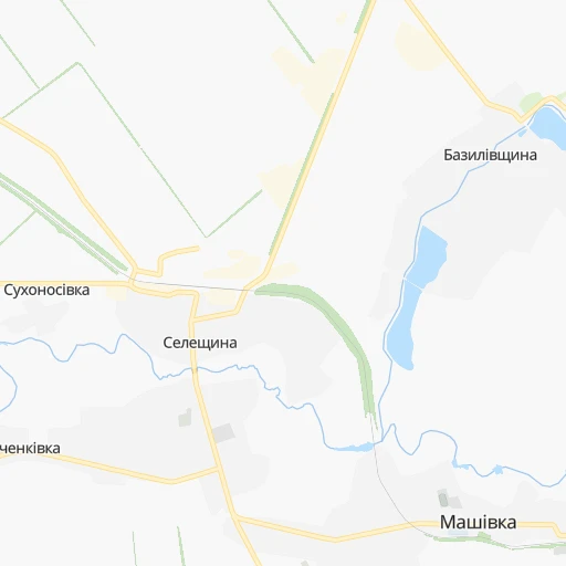
Roadmap (route) to go from Stantsiya Tahamlyk to Sevastopol detailed above, you can also see the course layout on the map.
While doing trip Stantsiya Tahamlyk - Sevastopol by car, the calculated route ends at a distance , or more straight.
Distance and duration of the route between Stantsiya Tahamlyk and Sevastopol
Calculation of distance and route from Sevastopol to Stantsiya Tahamlyk :
549.2698.4 km10h15mn
Continue 0h0mn 120 mTurn left onto Затишна вулиця 0h2mn 2.0 kmTurn left 0h1mn 1.1 kmTurn right onto Т-1712 0h2mn 1.6 kmTurn sharp left onto О-1714197 1h38mn 38.0 kmTurn left onto О-1716241 0h3mn 3.0 kmContinue onto вулиця Гончара 0h1mn 715 mTurn right onto Т-04-12 0h2mn 1.7 kmTurn left onto О040708 0h0mn 389 mKeep left onto О040708 0h25mn 27.2 kmKeep right onto О040410 0h19mn 21.7 kmTurn slight right onto вулиця Шевченка 0h9mn 8.4 kmTurn left onto О041001 0h12mn 12.2 kmTurn left onto вулиця Сучкова 0h2mn 2.1 kmTurn right onto вулиця Гавриїла Зелінського 0h1mn 598 mTurn left 0h1mn 382 mTurn right onto Гетьманська вулиця 0h0mn 202 mTurn left onto вулиця 195-ї Стрілецької Дивізії 1h29mn 101.6 kmAt roundabout, take exit 3 onto Оріхівське шосе 1h44mn 50.9 kmAt roundabout, take exit 1 onto Н-08, Т-04-08 0h0mn 439 mTurn left onto Запорізька вулиця 0h4mn 3.6 kmKeep right 0h0mn 124 mTurn slight right onto Н-08, Т-04-08 0h6mn 5.2 kmContinue onto Т-04-08 1h32mn 31.1 kmAt roundabout, take exit 1 onto Гоголя вулиця 0h0mn 404 mAt roundabout, take exit 2 onto Гоголя вулиця 1h34mn 38.9 kmTurn right onto Т-04-01 0h16mn 15.8 kmTurn left onto Суворова вулиця 0h0mn 72 mTurn left onto Незалежності вулиця 0h1mn 539 mTurn right onto Козацька вулиця 0h2mn 1.5 kmTurn left onto 50 років Перемоги проспект 0h0mn 327 mTurn slight left onto 50 років Перемоги проспект 0h2mn 2.3 kmContinue onto Богдана Хмельницького проспект 0h5mn 4.1 kmAt roundabout, take exit 2 onto М-18 2h3mn 150.1 kmContinue onto 35А-002, М-18, 35А-001 1h8mn 82.7 kmKeep right 1h59mn 79.9 kmKeep right 0h0mn 88 mKeep left 0h1mn 769 mKeep right onto 67К-2 0h1mn 744 mKeep right 0h4mn 3.8 kmKeep right onto Генерала Острякова проспект 0h2mn 1.8 kmKeep left onto Чапаева улица 0h0mn 51 mArrive at destination 0h0mn 0 m
Travel from Stantsiya Tahamlyk (Sevastopol City) to a selection of major cities.
Distances from Stantsiya Tahamlyk to biggest cities in Poltava
Other major cities in country :
- Zhytomyr [27], 282,192 inhabitants. 455 km
- Horlivka [05], 278,550 inhabitants. 262 km
- Rivne [19], 255,106 inhabitants. 633 km
- Kropyvnytskyi [10], 249,454 inhabitants. 218 km
- Kamianske [04], 248,575 inhabitants. 106 km
- Chernivtsi [03], 236,250 inhabitants. 668 km
- Ternopil [22], 235,676 inhabitants. 672 km
- Lutsk [24], 213,661 inhabitants. 697 km
- Ivano-Frankivsk [06], 204,200 inhabitants. 743 km
- Bila Tserkva [13], 199,163 inhabitants. 347 km
- Kramators'k [05], 173,700 inhabitants. 210 km
- Melitopol [26], 158,000 inhabitants. 291 km
- Kerch [11], 148,932 inhabitants. 470 km
- Nikopol [04], 130,500 inhabitants. 211 km
- Syevyerodonets'k [14], 130,000 inhabitants. 267 km
- Sloviansk [05], 124,800 inhabitants. 208 km
- Berdyansk [26], 118,284 inhabitants. 330 km
- Uzhgorod [25], 117,878 inhabitants. 923 km
- Alchevs'k [14], 116,000 inhabitants. 307 km
- Pavlohrad [04], 115,932 inhabitants. 124 km
Route from Sevastopol to major cities (Ukraine).
- Distance Sevastopol Kyiv691 km
- Distance Sevastopol Kharkiv635 km
- Distance Sevastopol Dnipro446 km
- Distance Sevastopol Donetsk504 km
- Distance Sevastopol Odessa302 km
- Distance Sevastopol Zaporizhia382 km
- Distance Sevastopol Lviv925 km
- Distance Sevastopol Kryvyi Rih370 km
- Distance Sevastopol Mykolayiv290 km
- Distance Sevastopol Mariupol418 km
- Distance Sevastopol Luhansk626 km
- Distance Sevastopol Khmelnytskyi731 km
- Distance Sevastopol Makiyivka513 km
- Distance Sevastopol Vinnytsia643 km
- Distance Sevastopol Simferopol62 km
- Distance Sevastopol Kherson241 km
- Distance Sevastopol Poltava562 km
- Distance Sevastopol Chernihiv788 km
- Distance Sevastopol Cherkasy550 km
- Distance Sevastopol Sumy711 km
Nearest cities to Stantsiya Tahamlyk :
- Kharkiv, 1,430,885 inhabitants. 115 km
- Dnipro, 1,032,822 inhabitants. 110 km
- Donetsk, 1,024,700 inhabitants. 266 km
- Zaporizhia, 796,217 inhabitants. 182 km
- Kryvyi Rih, 652,380 inhabitants. 204 km
- Mykolayiv, 510,840 inhabitants. 349 km
- Mariupol, 481,626 inhabitants. 327 km
- Kherson, 320,477 inhabitants. 353 km
- Poltava, 317,847 inhabitants. 31 km
- Cherkasy, 297,568 inhabitants. 205 km
- Sumy, 294,456 inhabitants. 165 km
- Kropyvnytskyi, 249,454 inhabitants. 218 km
- Kamianske, 248,575 inhabitants. 106 km
- Kremenchuk, 227,494 inhabitants. 115 km
- Kramators'k, 173,700 inhabitants. 210 km
- Melitopol, 158,000 inhabitants. 291 km
- Nikopol, 130,500 inhabitants. 211 km
- Sloviansk, 124,800 inhabitants. 208 km
- Berdyansk, 118,284 inhabitants. 330 km
- Pavlohrad, 115,932 inhabitants. 124 km
- Oleksandriya, 103,000 inhabitants. 156 km
- Konotop, 91,798 inhabitants. 233 km
- Kostyantynivka, 91,259 inhabitants. 229 km
- Shostka, 85,432 inhabitants. 288 km
- Novomoskovs'k, 73,100 inhabitants. 93 km
- Pokrovsk, 68,263 inhabitants. 211 km
- Pryluky, 62,823 inhabitants. 220 km
- Druzhkivka, 62,315 inhabitants. 214 km
- Lozova, 62,311 inhabitants. 121 km
- Energodar, 55,800 inhabitants. 217 km
- Izyum, 53,778 inhabitants. 173 km
- Lubny, 52,600 inhabitants. 151 km
- Horishni Plavni, 51,740 inhabitants. 103 km
- Zhovti Vody, 51,559 inhabitants. 159 km
- Nova Kakhovka, 50,672 inhabitants. 320 km
- Marhanets', 50,443 inhabitants. 202 km
- Okhtyrka, 49,818 inhabitants. 97 km
- Myrnohrad, 49,646 inhabitants. 215 km
- Romny, 48,570 inhabitants. 177 km
- Svitlovods'k, 47,946 inhabitants. 128 km
- Toretsk, 41,758 inhabitants. 245 km
- Myrhorod, 41,377 inhabitants. 109 km
- Yasynuvata, 37,600 inhabitants. 262 km
- Kakhovka, 36,816 inhabitants. 311 km
- Chuhuyiv, 36,519 inhabitants. 137 km
- Dobropillya, 35,977 inhabitants. 194 km
- Avdiyivka, 35,826 inhabitants. 254 km
- Hlukhiv, 35,387 inhabitants. 258 km
- Tokmak, 34,926 inhabitants. 251 km
- Dolyns'ka, 34,267 inhabitants. 215 km
Location Stantsiya Tahamlyk (Poltava) :
| Country flag |  |
| Location | Stantsiya Tahamlyk |
| State | Poltava |
| County | |
| Country | Ukraine |
| Country code / ISO 2 | UA |
| Latitude | 49.4419500 |
| Longitude | 34.8933400 |
| Altitude | 0 meters |
| Time zone | Europe/Zaporozhye |
Location Sevastopol (Sevastopol City) :
| Country flag | |
| Location | Sevastopol |
| State | Sevastopol City |
| County | |
| Country | Ukraine |
| Country code / ISO 2 | UA |
| Latitude | 44.5888300 |
| Longitude | 33.5224000 |
| Altitude | 50 meters |
| Time zone | Europe/Simferopol |