


How to get from Tysmenytsya (Ivano-Frankivsk) to Horodok (Khmelnytskyi)
Calculate route from Tysmenytsya (Ivano-Frankivsk, Ukraine) to Horodok (Khmelnytskyi, Ukraine).
The flight distance (as the crow flies) between Tysmenytsya and Horodok is 130.0 km.
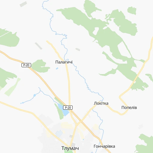
Roadmap (route) to go from Tysmenytsya to Horodok detailed above, you can also see the course layout on the map.
While doing trip Tysmenytsya - Horodok by car, the calculated route ends at a distance , or more straight.
Distance and duration of the route between Tysmenytsya and Horodok
Calculation of distance and route from Horodok to Tysmenytsya :
130.0166.8 km3h58mn
Continue onto вулиця Северина Наливайка 0h0mn 172 mTurn left onto вулиця Костя Левицького 0h0mn 111 mTurn right onto Галицька вулиця 0h3mn 2.7 kmAt roundabout, take exit 2 onto Н-18 0h6mn 4.3 kmAt roundabout, take exit 2 onto вулиця Івана Франка 0h0mn 146 mContinue onto Н-18 1h35mn 31.4 kmTurn left 0h0mn 59 mTurn right onto Горіхова вулиця 0h1mn 277 mTurn left onto вулиця Тараса Шевченка 0h12mn 12.8 kmTurn right 0h4mn 3.2 kmKeep left onto вулиця Богдана Хмельницького 0h3mn 2.0 kmTurn left 0h0mn 217 mTurn right onto Підгаєцька вулиця 0h0mn 129 mKeep right 0h0mn 371 mTurn left 0h1mn 1.0 kmKeep right 0h0mn 63 mTurn slight right onto вулиця Генерала Шухевича 1h33mn 27.9 kmKeep left onto Бучацька вулиця 0h2mn 2.0 kmTurn right 0h0mn 158 mTurn left onto Ягільницька вулиця 0h0mn 71 mKeep right onto вулиця Незалежності 0h1mn 1.5 kmTurn right onto вулиця Шевченка 0h3mn 2.8 kmKeep left 0h0mn 453 mTurn sharp left 0h1mn 521 mTurn sharp left onto М-19 0h9mn 10.8 kmTurn right onto Т-20-11 0h2mn 1.5 kmTurn right onto Гусятинська вулиця 0h22mn 22.4 kmAt roundabout, take exit 1 onto Т-20-11 0h1mn 824 mTurn sharp right onto Суходільська вулиця 0h0mn 31 mTurn left 0h0mn 248 mContinue onto Надозерна вулиця 0h0mn 108 mTurn sharp left onto Т-20-02 0h1mn 1.1 kmAt roundabout, take exit 1 onto Т-23-12 0h11mn 10.6 kmAt roundabout, take exit 2 onto Т-23-12 0h23mn 22.9 kmTurn right onto вулиця Гончара 0h2mn 1.6 kmTurn right onto провулок Панаса Саксаганського 0h0mn 95 mKeep right onto провулок Панаса Саксаганського 0h0mn 97 mTurn sharp right 0h0mn 47 mArrive at destination 0h0mn 0 m
Travel from Tysmenytsya (Khmelnytskyi) to a selection of major cities.
Distances from Tysmenytsya to biggest cities in Ivano-Frankivsk
Other major cities in country :
- Sumy [21], 294,456 inhabitants. 748 km
- Zhytomyr [27], 282,192 inhabitants. 315 km
- Horlivka [05], 278,550 inhabitants. 973 km
- Rivne [19], 255,106 inhabitants. 216 km
- Kropyvnytskyi [10], 249,454 inhabitants. 546 km
- Kamianske [04], 248,575 inhabitants. 718 km
- Chernivtsi [03], 236,250 inhabitants. 105 km
- Ternopil [22], 235,676 inhabitants. 90 km
- Kremenchuk [18], 227,494 inhabitants. 626 km
- Lutsk [24], 213,661 inhabitants. 210 km
- Bila Tserkva [13], 199,163 inhabitants. 395 km
- Kramators'k [05], 173,700 inhabitants. 931 km
- Melitopol [26], 158,000 inhabitants. 817 km
- Kerch [11], 148,932 inhabitants. 964 km
- Nikopol [04], 130,500 inhabitants. 723 km
- Syevyerodonets'k [14], 130,000 inhabitants. 997 km
- Sloviansk [05], 124,800 inhabitants. 934 km
- Berdyansk [26], 118,284 inhabitants. 923 km
- Uzhgorod [25], 117,878 inhabitants. 189 km
- Alchevs'k [14], 116,000 inhabitants. 1,027 km
Route from Horodok to major cities (Ukraine).
- Distance Horodok Kyiv317 km
- Distance Horodok Kharkiv703 km
- Distance Horodok Dnipro624 km
- Distance Horodok Donetsk835 km
- Distance Horodok Odessa431 km
- Distance Horodok Zaporizhia652 km
- Distance Horodok Lviv200 km
- Distance Horodok Kryvyi Rih520 km
- Distance Horodok Mykolayiv471 km
- Distance Horodok Mariupol845 km
- Distance Horodok Luhansk934 km
- Distance Horodok Sevastopol733 km
- Distance Horodok Makiyivka843 km
- Distance Horodok Vinnytsia138 km
- Distance Horodok Simferopol738 km
- Distance Horodok Kherson530 km
- Distance Horodok Poltava578 km
- Distance Horodok Chernihiv424 km
- Distance Horodok Cherkasy399 km
- Distance Horodok Sumy619 km
Nearest cities to Tysmenytsya :
- Lviv, 717,803 inhabitants. 120 km
- Khmelnytskyi, 398,346 inhabitants. 167 km
- Rivne, 255,106 inhabitants. 216 km
- Chernivtsi, 236,250 inhabitants. 105 km
- Ternopil, 235,676 inhabitants. 90 km
- Lutsk, 213,661 inhabitants. 210 km
- Ivano-Frankivsk, 204,200 inhabitants. 10 km
- Uzhgorod, 117,878 inhabitants. 189 km
- Kamianets-Podilskyi, 100,000 inhabitants. 130 km
- Chervonohrad, 83,000 inhabitants. 171 km
- Mukacheve, 81,633 inhabitants. 165 km
- Drohobych, 79,406 inhabitants. 110 km
- Kalush, 67,698 inhabitants. 37 km
- Kovel, 66,400 inhabitants. 258 km
- Kolomyia, 61,781 inhabitants. 44 km
- Stryi, 61,404 inhabitants. 82 km
- Novovolyns'k, 57,800 inhabitants. 209 km
- Novohrad-Volynskyi, 55,925 inhabitants. 274 km
- Shepetivka, 46,419 inhabitants. 215 km
- Varash, 42,000 inhabitants. 282 km
- Volodymyr-Volynskyi, 38,256 inhabitants. 220 km
- Dubno, 37,690 inhabitants. 180 km
- Boryslav, 36,704 inhabitants. 111 km
- Sambir, 35,197 inhabitants. 138 km
- Starokostiantyniv, 33,897 inhabitants. 196 km
- Slavuta, 33,080 inhabitants. 213 km
- Netishyn, 33,063 inhabitants. 206 km
- Mohyliv-Podilskyi, 32,500 inhabitants. 223 km
- Kostopil', 30,500 inhabitants. 248 km
- Chortkiv, 28,855 inhabitants. 71 km
- Novoyavorivs'k, 28,807 inhabitants. 147 km
- Khust, 27,999 inhabitants. 139 km
- Vynohradiv, 27,600 inhabitants. 159 km
- Sarny, 27,097 inhabitants. 299 km
- Truskavets', 26,600 inhabitants. 106 km
- Berehove, 25,741 inhabitants. 180 km
- Zdolbuniv, 23,697 inhabitants. 206 km
- Brody, 23,239 inhabitants. 134 km
- Zolochiv, 22,608 inhabitants. 101 km
- Polonne, 22,348 inhabitants. 236 km
- Sokal', 21,451 inhabitants. 180 km
- Kremenets, 21,000 inhabitants. 147 km
- Dolyna, 20,696 inhabitants. 62 km
- Nadvirna, 20,154 inhabitants. 36 km
- Stebnyk, 20,087 inhabitants. 103 km
- Krasyliv, 19,815 inhabitants. 176 km
- Izyaslav, 17,758 inhabitants. 197 km
- Horodok, 17,086 inhabitants. 130 km
- Berezhani, 16,962 inhabitants. 61 km
- Bar, 16,641 inhabitants. 208 km
Location Tysmenytsya (Ivano-Frankivsk) :
| Country flag |  |
| Location | Tysmenytsya |
| State | Ivano-Frankivsk |
| County | |
| Country | Ukraine |
| Country code / ISO 2 | UA |
| Latitude | 48.9021900 |
| Longitude | 24.8448200 |
| Altitude | 0 meters |
| Time zone | Europe/Kiev |
Location Horodok (Khmelnytskyi) :
| Country flag | |
| Location | Horodok |
| State | Khmelnytskyi |
| County | |
| Country | Ukraine |
| Country code / ISO 2 | UA |
| Latitude | 49.1637400 |
| Longitude | 26.5839400 |
| Altitude | 0 meters |
| Time zone | Europe/Kiev |