
How to get from Stantsiya Voskobiynya (Dnipropetrovsk) to Pavlohrad (Dnipropetrovsk)
Calculate route from Stantsiya Voskobiynya (Dnipropetrovsk, Ukraine) to Pavlohrad (Dnipropetrovsk, Ukraine).
The flight distance (as the crow flies) between Stantsiya Voskobiynya and Pavlohrad is 103.4 km.
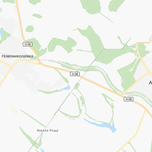
Roadmap (route) to go from Stantsiya Voskobiynya to Pavlohrad detailed above, you can also see the course layout on the map.
While doing trip Stantsiya Voskobiynya - Pavlohrad by car, the calculated route ends at a distance , or more straight.
Distance and duration of the route between Stantsiya Voskobiynya and Pavlohrad
Calculation of distance and route from Pavlohrad to Stantsiya Voskobiynya :
103.4120.8 km2h52mn
Continue 0h3mn 677 mTurn slight right 0h0mn 182 mTurn left onto Н-08 0h23mn 24.2 kmTurn left 0h0mn 15 mTurn slight right 0h5mn 2.3 kmTurn left 0h1mn 154 mTurn right onto вулиця Михайла Лояна 0h7mn 5.3 kmContinue onto Новопокровська вулиця 0h3mn 2.5 kmTurn right onto Геологічна вулиця 0h1mn 967 mContinue onto Мукачівська вулиця 0h2mn 1.6 kmTurn right onto Велика Діївська вулиця 0h4mn 3.2 kmContinue onto Велика Діївська вулиця 0h0mn 78 mTurn slight right onto проспект Свободи 0h3mn 2.5 kmTurn left onto вулиця Кайдацький Шлях 0h15mn 15.0 kmKeep right onto О040410 0h0mn 50 mKeep left onto Шосейна вулиця 1h43mn 60.5 kmKeep left onto Р-51 and take Р-51 toward Кочережки, Санаторій "Сонячний", Вул. Полтавська 0h0mn 32 mTurn left onto Полтавська вулиця 0h1mn 810 mTurn right onto Соборна вулиця 0h1mn 452 mTurn left onto Центральна вулиця 0h0mn 301 mTurn right onto вулиця Миру 0h0mn 150 mArrive at destination 0h0mn 0 m
Travel from Stantsiya Voskobiynya (Dnipropetrovsk) to a selection of major cities.
Distances from Stantsiya Voskobiynya to biggest cities in Dnipropetrovsk
Other major cities in country :
- Horlivka [05], 278,550 inhabitants. 266 km
- Rivne [19], 255,106 inhabitants. 639 km
- Kropyvnytskyi [10], 249,454 inhabitants. 163 km
- Chernivtsi [03], 236,250 inhabitants. 630 km
- Ternopil [22], 235,676 inhabitants. 657 km
- Kremenchuk [18], 227,494 inhabitants. 98 km
- Lutsk [24], 213,661 inhabitants. 703 km
- Ivano-Frankivsk [06], 204,200 inhabitants. 717 km
- Bila Tserkva [13], 199,163 inhabitants. 348 km
- Kramators'k [05], 173,700 inhabitants. 229 km
- Melitopol [26], 158,000 inhabitants. 198 km
- Kerch [11], 148,932 inhabitants. 384 km
- Syevyerodonets'k [14], 130,000 inhabitants. 299 km
- Sloviansk [05], 124,800 inhabitants. 235 km
- Berdyansk [26], 118,284 inhabitants. 262 km
- Uzhgorod [25], 117,878 inhabitants. 895 km
- Alchevs'k [14], 116,000 inhabitants. 321 km
- Lysychans'k [14], 111,600 inhabitants. 295 km
- Yevpatoriya [11], 106,202 inhabitants. 379 km
- Yenakiyeve [05], 104,101 inhabitants. 279 km
Route from Pavlohrad to major cities (Ukraine).
- Distance Pavlohrad Kyiv442 km
- Distance Pavlohrad Kharkiv163 km
- Distance Pavlohrad Donetsk154 km
- Distance Pavlohrad Odessa449 km
- Distance Pavlohrad Zaporizhia94 km
- Distance Pavlohrad Lviv873 km
- Distance Pavlohrad Mykolayiv338 km
- Distance Pavlohrad Mariupol203 km
- Distance Pavlohrad Luhansk254 km
- Distance Pavlohrad Sevastopol475 km
- Distance Pavlohrad Khmelnytskyi655 km
- Distance Pavlohrad Makiyivka162 km
- Distance Pavlohrad Vinnytsia546 km
- Distance Pavlohrad Simferopol420 km
- Distance Pavlohrad Kherson321 km
- Distance Pavlohrad Poltava153 km
- Distance Pavlohrad Chernihiv466 km
- Distance Pavlohrad Cherkasy296 km
- Distance Pavlohrad Sumy277 km
- Distance Pavlohrad Zhytomyr555 km
Nearest cities to Stantsiya Voskobiynya :
- Kharkiv, 1,430,885 inhabitants. 208 km
- Dnipro, 1,032,822 inhabitants. 43 km
- Zaporizhia, 796,217 inhabitants. 95 km
- Kryvyi Rih, 652,380 inhabitants. 106 km
- Mykolayiv, 510,840 inhabitants. 253 km
- Kherson, 320,477 inhabitants. 250 km
- Poltava, 317,847 inhabitants. 119 km
- Cherkasy, 297,568 inhabitants. 202 km
- Sumy, 294,456 inhabitants. 268 km
- Kropyvnytskyi, 249,454 inhabitants. 163 km
- Kamianske, 248,575 inhabitants. 10 km
- Kremenchuk, 227,494 inhabitants. 98 km
- Melitopol, 158,000 inhabitants. 198 km
- Nikopol, 130,500 inhabitants. 106 km
- Berdyansk, 118,284 inhabitants. 262 km
- Pavlohrad, 115,932 inhabitants. 104 km
- Oleksandriya, 103,000 inhabitants. 101 km
- Konotop, 91,798 inhabitants. 316 km
- Nizhyn, 75,499 inhabitants. 337 km
- Novomoskovs'k, 73,100 inhabitants. 59 km
- Pokrovsk, 68,263 inhabitants. 202 km
- Smila, 67,530 inhabitants. 204 km
- Pryluky, 62,823 inhabitants. 275 km
- Lozova, 62,311 inhabitants. 142 km
- Energodar, 55,800 inhabitants. 115 km
- Izyum, 53,778 inhabitants. 218 km
- Lubny, 52,600 inhabitants. 197 km
- Horishni Plavni, 51,740 inhabitants. 82 km
- Zhovti Vody, 51,559 inhabitants. 74 km
- Nova Kakhovka, 50,672 inhabitants. 214 km
- Marhanets', 50,443 inhabitants. 100 km
- Okhtyrka, 49,818 inhabitants. 201 km
- Myrnohrad, 49,646 inhabitants. 208 km
- Romny, 48,570 inhabitants. 258 km
- Svitlovods'k, 47,946 inhabitants. 107 km
- Dzhankoy, 41,731 inhabitants. 313 km
- Myrhorod, 41,377 inhabitants. 173 km
- Kakhovka, 36,816 inhabitants. 204 km
- Chuhuyiv, 36,519 inhabitants. 218 km
- Dobropillya, 35,977 inhabitants. 193 km
- Tokmak, 34,926 inhabitants. 169 km
- Dolyns'ka, 34,267 inhabitants. 134 km
- Synel'nykove, 31,900 inhabitants. 81 km
- Balakliya, 31,156 inhabitants. 204 km
- Krasnoperekops'k, 30,700 inhabitants. 290 km
- Pervomays'kyy, 30,000 inhabitants. 160 km
- Tsyurupyns'k, 28,800 inhabitants. 249 km
- Znomenka, 28,318 inhabitants. 134 km
- Zolotonosha, 27,722 inhabitants. 218 km
- Lebedyn, 27,695 inhabitants. 230 km
Location Stantsiya Voskobiynya (Dnipropetrovsk) :
| Country flag |  |
| Location | Stantsiya Voskobiynya |
| State | Dnipropetrovsk |
| County | |
| Country | Ukraine |
| Country code / ISO 2 | UA |
| Latitude | 48.5230000 |
| Longitude | 34.4653300 |
| Altitude | 0 meters |
| Time zone | Europe/Zaporozhye |
Location Pavlohrad (Dnipropetrovsk) :
| Country flag | |
| Location | Pavlohrad |
| State | Dnipropetrovsk |
| County | |
| Country | Ukraine |
| Country code / ISO 2 | UA |
| Latitude | 48.5342600 |
| Longitude | 35.8709800 |
| Altitude | 0 meters |
| Time zone | Europe/Kiev |
