

How to get from Stantsiya Yushun’ (Republic of Crimea) to Novoukrayinka (Kirovohrad)
Calculate route from Stantsiya Yushun’ (Republic of Crimea, Ukraine) to Novoukrayinka (Kirovohrad, Ukraine).
The flight distance (as the crow flies) between Stantsiya Yushun’ and Novoukrayinka is 317.2 km.
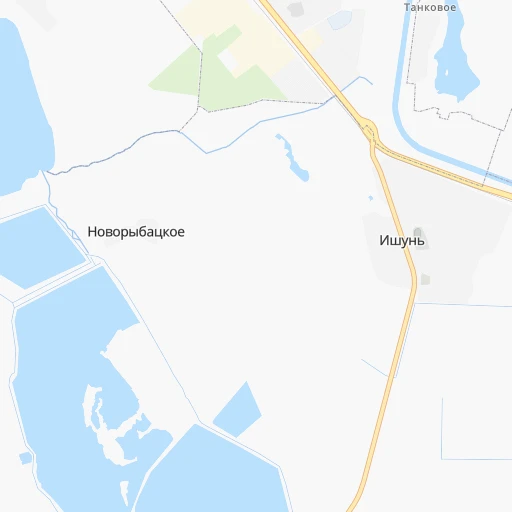
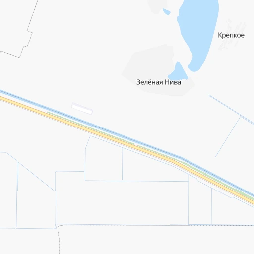
Roadmap (route) to go from Stantsiya Yushun’ to Novoukrayinka detailed above, you can also see the course layout on the map.
While doing trip Stantsiya Yushun’ - Novoukrayinka by car, the calculated route ends at a distance , or more straight.
Distance and duration of the route between Stantsiya Yushun’ and Novoukrayinka
Calculation of distance and route from Novoukrayinka to Stantsiya Yushun’ :
317.2709.0 km11h15mn
Continue 0h0mn 36 mTurn sharp left onto 35А-001, М-17 0h14mn 16.9 kmKeep left onto Северо-Крымская улица 0h25mn 27.1 kmTurn left onto 35Н-127, С-010403 0h3mn 1.6 kmTurn right onto 35Н-183, С-010459 0h8mn 3.9 kmContinue onto улица Шевченко 0h3mn 1.5 kmContinue onto 35Н-183, С-010459 0h4mn 1.8 kmKeep left onto 35Н-183, С-010459 0h10mn 5.0 kmKeep left onto 35Н-183, С-010459 0h3mn 1.7 kmContinue onto улица Гагарина 0h1mn 1.2 kmTurn left onto 35А-002, М-18 2h49mn 134.5 kmAt roundabout, take exit 2 onto Богдана Хмельницького проспект 0h5mn 4.2 kmContinue onto 50 років Перемоги проспект 0h2mn 2.3 kmTurn slight right onto 50 років Перемоги проспект 0h0mn 327 mTurn right onto Олександра Тишлера провулок 0h2mn 1.5 kmTurn left onto Незалежності вулиця 0h1mn 539 mTurn right onto Суворова вулиця 0h0mn 72 mTurn right onto Т-04-01 0h16mn 15.8 kmTurn left onto Т-04-01 1h34mn 38.9 kmAt roundabout, take exit 2 onto Гоголя вулиця 0h0mn 437 mAt roundabout, take exit 3 onto Гоголя вулиця 1h32mn 31.2 kmContinue onto Н-08, Т-04-08 0h6mn 5.3 kmTurn left onto Овчаренка вулиця 0h5mn 3.7 kmTurn right onto Запорізька вулиця 0h0mn 435 mAt roundabout, take exit 2 onto Н-08 1h44mn 50.9 kmAt roundabout, take exit 2 onto Космічна вулиця 0h5mn 4.5 kmKeep right onto Соборний проспект 0h10mn 9.8 kmTurn left onto Запорізька площа 0h0mn 137 mAt roundabout, take exit 1 onto Запорізька площа 0h3mn 2.2 kmTurn left onto Вінтера бульвар 0h1mn 675 mKeep right onto Кияшка вулиця 0h2mn 1.4 kmAt roundabout, take exit 1 0h3mn 2.8 kmTurn right 0h0mn 248 mTurn left onto Тиражна вулиця 0h3mn 3.0 kmAt roundabout, take exit 1 onto Н-08 0h14mn 22.3 kmTurn left 0h0mn 11 mTurn left onto Н-08 0h0mn 119 mKeep right 0h0mn 70 mContinue onto С-080703 0h3mn 2.3 kmTurn right onto Центральна вулиця 0h4mn 3.6 kmKeep left 0h9mn 2.5 kmTurn sharp left 0h2mn 463 mTurn sharp right 0h3mn 1.6 kmContinue 0h0mn 249 mTurn left onto О-041707 0h0mn 18 mKeep right onto О-041707 0h5mn 4.4 kmTurn right onto Польова вулиця 0h2mn 904 mTurn right onto О-041707 0h5mn 4.8 kmTurn right 0h3mn 1.4 kmTurn left 0h1mn 231 mTurn right 0h2mn 557 mTurn left 0h13mn 3.4 kmTurn right onto Т-04-20 0h2mn 1.7 kmTurn left onto Українська вулиця 2h2mn 145.6 kmTurn left onto Новопразьке шосе 1h3mn 62.1 kmKeep left 0h0mn 122 mTurn slight right onto Н-14 0h1mn 951 mTurn sharp left onto М-30 and drive toward Дніпро, Полтава 0h0mn 305 mKeep right and drive toward Кропивницький 0h2mn 2.4 kmContinue onto вулиця Романа Шухевича 0h0mn 153 mAt roundabout, take exit 2 0h1mn 1.2 kmTurn left onto вулиця Миколи Левитського 0h2mn 2.1 kmTurn right onto вулиця Євгена Чикаленка 0h1mn 1.0 kmContinue onto Вокзальна вулиця 0h2mn 1.9 kmTurn right onto вулиця Євгена Тельнова 0h4mn 3.1 kmAt roundabout, take exit 2 onto Перша Виставкова вулиця 0h4mn 2.7 kmTurn left onto М-13 1h34mn 46.8 kmKeep right onto Т-24-01 0h12mn 12.2 kmTurn right onto вулиця Леоніда Глібова 0h1mn 394 mTurn right 0h0mn 52 mTurn left onto провулок Єсєніна 0h0mn 129 mArrive at destination 0h0mn 0 m
Travel from Stantsiya Yushun’ (Kirovohrad) to a selection of major cities.
Distances from Stantsiya Yushun’ to biggest cities in Republic of Crimea
Other major cities in country :
- Zhytomyr [27], 282,192 inhabitants. 615 km
- Horlivka [05], 278,550 inhabitants. 418 km
- Rivne [19], 255,106 inhabitants. 767 km
- Kropyvnytskyi [10], 249,454 inhabitants. 310 km
- Kamianske [04], 248,575 inhabitants. 293 km
- Chernivtsi [03], 236,250 inhabitants. 651 km
- Ternopil [22], 235,676 inhabitants. 735 km
- Kremenchuk [18], 227,494 inhabitants. 350 km
- Lutsk [24], 213,661 inhabitants. 825 km
- Ivano-Frankivsk [06], 204,200 inhabitants. 762 km
- Bila Tserkva [13], 199,163 inhabitants. 512 km
- Kramators'k [05], 173,700 inhabitants. 419 km
- Melitopol [26], 158,000 inhabitants. 157 km
- Nikopol [04], 130,500 inhabitants. 188 km
- Syevyerodonets'k [14], 130,000 inhabitants. 486 km
- Sloviansk [05], 124,800 inhabitants. 434 km
- Berdyansk [26], 118,284 inhabitants. 247 km
- Uzhgorod [25], 117,878 inhabitants. 919 km
- Alchevs'k [14], 116,000 inhabitants. 472 km
- Pavlohrad [04], 115,932 inhabitants. 329 km
Route from Novoukrayinka to major cities (Ukraine).
- Distance Novoukrayinka Kyiv248 km
- Distance Novoukrayinka Kharkiv390 km
- Distance Novoukrayinka Dnipro260 km
- Distance Novoukrayinka Donetsk467 km
- Distance Novoukrayinka Odessa214 km
- Distance Novoukrayinka Zaporizhia278 km
- Distance Novoukrayinka Lviv572 km
- Distance Novoukrayinka Kryvyi Rih145 km
- Distance Novoukrayinka Mykolayiv155 km
- Distance Novoukrayinka Mariupol471 km
- Distance Novoukrayinka Luhansk575 km
- Distance Novoukrayinka Sevastopol443 km
- Distance Novoukrayinka Khmelnytskyi353 km
- Distance Novoukrayinka Makiyivka476 km
- Distance Novoukrayinka Vinnytsia245 km
- Distance Novoukrayinka Simferopol424 km
- Distance Novoukrayinka Kherson203 km
- Distance Novoukrayinka Poltava261 km
- Distance Novoukrayinka Chernihiv354 km
- Distance Novoukrayinka Cherkasy129 km
Nearest cities to Stantsiya Yushun’ :
- Dnipro, 1,032,822 inhabitants. 296 km
- Zaporizhia, 796,217 inhabitants. 235 km
- Kryvyi Rih, 652,380 inhabitants. 222 km
- Mykolayiv, 510,840 inhabitants. 181 km
- Sevastopol, 416,263 inhabitants. 151 km
- Simferopol, 336,460 inhabitants. 111 km
- Kherson, 320,477 inhabitants. 122 km
- Kropyvnytskyi, 249,454 inhabitants. 310 km
- Kamianske, 248,575 inhabitants. 293 km
- Melitopol, 158,000 inhabitants. 157 km
- Kerch, 148,932 inhabitants. 217 km
- Nikopol, 130,500 inhabitants. 188 km
- Berdyansk, 118,284 inhabitants. 247 km
- Pavlohrad, 115,932 inhabitants. 329 km
- Yevpatoriya, 106,202 inhabitants. 89 km
- Oleksandriya, 103,000 inhabitants. 309 km
- Yalta, 77,003 inhabitants. 162 km
- Novomoskovs'k, 73,100 inhabitants. 320 km
- Pervomays'k, 70,746 inhabitants. 325 km
- Feodosiya, 68,562 inhabitants. 157 km
- Lozova, 62,311 inhabitants. 379 km
- Energodar, 55,800 inhabitants. 186 km
- Zhovti Vody, 51,559 inhabitants. 270 km
- Nova Kakhovka, 50,672 inhabitants. 98 km
- Marhanets', 50,443 inhabitants. 199 km
- Voznesensk, 42,248 inhabitants. 263 km
- Dzhankoy, 41,731 inhabitants. 51 km
- Yuzhnoukrains'k, 39,430 inhabitants. 290 km
- Kakhovka, 36,816 inhabitants. 101 km
- Tokmak, 34,926 inhabitants. 207 km
- Dolyns'ka, 34,267 inhabitants. 255 km
- Synel'nykove, 31,900 inhabitants. 295 km
- Krasnoperekops'k, 30,700 inhabitants. 3 km
- Alushta, 29,586 inhabitants. 147 km
- Tsyurupyns'k, 28,800 inhabitants. 114 km
- Saki, 28,322 inhabitants. 91 km
- Znomenka, 28,318 inhabitants. 321 km
- Bakhchisaray, 27,351 inhabitants. 131 km
- Yuzhne, 25,000 inhabitants. 223 km
- Armyansk, 24,442 inhabitants. 22 km
- Heniches'k, 21,663 inhabitants. 81 km
- Polohy, 21,380 inhabitants. 254 km
- Piatykhatky, 20,459 inhabitants. 276 km
- Dniprorudne, 20,271 inhabitants. 184 km
- Skadovs'k, 19,404 inhabitants. 73 km
- Balaklava, 18,649 inhabitants. 159 km
- Novoukrayinka, 18,633 inhabitants. 318 km
- Orikhiv, 17,287 inhabitants. 236 km
- Pidhorodne, 17,103 inhabitants. 310 km
- Sudak, 16,597 inhabitants. 151 km
Location Stantsiya Yushun’ (Republic of Crimea) :
| Country flag |  |
| Location | Stantsiya Yushun’ |
| State | Republic of Crimea |
| County | |
| Country | Ukraine |
| Country code / ISO 2 | UA |
| Latitude | 45.9333300 |
| Longitude | 33.8166700 |
| Altitude | 0 meters |
| Time zone | Europe/Simferopol |
Location Novoukrayinka (Kirovohrad) :
| Country flag | |
| Location | Novoukrayinka |
| State | Kirovohrad |
| County | |
| Country | Ukraine |
| Country code / ISO 2 | UA |
| Latitude | 48.3263500 |
| Longitude | 31.5285200 |
| Altitude | 0 meters |
| Time zone | Europe/Kiev |