

How to get from Whitecourt (airport) (Alberta) to Etobicoke (Ontario)
Calculate route from Whitecourt (airport) (Alberta, Canada) to Etobicoke (Ontario, Canada).
The flight distance (as the crow flies) between Whitecourt (airport) and Etobicoke is 2,851.2 km.
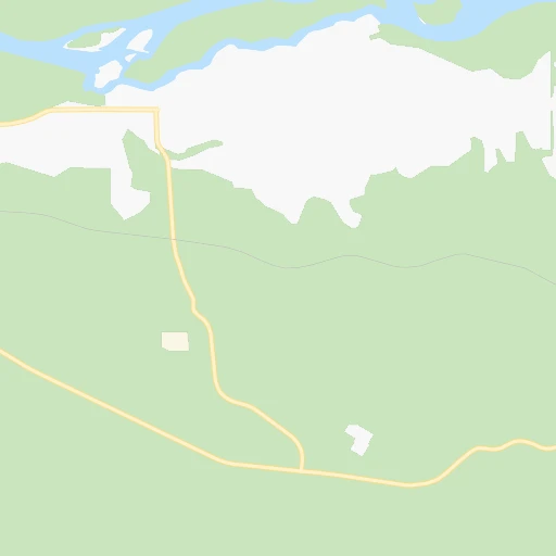
Roadmap (route) to go from Whitecourt Airport to Etobicoke detailed above, you can also see the course layout on the map.
While doing trip Whitecourt (airport) - Etobicoke by car, the calculated route ends at a distance , or more straight.
Distance and duration of the route between Whitecourt (airport) and Etobicoke
Calculation of distance and route from Etobicoke to Whitecourt (airport) :
2,851.23,454.6 km39h21mn
Continue onto Range Road 125 0h2mn 1.4 kmTurn sharp left onto 32 0h3mn 4.9 kmTurn right 1h8mn 110.9 kmTurn left onto Range Road 24 and drive toward Fort Saskatchewan 0h0mn 85 mTurn right onto Township Road 550 1h35mn 51.2 kmTurn sharp right onto 28 0h5mn 7.3 kmKeep right toward 216 0h0mn 210 mKeep left 0h10mn 15.4 kmKeep right and take 16 toward Lloydminster, Edmonton 0h0mn 318 mKeep left and take 16 East toward Lloydminster 0h1mn 936 mKeep left and take 16 East toward Lloydminster 5h12mn 506.0 kmKeep right toward 16 East 0h0mn 430 mKeep left 0h0mn 46 mTurn left onto Circle Drive 0h2mn 1.4 kmKeep left onto Circle Drive 3h37mn 254.4 kmKeep right toward 6 South 0h5mn 7.8 kmKeep right toward 33 East 0h0mn 246 mKeep left and take 33 East toward Francis 0h0mn 137 mTurn left onto Arcola Avenue 2h45mn 139.0 kmTurn right onto Highway 47 1h38mn 56.7 kmTurn left onto Highway 39 0h7mn 7.9 kmTurn left onto Highway 39 0h28mn 33.0 kmKeep right 0h10mn 12.1 kmTurn left onto United States Highway 52 2h52mn 143.6 kmKeep right onto US 52 and take US 52 East, US 52 Business toward Jamestown 0h1mn 581 mTurn right onto US 52 2h56mn 140.0 kmTurn left onto State Highway 15 0h12mn 16.6 kmTurn right onto State Highway 30 0h13mn 20.9 kmTurn left onto United States Highway 52 0h15mn 22.5 kmAt roundabout, take exit 1 onto 4th Avenue North 1h54mn 65.3 kmContinue onto US 52, US 281 0h3mn 3.8 kmKeep right 0h0mn 62 mTurn slight right onto 1st Avenue North 0h1mn 1.5 kmContinue 0h0mn 100 mTurn slight right onto 10th Street Southeast 0h2mn 2.5 kmContinue 5h0mn 508.5 kmKeep left onto I 694 0h7mn 11.9 kmKeep right and take MN 51 toward Snelling Ave, Lexington Ave 0h4mn 7.0 kmKeep left onto I 694 0h1mn 2.1 kmKeep right onto I 694 0h6mn 8.5 kmKeep right and take MN 36 East toward Stillwater 0h10mn 13.4 kmKeep right and take MN 95 toward Stillwater, Bayport 0h1mn 619 mTurn right onto Saint Croix Trail North 0h2mn 2.4 kmTurn slight right onto Minnesota Street South 0h5mn 6.3 kmTurn left onto MN 95 4h47mn 384.6 kmKeep left onto I 94 and take I 94 toward Milwaukee 1h9mn 113.4 kmKeep right onto I 94 and take I 43 South, I 94 toward Chicago 0h2mn 2.3 kmKeep right and drive toward Lapham Boulevard, Mitchell Street 0h0mn 494 mTurn sharp left onto West Lapham Boulevard 0h1mn 454 mTurn right onto South 1st Street 0h0mn 135 mContinue onto South Kinnickinnic Avenue 0h1mn 787 mKeep left onto East Bay Street 0h1mn 740 mKeep right 0h1mn 726 mKeep right 0h0mn 163 mTurn left 0h1mn 197 mTurn left 0h1mn 175 mTurn left 0h0mn 4 mTurn right onto Staging lane 5 4h32mn 133.7 kmTurn right onto Estes Street 0h1mn 498 mTurn left onto Lakeshore Drive 0h3mn 2.4 kmTurn right onto Seaway Drive 2h30mn 150.8 kmKeep right and take I 69 East toward Flint 2h50mn 194.2 kmKeep left onto I 69 and take I 94 East, I 69 East toward Canada 0h7mn 7.2 kmKeep right onto CBSA - Sarnia (Point Edward) Point Of Entry Commercial Lanes 2h35mn 153.0 kmKeep left onto Highway 401 1h60mn 89.9 kmKeep right onto Highway 401 Collector 0h6mn 9.5 kmKeep left onto Highway 401 Express 0h9mn 13.7 kmKeep right 0h1mn 2.1 kmKeep right 0h1mn 562 mTurn right onto Renforth Drive 0h1mn 933 mTurn left onto Erinview Terrace 0h0mn 187 mTurn right onto Wellesworth Drive 0h2mn 1.2 kmTurn right onto The West Mall 0h0mn 255 mTurn left onto Rathburn Road 0h1mn 457 mArrive at destination 0h0mn 0 m
Travel from Whitecourt (airport) (Ontario) to a selection of major cities.
Distances from Whitecourt Airport to biggest cities in Alberta
Other major cities in country :
- Oshawa [08], 247,989 inhabitants. 2,886 km
- Gatineau [10], 242,124 inhabitants. 2,990 km
- Vaughan [08], 238,866 inhabitants. 2,849 km
- Kitchener [08], 233,700 inhabitants. 2,811 km
- Longueuil [10], 229,330 inhabitants. 3,129 km
- Burnaby [02], 202,799 inhabitants. 734 km
- Ladner [02], 200,000 inhabitants. 755 km
- Saskatoon [11], 198,958 inhabitants. 648 km
- Richmond Hill [08], 185,541 inhabitants. 2,850 km
- Barrie [08], 182,041 inhabitants. 2,801 km
- Richmond [02], 182,000 inhabitants. 750 km
- Nepean [08], 180,000 inhabitants. 2,995 km
- Regina [11], 176,183 inhabitants. 863 km
- Oakville [08], 165,697 inhabitants. 2,863 km
- Burlington [08], 164,415 inhabitants. 2,857 km
- Greater Sudbury [08], 157,857 inhabitants. 2,585 km
- Abbotsford [02], 151,683 inhabitants. 721 km
- Saguenay [10], 143,692 inhabitants. 3,123 km
- St. Catharines [08], 131,989 inhabitants. 2,910 km
- Sherbrooke [10], 129,447 inhabitants. 3,243 km
Route from Etobicoke to major cities (Canada).
- Distance Etobicoke Montreal517 km
- Distance Etobicoke Calgary2,702 km
- Distance Etobicoke Edmonton2,695 km
- Distance Etobicoke Winnipeg1,504 km
- Distance Etobicoke Vancouver3,350 km
- Distance Etobicoke Quebec743 km
- Distance Etobicoke Surrey3,330 km
- Distance Etobicoke Laval512 km
- Distance Etobicoke Halifax1,280 km
- Distance Etobicoke Okanagan3,071 km
- Distance Etobicoke Victoria3,379 km
- Distance Etobicoke Gatineau368 km
- Distance Etobicoke Longueuil523 km
- Distance Etobicoke Burnaby3,337 km
- Distance Etobicoke Ladner3,349 km
- Distance Etobicoke Saskatoon2,215 km
- Distance Etobicoke Richmond3,352 km
- Distance Etobicoke Regina2,033 km
- Distance Etobicoke Abbotsford3,289 km
- Distance Etobicoke Saguenay843 km
Nearest cities to Whitecourt (airport) :
- Edmonton, 712,391 inhabitants. 166 km
- Red Deer, 73,593 inhabitants. 247 km
- St. Albert, 57,719 inhabitants. 152 km
- Sherwood Park, 55,063 inhabitants. 177 km
- Airdrie, 24,673 inhabitants. 338 km
- Spruce Grove, 17,767 inhabitants. 140 km
- Cochrane, 16,365 inhabitants. 341 km
- Camrose, 15,686 inhabitants. 232 km
- Leduc, 15,561 inhabitants. 177 km
- Fort Saskatchewan, 14,957 inhabitants. 175 km
- Wetaskiwin, 11,302 inhabitants. 207 km
- Sylvan Lake, 10,518 inhabitants. 233 km
- Lacombe, 10,059 inhabitants. 231 km
- Hinton, 9,889 inhabitants. 144 km
- Stony Plain, 8,939 inhabitants. 135 km
- Whitecourt, 8,763 inhabitants. 7 km
- Morinville, 8,108 inhabitants. 145 km
- Silver Berry, 8,089 inhabitants. 176 km
- Wild Rose, 8,031 inhabitants. 175 km
- Edson, 7,975 inhabitants. 76 km
- Slave Lake, 7,661 inhabitants. 143 km
- Banff, 7,502 inhabitants. 331 km
- Beaumont, 7,366 inhabitants. 179 km
- Olds, 6,947 inhabitants. 286 km
- Ponoka, 6,656 inhabitants. 219 km
- Rocky Mountain House, 6,527 inhabitants. 206 km
- Drayton Valley, 6,099 inhabitants. 116 km
- Peace River, 5,340 inhabitants. 252 km
- Devon, 5,225 inhabitants. 160 km
- Westlock, 5,067 inhabitants. 125 km
- Larkspur, 4,988 inhabitants. 175 km
- Barrhead, 4,430 inhabitants. 90 km
- Didsbury, 4,134 inhabitants. 297 km
- Golden, 4,038 inhabitants. 326 km
- Jasper Park Lodge, 3,907 inhabitants. 205 km
- Fairview, 3,312 inhabitants. 271 km
- Blackfalds, 3,198 inhabitants. 237 km
- Three Hills, 3,051 inhabitants. 320 km
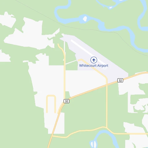
Location Whitecourt (airport) (Alberta) :
| Country flag |  |
| Location | Whitecourt (airport) |
| State | Alberta |
| County | |
| Country | Canada |
| Country code / ISO 2 | CA |
| Latitude | 54.1438900 |
| Longitude | -115.7866700 |
| Altitude | 782 meters |
| Time zone | America/Edmonton |
Location Etobicoke (Ontario) :
| Country flag | |
| Location | Etobicoke |
| State | Ontario |
| County | |
| Country | Canada |
| Country code / ISO 2 | CA |
| Latitude | 43.6542100 |
| Longitude | -79.5671100 |
| Altitude | 0 meters |
| Time zone | America/Toronto |


