


How to get from Kamloops (airport) (British Columbia) to Scarborough (Ontario)
Calculate route from Kamloops (airport) (British Columbia, Canada) to Scarborough (Ontario, Canada).
The flight distance (as the crow flies) between Kamloops (airport) and Scarborough is 3,157.5 km.
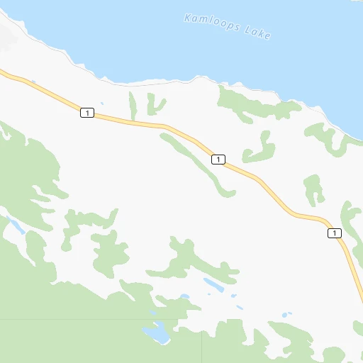
Roadmap (route) to go from Kamloops Airport to Scarborough detailed above, you can also see the course layout on the map.
While doing trip Kamloops (airport) - Scarborough by car, the calculated route ends at a distance , or more straight.
Distance and duration of the route between Kamloops (airport) and Scarborough
Calculation of distance and route from Scarborough to Kamloops (airport) :
3,157.53,864.6 km45h34mn
Continue 0h0mn 36 mTurn left 0h0mn 29 mTurn right onto Airport Road 0h0mn 345 mAt roundabout, take exit 2 onto Airport Road 0h1mn 731 mTurn right onto Tranquille Road 0h7mn 5.6 kmContinue onto Fortune Drive 0h6mn 5.3 kmTurn slight right onto Victoria Street 0h2mn 1.5 kmKeep left onto Valleyview Drive 0h0mn 124 mTurn left onto Frontage Road 0h1mn 449 mTurn left 2h39mn 136.6 kmKeep left 0h0mn 164 mTurn sharp right 0h0mn 12 mTurn left onto Trans-Canada Highway 0h16mn 24.5 kmTurn slight right 5h5mn 438.8 kmKeep right and take 201 toward Medicine Hat, Edmonton, Airport YYC, Lethbridge 0h1mn 1.3 kmKeep right and take 201 South toward Lethbridge 0h8mn 11.4 kmKeep right onto Glenmore Trail SW 0h2mn 2.2 kmKeep right and drive toward 37 Street SW, Grey Eagle Boulevard 0h0mn 306 mKeep left 0h6mn 6.6 kmKeep right 0h0mn 211 mKeep right 0h3mn 3.3 kmTurn left onto Southland Drive SE 0h0mn 256 mKeep right and take 2 South toward Deerfoot Trail 0h1mn 1.1 kmKeep left onto Deerfoot Trail SE 0h3mn 4.8 kmKeep right and drive toward 130 Avenue South East 0h0mn 576 mKeep left and drive toward 130 Avenue SE East 0h1mn 1.4 kmKeep right 0h4mn 3.4 kmTurn left 0h1mn 1.7 kmKeep right onto Highway 22X toward 22X East 1h46mn 67.3 kmTurn right onto Trans-Canada Highway 6h2mn 597.6 kmKeep right and take 301 North, 39 South toward Weyburn 0h0mn 430 mKeep right and take 39 South toward Weyburn 0h0mn 210 mContinue onto Highway 39 1h44mn 66.5 kmTurn right 0h1mn 1.6 kmTurn slight left onto Highway 334 0h0mn 215 mTurn right onto CanAm Highway and drive toward Weyburn 2h4mn 161.5 kmContinue onto Highway 39 0h28mn 33.0 kmKeep right 0h10mn 12.1 kmTurn left onto United States Highway 52 2h52mn 143.6 kmKeep right onto US 52 and take US 52 East, US 52 Business toward Jamestown 0h1mn 581 mTurn right onto US 52 2h56mn 140.0 kmTurn left onto State Highway 15 0h12mn 16.6 kmTurn right onto State Highway 30 0h13mn 20.9 kmTurn left onto United States Highway 52 0h15mn 22.5 kmAt roundabout, take exit 1 onto 4th Avenue North 1h54mn 65.3 kmContinue onto US 52, US 281 0h3mn 3.8 kmKeep right 0h0mn 62 mTurn slight right onto 1st Avenue North 0h1mn 1.5 kmContinue 0h0mn 100 mTurn slight right onto 10th Street Southeast 0h2mn 2.5 kmContinue 5h0mn 508.5 kmKeep left onto I 694 0h7mn 11.9 kmKeep right and take MN 51 toward Snelling Ave, Lexington Ave 0h4mn 7.0 kmKeep left onto I 694 0h1mn 2.1 kmKeep right onto I 694 0h6mn 8.5 kmKeep right and take MN 36 East toward Stillwater 0h10mn 13.4 kmKeep right and take MN 95 toward Stillwater, Bayport 0h1mn 619 mTurn right onto Saint Croix Trail North 0h2mn 2.4 kmTurn slight right onto Minnesota Street South 0h5mn 6.3 kmTurn left onto MN 95 4h47mn 384.6 kmKeep left onto I 94 and take I 94 toward Milwaukee 1h9mn 113.4 kmKeep right onto I 94 and take I 43 South, I 94 toward Chicago 0h2mn 2.3 kmKeep right and drive toward Lapham Boulevard, Mitchell Street 0h0mn 494 mTurn sharp left onto West Lapham Boulevard 0h1mn 454 mTurn right onto South 1st Street 0h0mn 135 mContinue onto South Kinnickinnic Avenue 0h1mn 787 mKeep left onto East Bay Street 0h1mn 740 mKeep right 0h1mn 726 mKeep right 0h0mn 163 mTurn left 0h1mn 197 mTurn left 0h1mn 175 mTurn left 0h0mn 4 mTurn right onto Staging lane 5 4h32mn 133.7 kmTurn right onto Estes Street 0h1mn 498 mTurn left onto Lakeshore Drive 0h3mn 2.4 kmTurn right onto Seaway Drive 2h30mn 150.8 kmKeep right and take I 69 East toward Flint 2h50mn 194.2 kmKeep left onto I 69 and take I 94 East, I 69 East toward Canada 0h7mn 7.2 kmKeep right onto CBSA - Sarnia (Point Edward) Point Of Entry Commercial Lanes 2h35mn 153.0 kmKeep left onto Highway 401 1h60mn 89.9 kmKeep right onto Highway 401 Collector 0h6mn 9.5 kmKeep left onto Highway 401 Express 0h14mn 20.9 kmKeep right onto Highway 401 Collector 0h3mn 5.0 kmKeep left and drive toward Express 0h8mn 11.5 kmKeep right 0h2mn 3.1 kmKeep left and drive toward Express 0h2mn 3.5 kmKeep right 0h2mn 2.7 kmKeep right 0h0mn 231 mKeep right 0h1mn 914 mTurn left onto Omni Drive 0h1mn 478 mMake a U-turn onto Borough Drive 0h0mn 49 mArrive at destination 0h0mn 0 m
Travel from Kamloops (airport) (Ontario) to a selection of major cities.
Distances from Kamloops Airport to biggest cities in British Columbia
- Vernon,47,274 inhabitants.96 km
- West End,44,560 inhabitants.249 km
- West Vancouver,42,694 inhabitants.245 km
- Penticton,37,721 inhabitants.149 km
- Campbell River,33,430 inhabitants.349 km
- Courtenay,32,793 inhabitants.343 km
- North Cowichan,32,272 inhabitants.312 km
- West Kelowna,28,793 inhabitants.112 km
- Port Moody,27,512 inhabitants.234 km
- Walnut Grove,25,683 inhabitants.232 km
- Langley,23,606 inhabitants.239 km
- Langford,22,459 inhabitants.334 km
- Duncan,22,199 inhabitants.317 km
- Port Alberni,21,282 inhabitants.352 km
Other major cities in country :
- Vaughan [08], 238,866 inhabitants. 3,143 km
- Kitchener [08], 233,700 inhabitants. 3,093 km
- Longueuil [10], 229,330 inhabitants. 3,474 km
- Saskatoon [11], 198,958 inhabitants. 968 km
- Richmond Hill [08], 185,541 inhabitants. 3,145 km
- Barrie [08], 182,041 inhabitants. 3,101 km
- Nepean [08], 180,000 inhabitants. 3,328 km
- Regina [11], 176,183 inhabitants. 1,117 km
- Oakville [08], 165,697 inhabitants. 3,150 km
- Burlington [08], 164,415 inhabitants. 3,143 km
- Greater Sudbury [08], 157,857 inhabitants. 2,907 km
- Saguenay [10], 143,692 inhabitants. 3,508 km
- St. Catharines [08], 131,989 inhabitants. 3,197 km
- Sherbrooke [10], 129,447 inhabitants. 3,594 km
- Levis [10], 126,396 inhabitants. 3,574 km
- Cambridge [08], 120,372 inhabitants. 3,111 km
- Trois-Rivieres [10], 119,693 inhabitants. 3,502 km
- Guelph [08], 115,760 inhabitants. 3,105 km
- East York [08], 115,365 inhabitants. 3,162 km
- Kingston [08], 114,195 inhabitants. 3,334 km
Route from Scarborough to major cities (Canada).
- Distance Scarborough Montreal489 km
- Distance Scarborough Calgary2,717 km
- Distance Scarborough Edmonton2,708 km
- Distance Scarborough Winnipeg1,518 km
- Distance Scarborough Vancouver3,366 km
- Distance Scarborough Quebec714 km
- Distance Scarborough Surrey3,347 km
- Distance Scarborough Laval484 km
- Distance Scarborough Halifax1,253 km
- Distance Scarborough Okanagan3,087 km
- Distance Scarborough Victoria3,396 km
- Distance Scarborough Gatineau340 km
- Distance Scarborough Longueuil495 km
- Distance Scarborough Burnaby3,354 km
- Distance Scarborough Ladner3,366 km
- Distance Scarborough Saskatoon2,228 km
- Distance Scarborough Richmond3,369 km
- Distance Scarborough Regina2,048 km
- Distance Scarborough Abbotsford3,306 km
- Distance Scarborough Saguenay816 km
Nearest cities to Kamloops (airport) :
- Vancouver, 600,000 inhabitants. 251 km
- Surrey, 394,976 inhabitants. 246 km
- Okanagan, 297,601 inhabitants. 86 km
- Victoria, 289,625 inhabitants. 329 km
- Burnaby, 202,799 inhabitants. 240 km
- Ladner, 200,000 inhabitants. 261 km
- Richmond, 182,000 inhabitants. 257 km
- Abbotsford, 151,683 inhabitants. 224 km
- Anmore, 126,456 inhabitants. 231 km
- Kelowna, 125,109 inhabitants. 114 km
- Coquitlam, 114,565 inhabitants. 229 km
- Delta, 101,668 inhabitants. 247 km
- Chilliwack, 77,000 inhabitants. 202 km
- Maple Ridge, 70,000 inhabitants. 226 km
- Kamloops, 68,714 inhabitants. 10 km
- White Rock, 66,450 inhabitants. 253 km
- New Westminster, 58,549 inhabitants. 243 km
- North Vancouver, 48,000 inhabitants. 243 km
- Vernon, 47,274 inhabitants. 96 km
- West End, 44,560 inhabitants. 249 km
- West Vancouver, 42,694 inhabitants. 245 km
- Penticton, 37,721 inhabitants. 149 km
- West Kelowna, 28,793 inhabitants. 112 km
- Port Moody, 27,512 inhabitants. 234 km
- Walnut Grove, 25,683 inhabitants. 232 km
- Langley, 23,606 inhabitants. 239 km
- Oak Bay, 18,015 inhabitants. 325 km
- Pitt Meadows, 17,410 inhabitants. 230 km
- Salmon Arm, 16,205 inhabitants. 81 km
- Williams Lake, 14,168 inhabitants. 199 km
- Quesnel, 13,788 inhabitants. 290 km
- Aldergrove, 12,363 inhabitants. 234 km
- North Saanich, 11,089 inhabitants. 312 km
- Whistler, 10,600 inhabitants. 191 km
- Hanceville, 10,000 inhabitants. 226 km
- Hinton, 9,889 inhabitants. 358 km
- Trail, 9,707 inhabitants. 265 km
- Castlegar, 8,715 inhabitants. 253 km
- Revelstoke, 7,533 inhabitants. 161 km
- Merritt, 7,179 inhabitants. 70 km
- Summerland, 6,292 inhabitants. 135 km
- Agassiz, 4,738 inhabitants. 189 km
- Oliver, 4,647 inhabitants. 181 km
- Hope, 4,598 inhabitants. 163 km
- Osoyoos, 4,314 inhabitants. 199 km
- Armstrong, 4,275 inhabitants. 92 km
- Grand Forks, 4,208 inhabitants. 235 km
- Jasper Park Lodge, 3,907 inhabitants. 293 km
- Fruitvale, 3,790 inhabitants. 272 km
- Rossland, 3,619 inhabitants. 261 km
Location Kamloops (airport) (British Columbia) :
| Country flag |  |
| Location | Kamloops (airport) |
| State | British Columbia |
| County | Thompson-Nicola Regional District |
| Country | Canada |
| Country code / ISO 2 | CA |
| Latitude | 50.7022200 |
| Longitude | -120.4444400 |
| Altitude | 345 meters |
| Time zone | America/Vancouver |
Location Scarborough (Ontario) :
| Country flag | |
| Location | Scarborough |
| State | Ontario |
| County | |
| Country | Canada |
| Country code / ISO 2 | CA |
| Latitude | 43.7722300 |
| Longitude | -79.2566600 |
| Altitude | 0 meters |
| Time zone | America/Toronto |


