

How to get from Lashio (airport) (Shan) to Chauk (Magway)
Calculate route from Lashio (airport) (Shan, Myanmar) to Chauk (Magway, Myanmar).
The flight distance (as the crow flies) between Lashio (airport) and Chauk is 380.6 km.
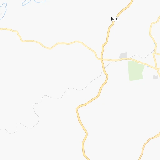
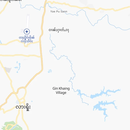
Roadmap (route) to go from Lashio Airport to Chauk detailed above, you can also see the course layout on the map.
While doing trip Lashio (airport) - Chauk by car, the calculated route ends at a distance , or more straight.
Distance and duration of the route between Lashio (airport) and Chauk
Calculation of distance and route from Chauk to Lashio (airport) :
380.6476.1 km7h17mn
Continue 0h0mn 68 mTurn right 0h1mn 201 mTurn left 0h2mn 656 mTurn right onto Airport Road 0h0mn 139 mKeep left 0h3mn 1.5 kmTurn slight left 0h2mn 1.1 kmTurn left 0h1mn 861 mTurn right 0h6mn 6.8 kmTurn slight left onto Mandalay Lashio Road 3h1mn 205.0 kmAt roundabout, take exit 3 onto Mandalay Lashio Road 0h21mn 25.0 kmTurn right onto Mandalay Lashio Road 0h10mn 12.0 kmKeep left onto Mandalay Lashio Road 0h5mn 6.0 kmKeep left onto Mandalay Lashio Road 0h13mn 15.1 kmTurn left onto 1 0h0mn 52 mTurn slight right onto 1 0h2mn 2.0 kmKeep right 0h0mn 539 mTurn slight right onto Myintnge-Sagaing Road 0h4mn 5.2 kmMake a U-turn onto Myintnge-Sagaing Road 0h0mn 238 mTurn right 0h1mn 350 mTurn left 0h1mn 228 mTurn slight right 0h0mn 40 mTurn left 0h0mn 86 mTurn right 0h2mn 3.7 kmAt roundabout, take exit 2 0h2mn 2.9 kmAt roundabout, take exit 1 1h12mn 79.0 kmTurn slight right onto Mandalay-Myingyan Highway Road 0h6mn 6.4 kmKeep right 1h39mn 43.2 kmKeep left 0h14mn 14.9 kmKeep left 0h6mn 4.6 kmTurn left 0h1mn 406 mTurn right 0h1mn 550 mKeep left 0h1mn 250 mTurn right 0h0mn 40 mTurn left 0h0mn 173 mTurn left 0h0mn 34 mTurn right 0h2mn 860 mTurn sharp left 0h7mn 6.2 kmTurn left onto Bagan - Chauk Road 0h29mn 29.3 kmTurn right 0h0mn 94 mTurn left 0h0mn 98 mTurn right 0h0mn 67 mArrive at destination 0h0mn 0 m
Travel from Lashio (airport) (Magway) to a selection of major cities.
Distances from Lashio Airport to biggest cities in Shan
Other major cities in country :
- Thayetmyo [15], 98,185 inhabitants. 487 km
- Pyinmana [18], 97,409 inhabitants. 395 km
- Magway [15], 96,954 inhabitants. 429 km
- Myitkyina [04], 90,894 inhabitants. 270 km
- Chauk [15], 90,870 inhabitants. 381 km
- Mogok [08], 90,843 inhabitants. 128 km
- Nyaunglebin [16], 89,626 inhabitants. 570 km
- Mudon [13], 89,123 inhabitants. 748 km
- Shwebo [10], 88,914 inhabitants. 216 km
- Sagaing [10], 78,739 inhabitants. 220 km
- Taungdwingyi [15], 70,094 inhabitants. 402 km
- Syriam [17], 69,448 inhabitants. 709 km
- Bogale [03], 68,938 inhabitants. 784 km
- Pyapon [03], 65,601 inhabitants. 776 km
- Yamethin [08], 59,867 inhabitants. 329 km
- Kanbe [17], 58,146 inhabitants. 722 km
- Kawthoung [12], 57,949 inhabitants. 1,449 km
- Myaydo [15], 57,897 inhabitants. 480 km
- Minbu [15], 57,342 inhabitants. 431 km
- Tharyarwady [16], 54,386 inhabitants. 627 km
Route from Chauk to major cities (Myanmar).
- Distance Chauk Yangon477 km
- Distance Chauk Mandalay178 km
- Distance Chauk Nay Pyi Taw188 km
- Distance Chauk Mawlamyine573 km
- Distance Chauk Kyain Seikgyi Township671 km
- Distance Chauk Bago434 km
- Distance Chauk Pathein459 km
- Distance Chauk Monywa139 km
- Distance Chauk Sittwe217 km
- Distance Chauk Meiktila108 km
- Distance Chauk Myeik1,024 km
- Distance Chauk Taunggyi231 km
- Distance Chauk Myingyan86 km
- Distance Chauk Dawei839 km
- Distance Chauk Pyay235 km
- Distance Chauk Hinthada368 km
- Distance Chauk Lashio378 km
- Distance Chauk Thaton518 km
- Distance Chauk Pyin Oo Lwin212 km
- Distance Chauk Taungoo276 km
Nearest cities to Lashio (airport) :
- Mandalay, 1,208,099 inhabitants. 205 km
- Monywa, 182,011 inhabitants. 286 km
- Meiktila, 177,442 inhabitants. 305 km
- Taunggyi, 160,115 inhabitants. 255 km
- Myingyan, 141,713 inhabitants. 296 km
- Lashio, 131,016 inhabitants. 5 km
- Pakokku, 126,938 inhabitants. 330 km
- Pyin Oo Lwin, 117,303 inhabitants. 170 km
- Yenangyaung, 110,553 inhabitants. 409 km
- Magway, 96,954 inhabitants. 429 km
- Myitkyina, 90,894 inhabitants. 270 km
- Chauk, 90,870 inhabitants. 381 km
- Mogok, 90,843 inhabitants. 128 km
- Shwebo, 88,914 inhabitants. 216 km
- Sagaing, 78,739 inhabitants. 220 km
- Taungdwingyi, 70,094 inhabitants. 402 km
- Yamethin, 59,867 inhabitants. 329 km
- Minbu, 57,342 inhabitants. 431 km
- Tachilek, 51,553 inhabitants. 358 km
- Kyaukse, 50,480 inhabitants. 226 km
- Bhamo, 47,920 inhabitants. 151 km
Location Lashio (airport) (Shan) :
| Country flag |  |
| Location | Lashio (airport) |
| State | Shan |
| County | Lashio District |
| Country | Myanmar |
| Country code / ISO 2 | MM |
| Latitude | 22.9783100 |
| Longitude | 97.7524000 |
| Altitude | 747 meters |
| Time zone | Asia/Yangon |
Location Chauk (Magway) :
| Country flag | |
| Location | Chauk |
| State | Magway |
| County | Magway District |
| Country | Myanmar |
| Country code / ISO 2 | MM |
| Latitude | 20.8992100 |
| Longitude | 94.8178400 |
| Altitude | 0 meters |
| Time zone | Asia/Yangon |