

Home
››
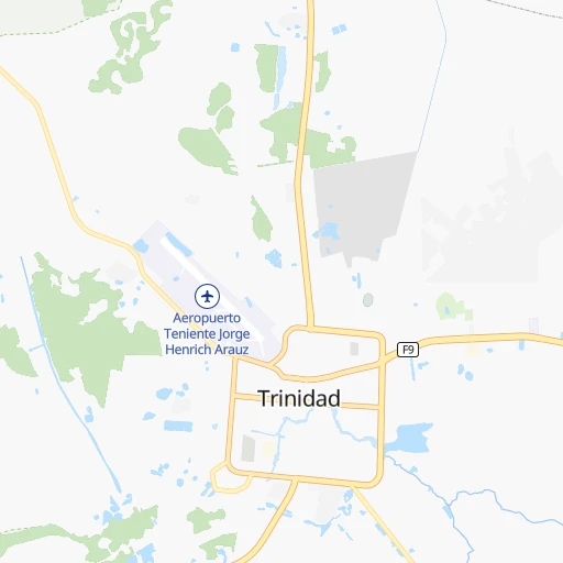
Teniente Jorge Henrich Arauz Airport
››
Roadmap from Teniente Jorge Henrich Arauz Airport to Rurrenabaque
How to get from Teniente Jorge Henrich Arauz (airport) (El Beni) to Rurrenabaque (El Beni)
Calculate route from Teniente Jorge Henrich Arauz (airport) (El Beni, Bolivia) to Rurrenabaque (El Beni, Bolivia).
The flight distance (as the crow flies) between Teniente Jorge Henrich Arauz (airport) and Rurrenabaque is 283.7 km.
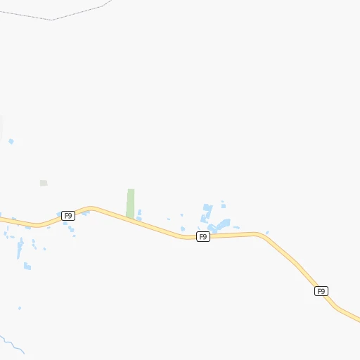
Roadmap (route) to go from Teniente Jorge Henrich Arauz Airport to Rurrenabaque detailed above, you can also see the course layout on the map.
While doing trip Teniente Jorge Henrich Arauz (airport) - Rurrenabaque by car, the calculated route ends at a distance , or more straight.
Distance and duration of the route between Teniente Jorge Henrich Arauz (airport) and Rurrenabaque
Calculation of distance and route from Rurrenabaque to Teniente Jorge Henrich Arauz (airport) :
283.7384.2 km6h7mn
Continue 0h1mn 401 mTurn right 0h2mn 1.1 kmTurn right onto Avenida Comunidad Europea 0h1mn 642 mTurn left onto Avenida Profesor José Chávez Suárez 0h1mn 591 mTurn right onto Calle Nicolás Suárez 0h2mn 1.2 kmTurn left onto Calle Benito Ruiz 0h0mn 80 mTurn right onto Avenida Pedro Ignacio Muiba 0h1mn 453 mTurn slight right onto RN3: Trinidad-San Ignacio de Moxos 4h5mn 276.0 kmKeep right and take F8 toward Rurrenabaque 0h2mn 2.5 kmAt roundabout, take exit 2 onto RN8: Yucumo-Rurrenabaque 2h48mn 97.2 kmAt roundabout, take exit 2 onto RN16: Rurrenabaque-Ixiamas 0h4mn 3.7 kmAt roundabout, take exit 3 onto RN16: Rurrenabaque 0h0mn 369 mTurn left onto Calle Bolivar 0h0mn 74 mArrive at destination 0h0mn 0 m
Travel from Teniente Jorge Henrich Arauz (airport) (El Beni) to a selection of major cities.
Distances from Teniente Jorge Henrich Arauz Airport to biggest cities in El Beni
Other major cities in country :
Route from Rurrenabaque to major cities (Bolivia).
- Distance Rurrenabaque Santa Cruz de la Sierra596 km
- Distance Rurrenabaque Cochabamba360 km
- Distance Rurrenabaque La Paz239 km
- Distance Rurrenabaque Sucre565 km
- Distance Rurrenabaque Oruro396 km
- Distance Rurrenabaque Tarija843 km
- Distance Rurrenabaque Potosi603 km
- Distance Rurrenabaque Sacaba366 km
- Distance Rurrenabaque Montero560 km
- Distance Rurrenabaque Quillacollo355 km
- Distance Rurrenabaque Yacuiba936 km
- Distance Rurrenabaque Tiquipaya352 km
Nearest cities to Teniente Jorge Henrich Arauz (airport) :
- Santa Cruz de la Sierra, 1,364,389 inhabitants. 379 km
- Cochabamba, 900,414 inhabitants. 315 km
- Sacaba, 107,628 inhabitants. 311 km
- Montero, 88,616 inhabitants. 332 km
- Quillacollo, 87,309 inhabitants. 321 km
- Trinidad, 84,259 inhabitants. 3 km
- Tiquipaya, 53,904 inhabitants. 313 km
- San Borja, 24,610 inhabitants. 197 km
- Warnes, 22,036 inhabitants. 354 km
- San Borja, 19,640 inhabitants. 208 km
- Ascencion de Guarayos, 18,816 inhabitants. 221 km
- Cotoca, 18,347 inhabitants. 389 km
- Villa Yapacani, 18,187 inhabitants. 310 km
- Punata, 15,194 inhabitants. 319 km
- Ascension, 14,429 inhabitants. 220 km
- Mineros, 14,385 inhabitants. 313 km
- Santa Ana de Yacuma, 12,783 inhabitants. 132 km
- Rurrenabaque, 11,749 inhabitants. 284 km
- Portachuelo, 11,485 inhabitants. 326 km
- Pailon, 9,304 inhabitants. 391 km
- Cliza, 8,654 inhabitants. 327 km
- Tarata, 8,043 inhabitants. 332 km
- San Julian, 7,706 inhabitants. 396 km
- Reyes, 7,376 inhabitants. 267 km
- La Belgica, 5,501 inhabitants. 354 km
- Santa Rosa del Sara, 5,251 inhabitants. 292 km
- Capinota, 5,157 inhabitants. 353 km
- Chimore, 5,147 inhabitants. 243 km
- Okinawa Numero Uno, 4,944 inhabitants. 350 km
- Santa Rosa, 4,459 inhabitants. 224 km
- San Ramon, 4,389 inhabitants. 172 km
- Buena Vista, 4,282 inhabitants. 323 km
- San Carlos, 4,180 inhabitants. 313 km
- Colquiri, 3,933 inhabitants. 371 km
- Colomi, 3,921 inhabitants. 299 km
- Arani, 3,906 inhabitants. 319 km
- Sipe Sipe, 3,776 inhabitants. 332 km
- San Juan del Surutu, 3,707 inhabitants. 324 km
- Urubicha, 3,267 inhabitants. 221 km
- Lahuachaca, 3,235 inhabitants. 409 km
- Los Negros, 3,046 inhabitants. 361 km
Location Teniente Jorge Henrich Arauz (airport) (El Beni) :
| Country flag |  |
| Location | Teniente Jorge Henrich Arauz (airport) |
| State | El Beni |
| County | |
| Country | Bolivia |
| Country code / ISO 2 | BO |
| Latitude | -14.8187400 |
| Longitude | -64.9180200 |
| Altitude | 155 meters |
| Time zone | America/La_Paz |
Location Rurrenabaque (El Beni) :
| Country flag | |
| Location | Rurrenabaque |
| State | El Beni |
| County | |
| Country | Bolivia |
| Country code / ISO 2 | BO |
| Latitude | -14.4412500 |
| Longitude | -67.5278100 |
| Altitude | 0 meters |
| Time zone | America/La_Paz |

