

Home
››
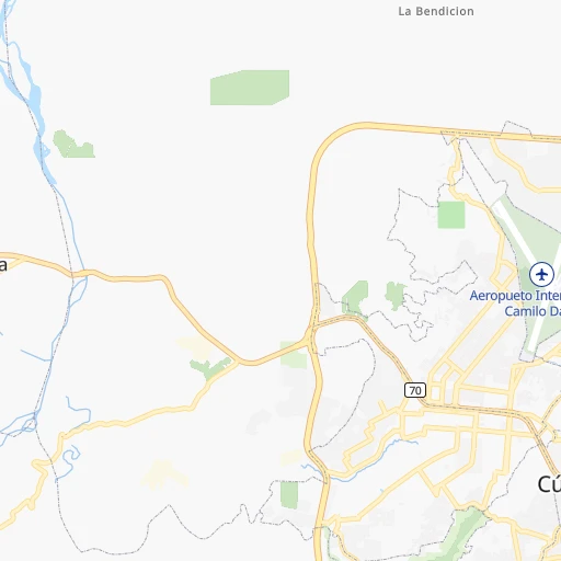
Camilo Daza International Airport
››
Roadmap from Camilo Daza International Airport to El Bagre
How to get from Camilo Daza International (airport) (Norte de Santander) to El Bagre (Antioquia)
Calculate route from Camilo Daza International (airport) (Norte de Santander, Colombia) to El Bagre (Antioquia, Colombia).
The flight distance (as the crow flies) between Camilo Daza International (airport) and El Bagre is 255.6 km.
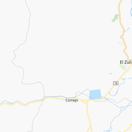
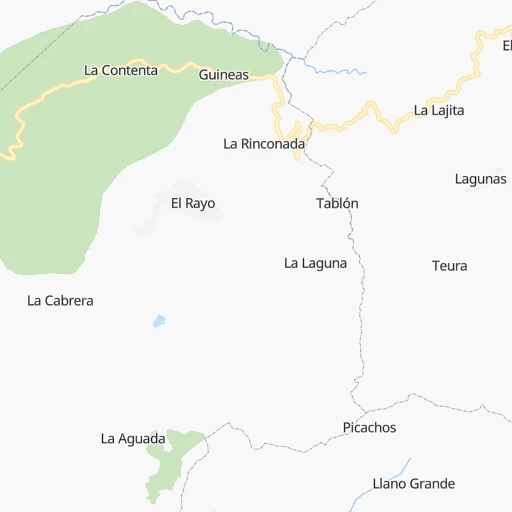
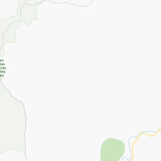
Roadmap (route) to go from Camilo Daza International Airport to El Bagre detailed above, you can also see the course layout on the map.
While doing trip Camilo Daza International (airport) - El Bagre by car, the calculated route ends at a distance , or more straight.
Distance and duration of the route between Camilo Daza International (airport) and El Bagre
Calculation of distance and route from El Bagre to Camilo Daza International (airport) :
255.6557.4 km10h56mn
Continue 0h0mn 114 mAt roundabout, take exit 1 onto Avenida Aeropuerto 0h7mn 7.9 kmTurn right 0h0mn 86 mTurn left onto Avenida 1 0h1mn 735 mAt roundabout, take exit 1 onto Avenida 10 0h5mn 5.4 kmAt roundabout, take exit 3 onto Vía Pamplona-Cucuta 1h51mn 60.6 kmAt roundabout, take exit 2 onto Vía Pamplona-Cucuta 0h1mn 1.4 kmKeep right onto Calle 3 0h1mn 994 mTurn left onto Carrera 3 0h0mn 109 mTurn right onto Calle 4 0h1mn 357 mTurn right 0h0mn 31 mTurn left 0h0mn 49 mKeep left 0h0mn 53 mTurn slight right 0h0mn 129 mKeep left 0h0mn 135 mTurn slight left onto Vía Orfanato 0h0mn 170 mKeep left onto Vía Orfanato 0h0mn 111 mTurn sharp left onto Vía Bucaramanga - Cucuta 1h2mn 102.9 kmAt roundabout, take exit 2 onto Vía Bucaramanga-Cucuta 0h7mn 6.5 kmKeep left and drive toward Cúcuta 0h0mn 97 mTurn right onto Itenary Bis Vía Cucuta 0h1mn 688 mTurn sharp right 0h3mn 1.6 kmKeep left 0h0mn 53 mContinue onto Calle 70 0h2mn 1.4 kmKeep right 0h0mn 324 mKeep left onto Carrera 32 0h0mn 293 mTurn right onto Carrera 32 0h0mn 29 mTurn right onto Carrera 32 0h0mn 146 mTurn sharp left 0h1mn 530 mTurn left onto Carrera 27 0h9mn 7.8 kmTurn right 0h1mn 421 mTurn sharp left onto Carrera 33 0h0mn 104 mTurn right 0h0mn 42 mTurn right onto Calle 47A 0h1mn 254 mTurn right onto Carrera 34 0h0mn 79 mKeep left 0h1mn 619 mKeep left 0h0mn 60 mTurn right onto Vía Bucaramanga - Aeropuerto - Lebrija 0h7mn 7.7 kmAt roundabout, take exit 2 onto 66 0h1mn 1.1 kmAt roundabout, take exit 1 onto 66 0h15mn 17.4 kmKeep left onto 66 1h40mn 43.9 kmKeep right onto 66 0h29mn 32.2 kmTurn left onto Avenida Circunvalación Oeste 0h0mn 517 mTurn right onto Carrera 20 0h1mn 582 mTurn left onto Calle 71 0h2mn 1.7 kmAt roundabout, take exit 1 0h0mn 71 mKeep left and drive toward Puerto Galán 0h7mn 7.1 kmKeep left onto Carrera 57 0h7mn 6.0 kmTurn right onto Calle 46 0h2mn 1.6 kmTurn right 1h14mn 68.3 kmTurn sharp right 1h44mn 21.9 kmTurn slight right 0h16mn 7.8 kmTurn slight left 0h23mn 11.6 kmTurn right 1h38mn 19.0 kmTurn right 1h34mn 16.8 kmTurn left 0h9mn 4.4 kmTurn left 0h3mn 1.3 kmTurn sharp right 0h1mn 608 mTurn right 0h0mn 166 mTurn left 0h0mn 178 mTurn left 0h0mn 224 mContinue 0h0mn 416 mTurn left 0h0mn 96 mTurn right 0h2mn 2.0 kmTurn right onto Autopista Conexión Norte 1h55mn 65.5 kmKeep right 0h4mn 2.0 kmKeep left 0h16mn 8.1 kmTurn right onto Escarralao - El Bagre 0h6mn 4.7 kmAt roundabout, take exit 1 onto Carrera 48 0h0mn 21 mTurn left 0h0mn 141 mTurn right 0h0mn 36 mTurn left 0h0mn 21 mArrive at destination 0h0mn 0 m
Travel from Camilo Daza International (airport) (Antioquia) to a selection of major cities.
Distances from Camilo Daza International Airport to biggest cities in Norte de Santander
Other major cities in country :
- Sincelejo [27], 261,187 inhabitants. 353 km
- Popayan [09], 258,653 inhabitants. 762 km
- Floridablanca [26], 252,267 inhabitants. 115 km
- Palmira [29], 247,986 inhabitants. 644 km
- Buenaventura [29], 240,387 inhabitants. 673 km
- Barrancabermeja [26], 191,403 inhabitants. 177 km
- Dos Quebradas [24], 179,583 inhabitants. 490 km
- Tulua [29], 165,501 inhabitants. 591 km
- Envigado [02], 163,007 inhabitants. 392 km
- Cartago [29], 134,827 inhabitants. 517 km
- Maicao [17], 130,348 inhabitants. 385 km
- Florencia [08], 130,337 inhabitants. 782 km
- Girardot City [33], 130,289 inhabitants. 477 km
- Sogamoso [36], 126,551 inhabitants. 251 km
- Buga [29], 118,004 inhabitants. 614 km
- Tunja [36], 117,479 inhabitants. 283 km
- Giron [26], 108,466 inhabitants. 120 km
- Malambo [04], 101,534 inhabitants. 410 km
- Magangue [35], 100,313 inhabitants. 287 km
- Facatativa [33], 94,611 inhabitants. 402 km
Route from El Bagre to major cities (Colombia).
- Distance El Bagre Bogota343 km
- Distance El Bagre Cali501 km
- Distance El Bagre Barranquilla375 km
- Distance El Bagre Cartagena321 km
- Distance El Bagre Cucuta256 km
- Distance El Bagre Bucaramanga194 km
- Distance El Bagre Pereira326 km
- Distance El Bagre Santa Marta410 km
- Distance El Bagre Ibague355 km
- Distance El Bagre Pasto762 km
- Distance El Bagre Manizales293 km
- Distance El Bagre Neiva523 km
- Distance El Bagre Soledad369 km
- Distance El Bagre Villavicencio407 km
- Distance El Bagre Armenia355 km
- Distance El Bagre Soacha343 km
- Distance El Bagre Valledupar361 km
- Distance El Bagre Monteria174 km
- Distance El Bagre Sincelejo200 km
- Distance El Bagre Popayan609 km
Nearest cities to Camilo Daza International (airport) :
- Cucuta, 721,398 inhabitants. 4 km
- Bucaramanga, 571,820 inhabitants. 112 km
- Soledad, 342,556 inhabitants. 415 km
- Valledupar, 308,237 inhabitants. 294 km
- Sincelejo, 261,187 inhabitants. 353 km
- Floridablanca, 252,267 inhabitants. 115 km
- Barrancabermeja, 191,403 inhabitants. 177 km
- Sogamoso, 126,551 inhabitants. 251 km
- Tunja, 117,479 inhabitants. 283 km
- Giron, 108,466 inhabitants. 120 km
- Malambo, 101,534 inhabitants. 410 km
- Magangue, 100,313 inhabitants. 287 km
- Duitama, 92,040 inhabitants. 241 km
- Zipaquira, 91,235 inhabitants. 363 km
- Piedecuesta, 86,387 inhabitants. 120 km
- Montelibano, 85,000 inhabitants. 321 km
- Ocana, 83,511 inhabitants. 99 km
- La Dorada, 81,950 inhabitants. 364 km
- Aguachica, 73,360 inhabitants. 129 km
- Arauca, 69,264 inhabitants. 215 km
- Sabanalarga, 68,535 inhabitants. 401 km
- Villa del Rosario, 64,951 inhabitants. 11 km
- Rionegro, 62,291 inhabitants. 373 km
- Yopal, 61,029 inhabitants. 289 km
- Sahagun, 59,188 inhabitants. 342 km
- Fundacion, 59,175 inhabitants. 342 km
- Los Patios, 58,661 inhabitants. 10 km
- Caucasia, 58,034 inhabitants. 296 km
- Turbaco, 56,171 inhabitants. 416 km
- El Banco, 54,522 inhabitants. 201 km
- Pamplona, 53,587 inhabitants. 63 km
- Agustin Codazzi, 51,478 inhabitants. 248 km
- Arjona, 50,405 inhabitants. 405 km
- Copacabana, 49,169 inhabitants. 375 km
- Plato, 48,606 inhabitants. 325 km
- El Carmen de Bolivar, 47,957 inhabitants. 349 km
- Chiquinquira, 45,294 inhabitants. 295 km
- Baranoa, 44,078 inhabitants. 414 km
- El Bagre, 40,798 inhabitants. 256 km
- Segovia, 39,938 inhabitants. 259 km
- Corozal, 39,800 inhabitants. 343 km
- La Ceja, 36,584 inhabitants. 386 km
- San Marcos, 36,549 inhabitants. 300 km
- Puerto Berrio, 33,983 inhabitants. 263 km
- San Gil, 33,592 inhabitants. 167 km
- Pivijay, 33,492 inhabitants. 365 km
- Mompos, 30,861 inhabitants. 257 km
- Since, 30,768 inhabitants. 325 km
- San Juan Nepomuceno, 29,619 inhabitants. 361 km
- Tame, 29,099 inhabitants. 184 km
Location Camilo Daza International (airport) (Norte de Santander) :
| Country flag |  |
| Location | Camilo Daza International (airport) |
| State | Norte de Santander |
| County | Cúcuta |
| Country | Colombia |
| Country code / ISO 2 | CO |
| Latitude | 7.9275700 |
| Longitude | -72.5115500 |
| Altitude | 334 meters |
| Time zone | America/Bogota |
Location El Bagre (Antioquia) :
| Country flag | |
| Location | El Bagre |
| State | Antioquia |
| County | El Bagre |
| Country | Colombia |
| Country code / ISO 2 | CO |
| Latitude | 7.6034700 |
| Longitude | -74.8095100 |
| Altitude | 0 meters |
| Time zone | America/Bogota |