

Home
››
Chautauqua County-Jamestown Airport
››
Roadmap from Chautauqua County-Jamestown Airport to Fresno
How to get from Chautauqua County-Jamestown (airport) (New York) to Fresno (California)
Calculate route from Chautauqua County-Jamestown (airport) (New York, United States) to Fresno (California, United States).
The flight distance (as the crow flies) between Chautauqua County-Jamestown (airport) and Fresno is 3,493.7 km.
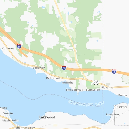
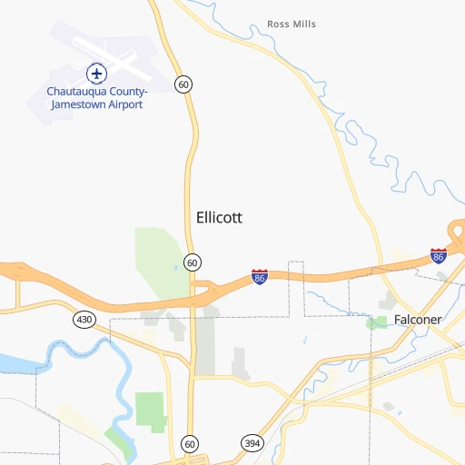
Roadmap (route) to go from Chautauqua County-Jamestown Airport to Fresno detailed above, you can also see the course layout on the map.
While doing trip Chautauqua County-Jamestown (airport) - Fresno by car, the calculated route ends at a distance , or more straight.
Distance and duration of the route between Chautauqua County-Jamestown (airport) and Fresno
Calculation of distance and route from Fresno to Chautauqua County-Jamestown (airport) :
3,493.74,114.1 km43h46mn
Continue 0h0mn 59 mTurn left onto Airport Drive 0h1mn 733 mTurn right onto West Oak Hill Road 0h1mn 316 mTurn left onto Strunk Road 0h6mn 3.2 kmTurn right 1h35mn 53.2 kmKeep left and take I-90 toward Erie 2h32mn 145.9 kmKeep right onto I 90 0h1mn 2.0 kmKeep right onto I 90 and drive toward Cleveland 0h16mn 23.5 kmKeep left onto Innerbelt 0h2mn 2.7 kmKeep left onto Innerbelt 0h2mn 2.6 kmKeep left onto I 71 and take I 71 South toward Columbus 0h1mn 2.0 kmKeep right onto I 71 0h8mn 11.8 kmKeep left onto Berea Freeway and take SR 237 South, I 480 West toward Airport, Berea, Toledo 0h1mn 933 mKeep right and take I 480 West toward Toledo 0h10mn 14.3 kmKeep right onto I 480 5h34mn 463.1 kmKeep right onto I 80 and take I 80 West, I 94, US 6 toward Des Moines 0h1mn 964 mKeep right onto I 80 toward I 94 West, I 80 West, SR 51 0h0mn 166 mKeep left onto I 80 toward I 94 West, I 80 West 0h17mn 22.9 kmKeep right and take US 41 North toward Calumet Avenue, Hammond, Munster 0h0mn 318 mKeep left and drive toward Calumet Avenue South 0h0mn 361 mKeep left 0h10mn 13.4 kmKeep right onto I 80 and take I 80 West toward Iowa 2h22mn 233.4 kmKeep right onto I 80 and take I 80 West toward Davenport 3h47mn 280.3 kmKeep right onto US 6 and take US 6 West, US 65 North, IA 330 North toward Marshalltown, Bondurant 0h1mn 755 mTurn left onto Northeast Hubbell Avenue 0h6mn 6.1 kmContinue onto Hubbell Avenue 0h0mn 240 mTurn slight right onto Hubbell Avenue 0h2mn 2.0 kmTurn right onto Guthrie Avenue 0h1mn 1.0 kmTurn left 2h6mn 209.1 kmKeep left onto I 80 Express and take I 80 West Express toward Council Bluffs, Omaha 5h21mn 570.8 kmKeep left onto I 80 and take I 80 West toward Sidney, Cheyanne 9h35mn 931.0 kmKeep right and take I 15 South, UT 201 West toward Las Vegas, West Valley 0h1mn 733 mKeep left and take I 15 South, UT 201 West toward Las Vegas, West Valley 0h0mn 273 mKeep right and take UT 201 West toward West Valley 0h1mn 999 mKeep left and take UT 201 West toward West Valley 2h43mn 190.5 kmKeep right and drive toward Wendover 0h0mn 295 mTurn left onto Aria Boulevard 0h0mn 287 mTurn sharp right onto Wendover Boulevard 0h1mn 1.2 kmTurn left onto US 93 ALT 1h56mn 94.7 kmContinue onto Great Basin Highway 1h2mn 95.5 kmTurn left onto Great Basin Boulevard 0h1mn 1.2 kmTurn right onto Veterans Boulevard 3h41mn 270.2 kmKeep right onto US 6 1h40mn 65.5 kmTurn left onto Grand Army of the Republic Highway 1h59mn 65.3 kmTurn right onto Mono Mills Road 1h5mn 65.5 kmTurn sharp right onto Test Station Road 0h2mn 1.2 kmTurn left onto Test Station Road 0h12mn 6.1 kmTurn left onto Picnic Grounds Road 0h3mn 1.7 kmTurn right onto Highway 395 0h1mn 1.3 kmTurn left onto Tioga Road 2h31mn 94.2 kmTurn left onto Big Oak Flat Road 0h19mn 15.3 kmTurn left onto Northside Drive 0h4mn 2.9 kmKeep right onto Wawona Road 1h43mn 42.1 kmAt roundabout, take exit 1 onto Wawona Road 1h15mn 95.0 kmKeep right and drive toward McKinley Avenue 0h0mn 366 mTurn left onto East McKinley Avenue 0h1mn 590 mTurn right onto North 1st Street 0h2mn 1.9 kmTurn left onto East Washington Avenue 0h0mn 21 mArrive at destination 0h0mn 0 m
Travel from Chautauqua County-Jamestown (airport) (California) to a selection of major cities.
Distances from Chautauqua County-Jamestown Airport to biggest cities in New York
- East Harlem,115,921 inhabitants.469 km
- Elmhurst,113,364 inhabitants.476 km
- Bushwick,112,620 inhabitants.475 km
- Gravesend,112,229 inhabitants.475 km
- Corona,109,698 inhabitants.477 km
- Richmond Hill,98,984 inhabitants.481 km
- Albany,98,469 inhabitants.456 km
- Fordham,94,678 inhabitants.470 km
- West Albany,93,794 inhabitants.455 km
- Flatbush,93,361 inhabitants.473 km
- Canarsie,87,366 inhabitants.478 km
- Greenburgh,86,764 inhabitants.468 km
- New Rochelle,79,846 inhabitants.477 km
- Cheektowaga,75,178 inhabitants.94 km
- Kings Bridge,75,132 inhabitants.469 km
- Brownsville,74,497 inhabitants.476 km
- Ridgewood,69,317 inhabitants.476 km
- Mount Vernon,68,628 inhabitants.473 km
- Forest Hills,67,714 inhabitants.479 km
- Jackson Heights,67,067 inhabitants.475 km
Other major cities in country :
- Boston [MA], 667,137 inhabitants. 676 km
- Memphis [TN], 655,770 inhabitants. 1,217 km
- New South Memphis [TN], 641,608 inhabitants. 1,223 km
- Portland [OR], 632,309 inhabitants. 3,463 km
- Oklahoma City [OK], 631,346 inhabitants. 1,744 km
- Las Vegas [NV], 623,747 inhabitants. 3,142 km
- Baltimore [MD], 621,849 inhabitants. 389 km
- Washington, D.C. [DC], 601,723 inhabitants. 408 km
- Milwaukee [WI], 600,155 inhabitants. 715 km
- South Boston [MA], 571,281 inhabitants. 677 km
- Albuquerque [NM], 559,121 inhabitants. 2,496 km
- Tucson [AZ], 531,641 inhabitants. 2,996 km
- Nashville [TN], 530,852 inhabitants. 929 km
- Fresno [CA], 520,052 inhabitants. 3,500 km
- Sacramento [CA], 490,712 inhabitants. 3,567 km
- Kansas City [MO], 475,378 inhabitants. 1,335 km
- Long Beach [CA], 474,140 inhabitants. 3,508 km
- Mesa [AZ], 471,825 inhabitants. 3,003 km
- Atlanta [GA], 463,878 inhabitants. 1,037 km
- Colorado Springs [CO], 456,568 inhabitants. 2,186 km
Route from Fresno to major cities (United States).
- Distance Fresno New York City3,954 km
- Distance Fresno Chicago2,808 km
- Distance Fresno Brooklyn3,960 km
- Distance Fresno Houston2,394 km
- Distance Fresno Queens3,969 km
- Distance Fresno Philadelphia3,870 km
- Distance Fresno Phoenix791 km
- Distance Fresno Manhattan3,956 km
- Distance Fresno San Antonio2,140 km
- Distance Fresno The Bronx3,963 km
- Distance Fresno Dallas2,141 km
- Distance Fresno Austin2,162 km
- Distance Fresno Jacksonville3,584 km
- Distance Fresno Columbus3,207 km
- Distance Fresno Fort Worth2,097 km
- Distance Fresno Indianapolis2,940 km
- Distance Fresno Charlotte3,486 km
- Distance Fresno Seattle1,227 km
- Distance Fresno Denver1,333 km
- Distance Fresno El Paso1,341 km
Nearest cities to Chautauqua County-Jamestown (airport) :
- Baltimore, 621,849 inhabitants. 389 km
- Cleveland, 388,072 inhabitants. 214 km
- Pittsburgh, 304,391 inhabitants. 200 km
- Buffalo, 258,071 inhabitants. 88 km
- Rochester, 209,802 inhabitants. 175 km
- Akron, 197,542 inhabitants. 222 km
- Amherst, 122,366 inhabitants. 100 km
- Columbia, 99,615 inhabitants. 383 km
- Erie, 99,475 inhabitants. 68 km
- Germantown, 86,395 inhabitants. 372 km
- Parma, 79,937 inhabitants. 220 km
- Cheektowaga, 75,178 inhabitants. 94 km
- Canton, 71,885 inhabitants. 232 km
- Frederick, 69,479 inhabitants. 342 km
- Glen Burnie, 67,639 inhabitants. 400 km
- Ellicott City, 65,834 inhabitants. 383 km
- Youngstown, 64,628 inhabitants. 164 km
- Lorain, 63,647 inhabitants. 254 km
- Dundalk, 63,597 inhabitants. 397 km
- Lancaster, 59,339 inhabitants. 342 km
- Towson, 55,197 inhabitants. 380 km
- Elyria, 53,775 inhabitants. 251 km
- Irondequoit, 51,692 inhabitants. 182 km
- Lakewood, 50,656 inhabitants. 223 km
- Cuyahoga Falls, 49,146 inhabitants. 216 km
- Harrisburg, 49,081 inhabitants. 289 km
- Niagara Falls, 48,916 inhabitants. 107 km
- South Bel Air, 48,828 inhabitants. 382 km
- Bel Air South, 47,709 inhabitants. 385 km
- Euclid, 47,676 inhabitants. 197 km
- Mentor, 46,901 inhabitants. 180 km
- Altoona, 45,344 inhabitants. 196 km
- Cleveland Heights, 44,962 inhabitants. 202 km
- West Seneca, 44,711 inhabitants. 87 km
- Strongsville, 44,668 inhabitants. 233 km
- Penn Hills, 44,610 inhabitants. 190 km
- York, 43,992 inhabitants. 324 km
- State College, 42,161 inhabitants. 191 km
- Catonsville, 41,567 inhabitants. 385 km
- Hagerstown, 40,432 inhabitants. 308 km
- Warren, 40,245 inhabitants. 164 km
- Essex, 39,262 inhabitants. 394 km
- Hanover, 38,088 inhabitants. 393 km
- Woodlawn, 37,879 inhabitants. 381 km
- Brighton, 36,609 inhabitants. 179 km
- Boardman, 35,376 inhabitants. 171 km
- Stow, 34,797 inhabitants. 212 km
- Brunswick, 34,689 inhabitants. 237 km
- Collinwood, 34,220 inhabitants. 202 km
- North Bel Air, 33,925 inhabitants. 380 km
Location Chautauqua County-Jamestown (airport) (New York) :
| Country flag |  |
| Location | Chautauqua County-Jamestown (airport) |
| State | New York |
| County | Chautauqua County |
| Country | United States |
| Country code / ISO 2 | US |
| Latitude | 42.1500000 |
| Longitude | -79.2666700 |
| Altitude | 525 meters |
| Time zone | America/New_York |
Location Fresno (California) :
| Country flag | |
| Location | Fresno |
| State | California |
| County | Fresno County |
| Country | United States |
| Country code / ISO 2 | US |
| Latitude | 36.7477300 |
| Longitude | -119.7723700 |
| Altitude | 94 meters |
| Time zone | America/Los_Angeles |


