


How to get from Greytown (airport) (KwaZulu-Natal) to Mthatha (Eastern Cape)
Calculate route from Greytown (airport) (KwaZulu-Natal, South Africa) to Mthatha (Eastern Cape, South Africa).
The flight distance (as the crow flies) between Greytown (airport) and Mthatha is 324.0 km.
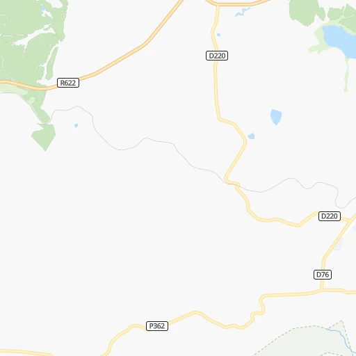
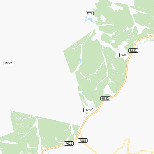
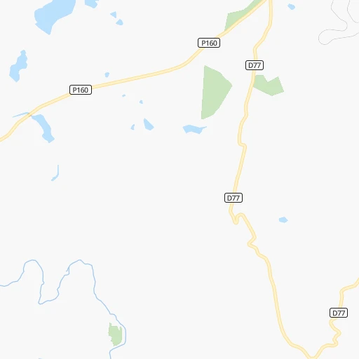
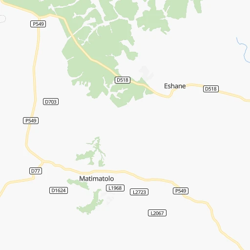
Roadmap (route) to go from Greytown Airport to Mthatha detailed above, you can also see the course layout on the map.
While doing trip Greytown (airport) - Mthatha by car, the calculated route ends at a distance , or more straight.
Distance and duration of the route between Greytown (airport) and Mthatha
Calculation of distance and route from Mthatha to Greytown (airport) :
324.0427.5 km6h16mn
Continue onto D76 0h2mn 2.1 kmTurn left onto P362 0h4mn 3.5 kmTurn right onto R33 1h50mn 60.0 kmKeep left toward R33 0h3mn 3.4 kmTurn left onto Chief Albert Luthuli Road 0h1mn 1.6 kmTurn right onto Alexandra Road 0h13mn 14.7 kmTurn slight left onto R56 2h58mn 130.1 kmTurn right 0h1mn 550 mContinue onto N2, R56 2h40mn 116.2 kmKeep right 0h0mn 119 mKeep left 0h1mn 528 mTurn right 0h0mn 240 mTurn left 0h0mn 27 mTurn right onto N2 1h20mn 93.7 kmTurn right onto Sutherland Drive 0h1mn 709 mTurn left onto Craister Street 0h0mn 70 mArrive at destination 0h0mn 0 m
Travel from Greytown (airport) (Eastern Cape) to a selection of major cities.
Distances from Greytown Airport to biggest cities in KwaZulu-Natal
Other major cities in country :
- Uitenhage [05], 228,912 inhabitants. 713 km
- Roodepoort [06], 225,000 inhabitants. 424 km
- Paarl [11], 190,000 inhabitants. 1,216 km
- Springs [06], 186,394 inhabitants. 386 km
- Carletonville [06], 182,304 inhabitants. 439 km
- Klerksdorp [10], 178,921 inhabitants. 461 km
- Midrand [06], 173,009 inhabitants. 425 km
- Westonaria [06], 156,831 inhabitants. 426 km
- Middelburg [07], 154,706 inhabitants. 389 km
- Orkney [10], 145,801 inhabitants. 452 km
- Kimberley [08], 142,089 inhabitants. 569 km
- eMbalenhle [07], 141,741 inhabitants. 325 km
- Nigel [06], 140,644 inhabitants. 365 km
- Bhisho [05], 137,287 inhabitants. 512 km
- Randfontein [06], 133,654 inhabitants. 433 km
- Worcester [11], 127,597 inhabitants. 1,171 km
- Rustenburg [10], 124,064 inhabitants. 507 km
- Polokwane [09], 123,749 inhabitants. 591 km
- Potchefstroom [10], 123,669 inhabitants. 435 km
- Virginia [03], 122,502 inhabitants. 381 km
Route from Mthatha to major cities (South Africa).
- Distance Mthatha Cape Town1,004 km
- Distance Mthatha Durban289 km
- Distance Mthatha Johannesburg604 km
- Distance Mthatha Soweto599 km
- Distance Mthatha Pretoria653 km
- Distance Mthatha Pietermaritzburg268 km
- Distance Mthatha Benoni603 km
- Distance Mthatha Tembisa625 km
- Distance Mthatha Vereeniging554 km
- Distance Mthatha Bloemfontein369 km
- Distance Mthatha Boksburg601 km
- Distance Mthatha Welkom448 km
- Distance Mthatha Newcastle441 km
- Distance Mthatha Krugersdorp620 km
- Distance Mthatha Diepsloot634 km
- Distance Mthatha Randburg616 km
- Distance Mthatha Botshabelo325 km
- Distance Mthatha Brakpan597 km
- Distance Mthatha Witbank638 km
- Distance Mthatha Richards Bay442 km
Nearest cities to Greytown (airport) :
- Durban, 3,120,282 inhabitants. 92 km
- Johannesburg, 2,026,469 inhabitants. 410 km
- Soweto, 1,695,047 inhabitants. 416 km
- Pietermaritzburg, 750,845 inhabitants. 58 km
- Benoni, 605,344 inhabitants. 396 km
- Vereeniging, 474,681 inhabitants. 378 km
- Boksburg, 445,168 inhabitants. 397 km
- Newcastle, 404,838 inhabitants. 165 km
- Brakpan, 305,692 inhabitants. 389 km
- Richards Bay, 252,968 inhabitants. 146 km
- Vanderbijlpark, 246,754 inhabitants. 381 km
- Roodepoort, 225,000 inhabitants. 424 km
- Springs, 186,394 inhabitants. 386 km
- Westonaria, 156,831 inhabitants. 426 km
- Vryheid, 150,012 inhabitants. 152 km
- eMbalenhle, 141,741 inhabitants. 325 km
- Nigel, 140,644 inhabitants. 365 km
- Mpumalanga, 140,121 inhabitants. 77 km
- Randfontein, 133,654 inhabitants. 433 km
- Alberton, 121,536 inhabitants. 400 km
- Bethal, 101,919 inhabitants. 316 km
- Delmas, 92,046 inhabitants. 381 km
- Dundee, 84,413 inhabitants. 112 km
- Piet Retief, 84,349 inhabitants. 236 km
- Phuthaditjhaba, 84,258 inhabitants. 185 km
- Bethlehem, 83,654 inhabitants. 244 km
- Mthatha, 78,663 inhabitants. 325 km
- Sasolburg, 77,016 inhabitants. 374 km
- Standerton, 74,021 inhabitants. 277 km
- Heidelberg, 64,199 inhabitants. 365 km
- KwaDukuza, 59,899 inhabitants. 72 km
- Heilbron, 55,196 inhabitants. 328 km
- Port Shepstone, 52,793 inhabitants. 181 km
- Edenvale, 49,292 inhabitants. 410 km
- eSikhaleni, 49,265 inhabitants. 131 km
- Balfour, 46,008 inhabitants. 337 km
- Mondlo, 44,922 inhabitants. 127 km
- Volksrust, 43,378 inhabitants. 207 km
- Ermelo, 41,124 inhabitants. 294 km
- Senekal, 39,584 inhabitants. 303 km
- Harrismith, 35,108 inhabitants. 171 km
- Margate, 34,407 inhabitants. 195 km
- Richmond, 32,445 inhabitants. 89 km
- Howick, 28,725 inhabitants. 53 km
- Driefontein, 28,127 inhabitants. 235 km
- Empangeni, 28,093 inhabitants. 133 km
- Mpophomeni, 26,229 inhabitants. 63 km
- Kokstad, 25,373 inhabitants. 194 km
- Scottburgh, 23,949 inhabitants. 131 km
- Ulundi, 20,753 inhabitants. 119 km
Location Greytown (airport) (KwaZulu-Natal) :
| Country flag |  |
| Location | Greytown (airport) |
| State | KwaZulu-Natal |
| County | uMzinyathi District Municipality |
| Country | South Africa |
| Country code / ISO 2 | ZA |
| Latitude | -29.1220100 |
| Longitude | 30.5867100 |
| Altitude | 1076 meters |
| Time zone | Africa/Johannesburg |
Location Mthatha (Eastern Cape) :
| Country flag | |
| Location | Mthatha |
| State | Eastern Cape |
| County | OR Tambo District Municipality |
| Country | South Africa |
| Country code / ISO 2 | ZA |
| Latitude | -31.5889300 |
| Longitude | 28.7844300 |
| Altitude | 0 meters |
| Time zone | Africa/Johannesburg |

