
How to get from Chapleau (airport) (Ontario) to Peterborough (Ontario)
Calculate route from Chapleau (airport) (Ontario, Canada) to Peterborough (Ontario, Canada).
The flight distance (as the crow flies) between Chapleau (airport) and Peterborough is 551.0 km.
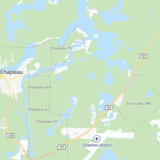
Roadmap (route) to go from Chapleau Airport to Peterborough detailed above, you can also see the course layout on the map.
While doing trip Chapleau (airport) - Peterborough by car, the calculated route ends at a distance , or more straight.
Distance and duration of the route between Chapleau (airport) and Peterborough
Calculation of distance and route from Peterborough to Chapleau (airport) :
551.0694.4 km11h47mn
Continue 0h1mn 358 mTurn sharp right 0h1mn 429 mTurn left onto Highway 101 0h2mn 2.5 kmTurn left onto Highway 101/129 0h7mn 7.6 kmTurn left onto Highway 129 0h19mn 20.4 kmTurn left onto Highway 667 1h35mn 35.3 kmTurn right onto Sultan Industrial Road 3h31mn 79.6 kmTurn right onto Highway 144 2h4mn 149.1 kmTurn right onto Elm Street 0h3mn 3.1 kmTurn right onto Ethelbert Street 0h0mn 142 mTurn left onto Spruce Street 0h0mn 329 mTurn right onto Whittaker Street 0h0mn 284 mTurn left onto Victoria Street 0h0mn 101 mTurn right onto Eyre Street 0h0mn 374 mTurn left onto Douglas Street 0h0mn 100 mTurn right onto Regent Street 0h0mn 249 mKeep right 0h0mn 58 mTurn slight right onto Lorne Street 0h0mn 71 mTurn left onto Regent Street 0h0mn 48 mTurn slight right onto Regent Street 0h1mn 816 mTurn right onto Regent Street 3h48mn 245.9 kmKeep right and take 12 East, 23 toward Coldwater, Fesserton 0h0mn 452 mTurn left onto Vasey Road 0h1mn 624 mTurn right onto Highway 12 0h21mn 23.2 kmTurn right onto West Street North 0h0mn 156 mTurn left onto Mississaga Street East 0h1mn 457 mTurn right onto Front Street South 0h4mn 3.4 kmTurn slight right onto Atherley Road 0h14mn 16.3 kmAt roundabout, take exit 2 onto Highway 12 0h15mn 17.2 kmTurn left onto Regional Road 15 0h5mn 6.1 kmTurn right onto Simcoe Street 0h13mn 15.5 kmTurn left onto Highway 7 1h43mn 49.1 kmContinue onto Lindsay Road 0h4mn 3.5 kmTurn right onto Fife's Bay Road 0h3mn 2.9 kmTurn left onto Lily Lake Road 0h3mn 3.2 kmTurn right onto Fairbairn Street 0h2mn 1.7 kmTurn left onto Parkhill Road West 0h0mn 244 mTurn right onto Park Street North 0h0mn 369 mTurn left onto McDonnel Street 0h1mn 967 mTurn right onto George Street North 0h0mn 412 mTurn left onto Hunter Street West 0h1mn 642 mTurn sharp right onto Burnham Street 0h1mn 502 mTurn right onto Charles Street 0h0mn 87 mTurn left onto Birdsall Street 0h0mn 75 mTurn slight right onto Edgewater Boulevard 0h1mn 304 mArrive at destination 0h0mn 0 m
Travel from Chapleau (airport) (Ontario) to a selection of major cities.
Distances from Chapleau Airport to biggest cities in Ontario
- St. Catharines,131,989 inhabitants.609 km
- Cambridge,120,372 inhabitants.550 km
- Guelph,115,760 inhabitants.533 km
- East York,115,365 inhabitants.556 km
- Kingston,114,195 inhabitants.664 km
- Thunder Bay,99,334 inhabitants.443 km
- Waterloo,97,475 inhabitants.532 km
- Ajax,90,167 inhabitants.554 km
- Pickering,87,838 inhabitants.545 km
- Brantford,87,759 inhabitants.575 km
- Milton,84,362 inhabitants.550 km
- Sarnia,82,998 inhabitants.544 km
- Niagara Falls,82,000 inhabitants.623 km
- Willowdale,79,440 inhabitants.546 km
- Peterborough,75,877 inhabitants.552 km
- Sault Ste. Marie,74,948 inhabitants.163 km
- Newmarket,74,295 inhabitants.516 km
- Norfolk County,60,847 inhabitants.602 km
- Welland,50,331 inhabitants.627 km
- North Bay,50,170 inhabitants.339 km
Other major cities in country :
- Sherbrooke [10], 129,447 inhabitants. 915 km
- Anmore [02], 126,456 inhabitants. 2,881 km
- Levis [10], 126,396 inhabitants. 925 km
- Kelowna [02], 125,109 inhabitants. 2,631 km
- Trois-Rivieres [10], 119,693 inhabitants. 835 km
- Coquitlam [02], 114,565 inhabitants. 2,875 km
- Sydney [07], 105,968 inhabitants. 1,763 km
- Delta [02], 101,668 inhabitants. 2,889 km
- Dartmouth [07], 101,343 inhabitants. 1,558 km
- St. John's [05], 99,182 inhabitants. 2,281 km
- Terrebonne [10], 94,703 inhabitants. 776 km
- Saint John [04], 87,857 inhabitants. 1,350 km
- Moncton [04], 87,467 inhabitants. 1,419 km
- Nanaimo [02], 84,905 inhabitants. 2,962 km
- Saint-Laurent [10], 77,391 inhabitants. 783 km
- Chilliwack [02], 77,000 inhabitants. 2,821 km
- Repentigny [10], 76,237 inhabitants. 789 km
- Fort McMurray [01], 76,000 inhabitants. 2,130 km
- La Haute-Saint-Charles [10], 74,070 inhabitants. 908 km
- Red Deer [01], 73,593 inhabitants. 2,215 km
Route from Peterborough to major cities (Canada).
- Distance Peterborough Montreal396 km
- Distance Peterborough Calgary2,754 km
- Distance Peterborough Edmonton2,735 km
- Distance Peterborough Winnipeg1,551 km
- Distance Peterborough Vancouver3,409 km
- Distance Peterborough Quebec620 km
- Distance Peterborough Surrey3,390 km
- Distance Peterborough Laval391 km
- Distance Peterborough Halifax1,170 km
- Distance Peterborough Okanagan3,127 km
- Distance Peterborough Victoria3,441 km
- Distance Peterborough Gatineau244 km
- Distance Peterborough Longueuil402 km
- Distance Peterborough Burnaby3,396 km
- Distance Peterborough Ladner3,408 km
- Distance Peterborough Saskatoon2,258 km
- Distance Peterborough Richmond3,411 km
- Distance Peterborough Regina2,085 km
- Distance Peterborough Abbotsford3,349 km
- Distance Peterborough Saguenay721 km
Nearest cities to Chapleau (airport) :
- Greater Sudbury, 157,857 inhabitants. 232 km
- Sault Ste. Marie, 74,948 inhabitants. 163 km
- Timmins, 42,997 inhabitants. 166 km
- Rayside-Balfour, 16,050 inhabitants. 211 km
- Elliot Lake, 12,508 inhabitants. 169 km
- Kapuskasing, 9,240 inhabitants. 190 km
- Hearst, 4,746 inhabitants. 209 km
- Espanola, 4,682 inhabitants. 211 km
- Iroquois Falls, 4,232 inhabitants. 224 km
Location Chapleau (airport) (Ontario) :
| Country flag |  |
| Location | Chapleau (airport) |
| State | Ontario |
| County | Sudbury |
| Country | Canada |
| Country code / ISO 2 | CA |
| Latitude | 47.8208800 |
| Longitude | -83.3527600 |
| Altitude | 448 meters |
| Time zone | America/Toronto |
Location Peterborough (Ontario) :
| Country flag | |
| Location | Peterborough |
| State | Ontario |
| County | |
| Country | Canada |
| Country code / ISO 2 | CA |
| Latitude | 44.3001200 |
| Longitude | -78.3162300 |
| Altitude | 0 meters |
| Time zone | America/Toronto |


