

How to get from Chitina (airport) (Alaska) to Jacksonville (Florida)
Calculate route from Chitina (airport) (Alaska, United States) to Jacksonville (Florida, United States).
The flight distance (as the crow flies) between Chitina (airport) and Jacksonville is 5,644.5 km.
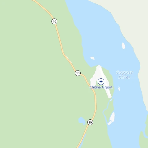
Roadmap (route) to go from Chitina Airport to Jacksonville detailed above, you can also see the course layout on the map.
While doing trip Chitina (airport) - Jacksonville by car, the calculated route ends at a distance , or more straight.
Distance and duration of the route between Chitina (airport) and Jacksonville
Calculation of distance and route from Jacksonville to Chitina (airport) :
5,644.57,122.1 km82h46mn
Continue onto Airport Access Road 0h1mn 381 mTurn right onto Edgerton Highway 1h35mn 45.7 kmTurn right onto Richardson Highway 1h48mn 72.5 kmTurn right onto Tok Cutoff 3h47mn 196.4 kmTurn right onto Alaska Highway 6h3mn 466.9 kmTurn left onto Alaska Highway 19h1mn 1,557.1 kmAt roundabout, take exit 2 onto Spirit River Highway 0h5mn 5.1 kmKeep right 0h0mn 41 mTurn slight right onto Rolla Road 0h1mn 1.6 kmTurn left onto Dawson Creek-Tupper Highway 1h48mn 67.0 kmTurn left onto Emerson Trail 1h32mn 48.2 kmTurn right onto Highway 2 0h6mn 8.1 kmKeep left 0h0mn 143 mTurn slight left onto 84 Avenue 0h2mn 1.9 kmTurn right onto Range Road 60 0h0mn 56 mTurn left onto Township Road 722A 0h1mn 1.6 kmTurn right onto Range Road 55 0h1mn 810 mTurn left onto Highway 43 4h51mn 378.9 kmTurn left onto Range Road 24 and drive toward Fort Saskatchewan 0h0mn 85 mTurn right onto Township Road 550 1h35mn 51.2 kmTurn sharp right onto 28 0h5mn 7.3 kmKeep right toward 216 0h0mn 210 mKeep left 0h10mn 15.4 kmKeep right and take 16 toward Lloydminster, Edmonton 0h0mn 318 mKeep left and take 16 East toward Lloydminster 0h1mn 936 mKeep left and take 16 East toward Lloydminster 5h12mn 506.0 kmKeep right toward 16 East 0h0mn 430 mKeep left 0h0mn 46 mTurn left onto Circle Drive 0h2mn 1.4 kmKeep left onto Circle Drive 3h37mn 254.4 kmKeep right toward 6 South 0h5mn 7.8 kmKeep right toward 33 East 0h0mn 246 mKeep left and take 33 East toward Francis 0h0mn 137 mTurn left onto Arcola Avenue 2h45mn 139.0 kmTurn right onto Highway 47 1h38mn 56.7 kmTurn left onto Highway 39 0h7mn 7.9 kmTurn left onto Highway 39 0h28mn 33.0 kmKeep right 0h10mn 12.1 kmTurn left onto United States Highway 52 2h52mn 143.6 kmKeep right onto US 52 and take US 52 East, US 52 Business toward Jamestown 0h1mn 581 mTurn right onto US 52 2h56mn 140.0 kmTurn left onto State Highway 15 0h12mn 16.6 kmTurn right onto State Highway 30 0h13mn 20.9 kmTurn left onto United States Highway 52 0h15mn 22.5 kmAt roundabout, take exit 1 onto 4th Avenue North 1h54mn 65.3 kmContinue onto US 52, US 281 0h3mn 3.8 kmKeep right 0h0mn 62 mTurn slight right onto 1st Avenue North 0h1mn 1.5 kmContinue 0h0mn 100 mTurn slight right onto 10th Street Southeast 0h2mn 2.5 kmContinue 5h0mn 508.5 kmKeep left onto I 694 0h7mn 11.9 kmKeep right and take MN 51 toward Snelling Ave, Lexington Ave 0h4mn 7.0 kmKeep left onto I 694 0h1mn 2.1 kmKeep right onto I 694 0h6mn 8.5 kmKeep right and take MN 36 East toward Stillwater 0h10mn 13.4 kmKeep right and take MN 95 toward Stillwater, Bayport 0h1mn 619 mTurn right onto Saint Croix Trail North 0h2mn 2.4 kmTurn slight right onto Minnesota Street South 0h5mn 6.3 kmTurn left onto MN 95 4h47mn 384.6 kmKeep right onto I 39, I 90 and take I 39, I 90 toward Chicago 1h4mn 108.1 kmKeep right onto I 39, US 51 and take I 39, US 51 South toward Bloomington 0h3mn 4.8 kmKeep right onto I 39, US 51 and take I 39, US 51 South toward Bloomington, Normal 2h1mn 204.6 kmKeep left onto I 74, US 51 and take I 74 East, US 51 South, US 55 Business North toward Indianapolis, Decatur 1h43mn 73.3 kmKeep right and take I 57 South toward Memphis, Decatur 1h50mn 85.1 kmKeep right and take US 45, IL 121 toward Toledo, Mattoon 0h0mn 384 mKeep left and take US 45, IL 121 toward Toledo, Mattoon 0h0mn 69 mTurn left onto Lakeland Boulevard 0h7mn 7.4 kmTurn left onto County Road 500 East 0h10mn 9.5 kmKeep right onto Montrose Road 0h29mn 23.8 kmTurn left onto East Center Street 0h19mn 21.1 kmTurn right onto South Van Buren Street 1h56mn 71.8 kmTurn left onto East Walnut Street 0h1mn 530 mTurn right onto South 1st Street 0h13mn 12.8 kmKeep right 0h0mn 37 mTurn slight right onto North Court Street 0h4mn 4.8 kmTurn right 0h5mn 8.9 kmKeep right and take SR 69 South toward New Harmony, Mount Vernon, Griffin 0h0mn 516 mTurn right onto SR 69 0h7mn 8.6 kmTurn left onto State Highway 66 0h23mn 31.6 kmTurn right onto Mesker Park Drive 0h2mn 2.1 kmTurn right onto St Joseph Avenue 0h1mn 1.2 kmTurn left onto West Lloyd Expressway 0h1mn 1.4 kmKeep right 0h0mn 308 mTurn right onto South Fulton Avenue 0h1mn 1.7 kmContinue onto Veterans Memorial Parkway 0h2mn 2.8 kmKeep right and take US 41 toward Henderson, Kentucky, Vincennes 0h0mn 289 mKeep right and take US 41 South toward Henderson, Kentucky 1h53mn 84.3 kmKeep left onto Pennyrile Parkway and take I 169 South toward Hopkinsville 0h25mn 43.0 kmKeep right toward US 41 0h0mn 369 mKeep left 0h0mn 50 mTurn left onto East 9th Street 0h1mn 703 mTurn right onto Bradshaw Road 0h13mn 17.6 kmTurn right onto Pembroke Oak Grove Road 0h2mn 2.2 kmTurn left and drive toward Nashville 1h47mn 78.6 kmKeep right onto I 24 and take I 24 East, I 65 South toward Nashville 0h6mn 8.2 kmKeep left onto I 24 and take I 40 East, I 24 East toward Knoxville, Chattanooga 0h2mn 3.3 kmKeep right onto I 24 and take I 24 East toward Chattanooga 2h4mn 203.5 kmKeep right 0h9mn 11.6 kmKeep right and take I 75 South toward Atlanta 2h46mn 174.2 kmKeep right and take GA 10 East toward John Lewis, Freedom Parkway, Carter Center 0h1mn 1.3 kmKeep right 0h0mn 63 mTurn slight right onto Boulevard Northeast 0h1mn 1.2 kmContinue onto Boulevard Southeast 0h4mn 4.1 kmTurn left onto McDonough Boulevard Southeast 0h2mn 2.1 kmKeep right 0h0mn 72 mTurn slight right onto Moreland Avenue Southeast 0h10mn 11.2 kmTurn left onto Forest Parkway 0h1mn 761 mTurn right and take I 675 South toward Macon 0h5mn 7.4 kmKeep left and take I 75 South toward Express Lanes 0h0mn 376 mContinue onto I-75 South Metro Express Lanes 1h48mn 80.8 kmKeep right onto Larry Justice Highway and take I 475 South toward Valdosta 1h32mn 54.6 kmKeep right and take US 341, GA 11 Conn toward Perry Parkway 0h0mn 424 mKeep left and take US 341, GA 11 Connector toward Houston County Justice Center, Hawkinsville 0h0mn 46 mTurn slight left onto North Perry Parkway 0h5mn 7.0 kmTurn left onto Main Street 0h8mn 10.2 kmTurn left onto Golden Isles Highway 0h0mn 330 mTurn slight right onto Main Street 0h12mn 18.0 kmTurn left onto Progress Avenue 0h2mn 1.4 kmTurn left onto Commerce Street 0h1mn 929 mTurn left onto Broad Street 0h1mn 1.1 kmKeep right onto GA 230 0h0mn 54 mTurn slight right onto Lower River Road 0h23mn 30.5 kmContinue onto Abbeville Highway 0h6mn 7.4 kmTurn left onto Rhine-Abbeville Highway 0h3mn 4.3 kmTurn right onto Reeves Street 0h1mn 960 mTurn slight right onto Old Jacksonville Highway 0h23mn 30.1 kmTurn sharp right onto South Ocmulgee Boulevard 0h28mn 35.4 kmKeep left 0h0mn 60 mTurn slight left onto McNeal Drive 0h1mn 562 mTurn right onto North Gaskin Avenue 0h3mn 2.4 kmKeep left onto McDonald Road 0h0mn 337 mKeep left onto East Baker Highway 1h32mn 41.6 kmTurn left onto Albany Highway and drive toward Waycross 0h2mn 3.9 kmTurn right onto Pineview Church Road 0h14mn 13.8 kmTurn sharp right onto Harrison Street 0h0mn 45 mTurn left onto Memorial Drive 1h24mn 115.5 kmContinue onto New Kings Road 0h8mn 6.7 kmArrive at destination 0h0mn 0 m
Travel from Chitina (airport) (Florida) to a selection of major cities.
Distances from Chitina Airport to biggest cities in Alaska
Other major cities in country :
- Charlotte [NC], 827,097 inhabitants. 5,247 km
- Seattle [WA], 684,451 inhabitants. 2,089 km
- Denver [CO], 682,545 inhabitants. 3,600 km
- El Paso [TX], 681,124 inhabitants. 4,292 km
- Detroit [MI], 677,116 inhabitants. 4,505 km
- Boston [MA], 667,137 inhabitants. 5,133 km
- Memphis [TN], 655,770 inhabitants. 4,772 km
- New South Memphis [TN], 641,608 inhabitants. 4,777 km
- Portland [OR], 632,309 inhabitants. 2,272 km
- Oklahoma City [OK], 631,346 inhabitants. 4,362 km
- Las Vegas [NV], 623,747 inhabitants. 3,488 km
- Baltimore [MD], 621,849 inhabitants. 5,109 km
- Washington, D.C. [DC], 601,723 inhabitants. 5,121 km
- Milwaukee [WI], 600,155 inhabitants. 4,187 km
- South Boston [MA], 571,281 inhabitants. 5,136 km
- Albuquerque [NM], 559,121 inhabitants. 3,961 km
- Tucson [AZ], 531,641 inhabitants. 4,055 km
- Nashville [TN], 530,852 inhabitants. 4,849 km
- Fresno [CA], 520,052 inhabitants. 3,253 km
- Sacramento [CA], 490,712 inhabitants. 3,004 km
Route from Jacksonville to major cities (United States).
- Distance Jacksonville New York City1,346 km
- Distance Jacksonville Los Angeles3,453 km
- Distance Jacksonville Chicago1,390 km
- Distance Jacksonville Brooklyn1,343 km
- Distance Jacksonville Houston1,322 km
- Distance Jacksonville Queens1,351 km
- Distance Jacksonville Philadelphia1,222 km
- Distance Jacksonville Phoenix2,886 km
- Distance Jacksonville Manhattan1,355 km
- Distance Jacksonville San Antonio1,627 km
- Distance Jacksonville San Diego3,364 km
- Distance Jacksonville The Bronx1,365 km
- Distance Jacksonville Dallas1,461 km
- Distance Jacksonville San Jose3,772 km
- Distance Jacksonville Austin1,545 km
- Distance Jacksonville San Francisco3,819 km
- Distance Jacksonville Columbus1,079 km
- Distance Jacksonville Fort Worth1,509 km
- Distance Jacksonville Indianapolis1,127 km
- Distance Jacksonville Charlotte550 km
Nearest cities to Chitina (airport) :
- Valdez, 3,870 inhabitants. 114 km
Location Chitina (airport) (Alaska) :
| Country flag |  |
| Location | Chitina (airport) |
| State | Alaska |
| County | Valdez-Cordova Census Area |
| Country | United States |
| Country code / ISO 2 | US |
| Latitude | 61.5828600 |
| Longitude | -144.4280800 |
| Altitude | 161 meters |
| Time zone | America/Anchorage |
Location Jacksonville (Florida) :
| Country flag | |
| Location | Jacksonville |
| State | Florida |
| County | Duval County |
| Country | United States |
| Country code / ISO 2 | US |
| Latitude | 30.3321800 |
| Longitude | -81.6556500 |
| Altitude | 5 meters |
| Time zone | America/New_York |


