


Home
››
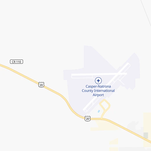
Natrona County International Airport
››
Roadmap from Natrona County International Airport to Sturgis
How to get from Natrona County International (airport) (Wyoming) to Sturgis (South Dakota)
Calculate route from Natrona County International (airport) (Wyoming, United States) to Sturgis (South Dakota, United States).
The flight distance (as the crow flies) between Natrona County International (airport) and Sturgis is 290.3 km.
Roadmap (route) to go from Natrona County International Airport to Sturgis detailed above, you can also see the course layout on the map.
While doing trip Natrona County International (airport) - Sturgis by car, the calculated route ends at a distance , or more straight.
Distance and duration of the route between Natrona County International (airport) and Sturgis
Calculation of distance and route from Sturgis to Natrona County International (airport) :
290.3390.4 km4h15mn
Continue onto Werner Street 0h1mn 517 mTurn left onto Studer Avenue 0h1mn 331 mTurn right onto Purcell Street 0h0mn 111 mTurn left onto Schulte Avenue 0h2mn 1.1 kmTurn left onto West Yellowstone Highway 0h5mn 5.4 kmTurn left onto US 20, US 26 0h3mn 4.7 kmTurn left 0h17mn 33.0 kmKeep right and drive toward Horse Ranch Creek Road 0h1mn 598 mTurn right onto Horseshoe Road 0h25mn 28.8 kmTurn sharp right onto WY 387 1h44mn 51.1 kmTurn left onto Skyline Drive 1h46mn 77.8 kmTurn right onto West 4-J Road 0h3mn 3.2 kmTurn left onto South 4-J Road 0h1mn 672 mTurn right onto West Lakeway Road 0h2mn 1.3 kmTurn left onto South Douglas Highway 0h1mn 1.0 kmTurn right onto I 90 2h41mn 177.5 kmKeep right onto SD 34 0h0mn 510 mTurn left onto Lazelle Street 0h2mn 2.1 kmTurn right onto Junction Avenue 0h1mn 641 mTurn left onto Edmunds Street 0h0mn 4 mArrive at destination 0h0mn 0 m
Travel from Natrona County International (airport) (South Dakota) to a selection of major cities.
Distances from Natrona County International Airport to biggest cities in Wyoming
Other major cities in country :
- Charlotte [NC], 827,097 inhabitants. 2,362 km
- Seattle [WA], 684,451 inhabitants. 1,346 km
- Denver [CO], 682,545 inhabitants. 374 km
- El Paso [TX], 681,124 inhabitants. 1,241 km
- Detroit [MI], 677,116 inhabitants. 1,913 km
- Boston [MA], 667,137 inhabitants. 2,879 km
- Memphis [TN], 655,770 inhabitants. 1,657 km
- New South Memphis [TN], 641,608 inhabitants. 1,661 km
- Portland [OR], 632,309 inhabitants. 1,323 km
- Oklahoma City [OK], 631,346 inhabitants. 1,131 km
- Las Vegas [NV], 623,747 inhabitants. 1,055 km
- Baltimore [MD], 621,849 inhabitants. 2,523 km
- Washington, D.C. [DC], 601,723 inhabitants. 2,503 km
- Milwaukee [WI], 600,155 inhabitants. 1,508 km
- South Boston [MA], 571,281 inhabitants. 2,880 km
- Albuquerque [NM], 559,121 inhabitants. 871 km
- Tucson [AZ], 531,641 inhabitants. 1,253 km
- Nashville [TN], 530,852 inhabitants. 1,843 km
- Fresno [CA], 520,052 inhabitants. 1,326 km
- Sacramento [CA], 490,712 inhabitants. 1,354 km
Route from Sturgis to major cities (United States).
- Distance Sturgis New York City2,440 km
- Distance Sturgis Los Angeles1,711 km
- Distance Sturgis Chicago1,317 km
- Distance Sturgis Brooklyn2,447 km
- Distance Sturgis Houston1,781 km
- Distance Sturgis Queens2,455 km
- Distance Sturgis Philadelphia2,378 km
- Distance Sturgis Phoenix1,426 km
- Distance Sturgis Manhattan2,441 km
- Distance Sturgis San Antonio1,726 km
- Distance Sturgis San Diego1,758 km
- Distance Sturgis The Bronx2,446 km
- Distance Sturgis Dallas1,418 km
- Distance Sturgis San Jose1,731 km
- Distance Sturgis Austin1,654 km
- Distance Sturgis Jacksonville2,475 km
- Distance Sturgis San Francisco1,745 km
- Distance Sturgis Columbus1,757 km
- Distance Sturgis Fort Worth1,407 km
- Distance Sturgis Indianapolis1,520 km
Nearest cities to Natrona County International (airport) :
- Fort Collins, 161,175 inhabitants. 283 km
- Billings, 110,263 inhabitants. 359 km
- Boulder, 107,349 inhabitants. 337 km
- Greeley, 100,883 inhabitants. 313 km
- Longmont, 92,088 inhabitants. 326 km
- Loveland, 75,182 inhabitants. 302 km
- Broomfield, 65,065 inhabitants. 352 km
- Cheyenne, 63,335 inhabitants. 239 km
- Casper, 60,285 inhabitants. 13 km
- Brighton, 37,585 inhabitants. 353 km
- Gillette, 32,649 inhabitants. 172 km
- Laramie, 32,158 inhabitants. 192 km
- Lafayette, 27,729 inhabitants. 344 km
- Rock Springs, 23,962 inhabitants. 269 km
- Windsor, 21,751 inhabitants. 300 km
- Erie, 21,420 inhabitants. 339 km
- Evans, 21,383 inhabitants. 318 km
- Louisville, 20,396 inhabitants. 345 km
- Sheridan, 17,873 inhabitants. 214 km
- Johnstown, 14,896 inhabitants. 314 km
- Scottsbluff, 14,802 inhabitants. 258 km
- Superior, 12,980 inhabitants. 346 km
- Steamboat Springs, 12,435 inhabitants. 271 km
- Firestone, 11,999 inhabitants. 336 km
- Frederick, 11,413 inhabitants. 338 km
- Fort Morgan, 11,319 inhabitants. 370 km
- Spearfish, 11,283 inhabitants. 274 km
- Riverton, 10,873 inhabitants. 157 km
- Cody, 9,792 inhabitants. 276 km
- Gunbarrel, 9,263 inhabitants. 335 km
- Rawlins, 9,040 inhabitants. 140 km
- Craig, 8,844 inhabitants. 281 km
- Gering, 8,334 inhabitants. 260 km
- Fort Lupton, 7,822 inhabitants. 343 km
- Wellington, 7,807 inhabitants. 273 km
- Lander, 7,686 inhabitants. 185 km
- Laurel, 6,943 inhabitants. 358 km
- Lockwood, 6,797 inhabitants. 359 km
- Sturgis, 6,688 inhabitants. 291 km
- Torrington, 6,669 inhabitants. 209 km
- Douglas, 6,531 inhabitants. 90 km
- Powell, 6,462 inhabitants. 276 km
- Milliken, 6,388 inhabitants. 317 km
- Estes Park, 6,257 inhabitants. 292 km
- Berthoud, 6,031 inhabitants. 311 km
- Ranchettes, 5,798 inhabitants. 233 km
- Belle Fourche, 5,696 inhabitants. 287 km
- Brush, 5,459 inhabitants. 378 km
- Lochbuie, 5,390 inhabitants. 354 km
- Worland, 5,372 inhabitants. 173 km
Location Natrona County International (airport) (Wyoming) :
| Country flag |  |
| Location | Natrona County International (airport) |
| State | Wyoming |
| County | Natrona County |
| Country | United States |
| Country code / ISO 2 | US |
| Latitude | 42.9080200 |
| Longitude | -106.4639200 |
| Altitude | 1625 meters |
| Time zone | America/Denver |
Location Sturgis (South Dakota) :
| Country flag | |
| Location | Sturgis |
| State | South Dakota |
| County | Meade County |
| Country | United States |
| Country code / ISO 2 | US |
| Latitude | 44.4097100 |
| Longitude | -103.5090800 |
| Altitude | 1043 meters |
| Time zone | America/Denver |
