
How to get from Shady Acres (airport) (Washington) to Albany (Oregon)
Calculate route from Shady Acres (airport) (Washington, United States) to Albany (Oregon, United States).
The flight distance (as the crow flies) between Shady Acres (airport) and Albany is 276.3 km.
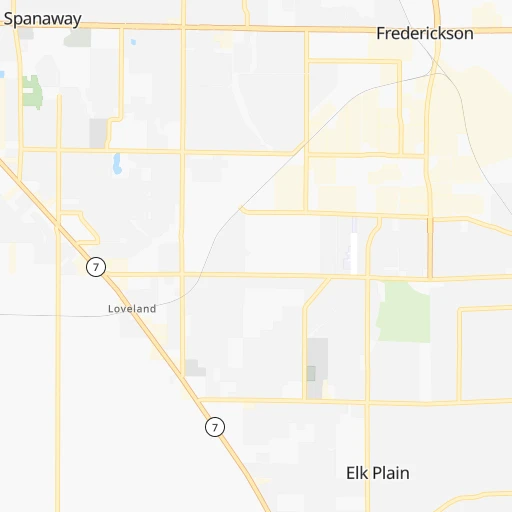
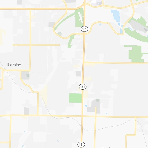
Roadmap (route) to go from Shady Acres Airport to Albany detailed above, you can also see the course layout on the map.
While doing trip Shady Acres (airport) - Albany by car, the calculated route ends at a distance , or more straight.
Distance and duration of the route between Shady Acres (airport) and Albany
An error occured: undefined - for url https://route.cartes.cc/route?point=47.07001%2C-122.37087&point=44.63651%2C-123.10593&vehicle=car&debug=false&data_type=application%2Fjson&locale=en&points_encoded=true&instructions=true&elevation=false&optimize=false&timeout=10000&skip.host=true&skip.basePath=true&graphhopper_maps_host=https%3A%2F%2Fgraphhopper.com%2Fmaps%2F%3F&turn_sign_map.0=continue&turn_sign_map.1=turn%20slight%20right&turn_sign_map.2=turn%20right&turn_sign_map.3=turn%20sharp%20right&turn_sign_map.4=finish&turn_sign_map.5=reached%20via%20point&turn_sign_map.6=enter%20roundabout&turn_sign_map.-6=leave%20roundabout&turn_sign_map.-3=turn%20sharp%20left&turn_sign_map.-2=turn%20left&turn_sign_map.-1=turn%20slight%20left&key=&position=topleft
Calculation of distance and route from Albany to Shady Acres (airport) :
276.3330.8 km4h55mn
Continue 0h0mn 105 mTurn right onto 46th Avenue East 0h0mn 301 mTurn right onto 208th Street East 0h4mn 3.4 kmTurn right onto Mountain Highway East 0h0mn 542 mTurn left onto 205th Street Court East 0h0mn 194 mTurn left onto 205th Street Court East 0h0mn 109 mTurn left onto 206th Street East 0h0mn 92 mTurn left onto 8th Avenue East 0h0mn 152 mTurn right onto 208th Street East 0h2mn 1.6 kmTurn left onto Spanaway McKenna Highway 0h22mn 22.8 kmTurn left onto 1st Street South 1h32mn 35.9 kmTurn left onto US 12 toward I 5 South 1h18mn 129.3 kmKeep left onto I 5 0h15mn 20.8 kmKeep left onto I 5 and take I 5 South toward Salem 1h15mn 111.2 kmKeep right onto OR 99E and take OR 99E toward Albany 0h1mn 607 mTurn slight right onto Pacific Boulevard Southeast 0h0mn 13 mKeep right 0h0mn 65 mTurn slight right onto Albany Avenue 0h0mn 89 mTurn left onto Salem Avenue Southeast 0h3mn 2.1 kmAt roundabout, take exit 1 onto Main Street Southeast 0h0mn 154 mTurn left onto 1st Avenue East 0h1mn 1.1 kmTurn left onto Ellsworth Street Southwest, Albany-Corvallis Highway 0h0mn 86 mTurn left onto 2nd Avenue Southwest 0h0mn 7 mArrive at destination 0h0mn 0 m
Travel from Shady Acres (airport) (Oregon) to a selection of major cities.
Distances from Shady Acres Airport to biggest cities in Washington
- Richland,54,248 inhabitants.251 km
- South Hill,52,431 inhabitants.11 km
- Sammamish,52,253 inhabitants.67 km
- Burien,50,467 inhabitants.45 km
- Olympia,50,302 inhabitants.40 km
- Lacey,46,409 inhabitants.35 km
- City of Sammamish,45,780 inhabitants.65 km
- Bothell,42,939 inhabitants.78 km
- Edmonds,41,375 inhabitants.82 km
- Puyallup,39,659 inhabitants.14 km
- Bremerton,39,520 inhabitants.59 km
- Lynnwood,36,997 inhabitants.84 km
- Longview,36,848 inhabitants.112 km
- Issaquah,36,081 inhabitants.57 km
- Parkland,35,803 inhabitants.11 km
- Mount Vernon,34,053 inhabitants.150 km
- West Lake Sammamish,33,929 inhabitants.60 km
- Wenatchee,33,636 inhabitants.161 km
- University Place,32,842 inhabitants.23 km
- Pullman,32,816 inhabitants.397 km
Other major cities in country :
- Charlotte [NC], 827,097 inhabitants. 3,671 km
- Denver [CO], 682,545 inhabitants. 1,620 km
- El Paso [TX], 681,124 inhabitants. 2,175 km
- Detroit [MI], 677,116 inhabitants. 3,122 km
- Boston [MA], 667,137 inhabitants. 4,019 km
- Memphis [TN], 655,770 inhabitants. 2,990 km
- New South Memphis [TN], 641,608 inhabitants. 2,993 km
- Portland [OR], 632,309 inhabitants. 174 km
- Oklahoma City [OK], 631,346 inhabitants. 2,432 km
- Las Vegas [NV], 623,747 inhabitants. 1,353 km
- Baltimore [MD], 621,849 inhabitants. 3,757 km
- Washington, D.C. [DC], 601,723 inhabitants. 3,747 km
- Milwaukee [WI], 600,155 inhabitants. 2,724 km
- South Boston [MA], 571,281 inhabitants. 4,021 km
- Albuquerque [NM], 559,121 inhabitants. 1,869 km
- Tucson [AZ], 531,641 inhabitants. 1,917 km
- Nashville [TN], 530,852 inhabitants. 3,167 km
- Fresno [CA], 520,052 inhabitants. 1,169 km
- Sacramento [CA], 490,712 inhabitants. 948 km
- Kansas City [MO], 475,378 inhabitants. 2,412 km
Route from Albany to major cities (United States).
- Distance Albany New York City3,981 km
- Distance Albany Los Angeles1,250 km
- Distance Albany Chicago2,869 km
- Distance Albany Brooklyn3,988 km
- Distance Albany Houston2,942 km
- Distance Albany Queens3,996 km
- Distance Albany Philadelphia3,925 km
- Distance Albany Phoenix1,566 km
- Distance Albany Manhattan3,981 km
- Distance Albany San Antonio2,747 km
- Distance Albany San Diego1,423 km
- Distance Albany The Bronx3,986 km
- Distance Albany Dallas2,621 km
- Distance Albany San Jose819 km
- Distance Albany Austin2,735 km
- Distance Albany Jacksonville3,940 km
- Distance Albany San Francisco766 km
- Distance Albany Columbus3,309 km
- Distance Albany Fort Worth2,587 km
- Distance Albany Indianapolis3,068 km
Nearest cities to Shady Acres (airport) :
- Seattle, 684,451 inhabitants. 60 km
- Portland, 632,309 inhabitants. 174 km
- Tacoma, 207,948 inhabitants. 21 km
- Vancouver, 172,860 inhabitants. 161 km
- Salem, 164,549 inhabitants. 242 km
- Bellevue, 139,820 inhabitants. 62 km
- Kent, 126,952 inhabitants. 36 km
- Gresham, 110,553 inhabitants. 175 km
- Everett, 108,010 inhabitants. 102 km
- Hillsboro, 102,347 inhabitants. 179 km
- Renton, 100,242 inhabitants. 47 km
- Beaverton, 96,577 inhabitants. 179 km
- Federal Way, 95,171 inhabitants. 28 km
- Yakima, 93,701 inhabitants. 151 km
- Kirkland, 87,281 inhabitants. 69 km
- Bellingham, 85,146 inhabitants. 188 km
- Auburn, 77,006 inhabitants. 29 km
- Marysville, 66,773 inhabitants. 110 km
- Redmond, 60,598 inhabitants. 70 km
- Lakewood, 59,829 inhabitants. 16 km
- Corvallis, 55,780 inhabitants. 287 km
- Shoreline, 55,439 inhabitants. 76 km
- South Hill, 52,431 inhabitants. 11 km
- Sammamish, 52,253 inhabitants. 67 km
- Albany, 52,175 inhabitants. 277 km
- Tigard, 51,253 inhabitants. 185 km
- Burien, 50,467 inhabitants. 45 km
- Olympia, 50,302 inhabitants. 40 km
- Aloha, 49,425 inhabitants. 180 km
- Lacey, 46,409 inhabitants. 35 km
- City of Sammamish, 45,780 inhabitants. 65 km
- Bothell, 42,939 inhabitants. 78 km
- Edmonds, 41,375 inhabitants. 82 km
- Puyallup, 39,659 inhabitants. 14 km
- Bremerton, 39,520 inhabitants. 59 km
- Lake Oswego, 38,496 inhabitants. 185 km
- Keizer, 37,895 inhabitants. 237 km
- Lynnwood, 36,997 inhabitants. 84 km
- Longview, 36,848 inhabitants. 112 km
- Issaquah, 36,081 inhabitants. 57 km
- Oregon City, 35,831 inhabitants. 192 km
- Parkland, 35,803 inhabitants. 11 km
- Mount Vernon, 34,053 inhabitants. 150 km
- West Lake Sammamish, 33,929 inhabitants. 60 km
- McMinnville, 33,892 inhabitants. 217 km
- Wenatchee, 33,636 inhabitants. 161 km
- University Place, 32,842 inhabitants. 23 km
- Des Moines, 31,221 inhabitants. 37 km
- Lake Stevens, 30,886 inhabitants. 108 km
- East Hill-Meridian, 29,878 inhabitants. 41 km
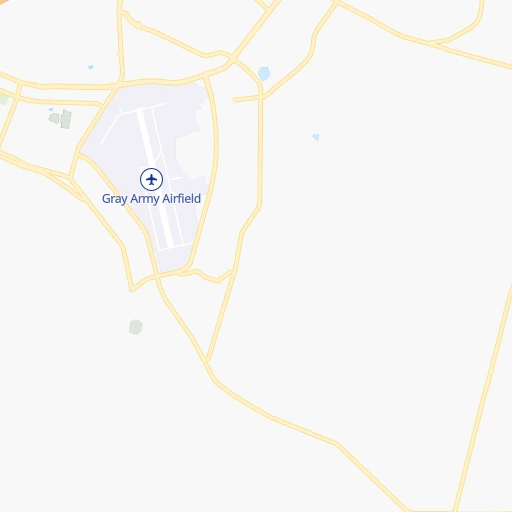
Location Shady Acres (airport) (Washington) :
| Country flag |  |
| Location | Shady Acres (airport) |
| State | Washington |
| County | Pierce County |
| Country | United States |
| Country code / ISO 2 | US |
| Latitude | 47.0700100 |
| Longitude | -122.3708700 |
| Altitude | 138 meters |
| Time zone | America/Los_Angeles |
Location Albany (Oregon) :
| Country flag | |
| Location | Albany |
| State | Oregon |
| County | Linn County |
| Country | United States |
| Country code / ISO 2 | US |
| Latitude | 44.6365100 |
| Longitude | -123.1059300 |
| Altitude | 65 meters |
| Time zone | America/Los_Angeles |


