


How to get from Ocean Shores Municipal (airport) (Washington) to Corvallis (Oregon)
Calculate route from Ocean Shores Municipal (airport) (Washington, United States) to Corvallis (Oregon, United States).
The flight distance (as the crow flies) between Ocean Shores Municipal (airport) and Corvallis is 279.9 km.
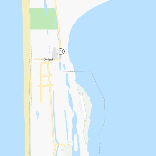
Roadmap (route) to go from Ocean Shores Municipal Airport to Corvallis detailed above, you can also see the course layout on the map.
While doing trip Ocean Shores Municipal (airport) - Corvallis by car, the calculated route ends at a distance , or more straight.
Distance and duration of the route between Ocean Shores Municipal (airport) and Corvallis
Calculation of distance and route from Corvallis to Ocean Shores Municipal (airport) :
279.9394.6 km5h48mn
Continue 0h0mn 156 mTurn sharp left onto Minard Avenue Northwest 0h0mn 88 mTurn right 0h0mn 74 mTurn right 0h0mn 12 mTurn left onto Point Brown Avenue Northeast 0h1mn 441 mAt roundabout, take exit 2 onto Point Brown Avenue Northeast 0h1mn 1.1 kmTurn right onto Damon Road 0h4mn 3.6 kmTurn right onto State Route 109 and drive toward Hoquiam 0h22mn 25.7 kmKeep right onto Simpson Avenue 0h7mn 5.1 kmTurn left onto West 1st Street 0h1mn 768 mTurn right onto North Broadway Street 0h0mn 111 mTurn left onto East Market Street 0h1mn 439 mAt roundabout, take exit 1 onto South F Street 0h0mn 217 mTurn left onto East Heron Street 0h1mn 419 mTurn slight right onto East Wishkah Street 0h25mn 32.9 kmKeep right onto US 12 and take US 12 East toward Oakville, Centralia 0h0mn 317 mTurn right onto US 12 0h26mn 28.1 kmAt roundabout, take exit 2 onto US 12 0h10mn 11.6 kmAt roundabout, take exit 2 onto US 12 0h1mn 761 mTurn sharp right onto US 12 toward I 5 South 1h18mn 129.3 kmKeep left onto I 5 0h15mn 20.8 kmKeep left onto I 5 and take I 5 South toward Salem 1h15mn 111.2 kmKeep right onto OR 99E and take OR 99E toward Albany 0h1mn 607 mTurn slight right onto Pacific Boulevard Southeast 0h0mn 13 mKeep right 0h0mn 65 mTurn slight right onto Albany Avenue 0h0mn 89 mTurn left onto Salem Avenue Southeast 0h3mn 2.1 kmAt roundabout, take exit 1 onto Main Street Southeast 0h0mn 154 mTurn left onto 1st Avenue East 0h1mn 1.0 kmTurn right onto Lyon Street South, Albany-Corvallis Highway 0h15mn 17.0 kmTurn right onto Northwest Jackson Avenue 0h0mn 178 mTurn left onto Northwest 4th Street 0h0mn 125 mArrive at destination 0h0mn 0 m
Travel from Ocean Shores Municipal (airport) (Oregon) to a selection of major cities.
Distances from Ocean Shores Municipal Airport to biggest cities in Washington
- Richland,54,248 inhabitants.381 km
- South Hill,52,431 inhabitants.144 km
- Sammamish,52,253 inhabitants.172 km
- Burien,50,467 inhabitants.147 km
- Olympia,50,302 inhabitants.96 km
- Lacey,46,409 inhabitants.102 km
- City of Sammamish,45,780 inhabitants.174 km
- Bothell,42,939 inhabitants.170 km
- Edmonds,41,375 inhabitants.162 km
- Puyallup,39,659 inhabitants.143 km
- Bremerton,39,520 inhabitants.131 km
- Lynnwood,36,997 inhabitants.166 km
- Longview,36,848 inhabitants.134 km
- Issaquah,36,081 inhabitants.171 km
- Parkland,35,803 inhabitants.132 km
- Mount Vernon,34,053 inhabitants.209 km
- West Lake Sammamish,33,929 inhabitants.168 km
- Wenatchee,33,636 inhabitants.295 km
- University Place,32,842 inhabitants.125 km
- Pullman,32,816 inhabitants.532 km
Other major cities in country :
- Charlotte [NC], 827,097 inhabitants. 3,806 km
- Denver [CO], 682,545 inhabitants. 1,744 km
- El Paso [TX], 681,124 inhabitants. 2,268 km
- Detroit [MI], 677,116 inhabitants. 3,258 km
- Boston [MA], 667,137 inhabitants. 4,154 km
- Memphis [TN], 655,770 inhabitants. 3,120 km
- New South Memphis [TN], 641,608 inhabitants. 3,123 km
- Portland [OR], 632,309 inhabitants. 201 km
- Oklahoma City [OK], 631,346 inhabitants. 2,555 km
- Las Vegas [NV], 623,747 inhabitants. 1,418 km
- Baltimore [MD], 621,849 inhabitants. 3,894 km
- Washington, D.C. [DC], 601,723 inhabitants. 3,883 km
- Milwaukee [WI], 600,155 inhabitants. 2,861 km
- South Boston [MA], 571,281 inhabitants. 4,156 km
- Albuquerque [NM], 559,121 inhabitants. 1,972 km
- Tucson [AZ], 531,641 inhabitants. 1,993 km
- Nashville [TN], 530,852 inhabitants. 3,300 km
- Fresno [CA], 520,052 inhabitants. 1,198 km
- Sacramento [CA], 490,712 inhabitants. 962 km
- Kansas City [MO], 475,378 inhabitants. 2,544 km
Route from Corvallis to major cities (United States).
- Distance Corvallis New York City3,995 km
- Distance Corvallis Los Angeles1,247 km
- Distance Corvallis Chicago2,882 km
- Distance Corvallis Brooklyn4,002 km
- Distance Corvallis Houston2,950 km
- Distance Corvallis Queens4,009 km
- Distance Corvallis Philadelphia3,938 km
- Distance Corvallis Phoenix1,568 km
- Distance Corvallis Manhattan3,995 km
- Distance Corvallis San Antonio2,754 km
- Distance Corvallis San Diego1,421 km
- Distance Corvallis The Bronx4,000 km
- Distance Corvallis Dallas2,630 km
- Distance Corvallis San Jose812 km
- Distance Corvallis Austin2,742 km
- Distance Corvallis Jacksonville3,951 km
- Distance Corvallis San Francisco759 km
- Distance Corvallis Columbus3,322 km
- Distance Corvallis Fort Worth2,596 km
- Distance Corvallis Indianapolis3,080 km
Nearest cities to Ocean Shores Municipal (airport) :
- Seattle, 684,451 inhabitants. 154 km
- Portland, 632,309 inhabitants. 201 km
- Tacoma, 207,948 inhabitants. 133 km
- Vancouver, 172,860 inhabitants. 191 km
- Salem, 164,549 inhabitants. 245 km
- Eugene, 163,460 inhabitants. 339 km
- Bellevue, 139,820 inhabitants. 163 km
- Kent, 126,952 inhabitants. 152 km
- Gresham, 110,553 inhabitants. 214 km
- Everett, 108,010 inhabitants. 183 km
- Hillsboro, 102,347 inhabitants. 188 km
- Renton, 100,242 inhabitants. 156 km
- Beaverton, 96,577 inhabitants. 199 km
- Federal Way, 95,171 inhabitants. 144 km
- Kirkland, 87,281 inhabitants. 166 km
- Bend, 87,014 inhabitants. 396 km
- Bellingham, 85,146 inhabitants. 232 km
- Auburn, 77,006 inhabitants. 150 km
- Marysville, 66,773 inhabitants. 189 km
- Springfield, 60,870 inhabitants. 341 km
- Redmond, 60,598 inhabitants. 171 km
- Lakewood, 59,829 inhabitants. 126 km
- Corvallis, 55,780 inhabitants. 280 km
- Shoreline, 55,439 inhabitants. 161 km
- South Hill, 52,431 inhabitants. 144 km
- Sammamish, 52,253 inhabitants. 172 km
- Albany, 52,175 inhabitants. 276 km
- Tigard, 51,253 inhabitants. 205 km
- Burien, 50,467 inhabitants. 147 km
- Olympia, 50,302 inhabitants. 96 km
- Aloha, 49,425 inhabitants. 195 km
- Lacey, 46,409 inhabitants. 102 km
- City of Sammamish, 45,780 inhabitants. 174 km
- Bothell, 42,939 inhabitants. 170 km
- Edmonds, 41,375 inhabitants. 162 km
- Puyallup, 39,659 inhabitants. 143 km
- Bremerton, 39,520 inhabitants. 131 km
- Lake Oswego, 38,496 inhabitants. 210 km
- Keizer, 37,895 inhabitants. 241 km
- Lynnwood, 36,997 inhabitants. 166 km
- Longview, 36,848 inhabitants. 134 km
- Issaquah, 36,081 inhabitants. 171 km
- Oregon City, 35,831 inhabitants. 219 km
- Parkland, 35,803 inhabitants. 132 km
- Mount Vernon, 34,053 inhabitants. 209 km
- West Lake Sammamish, 33,929 inhabitants. 168 km
- McMinnville, 33,892 inhabitants. 213 km
- University Place, 32,842 inhabitants. 125 km
- Des Moines, 31,221 inhabitants. 146 km
- Lake Stevens, 30,886 inhabitants. 194 km
Location Ocean Shores Municipal (airport) (Washington) :
| Country flag |  |
| Location | Ocean Shores Municipal (airport) |
| State | Washington |
| County | Grays Harbor County |
| Country | United States |
| Country code / ISO 2 | US |
| Latitude | 47.0037000 |
| Longitude | -124.1626700 |
| Altitude | 7 meters |
| Time zone | America/Los_Angeles |
Location Corvallis (Oregon) :
| Country flag | |
| Location | Corvallis |
| State | Oregon |
| County | Benton County |
| Country | United States |
| Country code / ISO 2 | US |
| Latitude | 44.5645700 |
| Longitude | -123.2620400 |
| Altitude | 71 meters |
| Time zone | America/Los_Angeles |


