


How to get from Isabel Municipal (airport) (South Dakota) to Beulah (North Dakota)
Calculate route from Isabel Municipal (airport) (South Dakota, United States) to Beulah (North Dakota, United States).
The flight distance (as the crow flies) between Isabel Municipal (airport) and Beulah is 210.0 km.
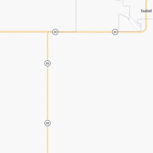
Roadmap (route) to go from Isabel Municipal Airport to Beulah detailed above, you can also see the course layout on the map.
While doing trip Isabel Municipal (airport) - Beulah by car, the calculated route ends at a distance , or more straight.
Distance and duration of the route between Isabel Municipal (airport) and Beulah
Calculation of distance and route from Beulah to Isabel Municipal (airport) :
210.0250.6 km4h16mn
Continue 0h1mn 294 mKeep right onto West Dakota Street 0h1mn 353 mTurn left onto Main Street 0h1mn 823 mTurn left onto State Highway 65 1h2mn 61.5 kmTurn left onto US 12, SD 65 0h1mn 853 mTurn right onto State Highway 65 1h38mn 58.8 kmTurn left onto State Highway 21 0h5mn 8.0 kmTurn right onto 47th Avenue Southwest 1h50mn 25.1 kmContinue onto Valley Road 0h13mn 6.4 kmKeep right 0h0mn 84 mTurn slight right onto 48th Avenue 0h5mn 2.5 kmTurn left onto County Road 137 0h10mn 5.2 kmTurn right onto County Road 86 0h18mn 14.6 kmTurn left 0h11mn 20.2 kmKeep right 0h0mn 437 mTurn right onto State Highway 49 1h41mn 44.9 kmTurn right onto Main Street West 0h1mn 582 mTurn right onto Central Avenue South 0h0mn 18 mArrive at destination 0h0mn 0 m
Travel from Isabel Municipal (airport) (North Dakota) to a selection of major cities.
Distances from Isabel Municipal Airport to biggest cities in South Dakota
Other major cities in country :
- Charlotte [NC], 827,097 inhabitants. 2,073 km
- Seattle [WA], 684,451 inhabitants. 1,615 km
- Denver [CO], 682,545 inhabitants. 693 km
- El Paso [TX], 681,124 inhabitants. 1,579 km
- Detroit [MI], 677,116 inhabitants. 1,511 km
- Boston [MA], 667,137 inhabitants. 2,446 km
- Memphis [TN], 655,770 inhabitants. 1,492 km
- New South Memphis [TN], 641,608 inhabitants. 1,497 km
- Portland [OR], 632,309 inhabitants. 1,654 km
- Oklahoma City [OK], 631,346 inhabitants. 1,153 km
- Las Vegas [NV], 623,747 inhabitants. 1,541 km
- Baltimore [MD], 621,849 inhabitants. 2,142 km
- Washington, D.C. [DC], 601,723 inhabitants. 2,130 km
- Milwaukee [WI], 600,155 inhabitants. 1,109 km
- South Boston [MA], 571,281 inhabitants. 2,448 km
- Albuquerque [NM], 559,121 inhabitants. 1,229 km
- Tucson [AZ], 531,641 inhabitants. 1,678 km
- Nashville [TN], 530,852 inhabitants. 1,602 km
- Fresno [CA], 520,052 inhabitants. 1,808 km
- Sacramento [CA], 490,712 inhabitants. 1,818 km
Route from Beulah to major cities (United States).
- Distance Beulah New York City2,326 km
- Distance Beulah Los Angeles2,016 km
- Distance Beulah Chicago1,270 km
- Distance Beulah Brooklyn2,334 km
- Distance Beulah Houston2,025 km
- Distance Beulah Queens2,341 km
- Distance Beulah Philadelphia2,281 km
- Distance Beulah Phoenix1,765 km
- Distance Beulah Manhattan2,326 km
- Distance Beulah San Antonio2,006 km
- Distance Beulah San Diego2,076 km
- Distance Beulah The Bronx2,330 km
- Distance Beulah Dallas1,666 km
- Distance Beulah San Jose1,982 km
- Distance Beulah Austin1,923 km
- Distance Beulah Jacksonville2,554 km
- Distance Beulah San Francisco1,987 km
- Distance Beulah Columbus1,712 km
- Distance Beulah Fort Worth1,662 km
- Distance Beulah Indianapolis1,508 km
Nearest cities to Isabel Municipal (airport) :
- Rapid City, 73,569 inhabitants. 203 km
- Bismarck, 71,167 inhabitants. 166 km
- Minot, 49,450 inhabitants. 317 km
- Aberdeen, 28,102 inhabitants. 231 km
- Williston, 26,977 inhabitants. 349 km
- Dickinson, 23,765 inhabitants. 196 km
- Mandan, 21,382 inhabitants. 166 km
- Jamestown, 15,422 inhabitants. 270 km
- Pierre, 14,002 inhabitants. 142 km
- Spearfish, 11,283 inhabitants. 216 km
- Box Elder, 9,289 inhabitants. 192 km
- Rapid Valley, 8,260 inhabitants. 200 km
- Devils Lake, 7,351 inhabitants. 361 km
- Sidney, 6,828 inhabitants. 332 km
- Watford City, 6,708 inhabitants. 304 km
- Sturgis, 6,688 inhabitants. 196 km
- Chadron, 5,775 inhabitants. 311 km
- Belle Fourche, 5,696 inhabitants. 206 km
- O'Neill, 3,653 inhabitants. 395 km
- Newcastle, 3,534 inhabitants. 278 km
- Hot Springs, 3,532 inhabitants. 271 km
- Lincoln, 3,519 inhabitants. 163 km
- Mobridge, 3,466 inhabitants. 80 km
- Beulah, 3,393 inhabitants. 210 km
- Pine Ridge, 3,308 inhabitants. 278 km
Location Isabel Municipal (airport) (South Dakota) :
| Country flag |  |
| Location | Isabel Municipal (airport) |
| State | South Dakota |
| County | Dewey County |
| Country | United States |
| Country code / ISO 2 | US |
| Latitude | 45.3880600 |
| Longitude | -101.4356300 |
| Altitude | 728 meters |
| Time zone | America/Denver |
Location Beulah (North Dakota) :
| Country flag | |
| Location | Beulah |
| State | North Dakota |
| County | Mercer County |
| Country | United States |
| Country code / ISO 2 | US |
| Latitude | 47.2633400 |
| Longitude | -101.7779500 |
| Altitude | 544 meters |
| Time zone | America/North_Dakota/Beulah |
