
How to get from Starvout Creek (airport) (Oregon) to Battle Ground (Washington)
Calculate route from Starvout Creek (airport) (Oregon, United States) to Battle Ground (Washington, United States).
The flight distance (as the crow flies) between Starvout Creek (airport) and Battle Ground is 336.3 km.
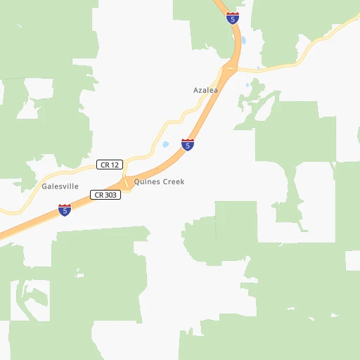
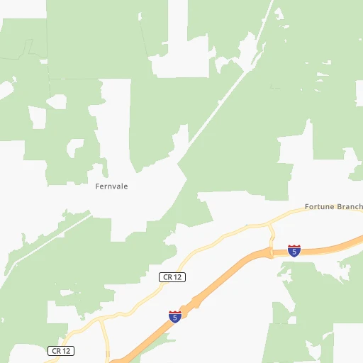
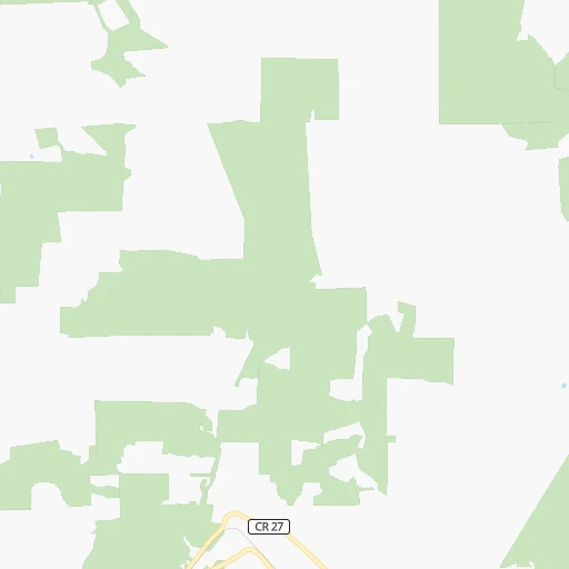
Roadmap (route) to go from Starvout Creek Airport to Battle Ground detailed above, you can also see the course layout on the map.
While doing trip Starvout Creek (airport) - Battle Ground by car, the calculated route ends at a distance , or more straight.
Distance and duration of the route between Starvout Creek (airport) and Battle Ground
Calculation of distance and route from Battle Ground to Starvout Creek (airport) :
336.3382.4 km4h20mn
Continue 0h1mn 207 mTurn left onto Starveout Creek Road 0h2mn 769 mTurn left onto Upper Cow Creek Road 0h1mn 1.2 kmTurn right 4h41mn 340.2 kmKeep right onto I 5 and drive toward Seattle 0h9mn 10.9 kmKeep right and drive toward Victory Boulevard, Expo Center 0h4mn 4.4 kmKeep right and take WA 501 toward 4th Plain Boulevard, Mill Plain Boulevard 0h0mn 220 mKeep left and drive toward 4th Plain Boulevard 0h1mn 1.0 kmKeep right 0h0mn 121 mTurn slight right onto East Fourth Plain Boulevard 0h1mn 484 mTurn left onto Saint Johns Boulevard 0h2mn 1.3 kmTurn right toward WA 500 East 0h8mn 10.1 kmTurn slight right onto Northeast 117th Avenue 0h9mn 10.3 kmTurn right onto West Main Street 0h2mn 1.1 kmArrive at destination 0h0mn 0 m
Travel from Starvout Creek (airport) (Washington) to a selection of major cities.
Distances from Starvout Creek Airport to biggest cities in Oregon
- West Linn,26,593 inhabitants.290 km
- Woodburn,25,173 inhabitants.263 km
- Forest Grove,23,897 inhabitants.303 km
- Newberg,22,780 inhabitants.280 km
- Wilsonville,22,729 inhabitants.281 km
- Roseburg,22,114 inhabitants.48 km
- Klamath Falls,21,399 inhabitants.135 km
- Ashland,20,861 inhabitants.79 km
- Milwaukie,20,830 inhabitants.299 km
- Bethany,20,646 inhabitants.309 km
- Lents,20,156 inhabitants.303 km
Other major cities in country :
- Charlotte [NC], 827,097 inhabitants. 3,721 km
- Seattle [WA], 684,451 inhabitants. 540 km
- Denver [CO], 682,545 inhabitants. 1,561 km
- El Paso [TX], 681,124 inhabitants. 1,920 km
- Detroit [MI], 677,116 inhabitants. 3,264 km
- Boston [MA], 667,137 inhabitants. 4,206 km
- Memphis [TN], 655,770 inhabitants. 2,974 km
- New South Memphis [TN], 641,608 inhabitants. 2,976 km
- Oklahoma City [OK], 631,346 inhabitants. 2,354 km
- Las Vegas [NV], 623,747 inhabitants. 1,012 km
- Baltimore [MD], 621,849 inhabitants. 3,884 km
- Washington, D.C. [DC], 601,723 inhabitants. 3,866 km
- Milwaukee [WI], 600,155 inhabitants. 2,858 km
- South Boston [MA], 571,281 inhabitants. 4,208 km
- Albuquerque [NM], 559,121 inhabitants. 1,668 km
- Tucson [AZ], 531,641 inhabitants. 1,599 km
- Nashville [TN], 530,852 inhabitants. 3,191 km
- Fresno [CA], 520,052 inhabitants. 735 km
- Sacramento [CA], 490,712 inhabitants. 491 km
- Kansas City [MO], 475,378 inhabitants. 2,432 km
Route from Battle Ground to major cities (United States).
- Distance Battle Ground New York City3,914 km
- Distance Battle Ground Los Angeles1,355 km
- Distance Battle Ground Chicago2,813 km
- Distance Battle Ground Brooklyn3,921 km
- Distance Battle Ground Houston2,958 km
- Distance Battle Ground Queens3,928 km
- Distance Battle Ground Philadelphia3,861 km
- Distance Battle Ground Phoenix1,637 km
- Distance Battle Ground Manhattan3,914 km
- Distance Battle Ground San Antonio2,775 km
- Distance Battle Ground San Diego1,525 km
- Distance Battle Ground The Bronx3,918 km
- Distance Battle Ground Dallas2,629 km
- Distance Battle Ground San Jose941 km
- Distance Battle Ground Austin2,756 km
- Distance Battle Ground Jacksonville3,919 km
- Distance Battle Ground San Francisco891 km
- Distance Battle Ground Columbus3,255 km
- Distance Battle Ground Fort Worth2,597 km
- Distance Battle Ground Indianapolis3,019 km
Nearest cities to Starvout Creek (airport) :
- Portland, 632,309 inhabitants. 307 km
- Vancouver, 172,860 inhabitants. 320 km
- Salem, 164,549 inhabitants. 240 km
- Eugene, 163,460 inhabitants. 140 km
- Gresham, 110,553 inhabitants. 308 km
- Hillsboro, 102,347 inhabitants. 304 km
- Beaverton, 96,577 inhabitants. 302 km
- Redding, 91,582 inhabitants. 256 km
- Bend, 87,014 inhabitants. 209 km
- Medford, 79,805 inhabitants. 60 km
- Springfield, 60,870 inhabitants. 140 km
- Corvallis, 55,780 inhabitants. 197 km
- Albany, 52,175 inhabitants. 205 km
- Tigard, 51,253 inhabitants. 296 km
- Aloha, 49,425 inhabitants. 302 km
- Lake Oswego, 38,496 inhabitants. 296 km
- Keizer, 37,895 inhabitants. 245 km
- Grants Pass, 37,088 inhabitants. 40 km
- Oregon City, 35,831 inhabitants. 290 km
- McMinnville, 33,892 inhabitants. 269 km
- Redmond, 28,654 inhabitants. 234 km
- Tualatin, 27,154 inhabitants. 291 km
- Eureka, 27,017 inhabitants. 235 km
- West Linn, 26,593 inhabitants. 290 km
- Woodburn, 25,173 inhabitants. 263 km
- Forest Grove, 23,897 inhabitants. 303 km
- Newberg, 22,780 inhabitants. 280 km
- Wilsonville, 22,729 inhabitants. 281 km
- Roseburg, 22,114 inhabitants. 48 km
- Camas, 21,846 inhabitants. 318 km
- Klamath Falls, 21,399 inhabitants. 135 km
- Ashland, 20,861 inhabitants. 79 km
- Milwaukie, 20,830 inhabitants. 299 km
- Bethany, 20,646 inhabitants. 309 km
- Lents, 20,156 inhabitants. 303 km
- Hayesville, 19,936 inhabitants. 245 km
- Salmon Creek, 19,686 inhabitants. 328 km
- Orchards, 19,556 inhabitants. 324 km
- Hazel Dell, 19,435 inhabitants. 323 km
- Battle Ground, 19,407 inhabitants. 337 km
- Sherwood, 19,283 inhabitants. 287 km
- Altamont, 19,257 inhabitants. 139 km
- Happy Valley, 18,493 inhabitants. 300 km
- Five Corners, 18,159 inhabitants. 326 km
- Central Point, 17,995 inhabitants. 53 km
- Arcata, 17,843 inhabitants. 226 km
- Canby, 17,271 inhabitants. 278 km
- Bayside, 17,132 inhabitants. 228 km
- Troutdale, 16,631 inhabitants. 313 km
- Oak Grove, 16,629 inhabitants. 296 km
Location Starvout Creek (airport) (Oregon) :
| Country flag |  |
| Location | Starvout Creek (airport) |
| State | Oregon |
| County | Douglas County |
| Country | United States |
| Country code / ISO 2 | US |
| Latitude | 42.7956800 |
| Longitude | -123.2317300 |
| Altitude | 501 meters |
| Time zone | America/Los_Angeles |
Location Battle Ground (Washington) :
| Country flag | |
| Location | Battle Ground |
| State | Washington |
| County | Clark County |
| Country | United States |
| Country code / ISO 2 | US |
| Latitude | 45.7809500 |
| Longitude | -122.5334300 |
| Altitude | 90 meters |
| Time zone | America/Los_Angeles |