
How to get from Rager Airstrip (Oregon) to Jacksonville (Florida)
Calculate route from Rager Airstrip (Oregon, United States) to Jacksonville (Florida, United States).
The flight distance (as the crow flies) between Rager Airstrip and Jacksonville is 3,664.5 km.
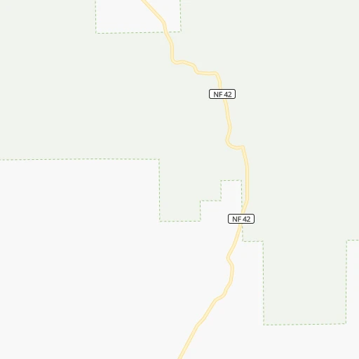
Roadmap (route) to go from Rager Airstrip to Jacksonville detailed above, you can also see the course layout on the map.
While doing trip Rager Airstrip - Jacksonville by car, the calculated route ends at a distance , or more straight.
Distance and duration of the route between Rager Airstrip and Jacksonville
Calculation of distance and route from Jacksonville to Rager Airstrip :
3,664.54,368.4 km47h42mn
Continue onto National Forest Road 100 0h3mn 736 mTurn right onto National Forest Road 58 0h16mn 8.2 kmTurn left onto National Forest Road 58 0h13mn 6.7 kmContinue onto National Forest Road 58 0h0mn 49 mTurn right onto National Forest Road 58 0h24mn 12.1 kmTurn right onto South Fork John Day Road 0h11mn 5.5 kmContinue onto South Fork John Day Road 0h7mn 3.5 kmTurn left onto Izee-Paulina Lane 1h1mn 51.2 kmTurn left onto John Day-Burns Highway 0h26mn 28.4 kmTurn right onto East Main Street 3h47mn 184.2 kmTurn left onto A Street East 0h1mn 628 mTurn slight right onto Washington Street East 0h16mn 18.3 kmTurn left onto Highway 201 0h3mn 4.0 kmTurn right onto Southwest 4th Avenue 0h3mn 3.1 kmTurn left onto Southwest 2nd Street 0h0mn 403 mTurn right onto West Idaho Avenue 0h1mn 1.2 kmTurn sharp right 1h47mn 81.0 kmKeep right onto I 84, US 30 2h24mn 276.8 kmKeep right onto Vietnam Veterans Memorial Highway 1h18mn 150.3 kmKeep right and drive toward Garland, Bothwell 0h0mn 529 mTurn left onto West 1000 North 0h3mn 3.4 kmTurn left and take I 15 North toward Pocatello 0h3mn 5.9 kmKeep right and take UT 30 East toward Riverside, Logan 0h1mn 902 mTurn right onto Highway 30 0h21mn 29.6 kmTurn left onto 600 West 0h1mn 424 mTurn right onto 400 North 1h49mn 59.6 kmTurn right onto Saddleback Drive 0h0mn 119 mKeep left onto South Hodges Canyon Road 0h10mn 3.9 kmTurn right onto South Bear Lake Boulevard 0h24mn 31.8 kmContinue onto UT 30 0h8mn 13.0 kmTurn right onto US 30 1h5mn 109.7 kmKeep left onto US 30 toward I 80 East 11h52mn 1,178.0 kmKeep right and take US 77 South, To NE 2 toward Beatrice, Nebraska City 0h3mn 4.3 kmKeep right and drive toward Lincoln via Van Dorn Street, Pioneers Park, Nebraska City 0h0mn 276 mKeep left and drive toward Lincoln, Nebraska City 0h0mn 101 mKeep right 0h2mn 2.0 kmTurn right onto South 9th Street 0h13mn 15.7 kmTurn left toward NE 2 East, I 29 1h43mn 70.6 kmTurn right 2h54mn 192.6 kmKeep left onto I 29, US 71 and take I 29 South, US 71 South toward Kansas City 0h12mn 19.3 kmKeep right and take US 169 South toward Kansas City Downtown 0h2mn 2.6 kmKeep right and take MO 9 South toward North Kansas City 0h2mn 2.7 kmContinue onto Burlington Street 0h3mn 3.1 kmKeep right 0h0mn 289 mTurn left onto East 3rd Street 0h0mn 51 mTurn right onto Cherry Street 0h1mn 605 mTurn right onto Charlotte Street 0h1mn 563 mTurn left onto East 10th Street 0h0mn 66 mTurn right toward I 70 East, US 24 East, US 40 East, US 71 South 0h0mn 323 mKeep left onto George Brett Super Highway and take I 70 East, US 24 East, US 40 East toward Saint Louis 4h54mn 382.4 kmKeep right and drive toward Bermuda Road 0h0mn 481 mKeep left and take I 70 East toward Saint Louis 0h10mn 13.7 kmKeep right onto Andy Gammon Memorial Highway and drive toward Illinois 0h3mn 4.5 kmKeep right and take I 64 East toward Louisville 1h9mn 113.7 kmKeep right onto I 64 toward I 57 South, I 64 East 1h49mn 83.4 kmKeep right and take I 24 East toward Nashville 3h48mn 283.9 kmKeep right onto I 24 and take I 24 East, I 65 South toward Nashville 0h6mn 8.2 kmKeep left onto I 24 and take I 40 East, I 24 East toward Knoxville, Chattanooga 0h2mn 3.3 kmKeep right onto I 24 and take I 24 East toward Chattanooga 2h4mn 203.5 kmKeep right 0h9mn 11.6 kmKeep right and take I 75 South toward Atlanta 2h46mn 174.2 kmKeep right and take GA 10 East toward John Lewis, Freedom Parkway, Carter Center 0h1mn 1.3 kmKeep right 0h0mn 63 mTurn slight right onto Boulevard Northeast 0h1mn 1.2 kmContinue onto Boulevard Southeast 0h4mn 4.1 kmTurn left onto McDonough Boulevard Southeast 0h2mn 2.1 kmKeep right 0h0mn 72 mTurn slight right onto Moreland Avenue Southeast 0h10mn 11.2 kmTurn left onto Forest Parkway 0h1mn 761 mTurn right and take I 675 South toward Macon 0h5mn 7.4 kmKeep left and take I 75 South toward Express Lanes 0h0mn 376 mContinue onto I-75 South Metro Express Lanes 1h48mn 80.8 kmKeep right onto Larry Justice Highway and take I 475 South toward Valdosta 1h32mn 54.6 kmKeep right and take US 341, GA 11 Conn toward Perry Parkway 0h0mn 424 mKeep left and take US 341, GA 11 Connector toward Houston County Justice Center, Hawkinsville 0h0mn 46 mTurn slight left onto North Perry Parkway 0h5mn 7.0 kmTurn left onto Main Street 0h8mn 10.2 kmTurn left onto Golden Isles Highway 0h0mn 330 mTurn slight right onto Main Street 0h12mn 18.0 kmTurn left onto Progress Avenue 0h2mn 1.4 kmTurn left onto Commerce Street 0h1mn 929 mTurn left onto Broad Street 0h1mn 1.1 kmKeep right onto GA 230 0h0mn 54 mTurn slight right onto Lower River Road 0h23mn 30.5 kmContinue onto Abbeville Highway 0h6mn 7.4 kmTurn left onto Rhine-Abbeville Highway 0h3mn 4.3 kmTurn right onto Reeves Street 0h1mn 960 mTurn slight right onto Old Jacksonville Highway 0h23mn 30.1 kmTurn sharp right onto South Ocmulgee Boulevard 0h28mn 35.4 kmKeep left 0h0mn 60 mTurn slight left onto McNeal Drive 0h1mn 562 mTurn right onto North Gaskin Avenue 0h3mn 2.4 kmKeep left onto McDonald Road 0h0mn 337 mKeep left onto East Baker Highway 1h32mn 41.6 kmTurn left onto Albany Highway and drive toward Waycross 0h2mn 3.9 kmTurn right onto Pineview Church Road 0h14mn 13.8 kmTurn sharp right onto Harrison Street 0h0mn 45 mTurn left onto Memorial Drive 1h24mn 115.5 kmContinue onto New Kings Road 0h8mn 6.7 kmArrive at destination 0h0mn 0 m
Travel from Rager Airstrip (Florida) to a selection of major cities.
Distances from Rager Airstrip to biggest cities in Oregon
- West Linn,26,593 inhabitants.258 km
- Woodburn,25,173 inhabitants.265 km
- Forest Grove,23,897 inhabitants.301 km
- Newberg,22,780 inhabitants.280 km
- Wilsonville,22,729 inhabitants.266 km
- Roseburg,22,114 inhabitants.309 km
- Klamath Falls,21,399 inhabitants.276 km
- Ashland,20,861 inhabitants.328 km
- Milwaukie,20,830 inhabitants.264 km
- Bethany,20,646 inhabitants.286 km
- Lents,20,156 inhabitants.262 km
Other major cities in country :
- Charlotte [NC], 827,097 inhabitants. 3,444 km
- Seattle [WA], 684,451 inhabitants. 426 km
- Denver [CO], 682,545 inhabitants. 1,319 km
- El Paso [TX], 681,124 inhabitants. 1,807 km
- Detroit [MI], 677,116 inhabitants. 2,959 km
- Boston [MA], 667,137 inhabitants. 3,894 km
- Memphis [TN], 655,770 inhabitants. 2,720 km
- New South Memphis [TN], 641,608 inhabitants. 2,723 km
- Oklahoma City [OK], 631,346 inhabitants. 2,127 km
- Las Vegas [NV], 623,747 inhabitants. 978 km
- Baltimore [MD], 621,849 inhabitants. 3,584 km
- Washington, D.C. [DC], 601,723 inhabitants. 3,567 km
- Milwaukee [WI], 600,155 inhabitants. 2,554 km
- South Boston [MA], 571,281 inhabitants. 3,896 km
- Albuquerque [NM], 559,121 inhabitants. 1,513 km
- Tucson [AZ], 531,641 inhabitants. 1,541 km
- Nashville [TN], 530,852 inhabitants. 2,922 km
- Fresno [CA], 520,052 inhabitants. 832 km
- Sacramento [CA], 490,712 inhabitants. 644 km
- Kansas City [MO], 475,378 inhabitants. 2,162 km
Route from Jacksonville to major cities (United States).
- Distance Jacksonville New York City1,346 km
- Distance Jacksonville Los Angeles3,453 km
- Distance Jacksonville Chicago1,390 km
- Distance Jacksonville Brooklyn1,343 km
- Distance Jacksonville Houston1,322 km
- Distance Jacksonville Queens1,351 km
- Distance Jacksonville Philadelphia1,222 km
- Distance Jacksonville Phoenix2,886 km
- Distance Jacksonville Manhattan1,355 km
- Distance Jacksonville San Antonio1,627 km
- Distance Jacksonville San Diego3,364 km
- Distance Jacksonville The Bronx1,365 km
- Distance Jacksonville Dallas1,461 km
- Distance Jacksonville San Jose3,772 km
- Distance Jacksonville Austin1,545 km
- Distance Jacksonville San Francisco3,819 km
- Distance Jacksonville Columbus1,079 km
- Distance Jacksonville Fort Worth1,509 km
- Distance Jacksonville Indianapolis1,127 km
- Distance Jacksonville Charlotte550 km
Nearest cities to Rager Airstrip :
- Portland, 632,309 inhabitants. 271 km
- Vancouver, 172,860 inhabitants. 277 km
- Gresham, 110,553 inhabitants. 254 km
- Yakima, 93,701 inhabitants. 271 km
- Bend, 87,014 inhabitants. 125 km
- Kennewick, 78,896 inhabitants. 227 km
- Pasco, 69,451 inhabitants. 231 km
- Lakewood, 59,829 inhabitants. 392 km
- Richland, 54,248 inhabitants. 233 km
- South Hill, 52,431 inhabitants. 379 km
- Puyallup, 39,659 inhabitants. 384 km
- Lake Oswego, 38,496 inhabitants. 265 km
- Oregon City, 35,831 inhabitants. 257 km
- Parkland, 35,803 inhabitants. 387 km
- Pullman, 32,816 inhabitants. 345 km
- Lewiston, 32,544 inhabitants. 326 km
- Walla Walla, 32,237 inhabitants. 234 km
- Lewiston Orchards, 31,422 inhabitants. 325 km
- Redmond, 28,654 inhabitants. 112 km
- Spanaway, 27,227 inhabitants. 382 km
- Tualatin, 27,154 inhabitants. 270 km
- West Linn, 26,593 inhabitants. 258 km
- Moscow, 25,060 inhabitants. 353 km
- Graham, 23,491 inhabitants. 371 km
- Moses Lake, 22,082 inhabitants. 326 km
- Camas, 21,846 inhabitants. 257 km
- Klamath Falls, 21,399 inhabitants. 276 km
- Ashland, 20,861 inhabitants. 328 km
- Milwaukie, 20,830 inhabitants. 264 km
- Lents, 20,156 inhabitants. 262 km
- Bonney Lake, 19,903 inhabitants. 379 km
- Salmon Creek, 19,686 inhabitants. 281 km
- Orchards, 19,556 inhabitants. 273 km
- Hazel Dell, 19,435 inhabitants. 279 km
- Battle Ground, 19,407 inhabitants. 278 km
- Altamont, 19,257 inhabitants. 275 km
- Ellensburg, 19,001 inhabitants. 315 km
- Frederickson, 18,719 inhabitants. 378 km
- Happy Valley, 18,493 inhabitants. 257 km
- Five Corners, 18,159 inhabitants. 275 km
- Canby, 17,271 inhabitants. 259 km
- Hermiston, 17,201 inhabitants. 184 km
- Pendleton, 16,881 inhabitants. 179 km
- Troutdale, 16,631 inhabitants. 253 km
- Oak Grove, 16,629 inhabitants. 263 km
- Sunnyside, 16,325 inhabitants. 235 km
- The Dalles, 15,340 inhabitants. 189 km
- Washougal, 15,288 inhabitants. 254 km
- Elk Plain, 14,205 inhabitants. 376 km
- West Richland, 13,746 inhabitants. 234 km
Location Rager Airstrip (Oregon) :
| Country flag |  |
| Location | Rager Airstrip |
| State | Oregon |
| County | Crook County |
| Country | United States |
| Country code / ISO 2 | US |
| Latitude | 44.2220900 |
| Longitude | -119.7677600 |
| Altitude | 1281 meters |
| Time zone | America/Los_Angeles |
Location Jacksonville (Florida) :
| Country flag | |
| Location | Jacksonville |
| State | Florida |
| County | Duval County |
| Country | United States |
| Country code / ISO 2 | US |
| Latitude | 30.3321800 |
| Longitude | -81.6556500 |
| Altitude | 5 meters |
| Time zone | America/New_York |


