
How to get from Enterprise Municipal (airport) (Oregon) to Dishman (Washington)
Calculate route from Enterprise Municipal (airport) (Oregon, United States) to Dishman (Washington, United States).
The flight distance (as the crow flies) between Enterprise Municipal (airport) and Dishman is 248.3 km.
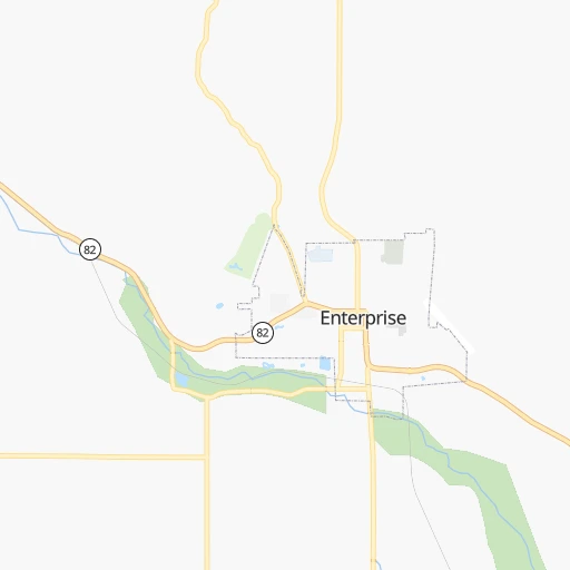
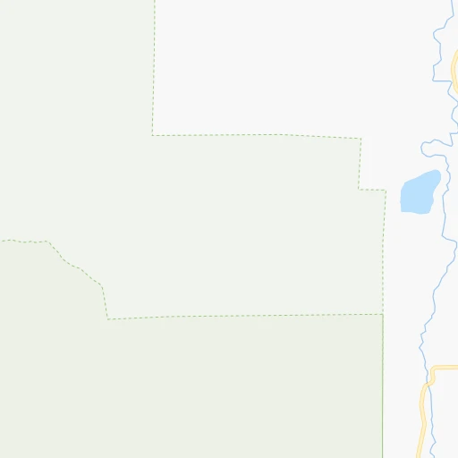
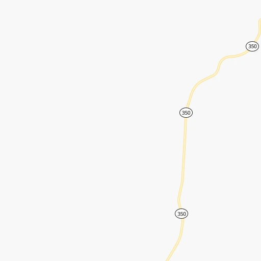
Roadmap (route) to go from Enterprise Municipal Airport to Dishman detailed above, you can also see the course layout on the map.
While doing trip Enterprise Municipal (airport) - Dishman by car, the calculated route ends at a distance , or more straight.
Distance and duration of the route between Enterprise Municipal (airport) and Dishman
Calculation of distance and route from Dishman to Enterprise Municipal (airport) :
248.3313.8 km5h31mn
Continue onto Greenwood Street 0h1mn 328 mTurn right onto Greenwood Street 0h0mn 104 mTurn left onto East Main Street 0h1mn 485 mTurn right onto North River Street 0h0mn 100 mTurn left onto West North Street 0h0mn 100 mTurn right onto Northwest 1st Street 2h56mn 124.2 kmTurn right 0h0mn 191 mTurn right onto Cemetery Road 0h1mn 550 mContinue onto Cemetery Road 0h1mn 744 mTurn sharp right onto State Route 129 0h0mn 209 mTurn left onto Fairgrounds Road 0h1mn 285 mTurn right onto Cleveland Street 0h1mn 466 mTurn left onto 1st Street 0h6mn 6.8 kmAt roundabout, take exit 2 0h1mn 927 mKeep right 0h0mn 163 mKeep right 0h0mn 106 mTurn slight right onto Snake River Avenue 0h1mn 864 mAt roundabout, take exit 1 onto Southway Avenue 0h2mn 1.9 kmTurn left onto 14th Street 0h1mn 581 mTurn right onto 11th Avenue 0h0mn 345 mTurn left onto 17th Street 0h0mn 376 mTurn right onto 8th Avenue 0h1mn 284 mTurn slight right onto 7th Avenue 0h0mn 139 mTurn left onto 21st Street 0h2mn 1.7 kmKeep left and take US 95 North, US 195 North toward Moscow, Pullman, Coeur d' Alene, Spokane 0h7mn 10.9 kmKeep right onto US 195 and drive toward Pullman, Spokane 0h25mn 33.6 kmTurn sharp left onto US 195 0h18mn 24.6 kmContinue onto South Main Street and drive toward Washtucna, Spokane 1h2mn 85.2 kmTurn right onto South Hatch Road 0h3mn 2.5 kmTurn slight right onto East 57th Avenue 0h0mn 148 mTurn left onto South Perry Street 0h3mn 2.1 kmTurn right onto East 37th Avenue 0h2mn 2.0 kmTurn left onto South Ray Street 0h1mn 978 mKeep left 0h0mn 58 mTurn right 0h4mn 2.9 kmTurn right onto East 3rd Avenue 0h0mn 220 mKeep left 0h2mn 2.2 kmKeep right onto I 90 Bus toward I 90 Business 0h4mn 3.3 kmContinue onto East Appleway Boulevard 0h1mn 636 mTurn left onto South Farr Road 0h1mn 528 mTurn left 0h0mn 66 mArrive at destination 0h0mn 0 m
Travel from Enterprise Municipal (airport) (Washington) to a selection of major cities.
Distances from Enterprise Municipal Airport to biggest cities in Oregon
- West Linn,26,593 inhabitants.418 km
- Woodburn,25,173 inhabitants.439 km
- Forest Grove,23,897 inhabitants.456 km
- Newberg,22,780 inhabitants.446 km
- Wilsonville,22,729 inhabitants.431 km
- Roseburg,22,114 inhabitants.542 km
- Klamath Falls,21,399 inhabitants.508 km
- Ashland,20,861 inhabitants.566 km
- Milwaukie,20,830 inhabitants.420 km
- Bethany,20,646 inhabitants.437 km
- Lents,20,156 inhabitants.414 km
Other major cities in country :
- Charlotte [NC], 827,097 inhabitants. 3,260 km
- Seattle [WA], 684,451 inhabitants. 457 km
- Denver [CO], 682,545 inhabitants. 1,187 km
- El Paso [TX], 681,124 inhabitants. 1,784 km
- Detroit [MI], 677,116 inhabitants. 2,746 km
- Boston [MA], 667,137 inhabitants. 3,671 km
- Memphis [TN], 655,770 inhabitants. 2,562 km
- New South Memphis [TN], 641,608 inhabitants. 2,565 km
- Oklahoma City [OK], 631,346 inhabitants. 1,999 km
- Las Vegas [NV], 623,747 inhabitants. 1,045 km
- Baltimore [MD], 621,849 inhabitants. 3,376 km
- Washington, D.C. [DC], 601,723 inhabitants. 3,362 km
- Milwaukee [WI], 600,155 inhabitants. 2,344 km
- South Boston [MA], 571,281 inhabitants. 3,673 km
- Albuquerque [NM], 559,121 inhabitants. 1,460 km
- Tucson [AZ], 531,641 inhabitants. 1,568 km
- Nashville [TN], 530,852 inhabitants. 2,747 km
- Fresno [CA], 520,052 inhabitants. 988 km
- Sacramento [CA], 490,712 inhabitants. 838 km
- Kansas City [MO], 475,378 inhabitants. 1,989 km
Route from Dishman to major cities (United States).
- Distance Dishman New York City3,492 km
- Distance Dishman Los Angeles1,517 km
- Distance Dishman Chicago2,413 km
- Distance Dishman Brooklyn3,499 km
- Distance Dishman Houston2,736 km
- Distance Dishman Queens3,506 km
- Distance Dishman Philadelphia3,445 km
- Distance Dishman Phoenix1,641 km
- Distance Dishman Manhattan3,491 km
- Distance Dishman San Antonio2,592 km
- Distance Dishman San Diego1,664 km
- Distance Dishman The Bronx3,495 km
- Distance Dishman Dallas2,388 km
- Distance Dishman San Jose1,209 km
- Distance Dishman Austin2,556 km
- Distance Dishman Jacksonville3,589 km
- Distance Dishman San Francisco1,177 km
- Distance Dishman Columbus2,857 km
- Distance Dishman Fort Worth2,362 km
- Distance Dishman Indianapolis2,632 km
Nearest cities to Enterprise Municipal (airport) :
- Spokane, 213,272 inhabitants. 249 km
- Boise, 145,987 inhabitants. 219 km
- Spokane Valley, 94,919 inhabitants. 250 km
- Meridian, 90,739 inhabitants. 214 km
- Nampa, 89,839 inhabitants. 217 km
- Kennewick, 78,896 inhabitants. 169 km
- Pasco, 69,451 inhabitants. 169 km
- Richland, 54,248 inhabitants. 183 km
- Caldwell, 51,686 inhabitants. 202 km
- Coeur d'Alene, 49,122 inhabitants. 253 km
- Twin Falls, 47,468 inhabitants. 390 km
- Pullman, 32,816 inhabitants. 145 km
- Lewiston, 32,544 inhabitants. 112 km
- Walla Walla, 32,237 inhabitants. 110 km
- Lewiston Orchards, 31,422 inhabitants. 109 km
- Post Falls, 30,453 inhabitants. 256 km
- Opportunity, 25,877 inhabitants. 248 km
- Moscow, 25,060 inhabitants. 147 km
- Eagle, 23,612 inhabitants. 206 km
- Moses Lake, 22,082 inhabitants. 245 km
- Kalispell, 22,052 inhabitants. 382 km
- Kuna, 17,226 inhabitants. 226 km
- Hermiston, 17,201 inhabitants. 164 km
- Pendleton, 16,881 inhabitants. 122 km
- Sunnyside, 16,325 inhabitants. 235 km
- Hayden, 14,133 inhabitants. 263 km
- West Richland, 13,746 inhabitants. 189 km
- Mountain Home, 13,730 inhabitants. 284 km
- La Grande, 13,074 inhabitants. 65 km
- Garden City, 11,550 inhabitants. 217 km
- Cheney, 11,534 inhabitants. 231 km
- Jerome, 11,184 inhabitants. 372 km
- Grandview, 11,176 inhabitants. 224 km
- Ontario, 10,999 inhabitants. 158 km
- Veradale, 9,991 inhabitants. 248 km
- Dishman, 9,978 inhabitants. 249 km
- Baker City, 9,752 inhabitants. 85 km
- College Place, 9,062 inhabitants. 111 km
- Liberty Lake, 8,906 inhabitants. 251 km
- Hailey, 8,134 inhabitants. 316 km
- Ephrata, 8,047 inhabitants. 274 km
- Fairwood, 7,905 inhabitants. 261 km
- Sandpoint, 7,835 inhabitants. 322 km
- Othello, 7,809 inhabitants. 214 km
- Star, 7,797 inhabitants. 203 km
- Evergreen, 7,616 inhabitants. 386 km
- Rathdrum, 7,538 inhabitants. 267 km
- Payette, 7,380 inhabitants. 152 km
- Quincy, 7,365 inhabitants. 283 km
- Clarkston, 7,317 inhabitants. 112 km
Location Enterprise Municipal (airport) (Oregon) :
| Country flag |  |
| Location | Enterprise Municipal (airport) |
| State | Oregon |
| County | Wallowa County |
| Country | United States |
| Country code / ISO 2 | US |
| Latitude | 45.4258800 |
| Longitude | -117.2676300 |
| Altitude | 1193 meters |
| Time zone | America/Los_Angeles |
Location Dishman (Washington) :
| Country flag | |
| Location | Dishman |
| State | Washington |
| County | Spokane County |
| Country | United States |
| Country code / ISO 2 | US |
| Latitude | 47.6600700 |
| Longitude | -117.2759600 |
| Altitude | 605 meters |
| Time zone | America/Los_Angeles |


