
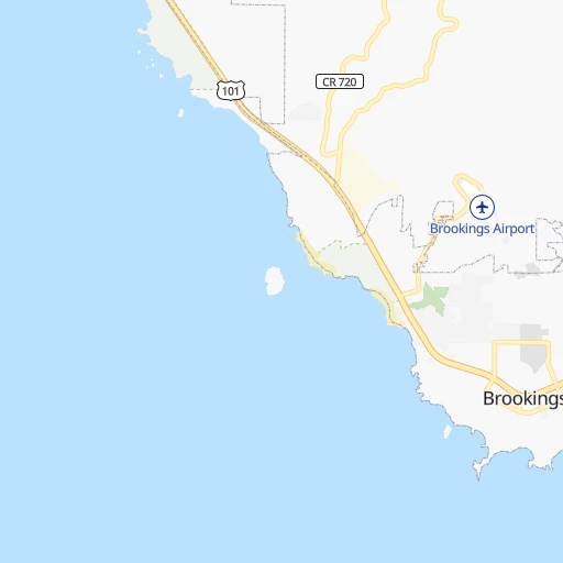


How to get from Brookings (airport) (Oregon) to Red Bluff (California)
Calculate route from Brookings (airport) (Oregon, United States) to Red Bluff (California, United States).
The flight distance (as the crow flies) between Brookings (airport) and Red Bluff is 272.0 km.
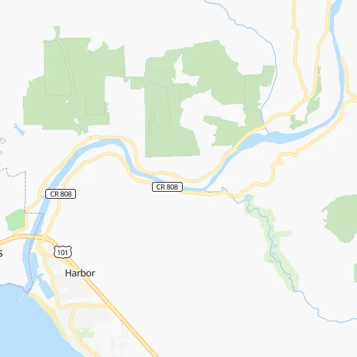
Roadmap (route) to go from Brookings Airport to Red Bluff detailed above, you can also see the course layout on the map.
While doing trip Brookings (airport) - Red Bluff by car, the calculated route ends at a distance , or more straight.
Distance and duration of the route between Brookings (airport) and Red Bluff
Calculation of distance and route from Red Bluff to Brookings (airport) :
272.0391.5 km7h37mn
Continue 0h0mn 34 mContinue onto Parkview Drive 0h2mn 1.3 kmTurn left onto Parkview Drive 0h2mn 1.2 kmTurn left onto Chetco Avenue 0h4mn 3.7 kmTurn slight right onto Oregon Coast Highway 0h25mn 32.6 kmTurn left onto Elk Valley Cross Road 0h1mn 929 mTurn right onto Elk Valley Road 0h6mn 4.8 kmTurn left onto Norris Avenue 0h1mn 292 mTurn right onto Mathews Street 0h1mn 401 mTurn left onto Howland Hill Road 0h0mn 114 mTurn right onto Pike Street 0h0mn 201 mTurn left onto Shirley Street 0h0mn 73 mTurn right onto Humboldt Road 0h4mn 1.8 kmAt roundabout, take exit 2 onto Humboldt Road 0h1mn 508 mTurn left onto Redwood Highway 0h26mn 36.0 kmKeep right and drive toward Newton B Drury Scenic Parkway 0h0mn 379 mTurn right onto Newton B Drury Scenic Parkway 0h14mn 14.5 kmTurn right 0h0mn 342 mContinue onto Redwood Highway 0h4mn 5.9 kmTurn left onto Bald Hills Road 1h0mn 31.9 kmTurn right onto Bald Hills Road 0h7mn 3.5 kmTurn sharp right onto French Camp Road 0h24mn 12.1 kmTurn slight left onto French Camp Road 0h9mn 4.5 kmTurn slight right onto Pine Creek Road 0h4mn 2.1 kmTurn left onto Pine Creek Road 0h16mn 8.0 kmTurn right onto Bigfoot Scenic Byway 0h14mn 17.6 kmTurn left onto Trinity Highway 2h15mn 156.0 kmTurn right onto Buenaventura Boulevard 0h5mn 4.9 kmTurn right onto South Market Street 0h28mn 42.7 kmKeep right onto I 5 Business and drive toward Red Bluff 0h0mn 358 mContinue onto Main Street 0h3mn 2.9 kmArrive at destination 0h0mn 0 m
Travel from Brookings (airport) (California) to a selection of major cities.
Distances from Brookings Airport to biggest cities in Oregon
- West Linn,26,593 inhabitants.390 km
- Woodburn,25,173 inhabitants.361 km
- Forest Grove,23,897 inhabitants.395 km
- Newberg,22,780 inhabitants.374 km
- Wilsonville,22,729 inhabitants.379 km
- Roseburg,22,114 inhabitants.149 km
- Klamath Falls,21,399 inhabitants.208 km
- Ashland,20,861 inhabitants.131 km
- Milwaukie,20,830 inhabitants.398 km
- Bethany,20,646 inhabitants.404 km
- Lents,20,156 inhabitants.403 km
Other major cities in country :
- Charlotte [NC], 827,097 inhabitants. 3,811 km
- Seattle [WA], 684,451 inhabitants. 635 km
- Denver [CO], 682,545 inhabitants. 1,641 km
- El Paso [TX], 681,124 inhabitants. 1,950 km
- Detroit [MI], 677,116 inhabitants. 3,367 km
- Boston [MA], 667,137 inhabitants. 4,314 km
- Memphis [TN], 655,770 inhabitants. 3,054 km
- New South Memphis [TN], 641,608 inhabitants. 3,057 km
- Oklahoma City [OK], 631,346 inhabitants. 2,426 km
- Las Vegas [NV], 623,747 inhabitants. 1,027 km
- Baltimore [MD], 621,849 inhabitants. 3,984 km
- Washington, D.C. [DC], 601,723 inhabitants. 3,965 km
- Milwaukee [WI], 600,155 inhabitants. 2,962 km
- South Boston [MA], 571,281 inhabitants. 4,316 km
- Albuquerque [NM], 559,121 inhabitants. 1,716 km
- Tucson [AZ], 531,641 inhabitants. 1,612 km
- Nashville [TN], 530,852 inhabitants. 3,278 km
- Fresno [CA], 520,052 inhabitants. 709 km
- Sacramento [CA], 490,712 inhabitants. 455 km
- Kansas City [MO], 475,378 inhabitants. 2,521 km
Route from Red Bluff to major cities (United States).
- Distance Red Bluff New York City4,034 km
- Distance Red Bluff Chicago2,891 km
- Distance Red Bluff Brooklyn4,040 km
- Distance Red Bluff Houston2,697 km
- Distance Red Bluff Queens4,048 km
- Distance Red Bluff Philadelphia3,962 km
- Distance Red Bluff Phoenix1,174 km
- Distance Red Bluff Manhattan4,035 km
- Distance Red Bluff San Antonio2,467 km
- Distance Red Bluff The Bronx4,041 km
- Distance Red Bluff Dallas2,410 km
- Distance Red Bluff Austin2,474 km
- Distance Red Bluff Jacksonville3,812 km
- Distance Red Bluff Columbus3,315 km
- Distance Red Bluff Fort Worth2,370 km
- Distance Red Bluff Indianapolis3,057 km
- Distance Red Bluff Charlotte3,654 km
- Distance Red Bluff Seattle827 km
- Distance Red Bluff Denver1,470 km
- Distance Red Bluff El Paso1,696 km
Nearest cities to Brookings (airport) :
- Salem, 164,549 inhabitants. 335 km
- Eugene, 163,460 inhabitants. 241 km
- Redding, 91,582 inhabitants. 229 km
- Chico, 90,316 inhabitants. 333 km
- Bend, 87,014 inhabitants. 327 km
- Medford, 79,805 inhabitants. 120 km
- Yuba City, 66,941 inhabitants. 397 km
- Springfield, 60,870 inhabitants. 242 km
- Corvallis, 55,780 inhabitants. 289 km
- Albany, 52,175 inhabitants. 301 km
- Keizer, 37,895 inhabitants. 340 km
- Grants Pass, 37,088 inhabitants. 89 km
- Eureka, 27,017 inhabitants. 142 km
- Paradise, 26,476 inhabitants. 342 km
- Roseburg, 22,114 inhabitants. 149 km
- Klamath Falls, 21,399 inhabitants. 208 km
- Ashland, 20,861 inhabitants. 131 km
- Hayesville, 19,936 inhabitants. 341 km
- Altamont, 19,257 inhabitants. 211 km
- Central Point, 17,995 inhabitants. 118 km
- Arcata, 17,843 inhabitants. 136 km
- Linda, 17,773 inhabitants. 402 km
- Bayside, 17,132 inhabitants. 139 km
- Lebanon, 16,324 inhabitants. 296 km
- Oroville, 16,260 inhabitants. 366 km
- Coos Bay, 16,182 inhabitants. 144 km
- Four Corners, 15,947 inhabitants. 335 km
- Ukiah, 15,917 inhabitants. 338 km
- Dallas, 15,277 inhabitants. 326 km
- South Yuba City, 15,217 inhabitants. 398 km
- McKinleyville, 15,177 inhabitants. 127 km
- Red Bluff, 14,131 inhabitants. 272 km
- Olivehurst, 13,656 inhabitants. 404 km
- Marysville, 12,216 inhabitants. 398 km
- Fortuna, 12,000 inhabitants. 165 km
- Magalia, 11,310 inhabitants. 340 km
- Newport, 10,268 inhabitants. 286 km
- Anderson, 10,217 inhabitants. 246 km
- Shasta Lake, 10,159 inhabitants. 223 km
- Monmouth, 10,032 inhabitants. 320 km
- Cottage Grove, 9,969 inhabitants. 216 km
- Silverton, 9,753 inhabitants. 348 km
- North Bend, 9,673 inhabitants. 148 km
- Sweet Home, 9,270 inhabitants. 288 km
- Independence, 9,227 inhabitants. 322 km
- Eagle Point, 8,902 inhabitants. 130 km
- Florence, 8,649 inhabitants. 213 km
- Lincoln City, 8,536 inhabitants. 322 km
- Live Oak, 8,531 inhabitants. 383 km
- Oroville East, 8,280 inhabitants. 371 km
Location Brookings (airport) (Oregon) :
| Country flag |  |
| Location | Brookings (airport) |
| State | Oregon |
| County | Curry County |
| Country | United States |
| Country code / ISO 2 | US |
| Latitude | 42.0751100 |
| Longitude | -124.2899400 |
| Altitude | 139 meters |
| Time zone | America/Los_Angeles |
Location Red Bluff (California) :
| Country flag | |
| Location | Red Bluff |
| State | California |
| County | Tehama County |
| Country | United States |
| Country code / ISO 2 | US |
| Latitude | 40.1784900 |
| Longitude | -122.2358300 |
| Altitude | 93 meters |
| Time zone | America/Los_Angeles |


