

How to get from Stevensville (airport) (Montana) to Saint Anthony (Idaho)
Calculate route from Stevensville (airport) (Montana, United States) to Saint Anthony (Idaho, United States).
The flight distance (as the crow flies) between Stevensville (airport) and Saint Anthony is 339.5 km.
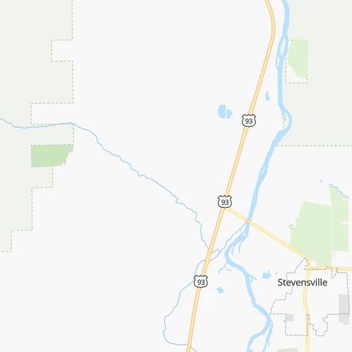
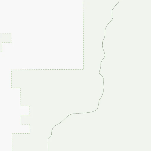
Roadmap (route) to go from Stevensville Airport to Saint Anthony detailed above, you can also see the course layout on the map.
While doing trip Stevensville (airport) - Saint Anthony by car, the calculated route ends at a distance , or more straight.
Distance and duration of the route between Stevensville (airport) and Saint Anthony
Calculation of distance and route from Saint Anthony to Stevensville (airport) :
339.5458.5 km6h3mn
Continue 0h0mn 55 mTurn right 0h0mn 16 mTurn left onto Flying Lane 0h1mn 337 mTurn left onto Airport Road 0h3mn 1.4 kmTurn left onto Eastside Highway 0h4mn 4.4 kmTurn right onto Main Street 0h2mn 2.1 kmTurn left onto US 93 3h31mn 180.0 kmTurn left 2h19mn 194.6 kmTurn left onto East 1500 North 1h50mn 55.5 kmTurn left 0h11mn 18.9 kmKeep right onto US 20 Business 0h1mn 609 mTurn left onto South Bridge Street 0h0mn 466 mTurn right onto East Main Street 0h0mn 26 mArrive at destination 0h0mn 0 m
Travel from Stevensville (airport) (Idaho) to a selection of major cities.
Distances from Stevensville Airport to biggest cities in Montana
Other major cities in country :
- Charlotte [NC], 827,097 inhabitants. 3,036 km
- Seattle [WA], 684,451 inhabitants. 639 km
- Denver [CO], 682,545 inhabitants. 1,054 km
- El Paso [TX], 681,124 inhabitants. 1,767 km
- Detroit [MI], 677,116 inhabitants. 2,492 km
- Boston [MA], 667,137 inhabitants. 3,405 km
- Memphis [TN], 655,770 inhabitants. 2,371 km
- New South Memphis [TN], 641,608 inhabitants. 2,375 km
- Portland [OR], 632,309 inhabitants. 675 km
- Oklahoma City [OK], 631,346 inhabitants. 1,849 km
- Las Vegas [NV], 623,747 inhabitants. 1,156 km
- Baltimore [MD], 621,849 inhabitants. 3,125 km
- Washington, D.C. [DC], 601,723 inhabitants. 3,113 km
- Milwaukee [WI], 600,155 inhabitants. 2,092 km
- South Boston [MA], 571,281 inhabitants. 3,407 km
- Albuquerque [NM], 559,121 inhabitants. 1,417 km
- Tucson [AZ], 531,641 inhabitants. 1,615 km
- Nashville [TN], 530,852 inhabitants. 2,536 km
- Fresno [CA], 520,052 inhabitants. 1,187 km
- Sacramento [CA], 490,712 inhabitants. 1,073 km
Route from Saint Anthony to major cities (United States).
- Distance Saint Anthony New York City3,094 km
- Distance Saint Anthony Los Angeles1,240 km
- Distance Saint Anthony Chicago1,967 km
- Distance Saint Anthony Brooklyn3,101 km
- Distance Saint Anthony Houston2,140 km
- Distance Saint Anthony Queens3,109 km
- Distance Saint Anthony Philadelphia3,031 km
- Distance Saint Anthony Phoenix1,171 km
- Distance Saint Anthony Manhattan3,095 km
- Distance Saint Anthony San Antonio1,996 km
- Distance Saint Anthony San Diego1,340 km
- Distance Saint Anthony The Bronx3,100 km
- Distance Saint Anthony Dallas1,793 km
- Distance Saint Anthony San Jose1,133 km
- Distance Saint Anthony Austin1,958 km
- Distance Saint Anthony Jacksonville3,041 km
- Distance Saint Anthony San Francisco1,135 km
- Distance Saint Anthony Columbus2,403 km
- Distance Saint Anthony Fort Worth1,766 km
- Distance Saint Anthony Indianapolis2,158 km
Nearest cities to Stevensville (airport) :
- Boise, 145,987 inhabitants. 366 km
- Meridian, 90,739 inhabitants. 373 km
- Nampa, 89,839 inhabitants. 387 km
- Missoula, 71,022 inhabitants. 39 km
- Great Falls, 59,638 inhabitants. 235 km
- Caldwell, 51,686 inhabitants. 380 km
- Coeur d'Alene, 49,122 inhabitants. 243 km
- Butte, 34,190 inhabitants. 130 km
- Butte-Silver Bow (Balance), 33,525 inhabitants. 128 km
- Lewiston, 32,544 inhabitants. 228 km
- Lewiston Orchards, 31,422 inhabitants. 225 km
- Helena, 30,581 inhabitants. 155 km
- Post Falls, 30,453 inhabitants. 257 km
- Rexburg, 27,663 inhabitants. 349 km
- Moscow, 25,060 inhabitants. 226 km
- Eagle, 23,612 inhabitants. 363 km
- Kalispell, 22,052 inhabitants. 187 km
- Hayden, 14,133 inhabitants. 249 km
- Garden City, 11,550 inhabitants. 366 km
- Ontario, 10,999 inhabitants. 360 km
- Anaconda, 9,417 inhabitants. 96 km
- Helena Valley Southeast, 8,227 inhabitants. 163 km
- Belgrade, 8,029 inhabitants. 237 km
- Helena Valley West Central, 7,883 inhabitants. 153 km
- Sandpoint, 7,835 inhabitants. 271 km
- Star, 7,797 inhabitants. 369 km
- Evergreen, 7,616 inhabitants. 190 km
- Rathdrum, 7,538 inhabitants. 258 km
- Payette, 7,380 inhabitants. 354 km
- Clarkston, 7,317 inhabitants. 230 km
- Whitefish, 7,073 inhabitants. 211 km
- Middleton, 6,828 inhabitants. 373 km
- Emmett, 6,604 inhabitants. 352 km
- Weiser, 5,317 inhabitants. 341 km
- Orchard Homes, 5,197 inhabitants. 38 km
- Columbia Falls, 5,093 inhabitants. 206 km
- Fruitland, 5,087 inhabitants. 359 km
- Polson, 4,707 inhabitants. 130 km
- Hamilton, 4,602 inhabitants. 32 km
- Bigfork, 4,270 inhabitants. 171 km
- Dillon, 4,210 inhabitants. 182 km
- Rigby, 4,029 inhabitants. 359 km
- Lolo, 3,892 inhabitants. 26 km
- Saint Anthony, 3,542 inhabitants. 340 km
- Helena Valley Northwest, 3,482 inhabitants. 154 km
- Malmstrom Air Force Base, 3,472 inhabitants. 244 km
- Shelby, 3,268 inhabitants. 275 km
- Nyssa, 3,175 inhabitants. 374 km
- Grangeville, 3,155 inhabitants. 173 km
- Four Corners, 3,146 inhabitants. 243 km
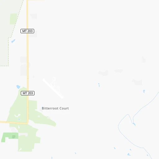
Location Stevensville (airport) (Montana) :
| Country flag |  |
| Location | Stevensville (airport) |
| State | Montana |
| County | Ravalli County |
| Country | United States |
| Country code / ISO 2 | US |
| Latitude | 46.5261100 |
| Longitude | -114.0523700 |
| Altitude | 1089 meters |
| Time zone | America/Denver |
Location Saint Anthony (Idaho) :
| Country flag | |
| Location | Saint Anthony |
| State | Idaho |
| County | Fremont County |
| Country | United States |
| Country code / ISO 2 | US |
| Latitude | 43.9663000 |
| Longitude | -111.6821800 |
| Altitude | 1514 meters |
| Time zone | America/Boise |