


How to get from Payette Municipal (airport) (Idaho) to Baker City (Oregon)
Calculate route from Payette Municipal (airport) (Idaho, United States) to Baker City (Oregon, United States).
The flight distance (as the crow flies) between Payette Municipal (airport) and Baker City is 106.1 km.
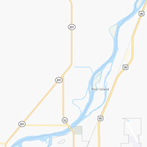
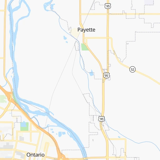
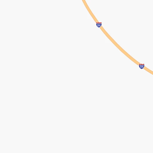
Roadmap (route) to go from Payette Municipal Airport to Baker City detailed above, you can also see the course layout on the map.
While doing trip Payette Municipal (airport) - Baker City by car, the calculated route ends at a distance , or more straight.
Distance and duration of the route between Payette Municipal (airport) and Baker City
Calculation of distance and route from Baker City to Payette Municipal (airport) :
106.1121.3 km1h21mn
Continue onto Airport Road 0h2mn 901 mTurn left onto Iowa Avenue 0h1mn 399 mTurn right onto Northeast 17th Avenue 0h2mn 790 mTurn left onto US 95 0h1mn 807 mTurn right onto 7th Avenue North 0h1mn 1.2 kmTurn right onto North 6th Street 0h2mn 1.8 kmTurn left onto Boat Landing Road 0h2mn 2.2 kmTurn left onto Olds Ferry-Ontario Highway 0h2mn 1.8 kmTurn right onto Stanton Boulevard 0h3mn 2.7 kmTurn left 1h3mn 104.0 kmKeep right onto US 30 and take US 30 West toward Baker City Center, Haines 0h0mn 483 mContinue onto US 30 0h3mn 3.8 kmTurn left onto Auburn Avenue 0h0mn 427 mTurn right onto 4th Street 0h0mn 41 mArrive at destination 0h0mn 0 m
Travel from Payette Municipal (airport) (Oregon) to a selection of major cities.
Distances from Payette Municipal Airport to biggest cities in Idaho
Other major cities in country :
- Charlotte [NC], 827,097 inhabitants. 3,215 km
- Seattle [WA], 684,451 inhabitants. 575 km
- Denver [CO], 682,545 inhabitants. 1,098 km
- El Paso [TX], 681,124 inhabitants. 1,647 km
- Detroit [MI], 677,116 inhabitants. 2,734 km
- Boston [MA], 667,137 inhabitants. 3,675 km
- Memphis [TN], 655,770 inhabitants. 2,494 km
- New South Memphis [TN], 641,608 inhabitants. 2,497 km
- Portland [OR], 632,309 inhabitants. 483 km
- Oklahoma City [OK], 631,346 inhabitants. 1,909 km
- Las Vegas [NV], 623,747 inhabitants. 894 km
- Baltimore [MD], 621,849 inhabitants. 3,357 km
- Washington, D.C. [DC], 601,723 inhabitants. 3,340 km
- Milwaukee [WI], 600,155 inhabitants. 2,330 km
- South Boston [MA], 571,281 inhabitants. 3,677 km
- Albuquerque [NM], 559,121 inhabitants. 1,331 km
- Tucson [AZ], 531,641 inhabitants. 1,420 km
- Nashville [TN], 530,852 inhabitants. 2,693 km
- Fresno [CA], 520,052 inhabitants. 853 km
- Sacramento [CA], 490,712 inhabitants. 723 km
Route from Baker City to major cities (United States).
- Distance Baker City New York City3,568 km
- Distance Baker City Los Angeles1,194 km
- Distance Baker City Chicago2,452 km
- Distance Baker City Brooklyn3,575 km
- Distance Baker City Houston2,583 km
- Distance Baker City Queens3,582 km
- Distance Baker City Philadelphia3,510 km
- Distance Baker City Phoenix1,355 km
- Distance Baker City Manhattan3,568 km
- Distance Baker City San Antonio2,411 km
- Distance Baker City San Diego1,344 km
- Distance Baker City The Bronx3,573 km
- Distance Baker City Dallas2,250 km
- Distance Baker City San Jose895 km
- Distance Baker City Austin2,387 km
- Distance Baker City Jacksonville3,536 km
- Distance Baker City San Francisco868 km
- Distance Baker City Columbus2,892 km
- Distance Baker City Fort Worth2,219 km
- Distance Baker City Indianapolis2,650 km
Nearest cities to Payette Municipal (airport) :
- Boise, 145,987 inhabitants. 77 km
- Meridian, 90,739 inhabitants. 67 km
- Nampa, 89,839 inhabitants. 67 km
- Kennewick, 78,896 inhabitants. 294 km
- Missoula, 71,022 inhabitants. 384 km
- Pasco, 69,451 inhabitants. 295 km
- Richland, 54,248 inhabitants. 308 km
- Caldwell, 51,686 inhabitants. 51 km
- Twin Falls, 47,468 inhabitants. 261 km
- Pullman, 32,816 inhabitants. 295 km
- Lewiston, 32,544 inhabitants. 259 km
- Walla Walla, 32,237 inhabitants. 247 km
- Lewiston Orchards, 31,422 inhabitants. 255 km
- Moscow, 25,060 inhabitants. 294 km
- Eagle, 23,612 inhabitants. 62 km
- Kuna, 17,226 inhabitants. 77 km
- Hermiston, 17,201 inhabitants. 271 km
- Pendleton, 16,881 inhabitants. 230 km
- West Richland, 13,746 inhabitants. 313 km
- Mountain Home, 13,730 inhabitants. 145 km
- La Grande, 13,074 inhabitants. 166 km
- Garden City, 11,550 inhabitants. 75 km
- Jerome, 11,184 inhabitants. 246 km
- Ontario, 10,999 inhabitants. 9 km
- Baker City, 9,752 inhabitants. 106 km
- College Place, 9,062 inhabitants. 247 km
- Hailey, 8,134 inhabitants. 217 km
- Othello, 7,809 inhabitants. 352 km
- Star, 7,797 inhabitants. 55 km
- Payette, 7,380 inhabitants. 3 km
- Clarkston, 7,317 inhabitants. 259 km
- Milton-Freewater, 7,035 inhabitants. 236 km
- Umatilla, 7,009 inhabitants. 280 km
- Middleton, 6,828 inhabitants. 48 km
- Emmett, 6,604 inhabitants. 40 km
- Clarkston Heights-Vineland, 6,326 inhabitants. 256 km
- Finley, 6,012 inhabitants. 284 km
- Prosser, 5,869 inhabitants. 326 km
- Connell, 5,446 inhabitants. 325 km
- Weiser, 5,317 inhabitants. 19 km
- West Clarkston-Highland, 5,261 inhabitants. 258 km
- Orchard Homes, 5,197 inhabitants. 380 km
- Fruitland, 5,087 inhabitants. 9 km
- Hamilton, 4,602 inhabitants. 322 km
- Buhl, 4,275 inhabitants. 240 km
- Lolo, 3,892 inhabitants. 370 km
- West Pasco, 3,739 inhabitants. 299 km
- Kimberly, 3,610 inhabitants. 269 km
- Gooding, 3,509 inhabitants. 218 km
- Boardman, 3,354 inhabitants. 294 km
Location Payette Municipal (airport) (Idaho) :
| Country flag |  |
| Location | Payette Municipal (airport) |
| State | Idaho |
| County | Payette County |
| Country | United States |
| Country code / ISO 2 | US |
| Latitude | 44.0915500 |
| Longitude | -116.9009900 |
| Altitude | 680 meters |
| Time zone | America/Boise |
Location Baker City (Oregon) :
| Country flag | |
| Location | Baker City |
| State | Oregon |
| County | Baker County |
| Country | United States |
| Country code / ISO 2 | US |
| Latitude | 44.7748700 |
| Longitude | -117.8343800 |
| Altitude | 1051 meters |
| Time zone | America/Los_Angeles |


