


How to get from Orofino (airport) (Idaho) to Pendleton (Oregon)
Calculate route from Orofino (airport) (Idaho, United States) to Pendleton (Oregon, United States).
The flight distance (as the crow flies) between Orofino (airport) and Pendleton is 214.1 km.
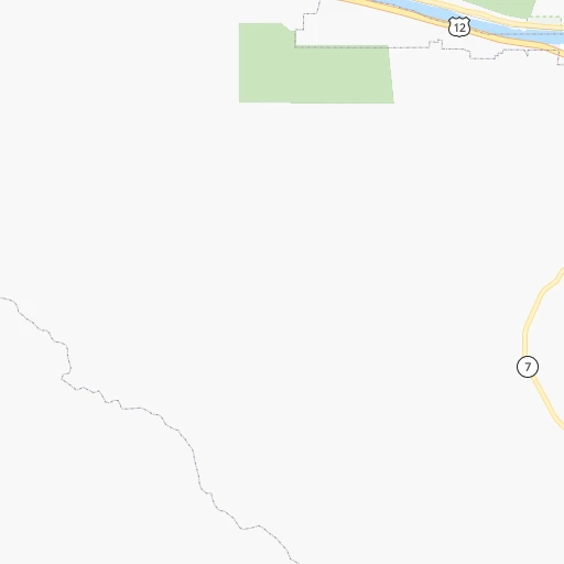
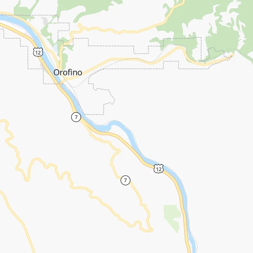
Roadmap (route) to go from Orofino Airport to Pendleton detailed above, you can also see the course layout on the map.
While doing trip Orofino (airport) - Pendleton by car, the calculated route ends at a distance , or more straight.
Distance and duration of the route between Orofino (airport) and Pendleton
Calculation of distance and route from Pendleton to Orofino (airport) :
214.1289.2 km4h49mn
Continue onto US 12 1h44mn 51.3 kmKeep right onto US 12 0h8mn 12.1 kmKeep left onto US 12 and drive toward Lewiston 0h1mn 1.1 kmKeep right onto North and South Highway and take ID 128 toward Lewiston, Wilma 0h0mn 215 mTurn right onto Down River Road 0h5mn 6.1 kmTurn left onto WA 128 0h1mn 824 mTurn right onto Bridge Street 1h48mn 67.0 kmTurn right onto Owens Road 0h0mn 46 mTurn left onto US 12 0h26mn 36.7 kmTurn right onto East Dayton Avenue 0h1mn 591 mTurn left onto North 3rd Street 0h1mn 511 mTurn right onto East Main Street 0h13mn 15.6 kmTurn left onto Coppei Avenue 0h23mn 31.1 kmKeep left 0h0mn 487 mTurn right onto East Melrose Street 0h1mn 808 mTurn left onto North Rose Street 0h0mn 206 mTurn right onto East Rose Street 0h1mn 1.6 kmTurn left onto North 9th Avenue 0h2mn 1.5 kmAt roundabout, take exit 2 onto WA 125 0h2mn 1.7 kmContinue onto WA 125 0h11mn 13.1 kmTurn sharp left onto South Main Street 1h38mn 44.4 kmTurn slight right onto Southeast Court Avenue 0h2mn 2.1 kmTurn left 0h0mn 28 mArrive at destination 0h0mn 0 m
Travel from Orofino (airport) (Oregon) to a selection of major cities.
Distances from Orofino Airport to biggest cities in Idaho
Other major cities in country :
- Charlotte [NC], 827,097 inhabitants. 3,202 km
- Seattle [WA], 684,451 inhabitants. 476 km
- Denver [CO], 682,545 inhabitants. 1,184 km
- El Paso [TX], 681,124 inhabitants. 1,842 km
- Detroit [MI], 677,116 inhabitants. 2,662 km
- Boston [MA], 667,137 inhabitants. 3,574 km
- Memphis [TN], 655,770 inhabitants. 2,527 km
- New South Memphis [TN], 641,608 inhabitants. 2,531 km
- Portland [OR], 632,309 inhabitants. 506 km
- Oklahoma City [OK], 631,346 inhabitants. 1,989 km
- Las Vegas [NV], 623,747 inhabitants. 1,152 km
- Baltimore [MD], 621,849 inhabitants. 3,295 km
- Washington, D.C. [DC], 601,723 inhabitants. 3,283 km
- Milwaukee [WI], 600,155 inhabitants. 2,262 km
- South Boston [MA], 571,281 inhabitants. 3,576 km
- Albuquerque [NM], 559,121 inhabitants. 1,504 km
- Tucson [AZ], 531,641 inhabitants. 1,653 km
- Nashville [TN], 530,852 inhabitants. 2,699 km
- Fresno [CA], 520,052 inhabitants. 1,123 km
- Sacramento [CA], 490,712 inhabitants. 979 km
Route from Pendleton to major cities (United States).
- Distance Pendleton New York City3,628 km
- Distance Pendleton Los Angeles1,294 km
- Distance Pendleton Chicago2,523 km
- Distance Pendleton Brooklyn3,635 km
- Distance Pendleton Houston2,700 km
- Distance Pendleton Queens3,642 km
- Distance Pendleton Philadelphia3,573 km
- Distance Pendleton Phoenix1,476 km
- Distance Pendleton Manhattan3,628 km
- Distance Pendleton San Antonio2,531 km
- Distance Pendleton San Diego1,449 km
- Distance Pendleton The Bronx3,633 km
- Distance Pendleton Dallas2,364 km
- Distance Pendleton San Jose963 km
- Distance Pendleton Austin2,506 km
- Distance Pendleton Jacksonville3,633 km
- Distance Pendleton San Francisco929 km
- Distance Pendleton Columbus2,965 km
- Distance Pendleton Fort Worth2,334 km
- Distance Pendleton Indianapolis2,728 km
Nearest cities to Orofino (airport) :
- Spokane, 213,272 inhabitants. 157 km
- Boise, 145,987 inhabitants. 320 km
- Spokane Valley, 94,919 inhabitants. 151 km
- Meridian, 90,739 inhabitants. 321 km
- Nampa, 89,839 inhabitants. 329 km
- Kennewick, 78,896 inhabitants. 222 km
- Missoula, 71,022 inhabitants. 179 km
- Pasco, 69,451 inhabitants. 219 km
- Caldwell, 51,686 inhabitants. 316 km
- Coeur d'Alene, 49,122 inhabitants. 138 km
- Pullman, 32,816 inhabitants. 74 km
- Lewiston, 32,544 inhabitants. 58 km
- Walla Walla, 32,237 inhabitants. 166 km
- Lewiston Orchards, 31,422 inhabitants. 55 km
- Post Falls, 30,453 inhabitants. 146 km
- Opportunity, 25,877 inhabitants. 148 km
- Moscow, 25,060 inhabitants. 62 km
- Eagle, 23,612 inhabitants. 311 km
- Kalispell, 22,052 inhabitants. 241 km
- Kuna, 17,226 inhabitants. 334 km
- Pendleton, 16,881 inhabitants. 215 km
- Hayden, 14,133 inhabitants. 147 km
- La Grande, 13,074 inhabitants. 191 km
- Garden City, 11,550 inhabitants. 319 km
- Cheney, 11,534 inhabitants. 149 km
- Ontario, 10,999 inhabitants. 280 km
- Veradale, 9,991 inhabitants. 147 km
- Dishman, 9,978 inhabitants. 151 km
- Baker City, 9,752 inhabitants. 226 km
- College Place, 9,062 inhabitants. 170 km
- Liberty Lake, 8,906 inhabitants. 147 km
- Hailey, 8,134 inhabitants. 365 km
- Fairwood, 7,905 inhabitants. 166 km
- Sandpoint, 7,835 inhabitants. 200 km
- Othello, 7,809 inhabitants. 225 km
- Star, 7,797 inhabitants. 312 km
- Evergreen, 7,616 inhabitants. 245 km
- Rathdrum, 7,538 inhabitants. 154 km
- Payette, 7,380 inhabitants. 274 km
- Clarkston, 7,317 inhabitants. 60 km
- Mead, 7,275 inhabitants. 164 km
- Whitefish, 7,073 inhabitants. 259 km
- Milton-Freewater, 7,035 inhabitants. 174 km
- Middleton, 6,828 inhabitants. 311 km
- Airway Heights, 6,639 inhabitants. 163 km
- Emmett, 6,604 inhabitants. 292 km
- Clarkston Heights-Vineland, 6,326 inhabitants. 63 km
- Otis Orchards-East Farms, 6,220 inhabitants. 149 km
- Finley, 6,012 inhabitants. 215 km
- Country Homes, 5,841 inhabitants. 164 km
Location Orofino (airport) (Idaho) :
| Country flag |  |
| Location | Orofino (airport) |
| State | Idaho |
| County | Clearwater County |
| Country | United States |
| Country code / ISO 2 | US |
| Latitude | 46.4910100 |
| Longitude | -116.2737500 |
| Altitude | 311 meters |
| Time zone | America/Los_Angeles |
Location Pendleton (Oregon) :
| Country flag | |
| Location | Pendleton |
| State | Oregon |
| County | Umatilla County |
| Country | United States |
| Country code / ISO 2 | US |
| Latitude | 45.6720700 |
| Longitude | -118.7886000 |
| Altitude | 325 meters |
| Time zone | America/Los_Angeles |


