
How to get from Glider (airport) (Idaho) to Baker City (Oregon)
Calculate route from Glider (airport) (Idaho, United States) to Baker City (Oregon, United States).
The flight distance (as the crow flies) between Glider (airport) and Baker City is 169.9 km.
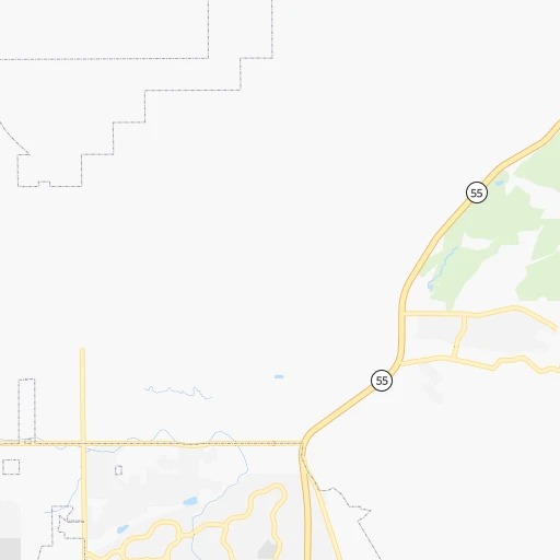
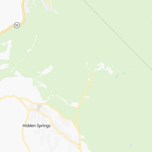
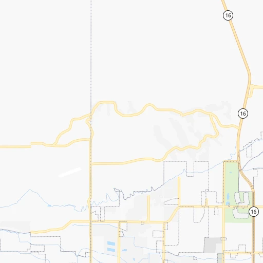
Roadmap (route) to go from Glider Airport to Baker City detailed above, you can also see the course layout on the map.
While doing trip Glider (airport) - Baker City by car, the calculated route ends at a distance , or more straight.
Distance and duration of the route between Glider (airport) and Baker City
Calculation of distance and route from Baker City to Glider (airport) :
169.9198.6 km2h18mn
Continue 0h4mn 1.1 kmContinue 0h2mn 569 mTurn left 0h0mn 131 mTurn right 0h3mn 889 mTurn slight right 0h0mn 22 mTurn sharp left 0h0mn 67 mTurn slight left 0h1mn 176 mTurn right onto North Seaman Gulch Road 0h2mn 1.8 kmTurn right onto West Hill Road 0h1mn 510 mTurn left onto North Bogart Lane 0h0mn 221 mTurn right onto West Hill Road Parkway 0h1mn 571 mTurn left onto North Duncan Lane 0h1mn 989 mTurn sharp right onto West State Street 0h1mn 1.5 kmTurn right onto East State Street 0h28mn 31.0 kmTurn right 1h30mn 154.3 kmKeep right onto US 30 and take US 30 West toward Baker City Center, Haines 0h0mn 483 mContinue onto US 30 0h3mn 3.8 kmTurn left onto Auburn Avenue 0h0mn 427 mTurn right onto 4th Street 0h0mn 41 mArrive at destination 0h0mn 0 m
Travel from Glider (airport) (Oregon) to a selection of major cities.
Distances from Glider Airport to biggest cities in Idaho
Other major cities in country :
- Charlotte [NC], 827,097 inhabitants. 3,162 km
- Seattle [WA], 684,451 inhabitants. 639 km
- Denver [CO], 682,545 inhabitants. 1,038 km
- El Paso [TX], 681,124 inhabitants. 1,584 km
- Detroit [MI], 677,116 inhabitants. 2,692 km
- Boston [MA], 667,137 inhabitants. 3,638 km
- Memphis [TN], 655,770 inhabitants. 2,437 km
- New South Memphis [TN], 641,608 inhabitants. 2,440 km
- Portland [OR], 632,309 inhabitants. 544 km
- Oklahoma City [OK], 631,346 inhabitants. 1,848 km
- Las Vegas [NV], 623,747 inhabitants. 845 km
- Baltimore [MD], 621,849 inhabitants. 3,313 km
- Washington, D.C. [DC], 601,723 inhabitants. 3,295 km
- Milwaukee [WI], 600,155 inhabitants. 2,287 km
- South Boston [MA], 571,281 inhabitants. 3,639 km
- Albuquerque [NM], 559,121 inhabitants. 1,268 km
- Tucson [AZ], 531,641 inhabitants. 1,363 km
- Nashville [TN], 530,852 inhabitants. 2,639 km
- Fresno [CA], 520,052 inhabitants. 830 km
- Sacramento [CA], 490,712 inhabitants. 718 km
Route from Baker City to major cities (United States).
- Distance Baker City New York City3,568 km
- Distance Baker City Los Angeles1,194 km
- Distance Baker City Chicago2,452 km
- Distance Baker City Brooklyn3,575 km
- Distance Baker City Houston2,583 km
- Distance Baker City Queens3,582 km
- Distance Baker City Philadelphia3,510 km
- Distance Baker City Phoenix1,355 km
- Distance Baker City Manhattan3,568 km
- Distance Baker City San Antonio2,411 km
- Distance Baker City San Diego1,344 km
- Distance Baker City The Bronx3,573 km
- Distance Baker City Dallas2,250 km
- Distance Baker City San Jose895 km
- Distance Baker City Austin2,387 km
- Distance Baker City Jacksonville3,536 km
- Distance Baker City San Francisco868 km
- Distance Baker City Columbus2,892 km
- Distance Baker City Fort Worth2,219 km
- Distance Baker City Indianapolis2,650 km
Nearest cities to Glider (airport) :
- Boise, 145,987 inhabitants. 14 km
- Meridian, 90,739 inhabitants. 14 km
- Nampa, 89,839 inhabitants. 29 km
- Kennewick, 78,896 inhabitants. 357 km
- Pasco, 69,451 inhabitants. 357 km
- Richland, 54,248 inhabitants. 370 km
- Caldwell, 51,686 inhabitants. 32 km
- Twin Falls, 47,468 inhabitants. 197 km
- Lewiston, 32,544 inhabitants. 306 km
- Walla Walla, 32,237 inhabitants. 307 km
- Lewiston Orchards, 31,422 inhabitants. 302 km
- Eagle, 23,612 inhabitants. 5 km
- Elko, 20,279 inhabitants. 324 km
- Kuna, 17,226 inhabitants. 27 km
- Hermiston, 17,201 inhabitants. 335 km
- Pendleton, 16,881 inhabitants. 294 km
- Mountain Home, 13,730 inhabitants. 81 km
- La Grande, 13,074 inhabitants. 229 km
- Spring Creek, 12,361 inhabitants. 338 km
- Garden City, 11,550 inhabitants. 11 km
- Jerome, 11,184 inhabitants. 182 km
- Ontario, 10,999 inhabitants. 64 km
- Burley, 10,436 inhabitants. 242 km
- Baker City, 9,752 inhabitants. 170 km
- College Place, 9,062 inhabitants. 308 km
- Hailey, 8,134 inhabitants. 161 km
- Winnemucca, 7,887 inhabitants. 327 km
- Star, 7,797 inhabitants. 16 km
- Payette, 7,380 inhabitants. 65 km
- Clarkston, 7,317 inhabitants. 306 km
- Milton-Freewater, 7,035 inhabitants. 297 km
- Middleton, 6,828 inhabitants. 26 km
- Emmett, 6,604 inhabitants. 24 km
- Clarkston Heights-Vineland, 6,326 inhabitants. 304 km
- Finley, 6,012 inhabitants. 347 km
- Rupert, 5,705 inhabitants. 245 km
- Connell, 5,446 inhabitants. 385 km
- Weiser, 5,317 inhabitants. 80 km
- West Clarkston-Highland, 5,261 inhabitants. 305 km
- Fruitland, 5,087 inhabitants. 59 km
- Hamilton, 4,602 inhabitants. 328 km
- West Wendover, 4,294 inhabitants. 379 km
- Buhl, 4,275 inhabitants. 176 km
- West Pasco, 3,739 inhabitants. 362 km
- Kimberly, 3,610 inhabitants. 205 km
- Gooding, 3,509 inhabitants. 155 km
- Burbank, 3,291 inhabitants. 350 km
- Heyburn, 3,223 inhabitants. 243 km
- Highland, 3,197 inhabitants. 349 km
- Nyssa, 3,175 inhabitants. 59 km
Location Glider (airport) (Idaho) :
| Country flag |  |
| Location | Glider (airport) |
| State | Idaho |
| County | Ada County |
| Country | United States |
| Country code / ISO 2 | US |
| Latitude | 43.7146100 |
| Longitude | -116.2967900 |
| Altitude | 860 meters |
| Time zone | America/Boise |
Location Baker City (Oregon) :
| Country flag | |
| Location | Baker City |
| State | Oregon |
| County | Baker County |
| Country | United States |
| Country code / ISO 2 | US |
| Latitude | 44.7748700 |
| Longitude | -117.8343800 |
| Altitude | 1051 meters |
| Time zone | America/Los_Angeles |


