


How to get from Donnelly (airport) (Idaho) to Burley (Idaho)
Calculate route from Donnelly (airport) (Idaho, United States) to Burley (Idaho, United States).
The flight distance (as the crow flies) between Donnelly (airport) and Burley is 305.7 km.
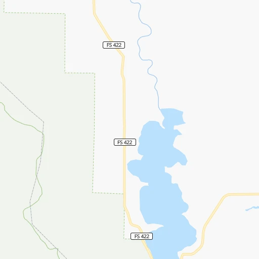
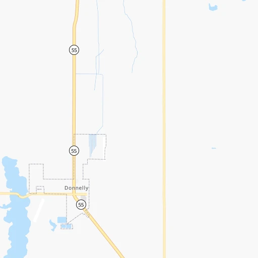
Roadmap (route) to go from Donnelly Airport to Burley detailed above, you can also see the course layout on the map.
While doing trip Donnelly (airport) - Burley by car, the calculated route ends at a distance , or more straight.
Distance and duration of the route between Donnelly (airport) and Burley
Calculation of distance and route from Burley to Donnelly (airport) :
305.7408.4 km4h17mn
Continue 0h1mn 322 mTurn right onto West Roseberry Road 0h1mn 802 mTurn right onto ID 55 2h44mn 137.5 kmTurn right onto North Highway 55 0h1mn 862 mTurn left onto East State Street 0h3mn 3.2 kmTurn right onto West State Street 0h1mn 766 mTurn right onto West State Street 0h4mn 4.2 kmContinue onto West State Street 0h1mn 491 mContinue onto West State Street 0h1mn 1.2 kmTurn right onto West State Street 0h0mn 54 mTurn right onto West State Street 0h0mn 162 mTurn slight right onto West State Street 0h0mn 359 mTurn right onto North 23rd Street 0h1mn 876 mTurn left onto West Fairview Avenue 0h0mn 309 mTurn right onto West Grove Street 0h1mn 715 mTurn right onto South 11th Street 0h0mn 239 mTurn left onto West Myrtle Street 0h0mn 244 mTurn right onto South 9th Street 0h2mn 1.4 kmContinue onto South Capitol Boulevard 0h0mn 56 mTurn slight right onto South Federal Way 0h3mn 3.4 kmTurn sharp right 0h1mn 1.1 kmKeep left onto US 20, US 26 toward I 84 East 2h8mn 246.2 kmKeep right and take I 84 Business, ID 27 toward Burley, Paul 0h0mn 258 mKeep right and take I 84 Business, ID 27 toward Burley, Paul 0h3mn 3.6 kmTurn left onto East 14th Street 0h0mn 55 mTurn left 0h0mn 28 mArrive at destination 0h0mn 0 m
Travel from Donnelly (airport) (Idaho) to a selection of major cities.
Distances from Donnelly Airport to biggest cities in Idaho
Other major cities in country :
- Charlotte [NC], 827,097 inhabitants. 3,158 km
- Seattle [WA], 684,451 inhabitants. 578 km
- Denver [CO], 682,545 inhabitants. 1,069 km
- El Paso [TX], 681,124 inhabitants. 1,667 km
- Detroit [MI], 677,116 inhabitants. 2,662 km
- Boston [MA], 667,137 inhabitants. 3,596 km
- Memphis [TN], 655,770 inhabitants. 2,451 km
- New South Memphis [TN], 641,608 inhabitants. 2,454 km
- Portland [OR], 632,309 inhabitants. 525 km
- Oklahoma City [OK], 631,346 inhabitants. 1,881 km
- Las Vegas [NV], 623,747 inhabitants. 956 km
- Baltimore [MD], 621,849 inhabitants. 3,288 km
- Washington, D.C. [DC], 601,723 inhabitants. 3,272 km
- Milwaukee [WI], 600,155 inhabitants. 2,258 km
- South Boston [MA], 571,281 inhabitants. 3,598 km
- Albuquerque [NM], 559,121 inhabitants. 1,340 km
- Tucson [AZ], 531,641 inhabitants. 1,462 km
- Nashville [TN], 530,852 inhabitants. 2,642 km
- Fresno [CA], 520,052 inhabitants. 941 km
- Sacramento [CA], 490,712 inhabitants. 818 km
Route from Burley to major cities (United States).
- Distance Burley New York City3,286 km
- Distance Burley Los Angeles1,021 km
- Distance Burley Chicago2,149 km
- Distance Burley Brooklyn3,293 km
- Distance Burley Houston2,174 km
- Distance Burley Queens3,301 km
- Distance Burley Philadelphia3,218 km
- Distance Burley Phoenix1,023 km
- Distance Burley Manhattan3,287 km
- Distance Burley San Antonio2,001 km
- Distance Burley San Diego1,133 km
- Distance Burley The Bronx3,293 km
- Distance Burley Dallas1,843 km
- Distance Burley San Jose901 km
- Distance Burley Austin1,977 km
- Distance Burley Jacksonville3,157 km
- Distance Burley San Francisco905 km
- Distance Burley Columbus2,579 km
- Distance Burley Fort Worth1,812 km
- Distance Burley Indianapolis2,326 km
Nearest cities to Donnelly (airport) :
- Spokane, 213,272 inhabitants. 342 km
- Boise, 145,987 inhabitants. 124 km
- Spokane Valley, 94,919 inhabitants. 340 km
- Meridian, 90,739 inhabitants. 127 km
- Nampa, 89,839 inhabitants. 138 km
- Missoula, 71,022 inhabitants. 289 km
- Caldwell, 51,686 inhabitants. 128 km
- Coeur d'Alene, 49,122 inhabitants. 333 km
- Twin Falls, 47,468 inhabitants. 274 km
- Pullman, 32,816 inhabitants. 239 km
- Lewiston, 32,544 inhabitants. 201 km
- Walla Walla, 32,237 inhabitants. 231 km
- Lewiston Orchards, 31,422 inhabitants. 196 km
- Post Falls, 30,453 inhabitants. 339 km
- Opportunity, 25,877 inhabitants. 337 km
- Moscow, 25,060 inhabitants. 234 km
- Eagle, 23,612 inhabitants. 117 km
- Kuna, 17,226 inhabitants. 140 km
- Pendleton, 16,881 inhabitants. 236 km
- Mountain Home, 13,730 inhabitants. 180 km
- La Grande, 13,074 inhabitants. 171 km
- Garden City, 11,550 inhabitants. 124 km
- Cheney, 11,534 inhabitants. 328 km
- Jerome, 11,184 inhabitants. 256 km
- Ontario, 10,999 inhabitants. 105 km
- Burley, 10,436 inhabitants. 306 km
- Veradale, 9,991 inhabitants. 336 km
- Dishman, 9,978 inhabitants. 339 km
- Baker City, 9,752 inhabitants. 138 km
- College Place, 9,062 inhabitants. 232 km
- Liberty Lake, 8,906 inhabitants. 338 km
- Hailey, 8,134 inhabitants. 195 km
- Star, 7,797 inhabitants. 120 km
- Payette, 7,380 inhabitants. 99 km
- Clarkston, 7,317 inhabitants. 202 km
- Milton-Freewater, 7,035 inhabitants. 224 km
- Middleton, 6,828 inhabitants. 121 km
- Airway Heights, 6,639 inhabitants. 345 km
- Emmett, 6,604 inhabitants. 101 km
- Clarkston Heights-Vineland, 6,326 inhabitants. 200 km
- Otis Orchards-East Farms, 6,220 inhabitants. 341 km
- Finley, 6,012 inhabitants. 279 km
- Rupert, 5,705 inhabitants. 305 km
- Connell, 5,446 inhabitants. 305 km
- Weiser, 5,317 inhabitants. 88 km
- West Clarkston-Highland, 5,261 inhabitants. 201 km
- Orchard Homes, 5,197 inhabitants. 286 km
- Fruitland, 5,087 inhabitants. 104 km
- Medical Lake, 4,942 inhabitants. 340 km
- Town and Country, 4,857 inhabitants. 349 km
Location Donnelly (airport) (Idaho) :
| Country flag |  |
| Location | Donnelly (airport) |
| State | Idaho |
| County | Valley County |
| Country | United States |
| Country code / ISO 2 | US |
| Latitude | 44.7282300 |
| Longitude | -116.0892900 |
| Altitude | 1479 meters |
| Time zone | America/Boise |
Location Burley (Idaho) :
| Country flag | |
| Location | Burley |
| State | Idaho |
| County | Cassia County |
| Country | United States |
| Country code / ISO 2 | US |
| Latitude | 42.5357400 |
| Longitude | -113.7927900 |
| Altitude | 1269 meters |
| Time zone | America/Boise |

