

How to get from Chubbuck (Idaho) to Lewiston (Idaho)
Calculate route from Chubbuck (Idaho, United States) to Lewiston (Idaho, United States).
The flight distance (as the crow flies) between Chubbuck and Lewiston is 529.2 km.
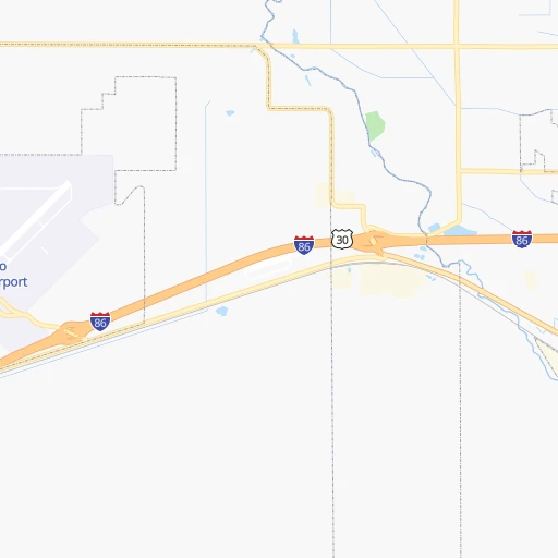
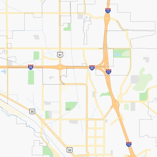
Roadmap (route) to go from Chubbuck to Lewiston detailed above, you can also see the course layout on the map.
While doing trip Chubbuck - Lewiston by car, the calculated route ends at a distance , or more straight.
Distance and duration of the route between Chubbuck and Lewiston
Calculation of distance and route from Lewiston to Chubbuck :
529.2803.5 km9h52mn
Continue onto Yellowstone Avenue 0h1mn 769 mKeep right 3h10mn 366.8 kmKeep right onto US 20, US 26 and take US 20, US 26 toward Broadway Avenue 0h0mn 372 mKeep right onto US 20, US 26 and take US 20, US 26 toward Boise State University, City Center:Convention Center 0h5mn 4.5 kmTurn slight right onto South Broadway Avenue 0h1mn 588 mTurn sharp left onto East Idaho Street 0h2mn 1.8 kmTurn right onto North 15th Street 0h0mn 311 mTurn left onto West State Street 0h2mn 1.4 kmTurn right onto West State Street 0h2mn 1.7 kmContinue onto West State Street 0h5mn 5.1 kmTurn slight right onto West State Street 0h3mn 3.1 kmTurn right onto East State Street 0h0mn 24 mKeep right toward SH-55 0h0mn 237 mContinue onto North Highway 55 2h59mn 157.0 kmTurn left onto Deinhard Lane 0h4mn 4.1 kmTurn left onto West Lake Street 0h14mn 17.1 kmTurn right onto North Norris Avenue 2h45mn 122.8 kmTurn left onto Johnston Road 0h4mn 3.6 kmTurn left onto US 95 1h10mn 108.4 kmKeep left onto US 12 and drive toward Lewiston 0h3mn 2.4 kmKeep left onto US 12 0h0mn 155 mTurn right onto Idaho Street 0h1mn 1.2 kmArrive at destination 0h0mn 0 m
Travel from Chubbuck (Idaho) to a selection of major cities.
Distances from Chubbuck to biggest cities in Idaho
Other major cities in country :
- Charlotte [NC], 827,097 inhabitants. 2,845 km
- Seattle [WA], 684,451 inhabitants. 931 km
- Denver [CO], 682,545 inhabitants. 718 km
- El Paso [TX], 681,124 inhabitants. 1,350 km
- Detroit [MI], 677,116 inhabitants. 2,398 km
- Boston [MA], 667,137 inhabitants. 3,357 km
- Memphis [TN], 655,770 inhabitants. 2,114 km
- New South Memphis [TN], 641,608 inhabitants. 2,117 km
- Portland [OR], 632,309 inhabitants. 864 km
- Oklahoma City [OK], 631,346 inhabitants. 1,530 km
- Las Vegas [NV], 623,747 inhabitants. 785 km
- Baltimore [MD], 621,849 inhabitants. 3,011 km
- Washington, D.C. [DC], 601,723 inhabitants. 2,992 km
- Milwaukee [WI], 600,155 inhabitants. 1,993 km
- South Boston [MA], 571,281 inhabitants. 3,358 km
- Albuquerque [NM], 559,121 inhabitants. 1,006 km
- Tucson [AZ], 531,641 inhabitants. 1,199 km
- Nashville [TN], 530,852 inhabitants. 2,318 km
- Fresno [CA], 520,052 inhabitants. 928 km
- Sacramento [CA], 490,712 inhabitants. 901 km
Route from Lewiston to major cities (United States).
- Distance Lewiston New York City3,483 km
- Distance Lewiston Los Angeles1,380 km
- Distance Lewiston Chicago2,386 km
- Distance Lewiston Brooklyn3,490 km
- Distance Lewiston Houston2,636 km
- Distance Lewiston Queens3,497 km
- Distance Lewiston Philadelphia3,431 km
- Distance Lewiston Phoenix1,503 km
- Distance Lewiston Manhattan3,482 km
- Distance Lewiston San Antonio2,482 km
- Distance Lewiston San Diego1,525 km
- Distance Lewiston The Bronx3,487 km
- Distance Lewiston Dallas2,292 km
- Distance Lewiston San Jose1,088 km
- Distance Lewiston Austin2,449 km
- Distance Lewiston Jacksonville3,526 km
- Distance Lewiston San Francisco1,060 km
- Distance Lewiston Columbus2,829 km
- Distance Lewiston Fort Worth2,264 km
- Distance Lewiston Indianapolis2,597 km
Nearest cities to Chubbuck :
- Salt Lake City, 192,672 inhabitants. 245 km
- West Valley City, 136,208 inhabitants. 251 km
- Provo, 115,264 inhabitants. 307 km
- West Jordan, 111,946 inhabitants. 261 km
- Orem, 94,457 inhabitants. 299 km
- Sandy Hills, 89,575 inhabitants. 265 km
- Sandy, 87,461 inhabitants. 264 km
- Ogden, 85,444 inhabitants. 193 km
- Layton, 74,143 inhabitants. 211 km
- South Jordan, 66,648 inhabitants. 266 km
- Millcreek, 62,139 inhabitants. 253 km
- Taylorsville, 60,514 inhabitants. 255 km
- Idaho Falls, 59,184 inhabitants. 70 km
- Lehi, 58,486 inhabitants. 286 km
- Pocatello, 54,441 inhabitants. 6 km
- Logan, 50,371 inhabitants. 142 km
- Murray, 49,250 inhabitants. 255 km
- Twin Falls, 47,468 inhabitants. 168 km
- Draper, 46,774 inhabitants. 271 km
- Bountiful, 43,784 inhabitants. 231 km
- Bozeman, 43,405 inhabitants. 327 km
- Riverton, 41,900 inhabitants. 271 km
- Pleasant Grove, 38,052 inhabitants. 291 km
- Roy, 37,964 inhabitants. 199 km
- Spanish Fork, 37,935 inhabitants. 320 km
- South Jordan Heights, 37,141 inhabitants. 266 km
- Kearns, 35,731 inhabitants. 255 km
- Cottonwood Heights, 34,343 inhabitants. 262 km
- Butte-Silver Bow (Balance), 33,525 inhabitants. 332 km
- Tooele, 33,157 inhabitants. 266 km
- Midvale, 32,613 inhabitants. 261 km
- Springville, 32,286 inhabitants. 315 km
- Holladay, 30,864 inhabitants. 256 km
- Herriman, 30,835 inhabitants. 270 km
- Clearfield, 30,653 inhabitants. 205 km
- Kaysville, 30,472 inhabitants. 214 km
- American Fork, 28,326 inhabitants. 289 km
- Rexburg, 27,663 inhabitants. 115 km
- Syracuse, 27,395 inhabitants. 207 km
- Eagle Mountain, 27,332 inhabitants. 293 km
- Magna, 26,505 inhabitants. 248 km
- Saratoga Springs, 25,407 inhabitants. 290 km
- South Salt Lake, 24,788 inhabitants. 250 km
- Farmington, 22,566 inhabitants. 221 km
- Clinton, 21,399 inhabitants. 201 km
- East Millcreek, 20,816 inhabitants. 253 km
- North Salt Lake, 19,796 inhabitants. 235 km
- Payson, 19,548 inhabitants. 326 km
- Brigham City, 18,752 inhabitants. 161 km
- North Ogden, 18,446 inhabitants. 184 km
Location Chubbuck (Idaho) :
| Country flag |  |
| Location | Chubbuck |
| State | Idaho |
| County | Bannock County |
| Country | United States |
| Country code / ISO 2 | US |
| Latitude | 42.9207500 |
| Longitude | -112.4660900 |
| Altitude | 1363 meters |
| Time zone | America/Boise |
Location Lewiston (Idaho) :
| Country flag | |
| Location | Lewiston |
| State | Idaho |
| County | Nez Perce County |
| Country | United States |
| Country code / ISO 2 | US |
| Latitude | 46.4165500 |
| Longitude | -117.0176600 |
| Altitude | 227 meters |
| Time zone | America/Los_Angeles |


