
How to get from Haxtun Municipal (airport) (Colorado) to Greeley (Colorado)
Calculate route from Haxtun Municipal (airport) (Colorado, United States) to Greeley (Colorado, United States).
The flight distance (as the crow flies) between Haxtun Municipal (airport) and Greeley is 179.0 km.
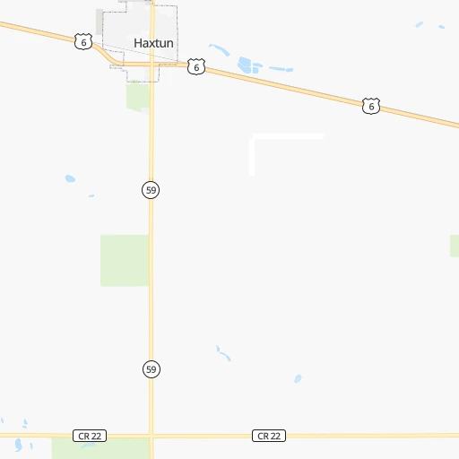
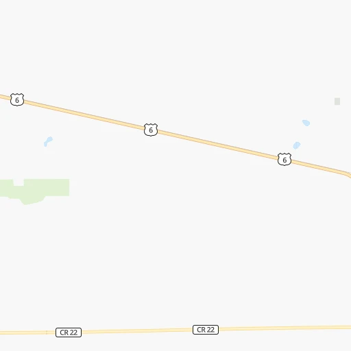
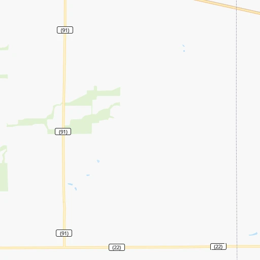
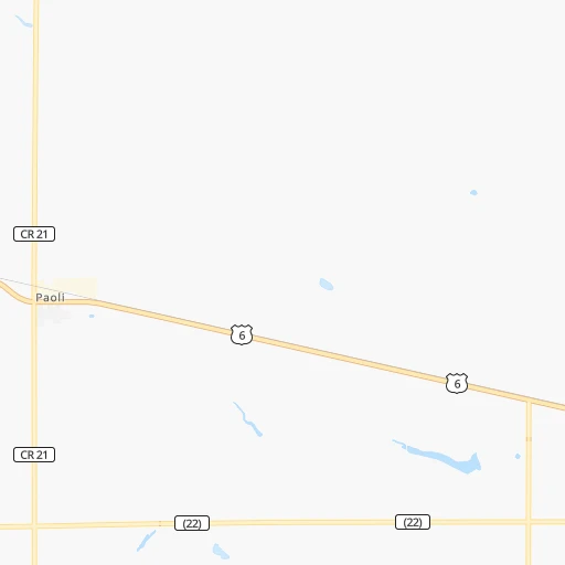
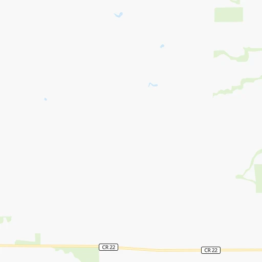
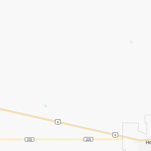
Roadmap (route) to go from Haxtun Municipal Airport to Greeley detailed above, you can also see the course layout on the map.
While doing trip Haxtun Municipal (airport) - Greeley by car, the calculated route ends at a distance , or more straight.
Distance and duration of the route between Haxtun Municipal (airport) and Greeley
Calculation of distance and route from Greeley to Haxtun Municipal (airport) :
179.0208.0 km2h28mn
Continue onto County Road 7 0h3mn 1.4 kmTurn left onto US 6 1h42mn 50.1 kmTurn left toward I 76 West 1h52mn 93.2 kmKeep right onto US 34 and take US 34 West toward Greeley Estates Park 0h1mn 837 mContinue onto United States Highway 34 1h43mn 53.8 kmKeep right 0h0mn 101 mTurn slight right onto US Highway 34 Business Loop 0h4mn 4.5 kmKeep right 0h0mn 138 mTurn slight right onto United States Highway 85 0h0mn 271 mTurn left onto 16th Street 0h1mn 938 mTurn sharp right onto South 8th Avenue 0h1mn 978 mTurn left onto 10th Street 0h0mn 11 mContinue onto West 10th Street 0h0mn 299 mTurn right onto 10th Avenue 0h0mn 153 mTurn left onto 9th Street 0h1mn 1.2 kmTurn left onto 19th Avenue 0h0mn 80 mArrive at destination 0h0mn 0 m
Travel from Haxtun Municipal (airport) (Colorado) to a selection of major cities.
Distances from Haxtun Municipal Airport to biggest cities in Colorado
- Littleton,46,368 inhabitants.234 km
- Southglenn,42,268 inhabitants.231 km
- Northglenn,39,197 inhabitants.218 km
- Brighton,37,585 inhabitants.201 km
- Englewood,33,082 inhabitants.230 km
- Security-Widefield,32,882 inhabitants.276 km
- Ken Caryl,32,438 inhabitants.243 km
- Wheat Ridge,31,192 inhabitants.231 km
- Pueblo West,29,637 inhabitants.312 km
- Fountain,27,767 inhabitants.281 km
- Lafayette,27,729 inhabitants.222 km
- Castlewood,25,271 inhabitants.227 km
- Columbine,24,280 inhabitants.239 km
- Windsor,21,751 inhabitants.195 km
- Erie,21,420 inhabitants.217 km
- Evans,21,383 inhabitants.179 km
- Louisville,20,396 inhabitants.226 km
- Golden,20,330 inhabitants.242 km
Other major cities in country :
- Charlotte [NC], 827,097 inhabitants. 1,997 km
- Seattle [WA], 684,451 inhabitants. 1,751 km
- El Paso [TX], 681,124 inhabitants. 1,046 km
- Detroit [MI], 677,116 inhabitants. 1,639 km
- Boston [MA], 667,137 inhabitants. 2,622 km
- Memphis [TN], 655,770 inhabitants. 1,259 km
- New South Memphis [TN], 641,608 inhabitants. 1,262 km
- Portland [OR], 632,309 inhabitants. 1,715 km
- Oklahoma City [OK], 631,346 inhabitants. 727 km
- Las Vegas [NV], 623,747 inhabitants. 1,199 km
- Baltimore [MD], 621,849 inhabitants. 2,215 km
- Washington, D.C. [DC], 601,723 inhabitants. 2,189 km
- Milwaukee [WI], 600,155 inhabitants. 1,247 km
- South Boston [MA], 571,281 inhabitants. 2,624 km
- Albuquerque [NM], 559,121 inhabitants. 712 km
- Tucson [AZ], 531,641 inhabitants. 1,195 km
- Nashville [TN], 530,852 inhabitants. 1,464 km
- Fresno [CA], 520,052 inhabitants. 1,550 km
- Sacramento [CA], 490,712 inhabitants. 1,633 km
- Kansas City [MO], 475,378 inhabitants. 706 km
Route from Greeley to major cities (United States).
- Distance Greeley New York City2,583 km
- Distance Greeley Los Angeles1,391 km
- Distance Greeley Chicago1,437 km
- Distance Greeley Brooklyn2,589 km
- Distance Greeley Houston1,458 km
- Distance Greeley Queens2,598 km
- Distance Greeley Philadelphia2,501 km
- Distance Greeley Phoenix1,015 km
- Distance Greeley Manhattan2,585 km
- Distance Greeley San Antonio1,349 km
- Distance Greeley San Diego1,403 km
- Distance Greeley The Bronx2,592 km
- Distance Greeley Dallas1,104 km
- Distance Greeley San Jose1,526 km
- Distance Greeley Austin1,294 km
- Distance Greeley Jacksonville2,365 km
- Distance Greeley San Francisco1,555 km
- Distance Greeley Columbus1,842 km
- Distance Greeley Fort Worth1,081 km
- Distance Greeley Indianapolis1,579 km
Nearest cities to Haxtun Municipal (airport) :
- Denver, 682,545 inhabitants. 225 km
- Colorado Springs, 456,568 inhabitants. 275 km
- Aurora, 359,407 inhabitants. 214 km
- Fort Collins, 161,175 inhabitants. 210 km
- Lakewood, 152,597 inhabitants. 234 km
- Thornton, 133,451 inhabitants. 218 km
- Arvada, 115,368 inhabitants. 230 km
- Westminster, 113,130 inhabitants. 224 km
- Centennial, 109,741 inhabitants. 226 km
- Pueblo, 109,412 inhabitants. 315 km
- Boulder, 107,349 inhabitants. 236 km
- Greeley, 100,883 inhabitants. 179 km
- Highlands Ranch, 96,713 inhabitants. 234 km
- Longmont, 92,088 inhabitants. 218 km
- Loveland, 75,182 inhabitants. 210 km
- Broomfield, 65,065 inhabitants. 225 km
- Cheyenne, 63,335 inhabitants. 195 km
- Castle Rock, 55,591 inhabitants. 237 km
- Commerce City, 53,696 inhabitants. 218 km
- Parker, 49,550 inhabitants. 221 km
- Littleton, 46,368 inhabitants. 234 km
- Southglenn, 42,268 inhabitants. 231 km
- Northglenn, 39,197 inhabitants. 218 km
- Brighton, 37,585 inhabitants. 201 km
- Englewood, 33,082 inhabitants. 230 km
- Security-Widefield, 32,882 inhabitants. 276 km
- Ken Caryl, 32,438 inhabitants. 243 km
- Laramie, 32,158 inhabitants. 262 km
- Wheat Ridge, 31,192 inhabitants. 231 km
- Pueblo West, 29,637 inhabitants. 312 km
- Dodge City, 27,912 inhabitants. 390 km
- Fountain, 27,767 inhabitants. 281 km
- Lafayette, 27,729 inhabitants. 222 km
- Garden City, 27,005 inhabitants. 331 km
- Castlewood, 25,271 inhabitants. 227 km
- Columbine, 24,280 inhabitants. 239 km
- North Platte, 24,194 inhabitants. 165 km
- Windsor, 21,751 inhabitants. 195 km
- Erie, 21,420 inhabitants. 217 km
- Evans, 21,383 inhabitants. 179 km
- Louisville, 20,396 inhabitants. 226 km
- Golden, 20,330 inhabitants. 242 km
- Sherrelwood, 18,287 inhabitants. 222 km
- Canon City, 16,400 inhabitants. 332 km
- Cimarron Hills, 16,161 inhabitants. 266 km
- Greenwood Village, 15,663 inhabitants. 229 km
- Johnstown, 14,896 inhabitants. 198 km
- Welby, 14,846 inhabitants. 218 km
- Scottsbluff, 14,802 inhabitants. 164 km
- Sterling, 14,104 inhabitants. 51 km
Location Haxtun Municipal (airport) (Colorado) :
| Country flag |  |
| Location | Haxtun Municipal (airport) |
| State | Colorado |
| County | Phillips County |
| Country | United States |
| Country code / ISO 2 | US |
| Latitude | 40.6234500 |
| Longitude | -102.6060100 |
| Altitude | 1230 meters |
| Time zone | America/Denver |
Location Greeley (Colorado) :
| Country flag | |
| Location | Greeley |
| State | Colorado |
| County | Weld County |
| Country | United States |
| Country code / ISO 2 | US |
| Latitude | 40.4233100 |
| Longitude | -104.7091300 |
| Altitude | 1425 meters |
| Time zone | America/Denver |


