

How to get from Robertson Ranch (airport) (Texas) to Carrizo Springs (Texas)
Calculate route from Robertson Ranch (airport) (Texas, United States) to Carrizo Springs (Texas, United States).
The flight distance (as the crow flies) between Robertson Ranch (airport) and Carrizo Springs is 181.6 km.
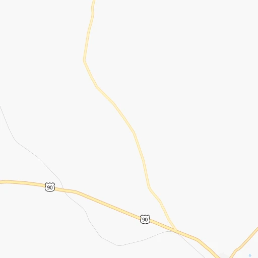
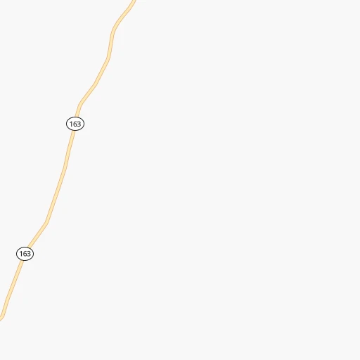
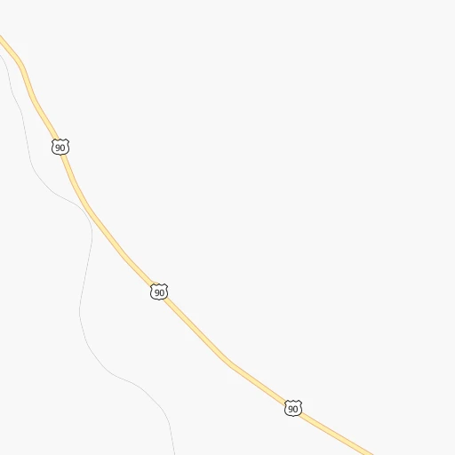
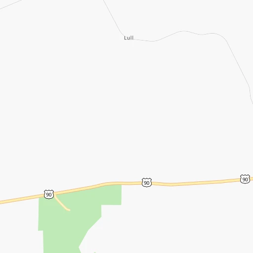
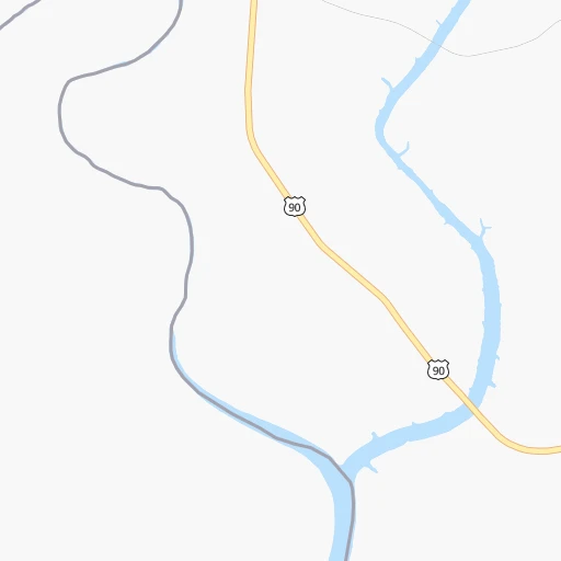
Roadmap (route) to go from Robertson Ranch Airport to Carrizo Springs detailed above, you can also see the course layout on the map.
While doing trip Robertson Ranch (airport) - Carrizo Springs by car, the calculated route ends at a distance , or more straight.
Distance and duration of the route between Robertson Ranch (airport) and Carrizo Springs
Calculation of distance and route from Carrizo Springs to Robertson Ranch (airport) :
181.6210.8 km3h52mn
Continue 0h0mn 43 mTurn left onto State Highway 163 0h1mn 742 mTurn sharp left onto US Highway 90 West 1h33mn 42.2 kmTurn left onto Loop 79 0h0mn 299 mTurn slight right onto Judge Mike L Fernandez Loop 0h11mn 19.0 kmTurn left onto US 277 1h6mn 76.6 kmTurn left onto North Veterans Boulevard 0h4mn 4.5 kmTurn left onto East Main Street 1h57mn 67.4 kmArrive at destination 0h0mn 0 m
Travel from Robertson Ranch (airport) (Texas) to a selection of major cities.
Distances from Robertson Ranch Airport to biggest cities in Texas
- Killeen,140,806 inhabitants.366 km
- McAllen,140,269 inhabitants.484 km
- Carrollton,133,168 inhabitants.545 km
- Midland,132,950 inhabitants.271 km
- Waco,132,356 inhabitants.437 km
- Denton,131,044 inhabitants.548 km
- Abilene,121,721 inhabitants.336 km
- Odessa,118,968 inhabitants.266 km
- Beaumont,118,129 inhabitants.683 km
- Round Rock,115,997 inhabitants.348 km
- Richardson,110,815 inhabitants.556 km
- Pearland,108,821 inhabitants.569 km
- College Station,107,889 inhabitants.477 km
- Wichita Falls,104,710 inhabitants.534 km
- Lewisville,104,039 inhabitants.545 km
- Tyler,103,700 inhabitants.633 km
- San Angelo,100,450 inhabitants.209 km
- Alief,98,725 inhabitants.539 km
- League City,98,312 inhabitants.588 km
- Allen,98,143 inhabitants.572 km
Other major cities in country :
- Memphis [TN], 655,770 inhabitants. 1,207 km
- New South Memphis [TN], 641,608 inhabitants. 1,204 km
- Portland [OR], 632,309 inhabitants. 2,574 km
- Oklahoma City [OK], 631,346 inhabitants. 728 km
- Las Vegas [NV], 623,747 inhabitants. 1,489 km
- Baltimore [MD], 621,849 inhabitants. 2,483 km
- Washington, D.C. [DC], 601,723 inhabitants. 2,434 km
- Milwaukee [WI], 600,155 inhabitants. 1,898 km
- South Boston [MA], 571,281 inhabitants. 3,033 km
- Albuquerque [NM], 559,121 inhabitants. 791 km
- Tucson [AZ], 531,641 inhabitants. 973 km
- Nashville [TN], 530,852 inhabitants. 1,523 km
- Fresno [CA], 520,052 inhabitants. 1,898 km
- Sacramento [CA], 490,712 inhabitants. 2,112 km
- Kansas City [MO], 475,378 inhabitants. 1,209 km
- Long Beach [CA], 474,140 inhabitants. 1,672 km
- Mesa [AZ], 471,825 inhabitants. 1,092 km
- Staten Island [NY], 468,730 inhabitants. 2,727 km
- Atlanta [GA], 463,878 inhabitants. 1,650 km
- Colorado Springs [CO], 456,568 inhabitants. 1,072 km
Route from Carrizo Springs to major cities (United States).
- Distance Carrizo Springs New York City2,715 km
- Distance Carrizo Springs Los Angeles1,851 km
- Distance Carrizo Springs Chicago1,849 km
- Distance Carrizo Springs Brooklyn2,716 km
- Distance Carrizo Springs Queens2,727 km
- Distance Carrizo Springs Philadelphia2,592 km
- Distance Carrizo Springs Phoenix1,287 km
- Distance Carrizo Springs Manhattan2,721 km
- Distance Carrizo Springs San Diego1,720 km
- Distance Carrizo Springs The Bronx2,731 km
- Distance Carrizo Springs San Jose2,273 km
- Distance Carrizo Springs Jacksonville1,775 km
- Distance Carrizo Springs San Francisco2,333 km
- Distance Carrizo Springs Columbus2,001 km
- Distance Carrizo Springs Indianapolis1,774 km
- Distance Carrizo Springs Charlotte1,942 km
- Distance Carrizo Springs Seattle2,876 km
- Distance Carrizo Springs Denver1,334 km
- Distance Carrizo Springs Detroit2,158 km
- Distance Carrizo Springs Boston3,010 km
Nearest cities to Robertson Ranch (airport) :
- San Antonio, 1,469,845 inhabitants. 261 km
- Laredo, 255,473 inhabitants. 292 km
- Midland, 132,950 inhabitants. 271 km
- Abilene, 121,721 inhabitants. 336 km
- Odessa, 118,968 inhabitants. 266 km
- San Angelo, 100,450 inhabitants. 209 km
- Schertz, 37,938 inhabitants. 281 km
- Del Rio, 36,153 inhabitants. 45 km
- Big Spring, 28,862 inhabitants. 286 km
- Eagle Pass, 28,765 inhabitants. 127 km
- Cibolo, 26,637 inhabitants. 285 km
- Kerrville, 23,136 inhabitants. 200 km
- West Odessa, 22,707 inhabitants. 271 km
- Converse, 21,987 inhabitants. 277 km
- Canyon Lake, 21,262 inhabitants. 281 km
- Stephenville, 20,120 inhabitants. 399 km
- Universal City, 19,986 inhabitants. 279 km
- Brownwood, 19,031 inhabitants. 306 km
- Uvalde, 16,476 inhabitants. 144 km
- Live Oak, 15,346 inhabitants. 274 km
- Andrews, 13,816 inhabitants. 321 km
- Boerne, 13,674 inhabitants. 236 km
- Timberwood Park, 13,447 inhabitants. 260 km
- Leon Valley, 11,174 inhabitants. 248 km
- Fredericksburg, 11,094 inhabitants. 231 km
- Sweetwater, 10,809 inhabitants. 318 km
- Pearsall, 9,980 inhabitants. 220 km
- Lackland Air Force Base, 9,918 inhabitants. 249 km
- Pleasanton, 9,829 inhabitants. 273 km
- Pecos, 9,517 inhabitants. 295 km
- Hondo, 9,119 inhabitants. 200 km
- Selma, 9,108 inhabitants. 277 km
- Eidson Road, 8,960 inhabitants. 131 km
- Fort Stockton, 8,649 inhabitants. 212 km
- Helotes, 8,591 inhabitants. 240 km
- Kirby, 8,550 inhabitants. 271 km
- Alamo Heights, 8,038 inhabitants. 263 km
- Cleveland, 7,936 inhabitants. 287 km
- Monahans, 7,690 inhabitants. 269 km
- Lampasas, 7,687 inhabitants. 325 km
- Crystal City, 7,496 inhabitants. 172 km
- Fair Oaks Ranch, 7,407 inhabitants. 244 km
- Kermit, 6,434 inhabitants. 303 km
- Marble Falls, 6,281 inhabitants. 295 km
- Burnet, 6,239 inhabitants. 307 km
- Kingsland, 6,030 inhabitants. 284 km
- Alpine, 5,952 inhabitants. 252 km
- Carrizo Springs, 5,898 inhabitants. 182 km
- Windcrest, 5,794 inhabitants. 270 km
- Brady, 5,549 inhabitants. 238 km
Location Robertson Ranch (airport) (Texas) :
| Country flag |  |
| Location | Robertson Ranch (airport) |
| State | Texas |
| County | Val Verde County |
| Country | United States |
| Country code / ISO 2 | US |
| Latitude | 29.6908700 |
| Longitude | -101.1675300 |
| Altitude | 496 meters |
| Time zone | America/Chicago |
Location Carrizo Springs (Texas) :
| Country flag | |
| Location | Carrizo Springs |
| State | Texas |
| County | Dimmit County |
| Country | United States |
| Country code / ISO 2 | US |
| Latitude | 28.5219300 |
| Longitude | -99.8606100 |
| Altitude | 184 meters |
| Time zone | America/Chicago |


