
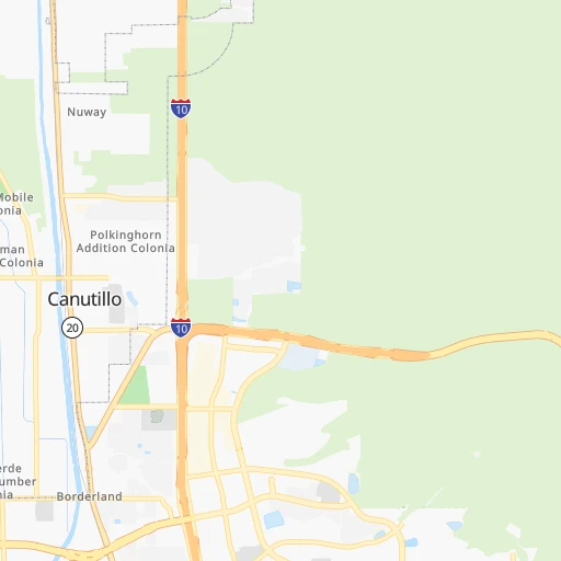

How to get from Canutillo (Texas) to Chaparral (New Mexico)
Calculate route from Canutillo (Texas, United States) to Chaparral (New Mexico, United States).
The flight distance (as the crow flies) between Canutillo and Chaparral is 23.8 km.
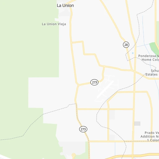
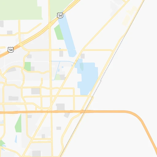
Roadmap (route) to go from Canutillo to Chaparral detailed above, you can also see the course layout on the map.
While doing trip Canutillo - Chaparral by car, the calculated route ends at a distance , or more straight.
Distance and duration of the route between Canutillo and Chaparral
Calculation of distance and route from Chaparral to Canutillo :
23.837.0 km1h33mn
Continue onto Doniphan Drive 0h0mn 371 mTurn left onto Talbot Avenue 0h1mn 1.3 kmTurn left onto Woodrow Bean Transmountain Drive 0h1mn 647 mKeep left onto Loop 375 0h13mn 16.2 kmKeep right and take US 54 toward Kenworthy Street 0h0mn 486 mKeep left and take US 54 East toward Kenworthy Street 0h0mn 42 mContinue onto Woodrow Bean Transmountain Drive 0h0mn 106 mTurn left onto Gateway North Boulevard 0h0mn 175 mKeep left 0h5mn 6.2 kmTurn left onto McCombs Street 0h9mn 8.5 kmTurn right onto Hermosa Drive 0h3mn 2.2 kmTurn left onto Prescott Anthony Drive 0h0mn 242 mContinue onto Prescott Anthony Drive 0h1mn 565 mArrive at destination 0h0mn 0 m
Travel from Canutillo (New Mexico) to a selection of major cities.
Distances from Canutillo to biggest cities in Texas
- Killeen,140,806 inhabitants.846 km
- McAllen,140,269 inhabitants.1,032 km
- Carrollton,133,168 inhabitants.919 km
- Midland,132,950 inhabitants.427 km
- Waco,132,356 inhabitants.896 km
- Denton,131,044 inhabitants.900 km
- Abilene,121,721 inhabitants.650 km
- Odessa,118,968 inhabitants.400 km
- Beaumont,118,129 inhabitants.1,209 km
- Round Rock,115,997 inhabitants.863 km
- Richardson,110,815 inhabitants.934 km
- Pearland,108,821 inhabitants.1,113 km
- College Station,107,889 inhabitants.987 km
- Wichita Falls,104,710 inhabitants.789 km
- Lewisville,104,039 inhabitants.911 km
- Tyler,103,700 inhabitants.1,066 km
- San Angelo,100,450 inhabitants.586 km
- Alief,98,725 inhabitants.1,080 km
- League City,98,312 inhabitants.1,133 km
- Allen,98,143 inhabitants.941 km
Other major cities in country :
- Memphis [TN], 655,770 inhabitants. 1,576 km
- New South Memphis [TN], 641,608 inhabitants. 1,574 km
- Portland [OR], 632,309 inhabitants. 2,053 km
- Oklahoma City [OK], 631,346 inhabitants. 929 km
- Las Vegas [NV], 623,747 inhabitants. 919 km
- Baltimore [MD], 621,849 inhabitants. 2,821 km
- Washington, D.C. [DC], 601,723 inhabitants. 2,779 km
- Milwaukee [WI], 600,155 inhabitants. 2,056 km
- South Boston [MA], 571,281 inhabitants. 3,333 km
- Albuquerque [NM], 559,121 inhabitants. 353 km
- Tucson [AZ], 531,641 inhabitants. 410 km
- Nashville [TN], 530,852 inhabitants. 1,885 km
- Fresno [CA], 520,052 inhabitants. 1,324 km
- Sacramento [CA], 490,712 inhabitants. 1,541 km
- Kansas City [MO], 475,378 inhabitants. 1,350 km
- Long Beach [CA], 474,140 inhabitants. 1,103 km
- Mesa [AZ], 471,825 inhabitants. 517 km
- Staten Island [NY], 468,730 inhabitants. 3,049 km
- Atlanta [GA], 463,878 inhabitants. 2,084 km
- Colorado Springs [CO], 456,568 inhabitants. 787 km
Route from Chaparral to major cities (United States).
- Distance Chaparral New York City3,039 km
- Distance Chaparral Los Angeles1,129 km
- Distance Chaparral Chicago1,987 km
- Distance Chaparral Brooklyn3,043 km
- Distance Chaparral Houston1,082 km
- Distance Chaparral Queens3,053 km
- Distance Chaparral Philadelphia2,930 km
- Distance Chaparral Phoenix556 km
- Distance Chaparral Manhattan3,044 km
- Distance Chaparral San Antonio809 km
- Distance Chaparral San Diego1,016 km
- Distance Chaparral The Bronx3,053 km
- Distance Chaparral Dallas904 km
- Distance Chaparral San Jose1,536 km
- Distance Chaparral Austin846 km
- Distance Chaparral Jacksonville2,358 km
- Distance Chaparral San Francisco1,595 km
- Distance Chaparral Columbus2,275 km
- Distance Chaparral Fort Worth856 km
- Distance Chaparral Indianapolis2,011 km
Nearest cities to Canutillo :
- El Paso, 681,124 inhabitants. 20 km
- Las Cruces, 101,643 inhabitants. 48 km
- Roswell, 48,544 inhabitants. 255 km
- Socorro, 33,222 inhabitants. 40 km
- Alamogordo, 30,753 inhabitants. 125 km
- Carlsbad, 28,957 inhabitants. 231 km
- Socorro Mission Number 1 Colonia, 28,637 inhabitants. 42 km
- Horizon City, 19,288 inhabitants. 44 km
- Douglas, 16,592 inhabitants. 286 km
- Sunland Park, 15,940 inhabitants. 13 km
- Los Lunas, 15,336 inhabitants. 322 km
- Chaparral, 14,631 inhabitants. 24 km
- Deming, 14,522 inhabitants. 116 km
- Artesia, 12,036 inhabitants. 231 km
- Silver City, 10,004 inhabitants. 185 km
- Anthony, 9,293 inhabitants. 10 km
- San Elizario, 8,999 inhabitants. 48 km
- Socorro, 8,722 inhabitants. 241 km
- Fort Bliss, 8,591 inhabitants. 21 km
- Fabens, 8,257 inhabitants. 62 km
- Ruidoso, 7,739 inhabitants. 180 km
- Homestead Meadows South, 7,247 inhabitants. 43 km
- Belen, 7,152 inhabitants. 307 km
- Canutillo, 6,321 inhabitants. 0 km
- Truth or Consequences, 6,079 inhabitants. 149 km
- Alpine, 5,952 inhabitants. 329 km
- Anthony, 5,517 inhabitants. 10 km
- Los Chavez, 5,446 inhabitants. 314 km
- Homestead Meadows North, 5,124 inhabitants. 41 km
- Eagar, 4,869 inhabitants. 351 km
- Rio Communities, 4,723 inhabitants. 305 km
- Meadow Lake, 4,708 inhabitants. 322 km
- El Cerro Mission, 4,657 inhabitants. 317 km
- Sparks, 4,529 inhabitants. 43 km
- Santa Teresa, 4,258 inhabitants. 7 km
- University Park, 4,192 inhabitants. 44 km
- Westway, 4,188 inhabitants. 6 km
- Presidio, 3,904 inhabitants. 338 km
- Bosque Farms, 3,838 inhabitants. 328 km
- Clifton, 3,685 inhabitants. 283 km
- Peralta, 3,585 inhabitants. 326 km
- Saint Johns, 3,480 inhabitants. 387 km
- Vado, 3,194 inhabitants. 23 km
- Holloman Air Force Base, 3,054 inhabitants. 114 km
- Agua Dulce, 3,014 inhabitants. 52 km
Location Canutillo (Texas) :
| Country flag |  |
| Location | Canutillo |
| State | Texas |
| County | El Paso County |
| Country | United States |
| Country code / ISO 2 | US |
| Latitude | 31.9114900 |
| Longitude | -106.6002700 |
| Altitude | 1150 meters |
| Time zone | America/Denver |
Location Chaparral (New Mexico) :
| Country flag | |
| Location | Chaparral |
| State | New Mexico |
| County | Doña Ana County |
| Country | United States |
| Country code / ISO 2 | US |
| Latitude | 32.0237600 |
| Longitude | -106.3856600 |
| Altitude | 1239 meters |
| Time zone | America/Denver |