


How to get from Tonopah Test Range (airport) (Nevada) to Dinuba (California)
Calculate route from Tonopah Test Range (airport) (Nevada, United States) to Dinuba (California, United States).
The flight distance (as the crow flies) between Tonopah Test Range (airport) and Dinuba is 269.5 km.
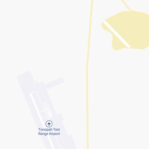
Roadmap (route) to go from Tonopah Test Range Airport to Dinuba detailed above, you can also see the course layout on the map.
While doing trip Tonopah Test Range (airport) - Dinuba by car, the calculated route ends at a distance , or more straight.
Distance and duration of the route between Tonopah Test Range (airport) and Dinuba
Calculation of distance and route from Dinuba to Tonopah Test Range (airport) :
269.5568.8 km11h42mn
Continue 0h1mn 646 mTurn right 0h2mn 525 mTurn left onto Moody Avenue 0h5mn 1.5 kmKeep left 0h2mn 470 mKeep left 0h1mn 262 mContinue onto Moody Avenue 0h19mn 6.4 kmTurn left 0h1mn 373 mKeep right 0h1mn 282 mKeep left 0h0mn 58 mKeep right 0h1mn 225 mKeep right 0h0mn 99 mKeep left 0h1mn 399 mTurn slight right 1h48mn 12.7 kmTurn sharp left 0h3mn 872 mTurn right 0h20mn 5.3 kmKeep left 0h24mn 6.4 kmKeep right 0h14mn 3.6 kmKeep right 0h6mn 1.5 kmKeep left 0h21mn 5.5 kmTurn right 0h8mn 2.2 kmTurn left onto Scott Drive 0h5mn 2.7 kmContinue onto Scott Drive 0h0mn 120 mTurn left onto Grand Army of the Republic Highway 0h7mn 10.1 kmKeep right onto US 6 1h40mn 65.5 kmTurn left onto Grand Army of the Republic Highway 1h59mn 65.3 kmTurn right onto Mono Mills Road 1h5mn 65.5 kmTurn sharp right onto Test Station Road 0h2mn 1.2 kmTurn left onto Test Station Road 0h12mn 6.1 kmTurn left onto Picnic Grounds Road 0h3mn 1.7 kmTurn right onto Highway 395 0h1mn 1.3 kmTurn left onto Tioga Road 2h31mn 94.2 kmTurn left onto Big Oak Flat Road 0h19mn 15.3 kmTurn left onto Northside Drive 0h4mn 2.9 kmKeep right onto Wawona Road 1h43mn 42.1 kmAt roundabout, take exit 1 onto Wawona Road 1h18mn 100.5 kmKeep right and take CA 99 South toward Bakersfield, Los Angeles 0h15mn 25.4 kmKeep right and drive toward Mountain View Avenue 0h0mn 351 mTurn left onto East Mountain View Avenue 0h16mn 18.6 kmTurn right onto North I Street 0h1mn 399 mTurn left onto East Tulare Street 0h0mn 25 mArrive at destination 0h0mn 0 m
Travel from Tonopah Test Range (airport) (California) to a selection of major cities.
Distances from Tonopah Test Range Airport to biggest cities in Nevada
Other major cities in country :
- Charlotte [NC], 827,097 inhabitants. 3,208 km
- Seattle [WA], 684,451 inhabitants. 1,182 km
- Denver [CO], 682,545 inhabitants. 1,046 km
- El Paso [TX], 681,124 inhabitants. 1,155 km
- Detroit [MI], 677,116 inhabitants. 2,898 km
- Boston [MA], 667,137 inhabitants. 3,880 km
- Memphis [TN], 655,770 inhabitants. 2,403 km
- New South Memphis [TN], 641,608 inhabitants. 2,404 km
- Portland [OR], 632,309 inhabitants. 990 km
- Oklahoma City [OK], 631,346 inhabitants. 1,737 km
- Baltimore [MD], 621,849 inhabitants. 3,472 km
- Washington, D.C. [DC], 601,723 inhabitants. 3,444 km
- Milwaukee [WI], 600,155 inhabitants. 2,502 km
- South Boston [MA], 571,281 inhabitants. 3,881 km
- Albuquerque [NM], 559,121 inhabitants. 955 km
- Tucson [AZ], 531,641 inhabitants. 818 km
- Nashville [TN], 530,852 inhabitants. 2,662 km
- Fresno [CA], 520,052 inhabitants. 290 km
- Sacramento [CA], 490,712 inhabitants. 422 km
- Kansas City [MO], 475,378 inhabitants. 1,936 km
Route from Dinuba to major cities (United States).
- Distance Dinuba New York City3,930 km
- Distance Dinuba Chicago2,784 km
- Distance Dinuba Brooklyn3,936 km
- Distance Dinuba Houston2,355 km
- Distance Dinuba Queens3,944 km
- Distance Dinuba Philadelphia3,845 km
- Distance Dinuba Phoenix750 km
- Distance Dinuba Manhattan3,932 km
- Distance Dinuba San Antonio2,100 km
- Distance Dinuba The Bronx3,939 km
- Distance Dinuba Dallas2,104 km
- Distance Dinuba Austin2,124 km
- Distance Dinuba Jacksonville3,549 km
- Distance Dinuba Columbus3,182 km
- Distance Dinuba Fort Worth2,060 km
- Distance Dinuba Indianapolis2,914 km
- Distance Dinuba Charlotte3,456 km
- Distance Dinuba Seattle1,255 km
- Distance Dinuba Denver1,309 km
- Distance Dinuba El Paso1,301 km
Nearest cities to Tonopah Test Range (airport) :
- Las Vegas, 623,747 inhabitants. 232 km
- Fresno, 520,052 inhabitants. 290 km
- Bakersfield, 373,640 inhabitants. 336 km
- Henderson, 285,667 inhabitants. 252 km
- North Las Vegas, 234,807 inhabitants. 231 km
- Paradise, 223,167 inhabitants. 238 km
- Sunrise Manor, 189,372 inhabitants. 232 km
- Spring Valley, 178,395 inhabitants. 232 km
- Visalia, 130,104 inhabitants. 276 km
- Enterprise, 108,481 inhabitants. 240 km
- Clovis, 104,180 inhabitants. 280 km
- Sparks, 96,094 inhabitants. 323 km
- Tulare, 62,315 inhabitants. 289 km
- Porterville, 56,058 inhabitants. 277 km
- Hanford, 55,659 inhabitants. 302 km
- Carson City, 54,521 inhabitants. 302 km
- Delano, 52,733 inhabitants. 315 km
- Bullhead City, 39,445 inhabitants. 355 km
- Whitney, 38,585 inhabitants. 244 km
- Pahrump, 36,441 inhabitants. 190 km
- Oildale, 32,684 inhabitants. 331 km
- Kingman, 28,912 inhabitants. 379 km
- Ridgecrest, 28,780 inhabitants. 254 km
- Winchester, 27,978 inhabitants. 237 km
- Wasco, 26,279 inhabitants. 335 km
- Reedley, 25,569 inhabitants. 272 km
- Sanger, 24,950 inhabitants. 274 km
- Selma, 24,414 inhabitants. 286 km
- Barstow Heights, 24,202 inhabitants. 326 km
- Summerlin South, 24,085 inhabitants. 227 km
- Dinuba, 23,702 inhabitants. 270 km
- Barstow, 23,692 inhabitants. 323 km
- Corcoran, 22,477 inhabitants. 311 km
- Arvin, 20,876 inhabitants. 341 km
- Fernley, 19,418 inhabitants. 295 km
- Sun Valley, 19,299 inhabitants. 329 km
- Shafter, 18,336 inhabitants. 339 km
- Rosamond, 18,150 inhabitants. 349 km
- Mesquite, 17,496 inhabitants. 264 km
- Boulder City, 15,551 inhabitants. 266 km
- Parlier, 15,138 inhabitants. 277 km
- Lamont, 15,120 inhabitants. 341 km
- Spanish Springs, 15,064 inhabitants. 328 km
- Rosedale, 14,058 inhabitants. 342 km
- McFarland, 13,985 inhabitants. 321 km
- California City, 13,277 inhabitants. 316 km
- Lindsay, 13,217 inhabitants. 271 km
- Tehachapi, 13,021 inhabitants. 332 km
- Spring Creek, 12,361 inhabitants. 342 km
- New Kingman-Butler, 12,134 inhabitants. 374 km
Location Tonopah Test Range (airport) (Nevada) :
| Country flag |  |
| Location | Tonopah Test Range (airport) |
| State | Nevada |
| County | Nye County |
| Country | United States |
| Country code / ISO 2 | US |
| Latitude | 37.7929900 |
| Longitude | -116.7786700 |
| Altitude | 1690 meters |
| Time zone | America/Los_Angeles |
Location Dinuba (California) :
| Country flag | |
| Location | Dinuba |
| State | California |
| County | Tulare County |
| Country | United States |
| Country code / ISO 2 | US |
| Latitude | 36.5432800 |
| Longitude | -119.3870700 |
| Altitude | 102 meters |
| Time zone | America/Los_Angeles |