


How to get from Smoky Valley Mine Landing Strip (Nevada) to Tulare (California)
Calculate route from Smoky Valley Mine Landing Strip (Nevada, United States) to Tulare (California, United States).
The flight distance (as the crow flies) between Smoky Valley Mine Landing Strip and Tulare is 343.8 km.
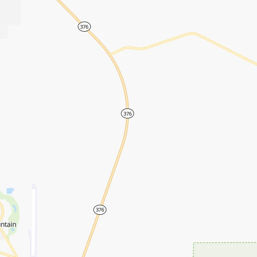
Roadmap (route) to go from Smoky Valley Mine Landing Strip to Tulare detailed above, you can also see the course layout on the map.
While doing trip Smoky Valley Mine Landing Strip - Tulare by car, the calculated route ends at a distance , or more straight.
Distance and duration of the route between Smoky Valley Mine Landing Strip and Tulare
Calculation of distance and route from Tulare to Smoky Valley Mine Landing Strip :
343.8629.6 km9h50mn
Continue 0h1mn 197 mTurn sharp right onto Jefferson Street 0h0mn 5 mTurn left 0h0mn 249 mTurn left onto Main Street 0h0mn 114 mTurn right onto Round Mountain Road 0h13mn 7.9 kmTurn left onto Tonopah-Austin Road 1h47mn 79.2 kmTurn right 0h6mn 8.6 kmKeep right onto US 6 1h40mn 65.5 kmTurn left onto Grand Army of the Republic Highway 1h59mn 65.3 kmTurn right onto Mono Mills Road 1h5mn 65.5 kmTurn sharp right onto Test Station Road 0h2mn 1.2 kmTurn left onto Test Station Road 0h12mn 6.1 kmTurn left onto Picnic Grounds Road 0h3mn 1.7 kmTurn right onto Highway 395 0h1mn 1.3 kmTurn left onto Tioga Road 2h31mn 94.2 kmTurn left onto Big Oak Flat Road 0h19mn 15.3 kmTurn left onto Northside Drive 0h4mn 2.9 kmKeep right onto Wawona Road 1h43mn 42.1 kmAt roundabout, take exit 1 onto Wawona Road 1h18mn 100.5 kmKeep right and take CA 99 South toward Bakersfield, Los Angeles 1h40mn 66.9 kmKeep right and drive toward M Street, Cartmill Avenue 0h0mn 538 mTurn right onto East Cartmill Avenue 0h0mn 218 mTurn left onto M Street 0h4mn 3.7 kmTurn right onto East Tulare Avenue 0h0mn 364 mTurn left onto South J Street 0h0mn 16 mArrive at destination 0h0mn 0 m
Travel from Smoky Valley Mine Landing Strip (California) to a selection of major cities.
Distances from Smoky Valley Mine Landing Strip to biggest cities in Nevada
Other major cities in country :
- Charlotte [NC], 827,097 inhabitants. 3,223 km
- Seattle [WA], 684,451 inhabitants. 1,078 km
- Denver [CO], 682,545 inhabitants. 1,047 km
- El Paso [TX], 681,124 inhabitants. 1,233 km
- Detroit [MI], 677,116 inhabitants. 2,887 km
- Boston [MA], 667,137 inhabitants. 3,865 km
- Memphis [TN], 655,770 inhabitants. 2,427 km
- New South Memphis [TN], 641,608 inhabitants. 2,428 km
- Portland [OR], 632,309 inhabitants. 888 km
- Oklahoma City [OK], 631,346 inhabitants. 1,769 km
- Baltimore [MD], 621,849 inhabitants. 3,470 km
- Washington, D.C. [DC], 601,723 inhabitants. 3,444 km
- Milwaukee [WI], 600,155 inhabitants. 2,488 km
- South Boston [MA], 571,281 inhabitants. 3,867 km
- Albuquerque [NM], 559,121 inhabitants. 1,010 km
- Tucson [AZ], 531,641 inhabitants. 911 km
- Nashville [TN], 530,852 inhabitants. 2,679 km
- Fresno [CA], 520,052 inhabitants. 324 km
- Sacramento [CA], 490,712 inhabitants. 386 km
- Kansas City [MO], 475,378 inhabitants. 1,943 km
Route from Tulare to major cities (United States).
- Distance Tulare New York City3,940 km
- Distance Tulare Chicago2,795 km
- Distance Tulare Brooklyn3,946 km
- Distance Tulare Houston2,344 km
- Distance Tulare Queens3,955 km
- Distance Tulare Philadelphia3,854 km
- Distance Tulare Phoenix732 km
- Distance Tulare Manhattan3,942 km
- Distance Tulare San Antonio2,087 km
- Distance Tulare The Bronx3,950 km
- Distance Tulare Dallas2,098 km
- Distance Tulare Austin2,112 km
- Distance Tulare Jacksonville3,546 km
- Distance Tulare Columbus3,190 km
- Distance Tulare Fort Worth2,054 km
- Distance Tulare Indianapolis2,922 km
- Distance Tulare Charlotte3,459 km
- Distance Tulare Seattle1,292 km
- Distance Tulare Denver1,319 km
- Distance Tulare El Paso1,285 km
Nearest cities to Smoky Valley Mine Landing Strip :
- Las Vegas, 623,747 inhabitants. 330 km
- Fresno, 520,052 inhabitants. 324 km
- Henderson, 285,667 inhabitants. 350 km
- Reno, 241,445 inhabitants. 255 km
- North Las Vegas, 234,807 inhabitants. 328 km
- Paradise, 223,167 inhabitants. 337 km
- Sunrise Manor, 189,372 inhabitants. 329 km
- Spring Valley, 178,395 inhabitants. 331 km
- Visalia, 130,104 inhabitants. 330 km
- Enterprise, 108,481 inhabitants. 340 km
- Clovis, 104,180 inhabitants. 313 km
- Sparks, 96,094 inhabitants. 250 km
- Tulare, 62,315 inhabitants. 344 km
- Porterville, 56,058 inhabitants. 342 km
- Hanford, 55,659 inhabitants. 350 km
- Carson City, 54,521 inhabitants. 240 km
- Delano, 52,733 inhabitants. 381 km
- Whitney, 38,585 inhabitants. 342 km
- Pahrump, 36,441 inhabitants. 295 km
- Winchester, 27,978 inhabitants. 335 km
- Lemoore, 25,647 inhabitants. 360 km
- Reedley, 25,569 inhabitants. 316 km
- Sanger, 24,950 inhabitants. 313 km
- Selma, 24,414 inhabitants. 328 km
- Summerlin South, 24,085 inhabitants. 327 km
- Dinuba, 23,702 inhabitants. 317 km
- Corcoran, 22,477 inhabitants. 366 km
- South Lake Tahoe, 21,706 inhabitants. 255 km
- Elko, 20,279 inhabitants. 261 km
- Fernley, 19,418 inhabitants. 214 km
- Sun Valley, 19,299 inhabitants. 254 km
- Mesquite, 17,496 inhabitants. 338 km
- Boulder City, 15,551 inhabitants. 363 km
- Parlier, 15,138 inhabitants. 319 km
- Spanish Springs, 15,064 inhabitants. 251 km
- Lindsay, 13,217 inhabitants. 332 km
- Spring Creek, 12,361 inhabitants. 257 km
- Kingsburg, 11,824 inhabitants. 329 km
- Gardnerville Ranchos, 11,312 inhabitants. 233 km
- Farmersville, 10,774 inhabitants. 329 km
- Exeter, 10,548 inhabitants. 326 km
- Orange Cove, 9,598 inhabitants. 306 km
- Dayton, 8,964 inhabitants. 227 km
- Incline Village, 8,777 inhabitants. 259 km
- Orosi, 8,770 inhabitants. 311 km
- Bonadelle Ranchos-Madera Ranchos, 8,569 inhabitants. 313 km
- Cold Springs, 8,544 inhabitants. 274 km
- Earlimart, 8,537 inhabitants. 371 km
- Fallon, 8,458 inhabitants. 171 km
- Mammoth Lakes, 7,946 inhabitants. 205 km
Location Smoky Valley Mine Landing Strip (Nevada) :
| Country flag |  |
| Location | Smoky Valley Mine Landing Strip |
| State | Nevada |
| County | Nye County |
| Country | United States |
| Country code / ISO 2 | US |
| Latitude | 38.7124300 |
| Longitude | -117.0592500 |
| Altitude | 1983 meters |
| Time zone | America/Los_Angeles |
Location Tulare (California) :
| Country flag | |
| Location | Tulare |
| State | California |
| County | Tulare County |
| Country | United States |
| Country code / ISO 2 | US |
| Latitude | 36.2077300 |
| Longitude | -119.3473400 |
| Altitude | 88 meters |
| Time zone | America/Los_Angeles |


