


How to get from Eureka Ranch (airport) (New Mexico) to Española (New Mexico)
Calculate route from Eureka Ranch (airport) (New Mexico, United States) to Española (New Mexico, United States).
The flight distance (as the crow flies) between Eureka Ranch (airport) and Española is 140.2 km.
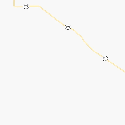
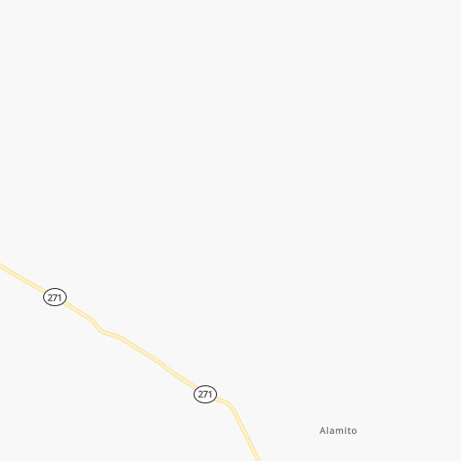
Roadmap (route) to go from Eureka Ranch Airport to Española detailed above, you can also see the course layout on the map.
While doing trip Eureka Ranch (airport) - Española by car, the calculated route ends at a distance , or more straight.
Distance and duration of the route between Eureka Ranch (airport) and Española
Calculation of distance and route from Española to Eureka Ranch (airport) :
140.2244.3 km3h3mn
Continue 0h3mn 1.3 kmTurn sharp right 0h1mn 656 mKeep left 0h7mn 3.7 kmTurn left 0h1mn 353 mTurn right 0h13mn 6.4 kmTurn right 0h0mn 41 mTurn left 0h0mn 97 mKeep left 0h8mn 4.0 kmKeep right 0h2mn 754 mTurn left onto NM 271 0h18mn 11.9 kmTurn left onto Bond Street 0h0mn 110 mTurn right onto Railroad Avenue 0h1mn 726 mTurn left onto Park Street 0h0mn 374 mTurn left 2h33mn 166.7 kmKeep right and take NM 466 toward Old Pecos Trail 0h0mn 299 mKeep right 0h2mn 2.0 kmKeep left onto Saint Michaels Drive 0h1mn 1.6 kmKeep right and take US 84, US 285 toward Espanola, Taos 1h32mn 42.1 kmKeep left onto Paseo de Onate 0h1mn 1.2 kmArrive at destination 0h0mn 0 m
Travel from Eureka Ranch (airport) (New Mexico) to a selection of major cities.
Distances from Eureka Ranch Airport to biggest cities in New Mexico
Other major cities in country :
- Charlotte [NC], 827,097 inhabitants. 2,142 km
- Seattle [WA], 684,451 inhabitants. 1,968 km
- Denver [CO], 682,545 inhabitants. 438 km
- El Paso [TX], 681,124 inhabitants. 487 km
- Detroit [MI], 677,116 inhabitants. 1,987 km
- Boston [MA], 667,137 inhabitants. 2,962 km
- Memphis [TN], 655,770 inhabitants. 1,314 km
- New South Memphis [TN], 641,608 inhabitants. 1,314 km
- Portland [OR], 632,309 inhabitants. 1,867 km
- Oklahoma City [OK], 631,346 inhabitants. 636 km
- Las Vegas [NV], 623,747 inhabitants. 955 km
- Baltimore [MD], 621,849 inhabitants. 2,484 km
- Washington, D.C. [DC], 601,723 inhabitants. 2,448 km
- Milwaukee [WI], 600,155 inhabitants. 1,636 km
- South Boston [MA], 571,281 inhabitants. 2,962 km
- Tucson [AZ], 531,641 inhabitants. 713 km
- Nashville [TN], 530,852 inhabitants. 1,597 km
- Fresno [CA], 520,052 inhabitants. 1,370 km
- Sacramento [CA], 490,712 inhabitants. 1,532 km
- Kansas City [MO], 475,378 inhabitants. 952 km
Route from Española to major cities (United States).
- Distance Española New York City2,833 km
- Distance Española Los Angeles1,129 km
- Distance Española Chicago1,720 km
- Distance Española Brooklyn2,837 km
- Distance Española Houston1,217 km
- Distance Española Queens2,847 km
- Distance Española Philadelphia2,735 km
- Distance Española Phoenix617 km
- Distance Española Manhattan2,836 km
- Distance Española San Antonio1,019 km
- Distance Española San Diego1,081 km
- Distance Española The Bronx2,844 km
- Distance Española Dallas923 km
- Distance Española San Jose1,418 km
- Distance Española Austin1,004 km
- Distance Española Jacksonville2,355 km
- Distance Española San Francisco1,466 km
- Distance Española Columbus2,067 km
- Distance Española Fort Worth883 km
- Distance Española Indianapolis1,796 km
Nearest cities to Eureka Ranch (airport) :
- Albuquerque, 559,121 inhabitants. 209 km
- Lubbock, 249,042 inhabitants. 350 km
- Amarillo, 198,645 inhabitants. 254 km
- Pueblo, 109,412 inhabitants. 271 km
- Enchanted Hills, 87,521 inhabitants. 194 km
- Rio Rancho, 87,521 inhabitants. 204 km
- Santa Fe, 84,099 inhabitants. 128 km
- Roswell, 48,544 inhabitants. 270 km
- South Valley, 40,976 inhabitants. 214 km
- Clovis, 39,480 inhabitants. 199 km
- Security-Widefield, 32,882 inhabitants. 326 km
- Alamogordo, 30,753 inhabitants. 351 km
- Pueblo West, 29,637 inhabitants. 282 km
- Fountain, 27,767 inhabitants. 318 km
- Plainview, 20,919 inhabitants. 316 km
- Canon City, 16,400 inhabitants. 298 km
- Los Lunas, 15,336 inhabitants. 229 km
- Hereford, 15,021 inhabitants. 224 km
- Dumas, 15,001 inhabitants. 231 km
- Canyon, 14,887 inhabitants. 255 km
- Levelland, 13,914 inhabitants. 318 km
- Fort Carson, 13,813 inhabitants. 325 km
- Las Vegas, 13,386 inhabitants. 67 km
- Artesia, 12,036 inhabitants. 332 km
- Los Alamos, 12,019 inhabitants. 160 km
- Portales, 11,995 inhabitants. 213 km
- Lovington, 11,800 inhabitants. 339 km
- North Valley, 11,333 inhabitants. 203 km
- Espanola, 10,224 inhabitants. 140 km
- Alamosa, 9,819 inhabitants. 218 km
- Brownfield, 9,736 inhabitants. 360 km
- Bernalillo, 8,843 inhabitants. 192 km
- Socorro, 8,722 inhabitants. 291 km
- Corrales, 8,502 inhabitants. 199 km
- Dalhart, 8,370 inhabitants. 184 km
- Trinidad, 8,153 inhabitants. 150 km
- Ruidoso, 7,739 inhabitants. 296 km
- Lamar, 7,555 inhabitants. 304 km
- Belen, 7,152 inhabitants. 241 km
- La Junta, 6,951 inhabitants. 256 km
- Stratmoor, 6,900 inhabitants. 329 km
- Raton, 6,187 inhabitants. 120 km
- Eldorado at Santa Fe, 6,130 inhabitants. 131 km
- Littlefield, 6,090 inhabitants. 293 km
- Truth or Consequences, 6,079 inhabitants. 390 km
- Gunnison, 6,076 inhabitants. 370 km
- Slaton, 6,072 inhabitants. 375 km
- Los Ranchos de Albuquerque, 6,063 inhabitants. 205 km
- Lee Acres, 5,858 inhabitants. 206 km
- Taos, 5,740 inhabitants. 114 km
Location Eureka Ranch (airport) (New Mexico) :
| Country flag |  |
| Location | Eureka Ranch (airport) |
| State | New Mexico |
| County | Mora County |
| Country | United States |
| Country code / ISO 2 | US |
| Latitude | 35.8242100 |
| Longitude | -104.5363700 |
| Altitude | 1748 meters |
| Time zone | America/Denver |
Location Española (New Mexico) :
| Country flag | |
| Location | Española |
| State | New Mexico |
| County | Rio Arriba County |
| Country | United States |
| Country code / ISO 2 | US |
| Latitude | 35.9911300 |
| Longitude | -106.0805800 |
| Altitude | 1705 meters |
| Time zone | America/Denver |

