

Home
››
Happy Canyon Aero Ranch Airport
››
Roadmap from Happy Canyon Aero Ranch Airport to Pueblo West
How to get from Happy Canyon Aero Ranch (airport) (Colorado) to Pueblo West (Colorado)
Calculate route from Happy Canyon Aero Ranch (airport) (Colorado, United States) to Pueblo West (Colorado, United States).
The flight distance (as the crow flies) between Happy Canyon Aero Ranch (airport) and Pueblo West is 276.9 km.
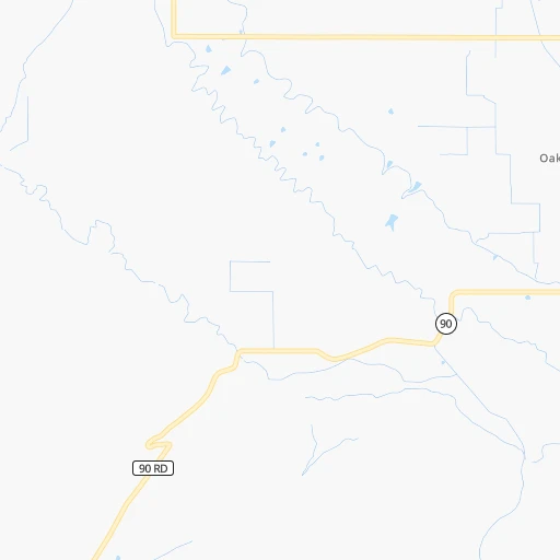
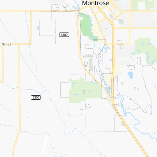
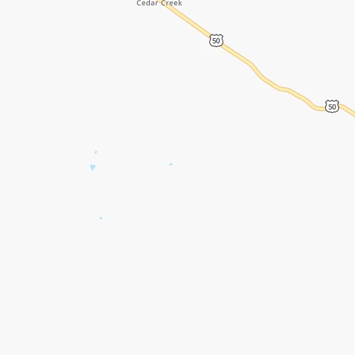
Roadmap (route) to go from Happy Canyon Aero Ranch Airport to Pueblo West detailed above, you can also see the course layout on the map.
While doing trip Happy Canyon Aero Ranch (airport) - Pueblo West by car, the calculated route ends at a distance , or more straight.
Distance and duration of the route between Happy Canyon Aero Ranch (airport) and Pueblo West
Calculation of distance and route from Pueblo West to Happy Canyon Aero Ranch (airport) :
276.9395.5 km6h47mn
Continue onto 6300 Road 0h4mn 2.0 kmTurn right onto Pearl Road 0h0mn 194 mTurn left onto 6300 Road 0h6mn 2.8 kmTurn left onto Oak Grove Road 0h1mn 401 mTurn right onto Highway 90 0h2mn 1.6 kmTurn right onto Spring Creek Road 1h51mn 61.5 kmTurn right onto Blue Mesa Road 1h54mn 27.1 kmTurn left onto Silver Thread Scenic Byway 1h31mn 39.5 kmTurn right onto US 50 1h23mn 111.4 kmTurn left onto West Highway 50 1h23mn 103.4 kmTurn right onto Royal Gorge Boulevard 0h26mn 40.5 kmTurn left onto North McCulloch Boulevard 0h4mn 3.9 kmTurn left onto North Matt Drive 0h1mn 518 mTurn left onto East Abeyta Drive 0h1mn 580 mArrive at destination 0h0mn 0 m
Travel from Happy Canyon Aero Ranch (airport) (Colorado) to a selection of major cities.
Distances from Happy Canyon Aero Ranch Airport to biggest cities in Colorado
- Littleton,46,368 inhabitants.283 km
- Southglenn,42,268 inhabitants.286 km
- Northglenn,39,197 inhabitants.300 km
- Brighton,37,585 inhabitants.318 km
- Englewood,33,082 inhabitants.287 km
- Security-Widefield,32,882 inhabitants.280 km
- Ken Caryl,32,438 inhabitants.274 km
- Wheat Ridge,31,192 inhabitants.287 km
- Pueblo West,29,637 inhabitants.277 km
- Fountain,27,767 inhabitants.280 km
- Lafayette,27,729 inhabitants.299 km
- Castlewood,25,271 inhabitants.290 km
- Columbine,24,280 inhabitants.277 km
- Windsor,21,751 inhabitants.345 km
- Erie,21,420 inhabitants.306 km
- Evans,21,383 inhabitants.352 km
- Louisville,20,396 inhabitants.295 km
- Golden,20,330 inhabitants.275 km
Other major cities in country :
- Charlotte [NC], 827,097 inhabitants. 2,428 km
- Seattle [WA], 684,451 inhabitants. 1,553 km
- El Paso [TX], 681,124 inhabitants. 752 km
- Detroit [MI], 677,116 inhabitants. 2,144 km
- Boston [MA], 667,137 inhabitants. 3,130 km
- Memphis [TN], 655,770 inhabitants. 1,630 km
- New South Memphis [TN], 641,608 inhabitants. 1,631 km
- Portland [OR], 632,309 inhabitants. 1,453 km
- Oklahoma City [OK], 631,346 inhabitants. 980 km
- Las Vegas [NV], 623,747 inhabitants. 687 km
- Baltimore [MD], 621,849 inhabitants. 2,701 km
- Washington, D.C. [DC], 601,723 inhabitants. 2,671 km
- Milwaukee [WI], 600,155 inhabitants. 1,759 km
- South Boston [MA], 571,281 inhabitants. 3,131 km
- Albuquerque [NM], 559,121 inhabitants. 387 km
- Tucson [AZ], 531,641 inhabitants. 742 km
- Nashville [TN], 530,852 inhabitants. 1,883 km
- Fresno [CA], 520,052 inhabitants. 1,063 km
- Sacramento [CA], 490,712 inhabitants. 1,183 km
- Kansas City [MO], 475,378 inhabitants. 1,158 km
Route from Pueblo West to major cities (United States).
- Distance Pueblo West New York City2,637 km
- Distance Pueblo West Los Angeles1,304 km
- Distance Pueblo West Chicago1,502 km
- Distance Pueblo West Brooklyn2,642 km
- Distance Pueblo West Houston1,286 km
- Distance Pueblo West Queens2,651 km
- Distance Pueblo West Philadelphia2,546 km
- Distance Pueblo West Phoenix858 km
- Distance Pueblo West Manhattan2,640 km
- Distance Pueblo West San Antonio1,148 km
- Distance Pueblo West San Diego1,288 km
- Distance Pueblo West The Bronx2,647 km
- Distance Pueblo West Dallas947 km
- Distance Pueblo West San Jose1,512 km
- Distance Pueblo West Austin1,104 km
- Distance Pueblo West Jacksonville2,292 km
- Distance Pueblo West San Francisco1,550 km
- Distance Pueblo West Columbus1,879 km
- Distance Pueblo West Fort Worth917 km
- Distance Pueblo West Indianapolis1,610 km
Nearest cities to Happy Canyon Aero Ranch (airport) :
- Denver, 682,545 inhabitants. 292 km
- Fort Collins, 161,175 inhabitants. 342 km
- Lakewood, 152,597 inhabitants. 283 km
- Thornton, 133,451 inhabitants. 300 km
- Arvada, 115,368 inhabitants. 288 km
- Westminster, 113,130 inhabitants. 294 km
- Boulder, 107,349 inhabitants. 288 km
- Highlands Ranch, 96,713 inhabitants. 284 km
- Longmont, 92,088 inhabitants. 310 km
- Santa Fe, 84,099 inhabitants. 350 km
- Loveland, 75,182 inhabitants. 328 km
- Broomfield, 65,065 inhabitants. 295 km
- Grand Junction, 60,358 inhabitants. 92 km
- Commerce City, 53,696 inhabitants. 299 km
- Littleton, 46,368 inhabitants. 283 km
- Farmington, 42,871 inhabitants. 190 km
- Southglenn, 42,268 inhabitants. 286 km
- Northglenn, 39,197 inhabitants. 300 km
- Englewood, 33,082 inhabitants. 287 km
- Ken Caryl, 32,438 inhabitants. 274 km
- Laramie, 32,158 inhabitants. 378 km
- Wheat Ridge, 31,192 inhabitants. 287 km
- Lafayette, 27,729 inhabitants. 299 km
- Columbine, 24,280 inhabitants. 277 km
- Gallup, 23,240 inhabitants. 330 km
- Windsor, 21,751 inhabitants. 345 km
- Erie, 21,420 inhabitants. 306 km
- Louisville, 20,396 inhabitants. 295 km
- Golden, 20,330 inhabitants. 275 km
- Clifton, 19,889 inhabitants. 89 km
- Montrose, 19,062 inhabitants. 7 km
- Sherrelwood, 18,287 inhabitants. 296 km
- Durango, 18,006 inhabitants. 127 km
- Canon City, 16,400 inhabitants. 232 km
- Greenwood Village, 15,663 inhabitants. 288 km
- Johnstown, 14,896 inhabitants. 334 km
- Welby, 14,846 inhabitants. 299 km
- Las Vegas, 13,386 inhabitants. 394 km
- Superior, 12,980 inhabitants. 291 km
- Fruita, 12,795 inhabitants. 110 km
- Steamboat Springs, 12,435 inhabitants. 248 km
- Federal Heights, 12,381 inhabitants. 297 km
- Los Alamos, 12,019 inhabitants. 315 km
- Firestone, 11,999 inhabitants. 318 km
- Frederick, 11,413 inhabitants. 317 km
- Berkley, 11,207 inhabitants. 292 km
- Vernal, 11,200 inhabitants. 267 km
- Edwards, 10,266 inhabitants. 177 km
- Espanola, 10,224 inhabitants. 315 km
- Glenwood Springs, 9,906 inhabitants. 136 km
Location Happy Canyon Aero Ranch (airport) (Colorado) :
| Country flag |  |
| Location | Happy Canyon Aero Ranch (airport) |
| State | Colorado |
| County | Montrose County |
| Country | United States |
| Country code / ISO 2 | US |
| Latitude | 38.4163800 |
| Longitude | -107.9011700 |
| Altitude | 1885 meters |
| Time zone | America/Denver |
Location Pueblo West (Colorado) :
| Country flag | |
| Location | Pueblo West |
| State | Colorado |
| County | Pueblo County |
| Country | United States |
| Country code / ISO 2 | US |
| Latitude | 38.3500000 |
| Longitude | -104.7227500 |
| Altitude | 1544 meters |
| Time zone | America/Denver |
