
How to get from Garfield County Regional (airport) (Colorado) to Fruita (Colorado)
Calculate route from Garfield County Regional (airport) (Colorado, United States) to Fruita (Colorado, United States).
The flight distance (as the crow flies) between Garfield County Regional (airport) and Fruita is 95.3 km.
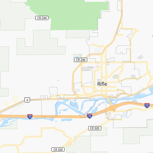
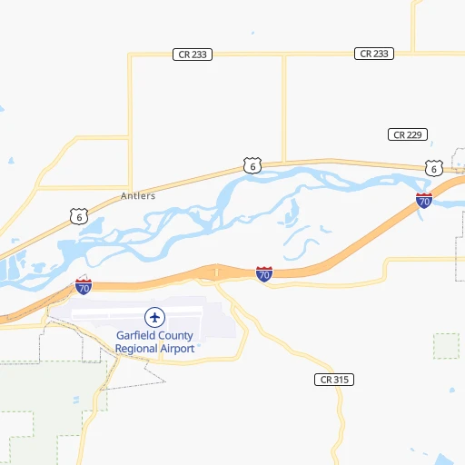
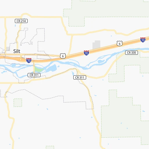
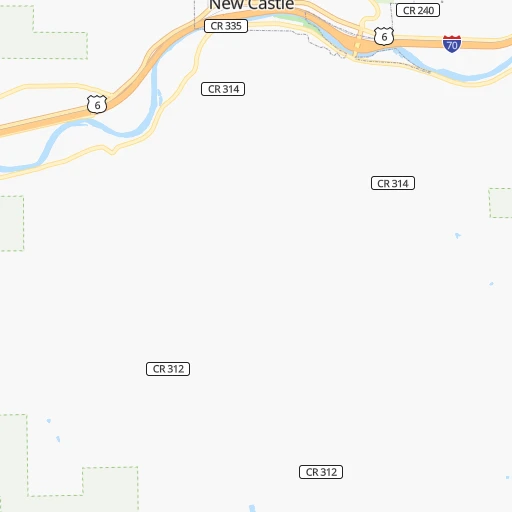
Roadmap (route) to go from Garfield County Regional Airport to Fruita detailed above, you can also see the course layout on the map.
While doing trip Garfield County Regional (airport) - Fruita by car, the calculated route ends at a distance , or more straight.
Distance and duration of the route between Garfield County Regional (airport) and Fruita
Calculation of distance and route from Fruita to Garfield County Regional (airport) :
95.3119.6 km1h15mn
Continue onto Runway Road 0h0mn 61 mTurn left onto Runway Road 0h1mn 244 mContinue 0h0mn 391 mTurn right onto Airport Road 0h5mn 4.7 kmAt roundabout, take exit 1 onto Taughenbaugh Boulevard 0h0mn 75 mAt roundabout, take exit 2 onto State Highway 13 0h0mn 204 mTurn left 1h0mn 104.1 kmKeep right and take US 6, US 50, I 70 Business toward Grand_Junction 0h0mn 461 mKeep right toward US 6, US 50, I 70 Business 0h7mn 8.7 kmTurn right onto South Maple Street 0h1mn 577 mArrive at destination 0h0mn 0 m
Travel from Garfield County Regional (airport) (Colorado) to a selection of major cities.
Distances from Garfield County Regional Airport to biggest cities in Colorado
- Littleton,46,368 inhabitants.233 km
- Southglenn,42,268 inhabitants.238 km
- Northglenn,39,197 inhabitants.238 km
- Brighton,37,585 inhabitants.254 km
- Englewood,33,082 inhabitants.235 km
- Security-Widefield,32,882 inhabitants.274 km
- Ken Caryl,32,438 inhabitants.225 km
- Wheat Ridge,31,192 inhabitants.229 km
- Pueblo West,29,637 inhabitants.291 km
- Fountain,27,767 inhabitants.278 km
- Lafayette,27,729 inhabitants.232 km
- Castlewood,25,271 inhabitants.243 km
- Columbine,24,280 inhabitants.228 km
- Windsor,21,751 inhabitants.263 km
- Erie,21,420 inhabitants.236 km
- Evans,21,383 inhabitants.276 km
- Louisville,20,396 inhabitants.228 km
- Golden,20,330 inhabitants.216 km
Other major cities in country :
- Charlotte [NC], 827,097 inhabitants. 2,416 km
- Seattle [WA], 684,451 inhabitants. 1,478 km
- El Paso [TX], 681,124 inhabitants. 872 km
- Detroit [MI], 677,116 inhabitants. 2,092 km
- Boston [MA], 667,137 inhabitants. 3,075 km
- Memphis [TN], 655,770 inhabitants. 1,636 km
- New South Memphis [TN], 641,608 inhabitants. 1,638 km
- Portland [OR], 632,309 inhabitants. 1,393 km
- Oklahoma City [OK], 631,346 inhabitants. 1,008 km
- Las Vegas [NV], 623,747 inhabitants. 750 km
- Baltimore [MD], 621,849 inhabitants. 2,663 km
- Washington, D.C. [DC], 601,723 inhabitants. 2,635 km
- Milwaukee [WI], 600,155 inhabitants. 1,699 km
- South Boston [MA], 571,281 inhabitants. 3,077 km
- Albuquerque [NM], 559,121 inhabitants. 504 km
- Tucson [AZ], 531,641 inhabitants. 863 km
- Nashville [TN], 530,852 inhabitants. 1,874 km
- Fresno [CA], 520,052 inhabitants. 1,098 km
- Sacramento [CA], 490,712 inhabitants. 1,194 km
- Kansas City [MO], 475,378 inhabitants. 1,132 km
Route from Fruita to major cities (United States).
- Distance Fruita New York City2,950 km
- Distance Fruita Los Angeles1,022 km
- Distance Fruita Chicago1,804 km
- Distance Fruita Brooklyn2,955 km
- Distance Fruita Houston1,609 km
- Distance Fruita Queens2,964 km
- Distance Fruita Philadelphia2,865 km
- Distance Fruita Phoenix703 km
- Distance Fruita Manhattan2,952 km
- Distance Fruita San Antonio1,433 km
- Distance Fruita San Diego1,044 km
- Distance Fruita The Bronx2,959 km
- Distance Fruita Dallas1,286 km
- Distance Fruita San Jose1,168 km
- Distance Fruita Austin1,409 km
- Distance Fruita Jacksonville2,652 km
- Distance Fruita San Francisco1,202 km
- Distance Fruita Columbus2,202 km
- Distance Fruita Fort Worth1,251 km
- Distance Fruita Indianapolis1,936 km
Nearest cities to Garfield County Regional (airport) :
- Denver, 682,545 inhabitants. 236 km
- Colorado Springs, 456,568 inhabitants. 262 km
- Aurora, 359,407 inhabitants. 249 km
- Fort Collins, 161,175 inhabitants. 254 km
- Lakewood, 152,597 inhabitants. 228 km
- Thornton, 133,451 inhabitants. 239 km
- Arvada, 115,368 inhabitants. 228 km
- Westminster, 113,130 inhabitants. 233 km
- Centennial, 109,741 inhabitants. 245 km
- Boulder, 107,349 inhabitants. 217 km
- Highlands Ranch, 96,713 inhabitants. 237 km
- Longmont, 92,088 inhabitants. 235 km
- Loveland, 75,182 inhabitants. 246 km
- Broomfield, 65,065 inhabitants. 230 km
- Cheyenne, 63,335 inhabitants. 305 km
- Grand Junction, 60,358 inhabitants. 88 km
- Castle Rock, 55,591 inhabitants. 247 km
- Commerce City, 53,696 inhabitants. 241 km
- Parker, 49,550 inhabitants. 255 km
- Littleton, 46,368 inhabitants. 233 km
- Farmington, 42,871 inhabitants. 314 km
- Southglenn, 42,268 inhabitants. 238 km
- Northglenn, 39,197 inhabitants. 238 km
- Brighton, 37,585 inhabitants. 254 km
- Englewood, 33,082 inhabitants. 235 km
- Ken Caryl, 32,438 inhabitants. 225 km
- Laramie, 32,158 inhabitants. 269 km
- Wheat Ridge, 31,192 inhabitants. 229 km
- Lafayette, 27,729 inhabitants. 232 km
- Castlewood, 25,271 inhabitants. 243 km
- Columbine, 24,280 inhabitants. 228 km
- Rock Springs, 23,962 inhabitants. 261 km
- Windsor, 21,751 inhabitants. 263 km
- Erie, 21,420 inhabitants. 236 km
- Louisville, 20,396 inhabitants. 228 km
- Golden, 20,330 inhabitants. 216 km
- Clifton, 19,889 inhabitants. 79 km
- Montrose, 19,062 inhabitants. 117 km
- Sherrelwood, 18,287 inhabitants. 236 km
- Durango, 18,006 inhabitants. 251 km
- Canon City, 16,400 inhabitants. 247 km
- Greenwood Village, 15,663 inhabitants. 238 km
- Johnstown, 14,896 inhabitants. 257 km
- Welby, 14,846 inhabitants. 240 km
- Fort Carson, 13,813 inhabitants. 268 km
- Lone Tree, 13,175 inhabitants. 244 km
- Superior, 12,980 inhabitants. 224 km
- Fruita, 12,795 inhabitants. 95 km
- Green River, 12,465 inhabitants. 267 km
- Steamboat Springs, 12,435 inhabitants. 131 km
Location Garfield County Regional (airport) (Colorado) :
| Country flag |  |
| Location | Garfield County Regional (airport) |
| State | Colorado |
| County | Garfield County |
| Country | United States |
| Country code / ISO 2 | US |
| Latitude | 39.5260900 |
| Longitude | -107.7272800 |
| Altitude | 1679 meters |
| Time zone | America/Denver |
Location Fruita (Colorado) :
| Country flag | |
| Location | Fruita |
| State | Colorado |
| County | Mesa County |
| Country | United States |
| Country code / ISO 2 | US |
| Latitude | 39.1588700 |
| Longitude | -108.7289900 |
| Altitude | 1376 meters |
| Time zone | America/Denver |
