


How to get from Stantsiya Kubanskaya (Krasnodarskiy) to Primorsko-Akhtarsk (Krasnodarskiy)
Calculate route from Stantsiya Kubanskaya (Krasnodarskiy, Russia) to Primorsko-Akhtarsk (Krasnodarskiy, Russia).
The flight distance (as the crow flies) between Stantsiya Kubanskaya and Primorsko-Akhtarsk is 241.1 km.
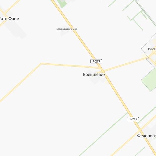
Roadmap (route) to go from Stantsiya Kubanskaya to Primorsko-Akhtarsk detailed above, you can also see the course layout on the map.
While doing trip Stantsiya Kubanskaya - Primorsko-Akhtarsk by car, the calculated route ends at a distance , or more straight.
Distance and duration of the route between Stantsiya Kubanskaya and Primorsko-Akhtarsk
Calculation of distance and route from Primorsko-Akhtarsk to Stantsiya Kubanskaya :
241.1282.4 km4h7mn
Continue 0h0mn 74 mTurn sharp left 0h0mn 70 mTurn right onto Привокзальная улица 0h1mn 355 mTurn right onto улица Добролюбова 0h0mn 158 mTurn left onto улица Островского 0h1mn 263 mTurn right onto Красная улица 0h2mn 1.7 kmTurn right 0h2mn 2.1 kmKeep right and take Р-217 toward Москва, Новороссийск 0h0mn 82 mTurn slight right onto «Кавказ» 1h30mn 41.1 kmAt roundabout, take exit 4 onto Новоукраинское кольцо 0h19mn 21.9 kmTurn right onto улица Якубина 0h6mn 5.4 kmTurn right onto Школьный переулок 0h4mn 3.3 kmTurn slight left onto Красная улица 0h0mn 108 mKeep right onto Красная улица 0h0mn 62 mKeep right onto улица Будённого 0h3mn 2.5 kmTurn left onto Горовая улица 0h2mn 1.2 kmTurn right onto Переездная улица 0h1mn 465 mAt roundabout, take exit 2 onto Переездная улица 0h1mn 748 mTurn left onto 03К-039 0h3mn 3.2 kmTurn left onto 03К-002 0h15mn 18.9 kmTurn right onto 03Н-535 0h15mn 18.4 kmTurn left onto 03К-021 0h2mn 1.8 kmKeep right 0h0mn 96 mTurn slight right onto Степная улица 0h17mn 18.8 kmKeep right onto 03К-240 0h5mn 4.9 kmTurn left onto Пионерская улица 0h0mn 163 mTurn right onto улица Крупской 0h1mn 297 mTurn left onto улица Фрунзе 0h3mn 2.7 kmTurn right onto улица Космонавтов 0h1mn 722 mTurn left onto улица Карла Маркса 1h37mn 45.7 kmAt roundabout, take exit 1 onto 03К-001 0h1mn 1.9 kmKeep left onto 03К-001 0h0mn 124 mKeep right onto 03К-015 0h5mn 4.3 kmKeep right 0h0mn 60 mTurn slight right onto Профильная улица 0h18mn 19.3 kmKeep right onto 03К-011 1h53mn 58.4 kmAt roundabout, take exit 2 onto улица Победы 0h0mn 331 mTurn right onto улица Горшковой 0h0mn 8 mKeep left onto улица Горшковой 0h1mn 709 mArrive at destination 0h0mn 0 m
Travel from Stantsiya Kubanskaya (Krasnodarskiy) to a selection of major cities.
Distances from Stantsiya Kubanskaya to biggest cities in Krasnodarskiy
- Korenovsk,41,665 inhabitants.126 km
- Apsheronsk,40,451 inhabitants.123 km
- Leningradskaya,38,712 inhabitants.182 km
- Temryuk,36,546 inhabitants.282 km
- Novokubansk,36,401 inhabitants.4 km
- Gul'kevichi,34,953 inhabitants.34 km
- Abinsk,34,668 inhabitants.224 km
- Dinskaya,34,573 inhabitants.138 km
- Primorsko-Akhtarsk,33,102 inhabitants.241 km
- Pavlovskaya,31,133 inhabitants.146 km
- Starominskaya,30,461 inhabitants.217 km
- Lazarevskoye,30,000 inhabitants.188 km
- Kushchevskaya,29,915 inhabitants.191 km
- Krasnoarmeyskaya,29,009 inhabitants.218 km
- Goryachiy Klyuch,28,078 inhabitants.156 km
- Mostovskoy,25,188 inhabitants.80 km
- Tbilisskaya,24,446 inhabitants.67 km
- Otradnaya,22,985 inhabitants.92 km
- Il'skiy,22,970 inhabitants.192 km
- Severskaya,22,849 inhabitants.184 km
Other major cities in country :
- Barnaul [04], 599,579 inhabitants. 3,188 km
- Vladivostok [59], 587,022 inhabitants. 6,853 km
- Irkutsk [20], 586,695 inhabitants. 4,567 km
- Khabarovsk [30], 579,000 inhabitants. 6,701 km
- Khabarovsk Vtoroy [30], 578,303 inhabitants. 6,706 km
- Orenburg [55], 550,204 inhabitants. 1,275 km
- Novokuznetsk [29], 539,616 inhabitants. 3,408 km
- Ryazan' [62], 520,173 inhabitants. 1,062 km
- Tyumen [78], 519,119 inhabitants. 2,155 km
- Lipetsk [43], 515,655 inhabitants. 839 km
- Penza [57], 512,602 inhabitants. 945 km
- Naberezhnyye Chelny [73], 509,870 inhabitants. 1,428 km
- Kalininskiy [42], 504,641 inhabitants. 1,799 km
- Astrakhan [07], 502,533 inhabitants. 565 km
- Makhachkala [17], 497,959 inhabitants. 574 km
- Tomsk [75], 485,519 inhabitants. 3,275 km
- Kemerovo [29], 477,090 inhabitants. 3,339 km
- Tula [76], 468,825 inhabitants. 1,038 km
- Kirov [33], 457,383 inhabitants. 1,611 km
- Cheboksary [16], 446,781 inhabitants. 1,302 km
Route from Primorsko-Akhtarsk to major cities (Russia).
- Distance Primorsko-Akhtarsk Moscow1,081 km
- Distance Primorsko-Akhtarsk Saint Petersburg1,631 km
- Distance Primorsko-Akhtarsk Novosibirsk3,257 km
- Distance Primorsko-Akhtarsk Yekaterinburg1,952 km
- Distance Primorsko-Akhtarsk Nizhniy Novgorod1,213 km
- Distance Primorsko-Akhtarsk Samara1,172 km
- Distance Primorsko-Akhtarsk Omsk2,648 km
- Distance Primorsko-Akhtarsk Kazan1,325 km
- Distance Primorsko-Akhtarsk Rostov-na-Donu177 km
- Distance Primorsko-Akhtarsk Chelyabinsk1,917 km
- Distance Primorsko-Akhtarsk Ufa1,583 km
- Distance Primorsko-Akhtarsk Volgograd562 km
- Distance Primorsko-Akhtarsk Perm1,807 km
- Distance Primorsko-Akhtarsk Krasnoyarsk3,873 km
- Distance Primorsko-Akhtarsk Saratov838 km
- Distance Primorsko-Akhtarsk Voronezh630 km
- Distance Primorsko-Akhtarsk Tol'yatti1,154 km
- Distance Primorsko-Akhtarsk Ulyanovsk1,172 km
- Distance Primorsko-Akhtarsk Izhevsk1,584 km
- Distance Primorsko-Akhtarsk Yaroslavl1,294 km
Nearest cities to Stantsiya Kubanskaya :
- Rostov-na-Donu, 1,074,482 inhabitants. 254 km
- Krasnodar, 649,851 inhabitants. 158 km
- Stavropol', 363,064 inhabitants. 79 km
- Sochi, 327,608 inhabitants. 197 km
- Taganrog, 279,056 inhabitants. 285 km
- Nal'chik, 272,800 inhabitants. 277 km
- Shakhty, 221,312 inhabitants. 294 km
- Armavir, 199,548 inhabitants. 19 km
- Volgodonsk, 167,731 inhabitants. 281 km
- Novocherkassk, 166,974 inhabitants. 265 km
- Maykop, 144,055 inhabitants. 90 km
- Pyatigorsk, 142,865 inhabitants. 204 km
- Nevinnomyssk, 134,345 inhabitants. 94 km
- Kislovodsk, 132,771 inhabitants. 193 km
- Cherkessk, 116,224 inhabitants. 132 km
- Bataysk, 109,962 inhabitants. 244 km
- Novoshakhtinsk, 99,478 inhabitants. 304 km
- Yeysk, 87,814 inhabitants. 274 km
- Azov, 82,133 inhabitants. 252 km
- Yessentuki, 81,015 inhabitants. 192 km
- Kropotkin, 79,599 inhabitants. 47 km
- Mineralnye Vody, 76,280 inhabitants. 199 km
- Georgiyevsk, 72,649 inhabitants. 225 km
- Adler, 70,200 inhabitants. 206 km
- Gukovo, 66,079 inhabitants. 337 km
- Slavyansk-na-Kubani, 65,196 inhabitants. 224 km
- Tikhoretsk, 64,387 inhabitants. 105 km
- Tuapse, 64,234 inhabitants. 188 km
- Labinsk, 61,945 inhabitants. 58 km
- Sal'sk, 61,000 inhabitants. 157 km
- Mikhaylovsk, 59,198 inhabitants. 82 km
- Krymsk, 57,555 inhabitants. 236 km
- Belorechensk, 54,526 inhabitants. 95 km
- Timashevsk, 53,940 inhabitants. 168 km
- Gelendzhik, 50,715 inhabitants. 237 km
- Kurganinsk, 47,681 inhabitants. 40 km
- Kanevskaya, 45,334 inhabitants. 190 km
- Krasnyy Sulin, 44,133 inhabitants. 316 km
- Ust'-Labinsk, 44,088 inhabitants. 102 km
- Pashkovskiy, 43,634 inhabitants. 148 km
- Korenovsk, 41,665 inhabitants. 126 km
- Zelenokumsk, 41,306 inhabitants. 243 km
- Apsheronsk, 40,451 inhabitants. 123 km
- Svetlograd, 39,727 inhabitants. 149 km
- Izobil'nyy, 39,022 inhabitants. 64 km
- Aksay, 38,871 inhabitants. 253 km
- Leningradskaya, 38,712 inhabitants. 182 km
- Baksan, 37,519 inhabitants. 259 km
- Novokubansk, 36,401 inhabitants. 4 km
- Blagodarnyy, 35,995 inhabitants. 193 km
Location Stantsiya Kubanskaya (Krasnodarskiy) :
| Country flag |  |
| Location | Stantsiya Kubanskaya |
| State | Krasnodarskiy |
| County | |
| Country | Russia |
| Country code / ISO 2 | RU |
| Latitude | 45.1230600 |
| Longitude | 40.9777800 |
| Altitude | 0 meters |
| Time zone | Europe/Moscow |
Location Primorsko-Akhtarsk (Krasnodarskiy) :
| Country flag | |
| Location | Primorsko-Akhtarsk |
| State | Krasnodarskiy |
| County | |
| Country | Russia |
| Country code / ISO 2 | RU |
| Latitude | 46.0497000 |
| Longitude | 38.1747000 |
| Altitude | 0 meters |
| Time zone | Europe/Moscow |
