
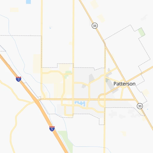


How to get from Patterson (airport) (California) to Santa Maria (California)
Calculate route from Patterson (airport) (California, United States) to Santa Maria (California, United States).
The flight distance (as the crow flies) between Patterson (airport) and Santa Maria is 287.2 km.
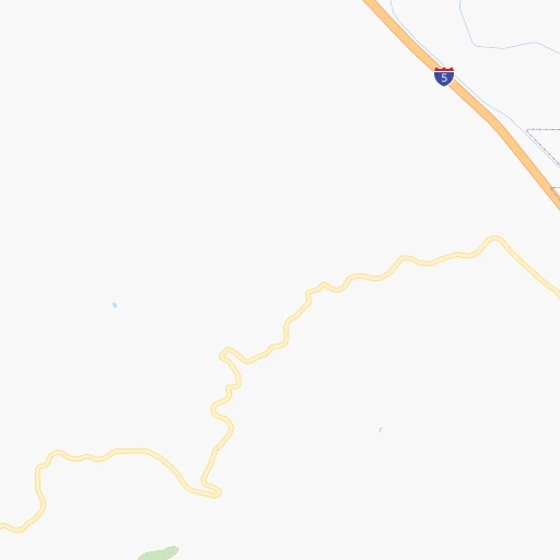
Roadmap (route) to go from Patterson Airport to Santa Maria detailed above, you can also see the course layout on the map.
While doing trip Patterson (airport) - Santa Maria by car, the calculated route ends at a distance , or more straight.
Distance and duration of the route between Patterson (airport) and Santa Maria
Calculation of distance and route from Santa Maria to Patterson (airport) :
287.2363.1 km4h13mn
Continue 0h2mn 503 mKeep right 0h0mn 48 mKeep right 0h0mn 36 mKeep left 0h0mn 62 mTurn right 0h0mn 50 mTurn right onto Park Center Drive 0h0mn 386 mTurn right onto Sperry Avenue 0h1mn 560 mTurn slight right onto Sperry Avenue 0h1mn 803 mTurn sharp left 2h48mn 183.7 kmKeep right and take CA 269 toward Lassen Avenue 0h0mn 433 mTurn right onto South Lassen Avenue 0h7mn 9.0 kmTurn left onto South 5th Avenue 0h2mn 770 mTurn left onto East Laneva Boulevard 0h11mn 14.3 kmTurn right onto CA 41 0h24mn 31.5 kmKeep right onto CA 41 0h0mn 199 mTurn slight right onto CA 46, CA 41 0h8mn 10.4 kmTurn left 0h4mn 4.3 kmTurn left onto CA 41 0h16mn 20.9 kmTurn sharp left onto Webster Road 0h15mn 14.5 kmTurn right onto Calf Canyon Highway 0h4mn 5.6 kmTurn right onto West Pozo Road 0h2mn 2.2 kmTurn left onto I Street 0h0mn 290 mTurn right onto Encina Avenue 0h0mn 255 mTurn left onto El Camino Real 0h10mn 14.7 kmKeep right and drive toward Monterey Street 0h0mn 227 mTurn left onto Buena Vista Avenue 0h0mn 214 mTurn right onto Monterey Street 0h1mn 649 mTurn left onto California Boulevard 0h0mn 191 mTurn right onto Marsh Street 0h0mn 309 mTurn left onto Johnson Avenue 0h0mn 212 mTurn right onto Pismo Street 0h0mn 338 mTurn left onto Santa Rosa Street 0h0mn 321 mTurn right onto Leff Street 0h0mn 153 mTurn left onto Santa Barbara Street 0h1mn 759 mKeep left onto Broad Street 0h15mn 17.9 kmTurn left onto Printz Road 0h0mn 86 mTurn right onto Tally Ho Road 0h2mn 1.3 kmTurn left onto North Mason Street 0h1mn 481 mTurn right onto Poole Street 0h0mn 265 mTurn left onto Traffic Way 0h13mn 20.6 kmKeep right toward CA 135 South 0h0mn 379 mKeep right toward CA 135 South 0h0mn 113 mTurn slight right onto North Broadway 0h3mn 3.0 kmTurn left onto West Main Street 0h0mn 23 mArrive at destination 0h0mn 0 m
Travel from Patterson (airport) (California) to a selection of major cities.
Distances from Patterson Airport to biggest cities in California
- Moreno Valley,204,198 inhabitants.530 km
- Huntington Beach,201,899 inhabitants.512 km
- Glendale,201,020 inhabitants.454 km
- Santa Clarita,182,371 inhabitants.416 km
- Oceanside,175,691 inhabitants.587 km
- Garden Grove,175,393 inhabitants.504 km
- Rancho Cucamonga,175,236 inhabitants.494 km
- Santa Rosa,174,972 inhabitants.173 km
- Ontario,171,214 inhabitants.495 km
- Hollywood,167,664 inhabitants.455 km
- Elk Grove,166,913 inhabitants.106 km
- Corona,164,226 inhabitants.516 km
- Lancaster,161,103 inhabitants.412 km
- Palmdale,158,351 inhabitants.423 km
- Hayward,158,289 inhabitants.83 km
- Salinas,157,380 inhabitants.98 km
- Pomona,153,266 inhabitants.489 km
- Sunnyvale,151,754 inhabitants.77 km
- Escondido,151,451 inhabitants.610 km
- Torrance,148,475 inhabitants.478 km
Other major cities in country :
- Detroit [MI], 677,116 inhabitants. 3,272 km
- Boston [MA], 667,137 inhabitants. 4,251 km
- Memphis [TN], 655,770 inhabitants. 2,791 km
- New South Memphis [TN], 641,608 inhabitants. 2,792 km
- Portland [OR], 632,309 inhabitants. 905 km
- Oklahoma City [OK], 631,346 inhabitants. 2,124 km
- Las Vegas [NV], 623,747 inhabitants. 556 km
- Baltimore [MD], 621,849 inhabitants. 3,854 km
- Washington, D.C. [DC], 601,723 inhabitants. 3,827 km
- Milwaukee [WI], 600,155 inhabitants. 2,873 km
- South Boston [MA], 571,281 inhabitants. 4,252 km
- Albuquerque [NM], 559,121 inhabitants. 1,328 km
- Tucson [AZ], 531,641 inhabitants. 1,102 km
- Nashville [TN], 530,852 inhabitants. 3,051 km
- Kansas City [MO], 475,378 inhabitants. 2,322 km
- Mesa [AZ], 471,825 inhabitants. 959 km
- Staten Island [NY], 468,730 inhabitants. 4,034 km
- Atlanta [GA], 463,878 inhabitants. 3,333 km
- Colorado Springs [CO], 456,568 inhabitants. 1,437 km
- Virginia Beach [VA], 452,745 inhabitants. 3,970 km
Route from Santa Maria to major cities (United States).
- Distance Santa Maria New York City4,084 km
- Distance Santa Maria Chicago2,942 km
- Distance Santa Maria Brooklyn4,090 km
- Distance Santa Maria Houston2,420 km
- Distance Santa Maria Queens4,099 km
- Distance Santa Maria Philadelphia3,996 km
- Distance Santa Maria Phoenix788 km
- Distance Santa Maria Manhattan4,087 km
- Distance Santa Maria San Antonio2,152 km
- Distance Santa Maria The Bronx4,094 km
- Distance Santa Maria Dallas2,192 km
- Distance Santa Maria Austin2,186 km
- Distance Santa Maria Jacksonville3,649 km
- Distance Santa Maria Columbus3,330 km
- Distance Santa Maria Fort Worth2,147 km
- Distance Santa Maria Indianapolis3,061 km
- Distance Santa Maria Charlotte3,582 km
- Distance Santa Maria Seattle1,417 km
- Distance Santa Maria Denver1,465 km
- Distance Santa Maria El Paso1,344 km
Nearest cities to Patterson (airport) :
- San Jose, 1,026,908 inhabitants. 66 km
- San Francisco, 864,816 inhabitants. 115 km
- Fresno, 520,052 inhabitants. 148 km
- Sacramento, 490,712 inhabitants. 127 km
- Oakland, 419,267 inhabitants. 104 km
- Bakersfield, 373,640 inhabitants. 302 km
- Stockton, 305,658 inhabitants. 55 km
- Reno, 241,445 inhabitants. 258 km
- Fremont, 232,206 inhabitants. 73 km
- Modesto, 211,266 inhabitants. 24 km
- Santa Rosa, 174,972 inhabitants. 173 km
- Elk Grove, 166,913 inhabitants. 106 km
- Hayward, 158,289 inhabitants. 83 km
- Salinas, 157,380 inhabitants. 98 km
- Sunnyvale, 151,754 inhabitants. 77 km
- Roseville, 130,269 inhabitants. 143 km
- Visalia, 130,104 inhabitants. 210 km
- Concord, 128,667 inhabitants. 95 km
- Santa Clara, 126,215 inhabitants. 71 km
- Vallejo, 121,253 inhabitants. 119 km
- Berkeley, 120,972 inhabitants. 107 km
- Fairfield, 112,970 inhabitants. 116 km
- Antioch, 110,542 inhabitants. 82 km
- Richmond, 109,708 inhabitants. 116 km
- Daly City, 106,562 inhabitants. 117 km
- Santa Maria, 105,093 inhabitants. 288 km
- Clovis, 104,180 inhabitants. 149 km
- San Mateo, 103,536 inhabitants. 103 km
- Chinatown, 100,574 inhabitants. 115 km
- Vacaville, 96,803 inhabitants. 122 km
- Sparks, 96,094 inhabitants. 261 km
- Arden-Arcade, 92,186 inhabitants. 128 km
- San Leandro, 90,712 inhabitants. 92 km
- Chico, 90,316 inhabitants. 258 km
- Livermore, 88,126 inhabitants. 58 km
- Tracy, 87,075 inhabitants. 38 km
- Citrus Heights, 87,056 inhabitants. 138 km
- Redwood City, 85,288 inhabitants. 94 km
- Merced, 82,436 inhabitants. 63 km
- Mountain View, 80,435 inhabitants. 81 km
- Napa, 80,434 inhabitants. 135 km
- Pleasanton, 79,510 inhabitants. 66 km
- Alameda, 78,630 inhabitants. 100 km
- Milpitas, 77,604 inhabitants. 65 km
- Folsom, 76,375 inhabitants. 135 km
- San Ramon, 76,134 inhabitants. 79 km
- Manteca, 75,448 inhabitants. 37 km
- Union City, 74,494 inhabitants. 76 km
- Turlock, 72,292 inhabitants. 29 km
- Rancho Cordova, 71,017 inhabitants. 125 km
Location Patterson (airport) (California) :
| Country flag |  |
| Location | Patterson (airport) |
| State | California |
| County | Stanislaus County |
| Country | United States |
| Country code / ISO 2 | US |
| Latitude | 37.4685500 |
| Longitude | -121.1693800 |
| Altitude | 52 meters |
| Time zone | America/Los_Angeles |
Location Santa Maria (California) :
| Country flag | |
| Location | Santa Maria |
| State | California |
| County | Santa Barbara County |
| Country | United States |
| Country code / ISO 2 | US |
| Latitude | 34.9530300 |
| Longitude | -120.4357200 |
| Altitude | 67 meters |
| Time zone | America/Los_Angeles |


