

How to get from Monterey Regional (airport) (California) to Sparks (Nevada)
Calculate route from Monterey Regional (airport) (California, United States) to Sparks (Nevada, United States).
The flight distance (as the crow flies) between Monterey Regional (airport) and Sparks is 374.9 km.
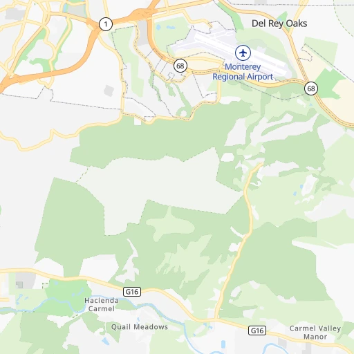
Roadmap (route) to go from Monterey Regional Airport to Sparks detailed above, you can also see the course layout on the map.
While doing trip Monterey Regional (airport) - Sparks by car, the calculated route ends at a distance , or more straight.
Distance and duration of the route between Monterey Regional (airport) and Sparks
Calculation of distance and route from Sparks to Monterey Regional (airport) :
374.9513.0 km6h36mn
Continue 0h0mn 20 mTurn sharp left 0h5mn 1.9 kmTurn right onto Euclid Avenue 0h0mn 112 mTurn left onto Ramona Avenue 0h1mn 391 mTurn right 0h0mn 56 mTurn right 0h0mn 32 mTurn right onto North Fremont Street 0h3mn 3.4 kmTurn slight right 0h10mn 16.0 kmKeep right onto CA 156 0h8mn 10.4 kmKeep left 0h0mn 61 mTurn slight right 0h0mn 289 mTurn left onto Vierra Canyon Road 0h12mn 19.1 kmKeep right 0h28mn 44.6 kmKeep left onto US 101 0h8mn 12.9 kmKeep right and take I 280, I 680 toward Downtown San Jose, Sacramento 0h1mn 908 mKeep right and take I 680 toward Sacramento 0h13mn 19.5 kmKeep right and drive toward Mission Boulevard 0h0mn 258 mKeep right and drive toward Mission Boulevard East 0h3mn 3.5 kmTurn slight right onto Mission Boulevard 0h2mn 1.8 kmTurn left onto Mission Road 0h0mn 11 mTurn slight left and take I 680 North toward Sacramento 1h35mn 54.4 kmKeep left onto Senator Daniel E Boatwright Highway and take I 680 North toward Martinez, Sacramento 0h6mn 9.6 kmKeep right onto Senator Daniel E Boatwright Highway 0h2mn 3.0 kmKeep right onto Benicia-Martinez Bridge 0h13mn 19.9 kmKeep right onto Luther E Gibson Freeway and take I 80 East, CA 12 East toward Fairfield, Sacramento 0h2mn 3.4 kmKeep left onto I 80 0h13mn 21.1 kmKeep left onto I 80 0h15mn 22.8 kmKeep left onto I 80 0h12mn 19.4 kmKeep right onto North Sacramento Beltline Freeway and take I 80 East toward Reno 0h13mn 20.0 kmKeep left onto North Sacramento Beltline Freeway 1h24mn 131.9 kmKeep right and drive toward Castle Peak 0h4mn 6.3 kmKeep right and drive toward Donner Lake 1h42mn 65.2 kmKeep right toward NV 445 0h0mn 275 mKeep left toward NV 445 North 0h0mn 168 mTurn right onto Victorian Avenue 0h0mn 105 mMake a U-turn onto Victorian Avenue 0h0mn 100 mArrive at destination 0h0mn 0 m
Travel from Monterey Regional (airport) (Nevada) to a selection of major cities.
Distances from Monterey Regional Airport to biggest cities in California
- Moreno Valley,204,198 inhabitants.512 km
- Huntington Beach,201,899 inhabitants.478 km
- Glendale,201,020 inhabitants.424 km
- Santa Clarita,182,371 inhabitants.386 km
- Oceanside,175,691 inhabitants.555 km
- Garden Grove,175,393 inhabitants.473 km
- Rancho Cucamonga,175,236 inhabitants.474 km
- Santa Rosa,174,972 inhabitants.220 km
- Ontario,171,214 inhabitants.473 km
- Hollywood,167,664 inhabitants.422 km
- Elk Grove,166,913 inhabitants.207 km
- Corona,164,226 inhabitants.492 km
- Lancaster,161,103 inhabitants.395 km
- Palmdale,158,351 inhabitants.404 km
- Hayward,158,289 inhabitants.122 km
- Salinas,157,380 inhabitants.19 km
- Pomona,153,266 inhabitants.466 km
- Sunnyvale,151,754 inhabitants.89 km
- Escondido,151,451 inhabitants.581 km
- Torrance,148,475 inhabitants.442 km
Other major cities in country :
- Detroit [MI], 677,116 inhabitants. 3,365 km
- Boston [MA], 667,137 inhabitants. 4,345 km
- Memphis [TN], 655,770 inhabitants. 2,859 km
- New South Memphis [TN], 641,608 inhabitants. 2,860 km
- Portland [OR], 632,309 inhabitants. 997 km
- Oklahoma City [OK], 631,346 inhabitants. 2,187 km
- Las Vegas [NV], 623,747 inhabitants. 602 km
- Baltimore [MD], 621,849 inhabitants. 3,941 km
- Washington, D.C. [DC], 601,723 inhabitants. 3,913 km
- Milwaukee [WI], 600,155 inhabitants. 2,967 km
- South Boston [MA], 571,281 inhabitants. 4,347 km
- Albuquerque [NM], 559,121 inhabitants. 1,379 km
- Tucson [AZ], 531,641 inhabitants. 1,113 km
- Nashville [TN], 530,852 inhabitants. 3,125 km
- Kansas City [MO], 475,378 inhabitants. 2,404 km
- Mesa [AZ], 471,825 inhabitants. 978 km
- Staten Island [NY], 468,730 inhabitants. 4,124 km
- Atlanta [GA], 463,878 inhabitants. 3,401 km
- Colorado Springs [CO], 456,568 inhabitants. 1,517 km
- Virginia Beach [VA], 452,745 inhabitants. 4,052 km
Route from Sparks to major cities (United States).
- Distance Sparks New York City3,852 km
- Distance Sparks Los Angeles625 km
- Distance Sparks Chicago2,706 km
- Distance Sparks Brooklyn3,858 km
- Distance Sparks Houston2,473 km
- Distance Sparks Queens3,866 km
- Distance Sparks Philadelphia3,776 km
- Distance Sparks Phoenix964 km
- Distance Sparks Manhattan3,853 km
- Distance Sparks San Antonio2,244 km
- Distance Sparks San Diego794 km
- Distance Sparks The Bronx3,859 km
- Distance Sparks Dallas2,188 km
- Distance Sparks San Jose308 km
- Distance Sparks Austin2,250 km
- Distance Sparks Jacksonville3,595 km
- Distance Sparks San Francisco303 km
- Distance Sparks Columbus3,124 km
- Distance Sparks Fort Worth2,147 km
- Distance Sparks Indianapolis2,862 km
Nearest cities to Monterey Regional (airport) :
- San Jose, 1,026,908 inhabitants. 84 km
- San Francisco, 864,816 inhabitants. 142 km
- Fresno, 520,052 inhabitants. 185 km
- Sacramento, 490,712 inhabitants. 224 km
- Oakland, 419,267 inhabitants. 141 km
- Bakersfield, 373,640 inhabitants. 288 km
- Stockton, 305,658 inhabitants. 160 km
- Reno, 241,445 inhabitants. 372 km
- Fremont, 232,206 inhabitants. 108 km
- Modesto, 211,266 inhabitants. 139 km
- Oxnard, 207,254 inhabitants. 359 km
- Santa Rosa, 174,972 inhabitants. 220 km
- Elk Grove, 166,913 inhabitants. 207 km
- Hayward, 158,289 inhabitants. 122 km
- Salinas, 157,380 inhabitants. 19 km
- Sunnyvale, 151,754 inhabitants. 89 km
- Roseville, 130,269 inhabitants. 246 km
- Visalia, 130,104 inhabitants. 230 km
- Concord, 128,667 inhabitants. 156 km
- Santa Clara, 126,215 inhabitants. 86 km
- Vallejo, 121,253 inhabitants. 173 km
- Berkeley, 120,972 inhabitants. 148 km
- Fairfield, 112,970 inhabitants. 186 km
- Antioch, 110,542 inhabitants. 158 km
- Richmond, 109,708 inhabitants. 157 km
- Daly City, 106,562 inhabitants. 136 km
- Santa Maria, 105,093 inhabitants. 222 km
- Clovis, 104,180 inhabitants. 192 km
- San Mateo, 103,536 inhabitants. 117 km
- Chinatown, 100,574 inhabitants. 144 km
- Vacaville, 96,803 inhabitants. 197 km
- Ventura, 96,769 inhabitants. 346 km
- Sparks, 96,094 inhabitants. 376 km
- Arden-Arcade, 92,186 inhabitants. 228 km
- Santa Barbara, 91,842 inhabitants. 310 km
- San Leandro, 90,712 inhabitants. 130 km
- Livermore, 88,126 inhabitants. 122 km
- Tracy, 87,075 inhabitants. 133 km
- Citrus Heights, 87,056 inhabitants. 241 km
- Redwood City, 85,288 inhabitants. 106 km
- Merced, 82,436 inhabitants. 145 km
- Mountain View, 80,435 inhabitants. 91 km
- Napa, 80,434 inhabitants. 194 km
- Pleasanton, 79,510 inhabitants. 120 km
- Alameda, 78,630 inhabitants. 136 km
- Milpitas, 77,604 inhabitants. 94 km
- Folsom, 76,375 inhabitants. 240 km
- San Ramon, 76,134 inhabitants. 133 km
- Manteca, 75,448 inhabitants. 146 km
- Union City, 74,494 inhabitants. 113 km
Location Monterey Regional (airport) (California) :
| Country flag |  |
| Location | Monterey Regional (airport) |
| State | California |
| County | Monterey County |
| Country | United States |
| Country code / ISO 2 | US |
| Latitude | 36.5879000 |
| Longitude | -121.8393900 |
| Altitude | 66 meters |
| Time zone | America/Los_Angeles |
Location Sparks (Nevada) :
| Country flag | |
| Location | Sparks |
| State | Nevada |
| County | Washoe County |
| Country | United States |
| Country code / ISO 2 | US |
| Latitude | 39.5349100 |
| Longitude | -119.7526900 |
| Altitude | 1345 meters |
| Time zone | America/Los_Angeles |


