


How to get from Winslow Municipal (airport) (Arizona) to Apache Junction (Arizona)
Calculate route from Winslow Municipal (airport) (Arizona, United States) to Apache Junction (Arizona, United States).
The flight distance (as the crow flies) between Winslow Municipal (airport) and Apache Junction is 194.0 km.
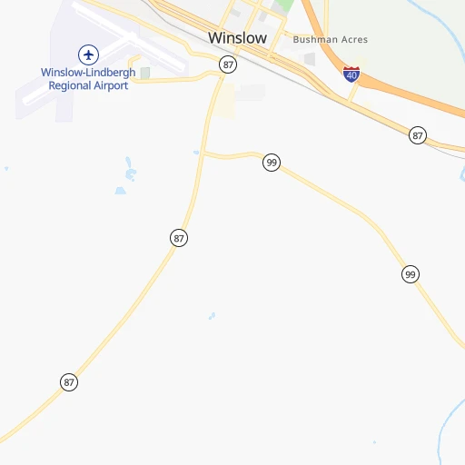
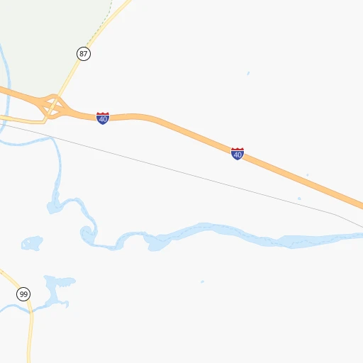
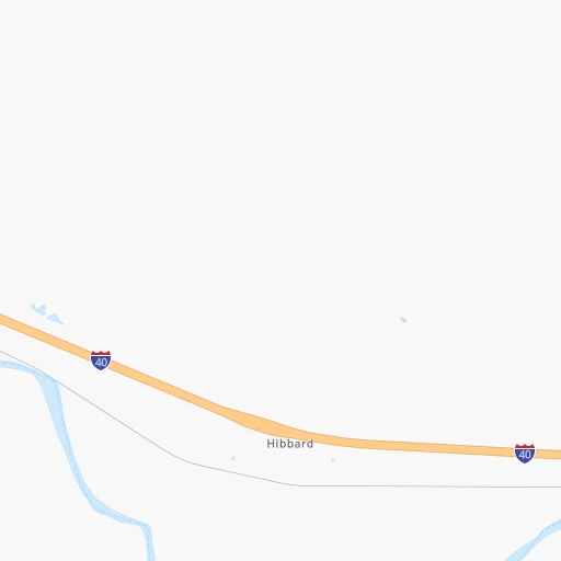
Roadmap (route) to go from Winslow Municipal Airport to Apache Junction detailed above, you can also see the course layout on the map.
While doing trip Winslow Municipal (airport) - Apache Junction by car, the calculated route ends at a distance , or more straight.
Distance and duration of the route between Winslow Municipal (airport) and Apache Junction
Calculation of distance and route from Apache Junction to Winslow Municipal (airport) :
194.0266.1 km4h2mn
Continue 0h1mn 351 mTurn sharp right onto Airport Road 0h2mn 2.0 kmTurn sharp right onto AZ 87, AZ 99 2h12mn 139.3 kmTurn right onto West Houston Mesa Road 0h0mn 92 mTurn left 0h0mn 95 mTurn left 0h0mn 42 mTurn right 0h0mn 120 mTurn left 0h0mn 35 mAt roundabout, take exit 1 onto North Beeline Highway 0h1mn 943 mAt roundabout, take exit 2 onto North Beeline Highway 0h0mn 120 mTurn slight right onto North Beeline Highway 1h9mn 84.5 kmKeep right 0h0mn 438 mTurn left onto North Bush Highway 0h14mn 15.5 kmTurn left onto North Usery Pass Road 0h14mn 14.9 kmTurn left onto East Apache Trail 0h7mn 7.5 kmKeep left 0h0mn 251 mArrive at destination 0h0mn 0 m
Travel from Winslow Municipal (airport) (Arizona) to a selection of major cities.
Distances from Winslow Municipal Airport to biggest cities in Arizona
- Catalina Foothills,50,796 inhabitants.304 km
- Maricopa,48,602 inhabitants.250 km
- Oro Valley,43,565 inhabitants.294 km
- Sierra Vista,43,355 inhabitants.388 km
- Prescott Valley,42,197 inhabitants.153 km
- Prescott,41,899 inhabitants.168 km
- Marana,41,315 inhabitants.291 km
- Bullhead City,39,445 inhabitants.351 km
- Apache Junction,38,074 inhabitants.194 km
- Sun City,37,499 inhabitants.213 km
- Queen Creek,34,614 inhabitants.214 km
- El Mirage,33,935 inhabitants.215 km
- San Luis,31,520 inhabitants.470 km
- Florence,31,110 inhabitants.230 km
- Kingman,28,912 inhabitants.304 km
- Drexel Heights,27,749 inhabitants.322 km
- Fortuna Foothills,26,265 inhabitants.431 km
- Sahuarita,25,707 inhabitants.342 km
- Sun City West,24,535 inhabitants.212 km
- Fountain Hills,23,899 inhabitants.182 km
Other major cities in country :
- Seattle [WA], 684,451 inhabitants. 1,700 km
- Denver [CO], 682,545 inhabitants. 730 km
- El Paso [TX], 681,124 inhabitants. 536 km
- Detroit [MI], 677,116 inhabitants. 2,526 km
- Boston [MA], 667,137 inhabitants. 3,508 km
- Memphis [TN], 655,770 inhabitants. 1,880 km
- New South Memphis [TN], 641,608 inhabitants. 1,880 km
- Portland [OR], 632,309 inhabitants. 1,545 km
- Oklahoma City [OK], 631,346 inhabitants. 1,201 km
- Las Vegas [NV], 623,747 inhabitants. 420 km
- Baltimore [MD], 621,849 inhabitants. 3,045 km
- Washington, D.C. [DC], 601,723 inhabitants. 3,010 km
- Milwaukee [WI], 600,155 inhabitants. 2,156 km
- South Boston [MA], 571,281 inhabitants. 3,509 km
- Albuquerque [NM], 559,121 inhabitants. 371 km
- Nashville [TN], 530,852 inhabitants. 2,165 km
- Fresno [CA], 520,052 inhabitants. 838 km
- Sacramento [CA], 490,712 inhabitants. 1,038 km
- Kansas City [MO], 475,378 inhabitants. 1,502 km
- Long Beach [CA], 474,140 inhabitants. 700 km
Route from Apache Junction to major cities (United States).
- Distance Apache Junction New York City3,405 km
- Distance Apache Junction Los Angeles624 km
- Distance Apache Junction Chicago2,297 km
- Distance Apache Junction Brooklyn3,409 km
- Distance Apache Junction Houston1,586 km
- Distance Apache Junction Queens3,419 km
- Distance Apache Junction Philadelphia3,305 km
- Distance Apache Junction Manhattan3,408 km
- Distance Apache Junction San Antonio1,316 km
- Distance Apache Junction San Diego530 km
- Distance Apache Junction The Bronx3,417 km
- Distance Apache Junction Dallas1,376 km
- Distance Apache Junction San Jose1,035 km
- Distance Apache Junction Austin1,351 km
- Distance Apache Junction Jacksonville2,837 km
- Distance Apache Junction San Francisco1,096 km
- Distance Apache Junction Columbus2,638 km
- Distance Apache Junction Fort Worth1,329 km
- Distance Apache Junction Indianapolis2,368 km
- Distance Apache Junction Charlotte2,819 km
Nearest cities to Winslow Municipal (airport) :
- Phoenix, 1,563,025 inhabitants. 215 km
- Tucson, 531,641 inhabitants. 312 km
- Mesa, 471,825 inhabitants. 205 km
- Chandler, 260,828 inhabitants. 217 km
- Gilbert, 247,542 inhabitants. 210 km
- Glendale, 240,126 inhabitants. 213 km
- Scottsdale, 236,839 inhabitants. 200 km
- Tempe, 175,826 inhabitants. 210 km
- Peoria, 171,237 inhabitants. 212 km
- Tempe Junction, 158,368 inhabitants. 211 km
- Surprise, 128,422 inhabitants. 214 km
- San Tan Valley, 81,321 inhabitants. 217 km
- Avondale, 80,684 inhabitants. 231 km
- Goodyear, 79,003 inhabitants. 232 km
- Saint George, 72,897 inhabitants. 346 km
- Flagstaff, 70,320 inhabitants. 87 km
- Casas Adobes, 66,795 inhabitants. 301 km
- Casa Grande, 51,460 inhabitants. 257 km
- Buckeye, 50,876 inhabitants. 251 km
- Catalina Foothills, 50,796 inhabitants. 304 km
- Maricopa, 48,602 inhabitants. 250 km
- Oro Valley, 43,565 inhabitants. 294 km
- Farmington, 42,871 inhabitants. 295 km
- Prescott Valley, 42,197 inhabitants. 153 km
- Prescott, 41,899 inhabitants. 168 km
- Marana, 41,315 inhabitants. 291 km
- Apache Junction, 38,074 inhabitants. 194 km
- Sun City, 37,499 inhabitants. 213 km
- Queen Creek, 34,614 inhabitants. 214 km
- El Mirage, 33,935 inhabitants. 215 km
- Florence, 31,110 inhabitants. 230 km
- Cedar City, 30,184 inhabitants. 362 km
- Drexel Heights, 27,749 inhabitants. 322 km
- Sun City West, 24,535 inhabitants. 212 km
- Washington, 24,299 inhabitants. 343 km
- Fountain Hills, 23,899 inhabitants. 182 km
- Gallup, 23,240 inhabitants. 189 km
- Anthem, 21,700 inhabitants. 183 km
- Durango, 18,006 inhabitants. 358 km
- Eloy, 17,059 inhabitants. 264 km
- Tanque Verde, 16,901 inhabitants. 308 km
- Flowing Wells, 16,419 inhabitants. 305 km
- Hurricane, 15,501 inhabitants. 333 km
- Payson, 15,345 inhabitants. 104 km
- New River, 14,952 inhabitants. 179 km
- Deming, 14,522 inhabitants. 412 km
- Sun Lakes, 13,975 inhabitants. 228 km
- Paradise Valley, 13,922 inhabitants. 200 km
- Coolidge, 12,297 inhabitants. 239 km
- Tucson Estates, 12,192 inhabitants. 317 km
Location Winslow Municipal (airport) (Arizona) :
| Country flag |  |
| Location | Winslow Municipal (airport) |
| State | Arizona |
| County | Navajo County |
| Country | United States |
| Country code / ISO 2 | US |
| Latitude | 35.0216900 |
| Longitude | -110.7229100 |
| Altitude | 1493 meters |
| Time zone | America/Phoenix |
Location Apache Junction (Arizona) :
| Country flag | |
| Location | Apache Junction |
| State | Arizona |
| County | Pinal County |
| Country | United States |
| Country code / ISO 2 | US |
| Latitude | 33.4150500 |
| Longitude | -111.5495800 |
| Altitude | 525 meters |
| Time zone | America/Phoenix |


