
How to get from Sycamore Creek (airport) (Arizona) to Queen Creek (Arizona)
Calculate route from Sycamore Creek (airport) (Arizona, United States) to Queen Creek (Arizona, United States).
The flight distance (as the crow flies) between Sycamore Creek (airport) and Queen Creek is 45.9 km.
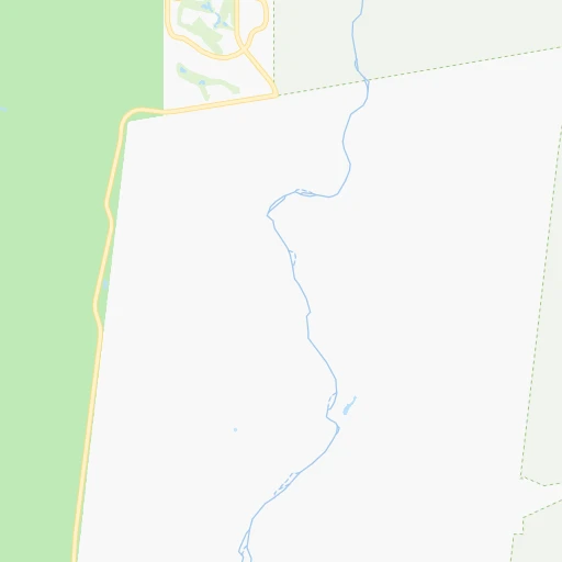
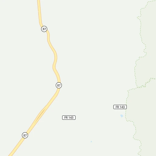
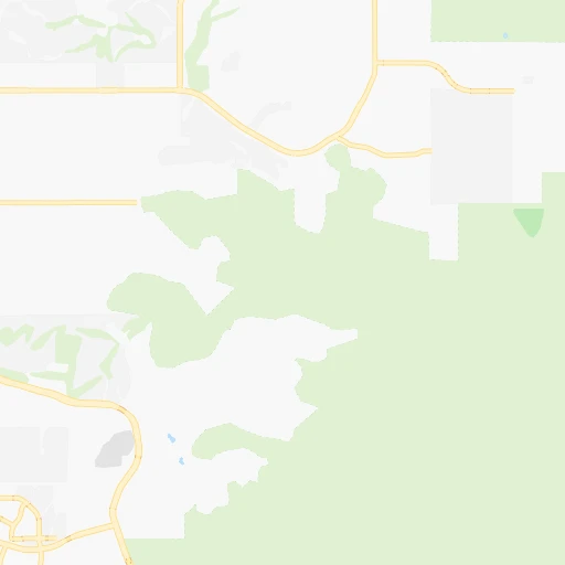
Roadmap (route) to go from Sycamore Creek Airport to Queen Creek detailed above, you can also see the course layout on the map.
While doing trip Sycamore Creek (airport) - Queen Creek by car, the calculated route ends at a distance , or more straight.
Distance and duration of the route between Sycamore Creek (airport) and Queen Creek
Calculation of distance and route from Queen Creek to Sycamore Creek (airport) :
45.961.2 km1h24mn
Continue onto FR 403 0h17mn 4.2 kmTurn left onto [FR 403] **4WD** 0h20mn 5.4 kmTurn right onto Beeline Highway 0h2mn 1.8 kmKeep right 0h0mn 438 mTurn left onto North Bush Highway 0h14mn 15.5 kmTurn left onto North Usery Pass Road 0h29mn 32.1 kmTurn left onto East Walnut Road 0h0mn 146 mTurn right onto South Ellsworth Road 0h2mn 1.4 kmTurn sharp left onto South Ellsworth Road 0h0mn 38 mTurn right 0h0mn 20 mTurn right 0h0mn 59 mTurn right 0h0mn 15 mTurn right onto East Ocotillo Road 0h0mn 40 mArrive at destination 0h0mn 0 m
Travel from Sycamore Creek (airport) (Arizona) to a selection of major cities.
Distances from Sycamore Creek Airport to biggest cities in Arizona
- Catalina Foothills,50,796 inhabitants.165 km
- Maricopa,48,602 inhabitants.78 km
- Oro Valley,43,565 inhabitants.154 km
- Sierra Vista,43,355 inhabitants.265 km
- Prescott Valley,42,197 inhabitants.124 km
- Prescott,41,899 inhabitants.125 km
- Marana,41,315 inhabitants.141 km
- Bullhead City,39,445 inhabitants.318 km
- Apache Junction,38,074 inhabitants.28 km
- Sun City,37,499 inhabitants.61 km
- Queen Creek,34,614 inhabitants.46 km
- El Mirage,33,935 inhabitants.66 km
- San Luis,31,520 inhabitants.323 km
- Florence,31,110 inhabitants.73 km
- Kingman,28,912 inhabitants.281 km
- Drexel Heights,27,749 inhabitants.178 km
- Fortuna Foothills,26,265 inhabitants.283 km
- Sahuarita,25,707 inhabitants.199 km
- Sun City West,24,535 inhabitants.67 km
- Fountain Hills,23,899 inhabitants.11 km
Other major cities in country :
- Seattle [WA], 684,451 inhabitants. 1,793 km
- Denver [CO], 682,545 inhabitants. 898 km
- El Paso [TX], 681,124 inhabitants. 525 km
- Detroit [MI], 677,116 inhabitants. 2,670 km
- Boston [MA], 667,137 inhabitants. 3,649 km
- Memphis [TN], 655,770 inhabitants. 1,984 km
- New South Memphis [TN], 641,608 inhabitants. 1,983 km
- Portland [OR], 632,309 inhabitants. 1,623 km
- Oklahoma City [OK], 631,346 inhabitants. 1,307 km
- Las Vegas [NV], 623,747 inhabitants. 426 km
- Baltimore [MD], 621,849 inhabitants. 3,175 km
- Washington, D.C. [DC], 601,723 inhabitants. 3,138 km
- Milwaukee [WI], 600,155 inhabitants. 2,307 km
- South Boston [MA], 571,281 inhabitants. 3,650 km
- Albuquerque [NM], 559,121 inhabitants. 483 km
- Nashville [TN], 530,852 inhabitants. 2,278 km
- Fresno [CA], 520,052 inhabitants. 817 km
- Sacramento [CA], 490,712 inhabitants. 1,043 km
- Kansas City [MO], 475,378 inhabitants. 1,639 km
- Long Beach [CA], 474,140 inhabitants. 609 km
Route from Queen Creek to major cities (United States).
- Distance Queen Creek New York City3,420 km
- Distance Queen Creek Los Angeles619 km
- Distance Queen Creek Chicago2,313 km
- Distance Queen Creek Brooklyn3,424 km
- Distance Queen Creek Houston1,590 km
- Distance Queen Creek Queens3,434 km
- Distance Queen Creek Philadelphia3,319 km
- Distance Queen Creek Manhattan3,423 km
- Distance Queen Creek San Antonio1,319 km
- Distance Queen Creek San Diego520 km
- Distance Queen Creek The Bronx3,432 km
- Distance Queen Creek Dallas1,384 km
- Distance Queen Creek San Jose1,037 km
- Distance Queen Creek Austin1,355 km
- Distance Queen Creek Jacksonville2,845 km
- Distance Queen Creek San Francisco1,099 km
- Distance Queen Creek Columbus2,653 km
- Distance Queen Creek Fort Worth1,337 km
- Distance Queen Creek Indianapolis2,383 km
- Distance Queen Creek Charlotte2,831 km
Nearest cities to Sycamore Creek (airport) :
- Phoenix, 1,563,025 inhabitants. 49 km
- Tucson, 531,641 inhabitants. 173 km
- Mesa, 471,825 inhabitants. 33 km
- Chandler, 260,828 inhabitants. 45 km
- Gilbert, 247,542 inhabitants. 38 km
- Glendale, 240,126 inhabitants. 54 km
- Scottsdale, 236,839 inhabitants. 31 km
- Tempe, 175,826 inhabitants. 39 km
- Peoria, 171,237 inhabitants. 58 km
- Tempe Junction, 158,368 inhabitants. 41 km
- Surprise, 128,422 inhabitants. 66 km
- San Tan Valley, 81,321 inhabitants. 53 km
- Avondale, 80,684 inhabitants. 72 km
- Goodyear, 79,003 inhabitants. 73 km
- Flagstaff, 70,320 inhabitants. 171 km
- Casas Adobes, 66,795 inhabitants. 160 km
- Lake Havasu City, 53,553 inhabitants. 266 km
- Casa Grande, 51,460 inhabitants. 88 km
- Buckeye, 50,876 inhabitants. 95 km
- Catalina Foothills, 50,796 inhabitants. 165 km
- Maricopa, 48,602 inhabitants. 78 km
- Oro Valley, 43,565 inhabitants. 154 km
- Sierra Vista, 43,355 inhabitants. 265 km
- Prescott Valley, 42,197 inhabitants. 124 km
- Prescott, 41,899 inhabitants. 125 km
- Marana, 41,315 inhabitants. 141 km
- Bullhead City, 39,445 inhabitants. 318 km
- Apache Junction, 38,074 inhabitants. 28 km
- Sun City, 37,499 inhabitants. 61 km
- Queen Creek, 34,614 inhabitants. 46 km
- El Mirage, 33,935 inhabitants. 66 km
- Florence, 31,110 inhabitants. 73 km
- Kingman, 28,912 inhabitants. 281 km
- Drexel Heights, 27,749 inhabitants. 178 km
- Fortuna Foothills, 26,265 inhabitants. 283 km
- Sahuarita, 25,707 inhabitants. 199 km
- Sun City West, 24,535 inhabitants. 67 km
- Fountain Hills, 23,899 inhabitants. 11 km
- Gallup, 23,240 inhabitants. 336 km
- Anthem, 21,700 inhabitants. 54 km
- Green Valley, 21,391 inhabitants. 209 km
- Nogales, 20,252 inhabitants. 266 km
- Blythe, 19,208 inhabitants. 276 km
- Rio Rico, 18,962 inhabitants. 251 km
- Eloy, 17,059 inhabitants. 101 km
- Tanque Verde, 16,901 inhabitants. 177 km
- Douglas, 16,592 inhabitants. 323 km
- Flowing Wells, 16,419 inhabitants. 162 km
- Payson, 15,345 inhabitants. 69 km
- New River, 14,952 inhabitants. 56 km
Location Sycamore Creek (airport) (Arizona) :
| Country flag |  |
| Location | Sycamore Creek (airport) |
| State | Arizona |
| County | Maricopa County |
| Country | United States |
| Country code / ISO 2 | US |
| Latitude | 33.6611500 |
| Longitude | -111.6173600 |
| Altitude | 474 meters |
| Time zone | America/Phoenix |
Location Queen Creek (Arizona) :
| Country flag | |
| Location | Queen Creek |
| State | Arizona |
| County | Maricopa County |
| Country | United States |
| Country code / ISO 2 | US |
| Latitude | 33.2486600 |
| Longitude | -111.6343000 |
| Altitude | 428 meters |
| Time zone | America/Phoenix |

