


How to get from Solair Estates (airport) (Arizona) to Prescott Valley (Arizona)
Calculate route from Solair Estates (airport) (Arizona, United States) to Prescott Valley (Arizona, United States).
The flight distance (as the crow flies) between Solair Estates (airport) and Prescott Valley is 40.0 km.
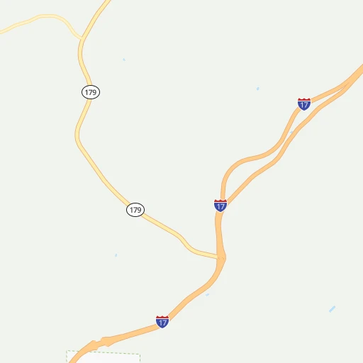
Roadmap (route) to go from Solair Estates Airport to Prescott Valley detailed above, you can also see the course layout on the map.
While doing trip Solair Estates (airport) - Prescott Valley by car, the calculated route ends at a distance , or more straight.
Distance and duration of the route between Solair Estates (airport) and Prescott Valley
Calculation of distance and route from Prescott Valley to Solair Estates (airport) :
40.060.9 km1h8mn
Continue onto Rancho Casero Drive 0h0mn 40 mTurn right onto Hillside Drive 0h1mn 270 mTurn right onto Mountain View Road 0h1mn 701 mTurn left onto East Cornville Road 0h13mn 12.4 kmAt roundabout, take exit 2 onto West Mingus Avenue 0h1mn 819 mTurn right onto AZ 89A 0h0mn 275 mAt roundabout, take exit 3 onto AZ 89A 0h1mn 1.2 kmAt roundabout, take exit 2 onto AZ 89A 0h1mn 1.2 kmAt roundabout, take exit 2 onto AZ 89A 0h1mn 608 mAt roundabout, take exit 2 onto AZ 89A 0h1mn 662 mAt roundabout, take exit 3 onto AZ 89A 0h8mn 7.1 kmTurn sharp left onto Verde Avenue 0h0mn 199 mTurn right onto 5th Street 0h0mn 80 mTurn left onto Center Avenue 0h0mn 166 mTurn sharp left onto Clark Street 1h38mn 34.7 kmTurn left onto East Spouse Drive 0h1mn 459 mArrive at destination 0h0mn 0 m
Travel from Solair Estates (airport) (Arizona) to a selection of major cities.
Distances from Solair Estates Airport to biggest cities in Arizona
- Catalina Foothills,50,796 inhabitants.283 km
- Maricopa,48,602 inhabitants.184 km
- Oro Valley,43,565 inhabitants.272 km
- Sierra Vista,43,355 inhabitants.381 km
- Prescott Valley,42,197 inhabitants.40 km
- Prescott,41,899 inhabitants.56 km
- Marana,41,315 inhabitants.261 km
- Bullhead City,39,445 inhabitants.249 km
- Apache Junction,38,074 inhabitants.148 km
- Sun City,37,499 inhabitants.129 km
- Queen Creek,34,614 inhabitants.164 km
- El Mirage,33,935 inhabitants.128 km
- San Luis,31,520 inhabitants.365 km
- Florence,31,110 inhabitants.193 km
- Kingman,28,912 inhabitants.204 km
- Drexel Heights,27,749 inhabitants.297 km
- Fortuna Foothills,26,265 inhabitants.326 km
- Sahuarita,25,707 inhabitants.319 km
- Sun City West,24,535 inhabitants.124 km
- Fountain Hills,23,899 inhabitants.123 km
Other major cities in country :
- Seattle [WA], 684,451 inhabitants. 1,678 km
- Denver [CO], 682,545 inhabitants. 829 km
- El Paso [TX], 681,124 inhabitants. 601 km
- Detroit [MI], 677,116 inhabitants. 2,637 km
- Boston [MA], 667,137 inhabitants. 3,620 km
- Memphis [TN], 655,770 inhabitants. 1,990 km
- New South Memphis [TN], 641,608 inhabitants. 1,990 km
- Portland [OR], 632,309 inhabitants. 1,511 km
- Oklahoma City [OK], 631,346 inhabitants. 1,311 km
- Las Vegas [NV], 623,747 inhabitants. 336 km
- Baltimore [MD], 621,849 inhabitants. 3,158 km
- Washington, D.C. [DC], 601,723 inhabitants. 3,123 km
- Milwaukee [WI], 600,155 inhabitants. 2,266 km
- South Boston [MA], 571,281 inhabitants. 3,620 km
- Albuquerque [NM], 559,121 inhabitants. 481 km
- Nashville [TN], 530,852 inhabitants. 2,277 km
- Fresno [CA], 520,052 inhabitants. 747 km
- Sacramento [CA], 490,712 inhabitants. 959 km
- Kansas City [MO], 475,378 inhabitants. 1,614 km
- Long Beach [CA], 474,140 inhabitants. 589 km
Route from Prescott Valley to major cities (United States).
- Distance Prescott Valley New York City3,416 km
- Distance Prescott Valley Los Angeles548 km
- Distance Prescott Valley Chicago2,293 km
- Distance Prescott Valley Brooklyn3,421 km
- Distance Prescott Valley Houston1,683 km
- Distance Prescott Valley Queens3,430 km
- Distance Prescott Valley Philadelphia3,319 km
- Distance Prescott Valley Manhattan3,419 km
- Distance Prescott Valley San Antonio1,425 km
- Distance Prescott Valley San Diego496 km
- Distance Prescott Valley The Bronx3,427 km
- Distance Prescott Valley Dallas1,449 km
- Distance Prescott Valley San Jose914 km
- Distance Prescott Valley Austin1,450 km
- Distance Prescott Valley Jacksonville2,907 km
- Distance Prescott Valley San Francisco973 km
- Distance Prescott Valley Columbus2,651 km
- Distance Prescott Valley Fort Worth1,404 km
- Distance Prescott Valley Indianapolis2,380 km
- Distance Prescott Valley Charlotte2,861 km
Nearest cities to Solair Estates (airport) :
- Phoenix, 1,563,025 inhabitants. 141 km
- Tucson, 531,641 inhabitants. 291 km
- Mesa, 471,825 inhabitants. 144 km
- Chandler, 260,828 inhabitants. 156 km
- Gilbert, 247,542 inhabitants. 151 km
- Glendale, 240,126 inhabitants. 133 km
- Scottsdale, 236,839 inhabitants. 134 km
- Tempe, 175,826 inhabitants. 144 km
- Peoria, 171,237 inhabitants. 130 km
- Tempe Junction, 158,368 inhabitants. 144 km
- Surprise, 128,422 inhabitants. 127 km
- Yuma, 94,139 inhabitants. 336 km
- San Tan Valley, 81,321 inhabitants. 172 km
- Avondale, 80,684 inhabitants. 148 km
- Goodyear, 79,003 inhabitants. 148 km
- Saint George, 72,897 inhabitants. 307 km
- Flagstaff, 70,320 inhabitants. 59 km
- Casas Adobes, 66,795 inhabitants. 279 km
- Lake Havasu City, 53,553 inhabitants. 224 km
- Casa Grande, 51,460 inhabitants. 204 km
- Buckeye, 50,876 inhabitants. 162 km
- Catalina Foothills, 50,796 inhabitants. 283 km
- Maricopa, 48,602 inhabitants. 184 km
- Oro Valley, 43,565 inhabitants. 272 km
- Prescott Valley, 42,197 inhabitants. 40 km
- Prescott, 41,899 inhabitants. 56 km
- Marana, 41,315 inhabitants. 261 km
- Bullhead City, 39,445 inhabitants. 249 km
- Apache Junction, 38,074 inhabitants. 148 km
- Sun City, 37,499 inhabitants. 129 km
- Queen Creek, 34,614 inhabitants. 164 km
- El Mirage, 33,935 inhabitants. 128 km
- San Luis, 31,520 inhabitants. 365 km
- Florence, 31,110 inhabitants. 193 km
- Cedar City, 30,184 inhabitants. 347 km
- Kingman, 28,912 inhabitants. 204 km
- Drexel Heights, 27,749 inhabitants. 297 km
- Fortuna Foothills, 26,265 inhabitants. 326 km
- Sahuarita, 25,707 inhabitants. 319 km
- Sun City West, 24,535 inhabitants. 124 km
- Washington, 24,299 inhabitants. 306 km
- Fountain Hills, 23,899 inhabitants. 123 km
- Anthem, 21,700 inhabitants. 97 km
- Green Valley, 21,391 inhabitants. 329 km
- Blythe, 19,208 inhabitants. 277 km
- Mesquite, 17,496 inhabitants. 305 km
- Eloy, 17,059 inhabitants. 220 km
- Tanque Verde, 16,901 inhabitants. 294 km
- Flowing Wells, 16,419 inhabitants. 281 km
- Boulder City, 15,551 inhabitants. 302 km
Location Solair Estates (airport) (Arizona) :
| Country flag |  |
| Location | Solair Estates (airport) |
| State | Arizona |
| County | Yavapai County |
| Country | United States |
| Country code / ISO 2 | US |
| Latitude | 34.7103000 |
| Longitude | -111.8951500 |
| Altitude | 1054 meters |
| Time zone | America/Phoenix |
Location Prescott Valley (Arizona) :
| Country flag | |
| Location | Prescott Valley |
| State | Arizona |
| County | Yavapai County |
| Country | United States |
| Country code / ISO 2 | US |
| Latitude | 34.6100200 |
| Longitude | -112.3157200 |
| Altitude | 1532 meters |
| Time zone | America/Phoenix |


