
How to get from Greenlee County (airport) (Arizona) to Sierra Vista Southeast (Arizona)
Calculate route from Greenlee County (airport) (Arizona, United States) to Sierra Vista Southeast (Arizona, United States).
The flight distance (as the crow flies) between Greenlee County (airport) and Sierra Vista Southeast is 191.9 km.
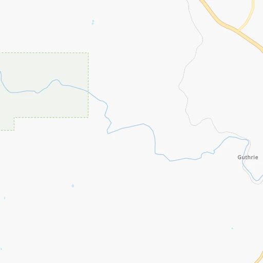
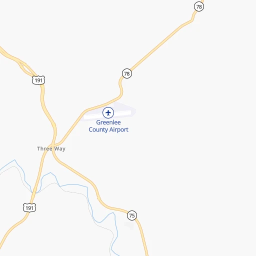
Roadmap (route) to go from Greenlee County Airport to Sierra Vista Southeast detailed above, you can also see the course layout on the map.
While doing trip Greenlee County (airport) - Sierra Vista Southeast by car, the calculated route ends at a distance , or more straight.
Distance and duration of the route between Greenlee County (airport) and Sierra Vista Southeast
Calculation of distance and route from Sierra Vista Southeast to Greenlee County (airport) :
191.9253.5 km3h52mn
Continue onto Airport Road 0h1mn 453 mTurn left onto AZ 78 0h27mn 40.0 kmTurn right onto US 70, US 191 0h8mn 11.4 kmTurn left onto Barney Lane 0h2mn 1.6 kmTurn right onto East Solomon Road 0h5mn 4.0 kmTurn left onto South 1st Avenue 1h34mn 50.4 kmTurn right onto US 191 1h45mn 80.5 kmKeep right and take AZ 90 East toward Ft Huachuca, Sierra Vista 0h1mn 781 mTurn left onto South State Highway 90 0h24mn 35.9 kmTurn slight right onto North Huachuca Boulevard 0h6mn 8.4 kmContinue onto Buffalo Soldier Trail 0h2mn 1.9 kmContinue onto Buffalo Soldier Trail 0h7mn 7.7 kmKeep right 0h4mn 4.8 kmTurn left onto East Ramsey Road 0h4mn 4.0 kmTurn right onto South Burro Drive 0h3mn 1.5 kmArrive at destination 0h0mn 0 m
Travel from Greenlee County (airport) (Arizona) to a selection of major cities.
Distances from Greenlee County Airport to biggest cities in Arizona
- Catalina Foothills,50,796 inhabitants.176 km
- Maricopa,48,602 inhabitants.265 km
- Oro Valley,43,565 inhabitants.176 km
- Sierra Vista,43,355 inhabitants.187 km
- Prescott Valley,42,197 inhabitants.341 km
- Prescott,41,899 inhabitants.349 km
- Marana,41,315 inhabitants.197 km
- Bullhead City,39,445 inhabitants.551 km
- Apache Junction,38,074 inhabitants.224 km
- Sun City,37,499 inhabitants.294 km
- Queen Creek,34,614 inhabitants.228 km
- El Mirage,33,935 inhabitants.299 km
- San Luis,31,520 inhabitants.524 km
- Florence,31,110 inhabitants.203 km
- Kingman,28,912 inhabitants.511 km
- Drexel Heights,27,749 inhabitants.193 km
- Fortuna Foothills,26,265 inhabitants.488 km
- Sahuarita,25,707 inhabitants.198 km
- Sun City West,24,535 inhabitants.302 km
- Fountain Hills,23,899 inhabitants.244 km
Other major cities in country :
- Seattle [WA], 684,451 inhabitants. 1,969 km
- Denver [CO], 682,545 inhabitants. 844 km
- El Paso [TX], 681,124 inhabitants. 289 km
- Detroit [MI], 677,116 inhabitants. 2,518 km
- Boston [MA], 667,137 inhabitants. 3,488 km
- Memphis [TN], 655,770 inhabitants. 1,781 km
- New South Memphis [TN], 641,608 inhabitants. 1,780 km
- Portland [OR], 632,309 inhabitants. 1,813 km
- Oklahoma City [OK], 631,346 inhabitants. 1,111 km
- Las Vegas [NV], 623,747 inhabitants. 651 km
- Baltimore [MD], 621,849 inhabitants. 2,997 km
- Washington, D.C. [DC], 601,723 inhabitants. 2,958 km
- Milwaukee [WI], 600,155 inhabitants. 2,171 km
- South Boston [MA], 571,281 inhabitants. 3,489 km
- Albuquerque [NM], 559,121 inhabitants. 334 km
- Nashville [TN], 530,852 inhabitants. 2,082 km
- Fresno [CA], 520,052 inhabitants. 1,052 km
- Sacramento [CA], 490,712 inhabitants. 1,272 km
- Kansas City [MO], 475,378 inhabitants. 1,482 km
- Long Beach [CA], 474,140 inhabitants. 839 km
Route from Sierra Vista Southeast to major cities (United States).
- Distance Sierra Vista Southeast New York City3,390 km
- Distance Sierra Vista Southeast Los Angeles805 km
- Distance Sierra Vista Southeast Chicago2,314 km
- Distance Sierra Vista Southeast Brooklyn3,394 km
- Distance Sierra Vista Southeast Houston1,434 km
- Distance Sierra Vista Southeast Queens3,403 km
- Distance Sierra Vista Southeast Philadelphia3,283 km
- Distance Sierra Vista Southeast Manhattan3,394 km
- Distance Sierra Vista Southeast San Antonio1,147 km
- Distance Sierra Vista Southeast San Diego670 km
- Distance Sierra Vista Southeast The Bronx3,403 km
- Distance Sierra Vista Southeast Dallas1,272 km
- Distance Sierra Vista Southeast San Jose1,256 km
- Distance Sierra Vista Southeast Austin1,199 km
- Distance Sierra Vista Southeast Jacksonville2,723 km
- Distance Sierra Vista Southeast San Francisco1,319 km
- Distance Sierra Vista Southeast Columbus2,623 km
- Distance Sierra Vista Southeast Fort Worth1,224 km
- Distance Sierra Vista Southeast Indianapolis2,356 km
- Distance Sierra Vista Southeast Charlotte2,754 km
Nearest cities to Greenlee County (airport) :
- Phoenix, 1,563,025 inhabitants. 272 km
- El Paso, 681,124 inhabitants. 289 km
- Albuquerque, 559,121 inhabitants. 334 km
- Tucson, 531,641 inhabitants. 181 km
- Mesa, 471,825 inhabitants. 249 km
- Chandler, 260,828 inhabitants. 248 km
- Gilbert, 247,542 inhabitants. 244 km
- Glendale, 240,126 inhabitants. 284 km
- Scottsdale, 236,839 inhabitants. 258 km
- Tempe, 175,826 inhabitants. 256 km
- Tempe Junction, 158,368 inhabitants. 260 km
- Las Cruces, 101,643 inhabitants. 239 km
- Enchanted Hills, 87,521 inhabitants. 358 km
- Rio Rancho, 87,521 inhabitants. 345 km
- San Tan Valley, 81,321 inhabitants. 218 km
- Flagstaff, 70,320 inhabitants. 336 km
- Casas Adobes, 66,795 inhabitants. 182 km
- Casa Grande, 51,460 inhabitants. 238 km
- Catalina Foothills, 50,796 inhabitants. 176 km
- Maricopa, 48,602 inhabitants. 265 km
- Oro Valley, 43,565 inhabitants. 176 km
- Sierra Vista, 43,355 inhabitants. 187 km
- Marana, 41,315 inhabitants. 197 km
- South Valley, 40,976 inhabitants. 327 km
- Apache Junction, 38,074 inhabitants. 224 km
- Queen Creek, 34,614 inhabitants. 228 km
- Socorro, 33,222 inhabitants. 310 km
- Florence, 31,110 inhabitants. 203 km
- Socorro Mission Number 1 Colonia, 28,637 inhabitants. 312 km
- Drexel Heights, 27,749 inhabitants. 193 km
- Sahuarita, 25,707 inhabitants. 198 km
- Fountain Hills, 23,899 inhabitants. 244 km
- Gallup, 23,240 inhabitants. 289 km
- Anthem, 21,700 inhabitants. 291 km
- Green Valley, 21,391 inhabitants. 208 km
- Nogales, 20,252 inhabitants. 242 km
- Rio Rico, 18,962 inhabitants. 235 km
- Eloy, 17,059 inhabitants. 220 km
- Tanque Verde, 16,901 inhabitants. 163 km
- Douglas, 16,592 inhabitants. 182 km
- Flowing Wells, 16,419 inhabitants. 184 km
- Sunland Park, 15,940 inhabitants. 279 km
- Payson, 15,345 inhabitants. 242 km
- Los Lunas, 15,336 inhabitants. 308 km
- New River, 14,952 inhabitants. 292 km
- Sierra Vista Southeast, 14,797 inhabitants. 192 km
- Chaparral, 14,631 inhabitants. 285 km
- Deming, 14,522 inhabitants. 156 km
- Sun Lakes, 13,975 inhabitants. 250 km
- Paradise Valley, 13,922 inhabitants. 262 km
Location Greenlee County (airport) (Arizona) :
| Country flag |  |
| Location | Greenlee County (airport) |
| State | Arizona |
| County | Greenlee County |
| Country | United States |
| Country code / ISO 2 | US |
| Latitude | 32.9570000 |
| Longitude | -109.2110000 |
| Altitude | 1134 meters |
| Time zone | America/Phoenix |
Location Sierra Vista Southeast (Arizona) :
| Country flag | |
| Location | Sierra Vista Southeast |
| State | Arizona |
| County | Cochise County |
| Country | United States |
| Country code / ISO 2 | US |
| Latitude | 31.4538500 |
| Longitude | -110.2163700 |
| Altitude | 1387 meters |
| Time zone | America/Phoenix |


